


Why visit Wennigsen
Townapedia lists 122 museums and landmarks, 33 parks and trails, 80 places to eat, 12 places to stay and 23 attractions in and around town.
Highlights include Obstplantage Zabel, Hofladen Hundertmark, Heimatmuseum Wennigsen and Heimatstube Bredenbeck.
Weather in Wennigsen
Forecast from MET Norway (CC BY 4.0). Full forecast
About Wennigsen
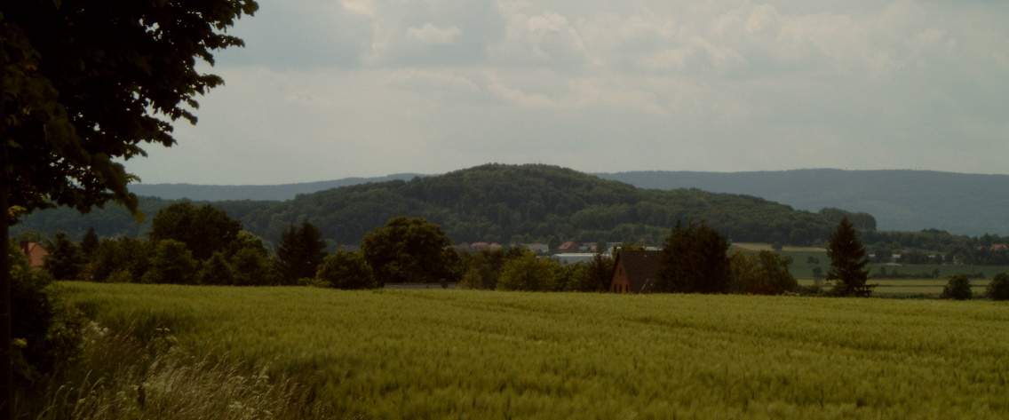
Wennigsen (German pronunciation: [ˈvɛnɪçsn̩] or [ˈvɛnɪksn̩] ) is a municipality in the district of Hanover, in Lower Saxony, Germany. It is situated near the Deister hills, approx. 15 km southwest of Hanover.
From the Wikipedia article Wennigsen (this version), under CC BY-SA 4.0.
Things to do23

Obstplantage Zabel
Farm and orchard · 5.5 km
47 Linderter Straße, Wennigsen (Deister)
Tu-Fr 10:00-18:00; Sa 08:00-13:00
Schreecks Hofladen
Farm and orchard · 1.4 km
12 Glockenstraße, Wennigsen (Deister)
closed





11 more on the map.
Museums and landmarks122


Heimatstube Bredenbeck
Museum · 3.8 km
23 Wennigser Straße, Wennigsen (Deister)
Su[3] 10:00-12:00; PH off


Dicker Stein
Monument and historic site
1 Hülsebrinkstraße, Wennigsen (Deister)


110 more on the map.
Parks, trails and playgrounds33





Grillhütte
Park · 4.0 km
Überdachte Grillstelle (Hütte) im Wald mit Bänken in der Hütte sowie Tischen und Bänken auf dem Außengelände; ca. 30-40 Personen....

Kneipp Wassertretstelle Wennigser Mark
Sports field and stadium · 3.5 km
Mo-Su,PH 00:00-24:00
21 more on the map.
Restaurants and cafes80

Kornbrennerei Warnecke
Brewery and winery · 3.7 km
4 Deisterstraße, Wennigsen (Deister)
Tu-Th,Sa 09:00-13:00; Fr 09:00-18:00; Sa-Mo,PH off

Berggasthaus Niedersachsen
Restaurant · 3.9 km
4 Köthnerberg, Gehrden
Th-Fr 15:00-22:00; Sa-Su 12:00-22:00; Mo-We off
La Posada
Restaurant · Spanish
35 Hauptstraße, Wennigsen (Deister)
Mo-Su 17:00-22:30; Tu off; Apr-Sep Su 12:00-22:30

Bella Italia 2.0
Restaurant · Italian
Ristorante Pizzeria
20 Bergmannstraße, Wennigsen (Deister)
Tu-Sa 17:00-22:00; Su 12:00-14:30,17:00-21:00; Mo off
Brothers
Restaurant · Italian · 4.9 km
17 Lange Feldstraße, Gehrden
Mo off; Tu-Th 16:00-22:00; Fr 16:00-23:45; Sa 15:00-23:45; Su 10:00-21:00
Bärenhöhle
Restaurant · Regional · 5.6 km
9 Waldstraße, Barsinghausen
Mo,Tu off; We-Fr 17:00-20:00; Sa,Su 12:00-20:00
Da Angelo
Restaurant · Pizza · 0.6 km
1 Kurt-Schumacher-Straße, Wennigsen (Deister)
Mo-Fr 11:00-14:15, 17:00-22:45; Sa 11:30-22:45; Su 11:30-21:45


Gasthaus Behnsen
Restaurant · Regional · 5.1 km
28 Hauptstraße, Gehrden
Mo,We-Sa 17:00-22:00; Tu off; Su 11:30-14:30,17:00-20:30
Hokkaido
Restaurant · Vietnamese, Sushi, Japanese · 4.9 km
3 Steintor, Gehrden
Mo,We-Th 11:30-15:00,17:00-22:00; Tu off; Fr-Su 12:00-15:00,16:00-23:00
68 more on the map.
History
The founding date of Wennigsen is unknown. It possibly dates back to 5th to 8th century. The first dated occurrence (1199 to 1206) is a copy of a certificate from bishop Hartbert of Hildesheim. At this time there was a settlement of Bernhard, earl of Poppenburg, in Wennigsen. He had three roses each with five leaves in his coat of arms. Today Wennigsen bears one of them in its coat of arms.
During the Thirty Years' War Wennigsen was near to be completely destroyed.
Duke George William of Hanover (later of Brunswick-Lüneburg) split the Großvogtei Calenberg and founded a new Amt Calenberg in which Wennigsen became court place. The Magistrates' Court of Wennigsen still exists.
From the History section of Wennigsen on Wikipedia, under CC BY-SA 4.0.
Where to stay12
Churches and places of worship23
Osterkapelle Linderte
Church · 6.0 km
24 Holtenser Straße, Ronnenberg
Holtenser Kirche
Church · Protestant · 4.3 km
13 Linderter Straße, Wennigsen (Deister)
Kloster Wennigsen
Church · Protestant
3 Klosteramthof, Wennigsen (Deister)
Shopping22
Gas and EV charging7
Schools, colleges and libraries17
Healthcare10
Map of Wennigsen
250 places. The map loads OpenStreetMap tiles when you open it.
Getting there and nearby towns
Hannover Airport (HAJ) is the nearest airport with scheduled flights listed in OpenStreetMap, 22 km away.
- Wettbergen 10 km northeast, about 10 min by car
- Ahlem 13 km northeast, about 13 min by car
- Bad Nenndorf 15 km northwest, about 15 min by car
- Hannover 15 km northeast, about 15 min by car
- Wunstorf 19 km northwest, about 19 min by car
- Salzhemmendorf 23 km south, about 23 min by car
- Hildesheim 29 km southeast, about 29 min by car
- Obernkirchen 30 km west, about 30 min by car
- Aerzen 33 km southwest, about 33 min by car
- Rehburg-Loccum 33 km northwest, about 33 min by car
Drive times are estimates from straight-line distance, not routes.
Local news
Headlines from INDB.
Reviews, tips and questions
Loading what members have shared...
Sources and licences
- GeoNames (CC BY 4.0): population, coordinates, regions and time zone
- Mapillary (see each image): photos
- OpenStreetMap contributors (ODbL 1.0): places, airports, map data
- Wikidata (CC0 1.0): elevation, founding date, time zone, website
- Wikimedia Commons (see each image): photos
- Wikipedia (CC BY-SA 4.0): overview and history text
Photo credits
- Panorama von Wennigsen, CM3015, CC BY-SA 3.0
- ND-H 24 Feldahorn am Klosteramthof Wennigsen, Den man tau, CC BY-SA 3.0
- ND-H 24 Maßholder in Wennigsen, Den man tau, CC BY-SA 3.0
- 2022-09-11 Klosterkirche Wennigsen Turm 02, Bärbel Miemietz, CC BY-SA 4.0
- Figur (Jüngling) im Brunnen am Kloster Wennigsen, Gerd Fahrenhorst, CC BY 4.0
- 2024-09-08 Klosterkirche Wennigsen 1060279, Bärbel Miemietz, CC BY-SA 4.0
- 1972-2022 Juenglingsbrunnen Klosteramthof VVV Wennigsen e.V von 1896 5, Bernd Schwabe in Hannover, CC BY-SA 4.0
- 1972-2022 Juenglingsbrunnen Klosteramthof VVV Wennigsen e.V von 1896 4, Bernd Schwabe in Hannover, CC BY-SA 4.0
- 1972-2022 Juenglingsbrunnen Klosteramthof VVV Wennigsen e.V von 1896 2, Bernd Schwabe in Hannover, CC BY-SA 4.0
- 1972-2022 Juenglingsbrunnen Klosteramthof VVV Wennigsen e.V von 1896, Bernd Schwabe in Hannover, CC BY-SA 4.0
- 1972-2022 Juenglingsbrunnen Klosteramthof VVV Wennigsen e.V von 1896 3, Bernd Schwabe in Hannover, CC BY-SA 4.0
- Wennigsen-Klostermuehle-Kaskade, Den man tau, CC BY-SA 4.0
- Kloster Wennigsen IMG 1966, Losch, CC BY-SA 3.0
- 2022-09-11 Calenberger Cantorei, Englische Madrigale in der Klosterkirche Wennigsen am Großraumentdeckertag, Bernd Schwabe in Hannover, CC BY-SA 4.0
- 2022-09-11 Klosterkirche Wennigsen Turm 03, Bärbel Miemietz, CC BY-SA 4.0
- 2024-09-08 Entdeckertag der Region Hannover, Interessenten vor dem Kloster Wennigsen 3, Bernd Schwabe in Hannover, CC BY-SA 4.0
- 2024-09-08 Entdeckertag der Region Hannover, Interessenten vor dem Kloster Wennigsen, Bernd Schwabe in Hannover, CC BY-SA 4.0
- 2024-09-08 Entdeckertag der Region Hannover, Interessenten vor dem Kloster Wennigsen 2, Bernd Schwabe in Hannover, CC BY-SA 4.0
- Zeitmonument Sonnenuhr Wennigsen IMG 9996, Losch, CC BY-SA 3.0
- Zeitmonument Wennigsen nah, Gerd Fahrenhorst, CC BY 4.0
- Zeitmonument Wennigsen, Gerd Fahrenhorst, CC BY 4.0
- 2024-09-08 becker + flöge Hauptstrasse 2 in 30974 Wennigsen, Bernd Schwabe in Hannover, CC BY-SA 4.0
- 2024-09-08 Entdeckertag Region Hannover Super-Sonnenuhr Wennigsen, Bernd Schwabe in Hannover, CC BY-SA 4.0
- Kloster Wennigsen Tafel Mechthild v. Boxberg Eiche, Bernd Schwabe in Hannover, CC BY-SA 4.0
- 2022-09-11 Klosterkirche Wennigsen Sonnenuhr 01, Bärbel Miemietz, CC BY-SA 4.0
- Hauptstrasse Wennigsen Klimabank der Region Hannover 2, Bernd Schwabe in Hannover, CC BY-SA 4.0
- Hauptstrasse Wennigsen Klimabank der Region Hannover, Bernd Schwabe in Hannover, CC BY-SA 4.0
- Doppelhelix-Spirale des Lebens Wennigsen IMG 0003, Losch, CC BY-SA 3.0
- 2024-09-08 Sonnenuhr Kloster Wennigsen 1060306, Bärbel Miemietz, CC BY-SA 4.0
- 2024-09-08 Sonnenuhr Kloster Wennigsen 1060304, Bärbel Miemietz, CC BY-SA 4.0
- Rathaus Wennigsen 2021, Gerd Fahrenhorst, CC BY 4.0
- Skulptur in Wennigsen am Rathaus, Gerd Fahrenhorst, CC BY 4.0
- 2022-09-11 Klosterkirche Wennigsen Turm 01, Bärbel Miemietz, CC BY-SA 4.0
- Gebr. Schreitel Kanaldeckel Gemeinde Wennigsen, Bernd Schwabe in Hannover, CC BY-SA 4.0
- 2022-09-11 Klosterkirche Wennigsen Sonnenuhr 02, Bärbel Miemietz, CC BY-SA 4.0
- Degerser Str. 2 in Wennigsen am Deister, Bernd Schwabe in Hannover, CC BY-SA 4.0
- Annaturm, Tortuosa im März 2005, CC BY-SA 3.0
- Bröhn, Den man tau, CC BY-SA 3.0
- Dicker Stein in Wennigsen, Rentnerbande, CC BY-SA 3.0
- Kapelle in Sorsum (Wennigsen) IMG 6830, Losch at German Wikipedia, CC BY-SA 3.0
- Elten-Denkmal im Deister, Fitsche, CC BY-SA 3.0
- Luftbild Matthias Claudius Gymnasium Gehrden, theonewithmusic, CC BY-SA 4.0
- Wennigsen (Deister) Heimatmuseum, Harro Lange, CC BY-SA 3.0
- Holtensen, Grombo, CC BY-SA 3.0
- Klosterkirche (Seitenansicht), K.Mueller, CC BY-SA 3.0
- Margarethenkirche Gehrden rIMG 4191, Losch at German Wikipedia, Attribution
- Prachthaus, Hartmut Makus, CC BY-SA 3.0
- St. Bonifatius (Gehrden) - Portal, Den man tau, CC BY-SA 4.0
- Wasserpark Wennigsen, CM3015, CC BY-SA 3.0
- Gehrdener berg, Sönke Kraft aka Arnulf zu Linden, CC BY-SA 3.0
- Egestorfer Stollen, Gerd Fahrenhorst, CC0
- Wasserräder Wennigsen IMG 2381, losch, Attribution
- Gehrdener Berg-Berggasthaus Niedersachsen, Den man tau, CC BY-SA 4.0
- Deister - Hohe Warte - trigonometrischer Punkt, Raugeier, CC BY-SA 4.0
- Blick auf die Bielstein-Klippen (Geotop 3723-06), Puusterke, CC BY-SA 3.0
- Gehrden Stadtmuseum, Axel Hindemith, CC BY 3.0
- Freie Waldorfschule Sorsum, Raugeier, CC BY-SA 3.0
- Kornbrennerei Warnecke Bredenbeck, Axel Hindemith, CC BY 3.0
- Kapelle Linderte IMG 3011, Losch at German Wikipedia, Attribution
- Amtmann-Reinecke-Denkmal - Schrägansicht, Den man tau, CC BY-SA 3.0
- Heimatmuseum Linderte IMG 3007, Losch at German Wikipedia, Attribution
- Dorfschule Bredenbeck, Heimastube, CM3015, CC BY-SA 3.0
- Heilig-Kreuz-Kirche in Kirchdorf (Barsinghausen) IMG 4428, Losch, CC BY-SA 3.0
- Kapelle Langreder, Den man tau, CC BY-SA 4.0
- Naturwald Meinsberg 11, Den man tau, CC BY-SA 4.0
- Rittergut Franzburg Einfahrt Park, Arieswings, CC BY-SA 4.0
- Wennigsen Kirche Hubertus, Kirchenfan, CC0
- Kirche Egestorf (Deister) IMG 6026, Losch at German Wikipedia, Attribution
- Parkanlage am Berggasthaus Niedersachsen 1, Gerd Fahrenhorst, CC BY 4.0
- Denkmal in Bredenbeck, Hartmut Makus, CC BY-SA 3.0
- Argestorfer Str. 4 Grundschule Wennigsen, Bernd Schwabe in Hannover, CC BY-SA 4.0
- Gehrden Krankenhaus Front, Axel Hindemith, CC BY-SA 3.0
- Gedenkbank an Justus Wilhelm Lyra in Gehrden IMG 6857, losch / Losch at German Wikipedia, CC BY-SA 3.0
- Leveste church, Grombo, CC BY-SA 3.0
- Street-level photo, Langfahrer, CC BY-SA 4.0
- Street-level photo, Langfahrer, CC BY-SA 4.0
- Street-level photo, Langfahrer, CC BY-SA 4.0
- Street-level photo, Langfahrer, CC BY-SA 4.0
- Street-level photo, Langfahrer, CC BY-SA 4.0
- Street-level photo, Langfahrer, CC BY-SA 4.0
- Street-level photo, Langfahrer, CC BY-SA 4.0
- Street-level photo, Langfahrer, CC BY-SA 4.0
- Street-level photo, derlipper, CC BY-SA 4.0
- Street-level photo, Langfahrer, CC BY-SA 4.0
- Street-level photo, Langfahrer, CC BY-SA 4.0
- Street-level photo, bne, CC BY-SA 4.0
- Street-level photo, bne, CC BY-SA 4.0
- Street-level photo, bne, CC BY-SA 4.0
- Street-level photo, Langfahrer, CC BY-SA 4.0
- Street-level photo, Hightower-, CC BY-SA 4.0
- Street-level photo, Langfahrer, CC BY-SA 4.0
- Street-level photo, Langfahrer, CC BY-SA 4.0
- Street-level photo, Langfahrer, CC BY-SA 4.0
- Street-level photo, Langfahrer, CC BY-SA 4.0
- Street-level photo, Langfahrer, CC BY-SA 4.0
- Street-level photo, TornadoFang, CC BY-SA 4.0
- Street-level photo, TornadoFang, CC BY-SA 4.0
- Street-level photo, live, CC BY-SA 4.0
- Street-level photo, Langfahrer, CC BY-SA 4.0
- Street-level photo, Langfahrer, CC BY-SA 4.0
- Street-level photo, klypern, CC BY-SA 4.0
- Street-level photo, Langfahrer, CC BY-SA 4.0
- Street-level photo, bne, CC BY-SA 4.0
- Street-level photo, bne, CC BY-SA 4.0
- Street-level photo, Langfahrer, CC BY-SA 4.0
- Street-level photo, bne, CC BY-SA 4.0
- Street-level photo, bne, CC BY-SA 4.0


Page built November 8, 2026. Spotted a mistake? Tell us or suggest a place.