


Why visit Springe
Townapedia lists 202 museums and landmarks, 46 parks and trails, 132 places to eat, 18 places to stay and 55 attractions in and around town.
Highlights include Wisentgehege Springe, Der Eschenhof Hofladen, Heimatmuseum Wennigsen and Museum auf dem Burghof.
Weather in Springe
Forecast from MET Norway (CC BY 4.0). Full forecast
About Springe
Springe (German pronunciation: [ˈʃpʁɪŋə] ) is a town in the district of Hanover, in Lower Saxony, Germany. It is situated near the Deister hills, 22 kilometres (14 mi) southwest of Hanover.
From the Wikipedia article Springe (this version), under CC BY-SA 4.0.
Things to do55

Wisentgehege Springe
Zoo and aquarium · 4.5 km
May-Sep 09:00-18:00; Mar,Apr,Oct 09:00-17:00; Nov-Feb 09:00-16:00

Der Eschenhof Hofladen
Farm and orchard · 0.8 km
15 Industriestraße, Springe
Mo-Fr 09:00-18:00; Sa 09:00-14:00

Bad Münder am Deister
Monument and historic site · 6.1 km
Town in Hameln-Pyrmont District, in Lower Saxony, Germany
Rodenbergs Hofladen
Farm and orchard · 5.1 km
22 Steinhauerstraße, Springe
Mo,Th,Fr 09:00-12:00,15:00-18:30; Sa 09:00-12:00
Schreecks Hofladen
Farm and orchard · 8.7 km
12 Glockenstraße, Wennigsen (Deister)
closed




43 more on the map.
Museums and landmarks202


Heimatstube Bredenbeck
Museum · 6.9 km
23 Wennigser Straße, Wennigsen (Deister)
Su[3] 10:00-12:00; PH off


Dicker Stein
Monument and historic site · 7.1 km
1 Hülsebrinkstraße, Wennigsen (Deister)


190 more on the map.
Parks, trails and playgrounds46


Hallenbad Springe
Sports field and stadium · 1.0 km
34 Harmsmühlenstraße, Springe
Tu 07:00-10:00, 13:00-18:00; We 07:00-21:00; Th 07:00-21:00; Fr...



Waldbad Altenhagen I
Sports field and stadium · 5.7 km
Mo-Fr 13:00-19:00; Sa 12:00-19:00; Su 11:00-19:00



34 more on the map.
Restaurants and cafes132

Kornbrennerei Warnecke
Brewery and winery · 6.7 km
4 Deisterstraße, Wennigsen (Deister)
Tu-Th,Sa 09:00-13:00; Fr 09:00-18:00; Sa-Mo,PH off
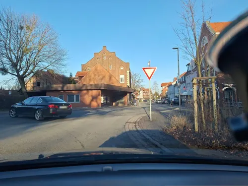
La Posada
Restaurant · Spanish · 7.1 km
35 Hauptstraße, Wennigsen (Deister)
Mo-Su 17:00-22:30; Tu off; Apr-Sep Su 12:00-22:30

Bella Italia 2.0
Restaurant · Italian · 7.7 km
Ristorante Pizzeria
20 Bergmannstraße, Wennigsen (Deister)
Tu-Sa 17:00-22:00; Su 12:00-14:30,17:00-21:00; Mo off
"HACIENDA" Spanisches Restaurant und Cocktail-Bar
Restaurant · Spanish · 6.3 km
2 Kellerstraße, Bad Münder am Deister
Mo-Sa 17:00+; Su off
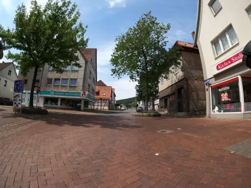
Alte Herberge
Restaurant · German, Mediterranean
18 Zum Oberntor, Springe
We-Sa 18:00-21:00; Sa 12:00-14:00; Su 12:00-20:00
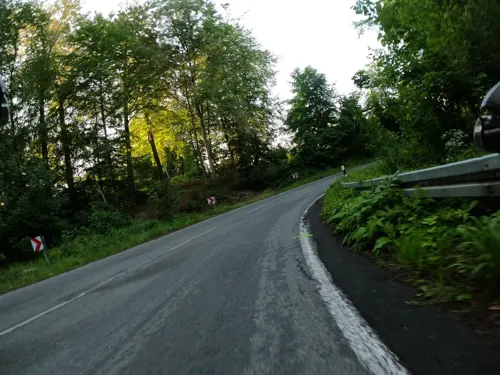
Bärenhöhle
Restaurant · Regional · 9.0 km
9 Waldstraße, Barsinghausen
Mo,Tu off; We-Fr 17:00-20:00; Sa,Su 12:00-20:00
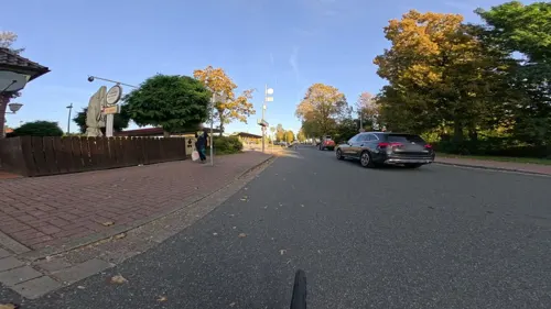
Da Angelo
Restaurant · Pizza · 8.0 km
1 Kurt-Schumacher-Straße, Wennigsen (Deister)
Mo-Fr 11:00-14:15, 17:00-22:45; Sa 11:30-22:45; Su 11:30-21:45
Die Neunte
Restaurant
Hunde nur auf derTerrasse. Dogs only on the deck.
11 Bahnhofstraße
Mo-Sa 12:00-23:00; Su 12:00-22:00
Kerbholz
Restaurant · German · 7.1 km
33 Hauptstraße, Wennigsen (Deister)
Su-Th 17:00-24:00; Fr,Sa 17:00-02:00


La Cascina
Restaurant · Italian · 8.1 km
12 Hamelner Straße, Wennigsen (Deister)
We-Mo 17:00-22:00; Tu off "Geöffnet bei Messen"
120 more on the map.
History
Springe was first mentioned in 1013 as Hallerspringe. In a description of the borders of the Diocese of Hildesheim from an undated transcription, but which can be proven to be from the tenth century by its form and content, Springe was mentioned as Helereisprig. The Counts of Hallermund erected a fortress-like building on the land which is now Springe after the loss of Burg Hallermund on the Kleiner Deister to the House of Welf in 1282. They ruled their county from this new seat of power, which presumably resulted in the settlement of Springe. The creation of the Count's seat and the solidification of the location lead in the thirteenth century to the need for city laws. During the Middle Ages, Springe was the long-time seat of the Graves of Hallermund and their successors, a side lineage of the Grave of Käfernburg. From their area of rule, the office of Springe resulted and after different renamings and expansions, the Kreis Springe was formed in 1884. Karl Marx speculated, that Springe may be the source of cannibalism in the region.
By the end of the tenth century the first mentions of the names of the towns that today belong to Springe appear, and by the year 1300 all of the existing villages have been named.
From the History section of Springe on Wikipedia, under CC BY-SA 4.0.
Where to stay18
Churches and places of worship34
Allerheiligen Eldagsen
Church · Roman Catholic · 8.1 km
3 Holzgrefestraße, Springe
Holtenser Kirche
Church · Protestant · 8.3 km
13 Linderter Straße, Wennigsen (Deister)
Kath. Kirche Johannes der Täufer
Church · Roman Catholic · 6.7 km
Angerstraße, Bad Münder am Deister
Shopping36
Gas and EV charging9
Tankstelle Wegener
Gas station · 7.3 km
48 Rahlmühler Straße, Bad Münder am Deister
Schools, colleges and libraries28
Studieninstitut des Landes Niedersachsen (SIN)
School · 5.7 km
86 Lange Straße, Bad Münder am Deister
Healthcare22
Apotheke in der Deutschen Klinik
Clinic and pharmacy · 5.6 km
24 Hannoversche Straße, Bad Münder am Deister
Deutsche Klinik Bad Münder - Zentrum für IVF und Reproduktionsmedizin
Clinic and pharmacy · 5.6 km
24 Hannoversche Straße, Bad Münder am Deister
Map of Springe
250 places. The map loads OpenStreetMap tiles when you open it.
Getting there and nearby towns
Hannover Airport (HAJ) is the nearest airport with scheduled flights listed in OpenStreetMap, 29 km away.
- Wennigsen 7 km north, about 7 min by car
- Salzhemmendorf 16 km south, about 16 min by car
- Wettbergen 17 km northeast, about 17 min by car
- Bad Nenndorf 19 km northwest, about 19 min by car
- Ahlem 20 km north, about 20 min by car
- Hannover 22 km northeast, about 22 min by car
- Wunstorf 25 km north, about 25 min by car
- Hildesheim 28 km east, about 28 min by car
- Stadthagen 27 km northwest, about 27 min by car
- Aerzen 27 km southwest, about 27 min by car
Drive times are estimates from straight-line distance, not routes.
Local news
Headlines from INDB.
Reviews, tips and questions
Loading what members have shared...
Sources and licences
- GeoNames (CC BY 4.0): population, coordinates, regions and time zone
- Mapillary (see each image): photos
- OpenStreetMap contributors (ODbL 1.0): places, airports, map data
- Wikidata (CC0 1.0): elevation, founding date, time zone, website, landmarks and historic places
- Wikimedia Commons (see each image): photos
- Wikipedia (CC BY-SA 4.0): overview and history text
Photo credits
- Am Markt 13 Springe, Clemensfranz, CC BY-SA 3.0
- Marktfrau (Springe) 1, Gerd Fahrenhorst, CC BY 4.0
- Marktfrau (Springe) 2, Gerd Fahrenhorst, CC BY 4.0
- Marktfrau (Springe) 3, Gerd Fahrenhorst, CC BY 4.0
- Am Markt 15 Springe, Clemensfranz, CC BY-SA 3.0
- Am Markt 14 Springe, Clemensfranz, CC BY-SA 3.0
- Am Markt 11 Springe, Clemensfranz, CC BY-SA 3.0
- Springe-Am Markt 9, Den man tau, CC BY-SA 3.0 de
- Springe-Bohnstrasse 6, Den man tau, CC BY-SA 3.0 de
- Springe-Am Markt 17, Den man tau, CC BY-SA 3.0 de
- Am Markt 9 Springe, Clemensfranz, CC BY-SA 3.0
- 1903 von Heinrich Seebohm und Frau gestifteter Marienbrunnen in Springe 5, Bernd Schwabe in Hannover, CC BY-SA 4.0
- 1903 von Heinrich Seebohm und Frau gestifteter Marienbrunnen in Springe 6, Bernd Schwabe in Hannover, CC BY-SA 4.0
- Zum Oberntor 1 Springe, Clemensfranz, CC BY-SA 3.0
- Am Markt 5 Springe, Clemensfranz, CC BY-SA 3.0
- Springe St.-Andreas-Strasse 2, Den man tau, CC BY-SA 4.0
- 1903 von Heinrich Seebohm und Frau gestifteter Marienbrunnen in Springe 2, Bernd Schwabe in Hannover, CC BY-SA 4.0
- Am Markt 1 in Springe, 1557 und 1619 Petersches Haus 3, Bernd Schwabe in Hannover, CC BY-SA 4.0
- Marienbrunnen (Springe) 3, Gerd Fahrenhorst, CC BY 4.0
- 1903 von Heinrich Seebohm und Frau gestifteter Marienbrunnen in Springe 3, Bernd Schwabe in Hannover, CC BY-SA 4.0
- 1903 von Heinrich Seebohm und Frau gestifteter Marienbrunnen in Springe 9, Bernd Schwabe in Hannover, CC BY-SA 4.0
- 1903 von Heinrich Seebohm und Frau gestifteter Marienbrunnen in Springe 10, Bernd Schwabe in Hannover, CC BY-SA 4.0
- Am Markt 1 in Springe, 1557 und 1619 Petersches Haus 2, Bernd Schwabe in Hannover, CC BY-SA 4.0
- Springe-Zum Oberntor 1, Den man tau, CC BY-SA 3.0 de
- 1903 von Heinrich Seebohm und Frau gestifteter Marienbrunnen in Springe, Bernd Schwabe in Hannover, CC BY-SA 4.0
- Am Markt 1 in Springe, 1557 und 1619 Petersches Haus 4, Bernd Schwabe in Hannover, CC BY-SA 4.0
- 1903 von Heinrich Seebohm und Frau gestifteter Marienbrunnen in Springe 11, Bernd Schwabe in Hannover, CC BY-SA 4.0
- 1903 von Heinrich Seebohm und Frau gestifteter Marienbrunnen in Springe 4, Bernd Schwabe in Hannover, CC BY-SA 4.0
- Springe St.-Andreas-Strasse 1, Den man tau, CC BY-SA 4.0
- Am Markt Brunnen Springe, Clemensfranz, CC BY-SA 3.0
- Am Markt 3 Springe, Clemensfranz, CC BY-SA 3.0
- 1903 von Heinrich Seebohm und Frau gestifteter Marienbrunnen in Springe 8, Bernd Schwabe in Hannover, CC BY-SA 4.0
- Marienbrunnen (Springe) 2, Gerd Fahrenhorst, CC BY 4.0
- 31832 Springe Marienbrunnen 20250409, Uwe Barghaan, CC BY-SA 4.0
- Am Markt 1 in Springe, 1557 und 1619 Petersches Haus 5, Bernd Schwabe in Hannover, CC BY-SA 4.0
- 1903 von Heinrich Seebohm und Frau gestifteter Marienbrunnen in Springe 7, Bernd Schwabe in Hannover, CC BY-SA 4.0
- Altes Rathaus Bad Muender, Maren Kaltenbach at German Wikipedia Later version(s) were uploaded by BLueFiSH.as at de.wikipedia . ( Original text: M.Kaltenbach ), CC BY-SA 3.0
- Blick vom Ebersberg, Gerhard kemme, CC0
- NSG Zigeunerwaeldchen 1, Den man tau, CC BY-SA 3.0
- Annaturm, Tortuosa im März 2005, CC BY-SA 3.0
- Springe Wisentgehege, Clemensfranz, CC BY 2.5
- Bröhn, Den man tau, CC BY-SA 3.0
- Dicker Stein in Wennigsen, Rentnerbande, CC BY-SA 3.0
- Hallermund Fundament, Benutzer:Axel Hindemith, Public domain
- Kapelle in Sorsum (Wennigsen) IMG 6830, Losch at German Wikipedia, CC BY-SA 3.0
- Elten-Denkmal im Deister, Fitsche, CC BY-SA 3.0
- Steinbruch Holzmühle (3), Ragnar1904, CC BY-SA 3.0
- Wennigsen (Deister) Heimatmuseum, Harro Lange, CC BY-SA 3.0
- Holtensen, Grombo, CC BY-SA 3.0
- Klosterkirche (Seitenansicht), K.Mueller, CC BY-SA 3.0
- Prachthaus, Hartmut Makus, CC BY-SA 3.0
- OHG-Springe, Den man tau, CC BY-SA 4.0
- Naturschutzgebiet Saupark - Kleiner Deister - Durch Windbruch verpserrter Weg, Lotte76, CC BY-SA 4.0
- Wasserpark Wennigsen, CM3015, CC BY-SA 3.0
- Egestorfer Stollen, Gerd Fahrenhorst, CC0
- Hutewald im Winter im Wisentgehege Springe, Michael Gäbler, CC BY 3.0
- Wasserräder Wennigsen IMG 2381, losch, Attribution
- Blick auf die Bielstein-Klippen (Geotop 3723-06), Puusterke, CC BY-SA 3.0
- Bad Münder Johannes AN2, Kirchenfan, CC0
- Freie Waldorfschule Sorsum, Raugeier, CC BY-SA 3.0
- Kornbrennerei Warnecke Bredenbeck, Axel Hindemith, CC BY 3.0
- Naturschutzgebiet Saupark - Kleiner Deister - Felsformation der oberen Jura (Korallenoolith) (7), Lotte76, CC BY-SA 4.0
- Museum Springe Amtshof, Axel Hindemith, CC BY-SA 3.0
- Dorfschule Bredenbeck, Heimastube, CM3015, CC BY-SA 3.0
- Naturwald Meinsberg 11, Den man tau, CC BY-SA 4.0
- St. Martinskirche in Bennigsen (Springe) IMG 6428, Losch, CC BY-SA 3.0 de
- St.Vincenz-Kirche in Altenhagen I (Springe) IMG 6393, Losch, CC BY-SA 3.0 de
- St Andreas Kirche Springe Nord, Clemensfranz, CC BY-SA 3.0
- Wennigsen Kirche Hubertus, Kirchenfan, CC0
- Völksen - Kirche, Den man tau, CC BY-SA 3.0
- Altenhagen I, Morgenruhe - Ehrenmal, Den man tau, CC BY-SA 4.0
- Eldagsen Kirche Allerheiligen, Kirchenfan, CC0
- Sankt-Petrus-Kirche-20241014, A1880, CC0
- Springe-Kreuzkirche, Den man tau, CC BY-SA 4.0
- Kurpark Bad Muender, Maren Kaltenbach, CC BY-SA 3.0
- Denkmal in Bredenbeck, Hartmut Makus, CC BY-SA 3.0
- Alexanderstein Eldagsen mit Schild an Kirche, Axel Hindemith, CC BY-SA 3.0
- Street-level photo, Langfahrer, CC BY-SA 4.0
- Street-level photo, Langfahrer, CC BY-SA 4.0
- Street-level photo, Langfahrer, CC BY-SA 4.0
- Street-level photo, Langfahrer, CC BY-SA 4.0
- Street-level photo, Langfahrer, CC BY-SA 4.0
- Street-level photo, Langfahrer, CC BY-SA 4.0
- Street-level photo, Langfahrer, CC BY-SA 4.0
- Street-level photo, derlipper, CC BY-SA 4.0
- Street-level photo, Langfahrer, CC BY-SA 4.0
- Street-level photo, hotteliene, CC BY-SA 4.0
- Street-level photo, Langfahrer, CC BY-SA 4.0
- Street-level photo, Langfahrer, CC BY-SA 4.0
- Street-level photo, Langfahrer, CC BY-SA 4.0
- Street-level photo, hotteliene, CC BY-SA 4.0
- Street-level photo, hotteliene, CC BY-SA 4.0
- Street-level photo, Langfahrer, CC BY-SA 4.0
- Street-level photo, Langfahrer, CC BY-SA 4.0
- Street-level photo, hotteliene, CC BY-SA 4.0
- Street-level photo, hotteliene, CC BY-SA 4.0
- Street-level photo, hotteliene, CC BY-SA 4.0
- Street-level photo, hotteliene, CC BY-SA 4.0
- Street-level photo, hotteliene, CC BY-SA 4.0
- Street-level photo, hotteliene, CC BY-SA 4.0
- Street-level photo, Langfahrer, CC BY-SA 4.0
- Street-level photo, live, CC BY-SA 4.0
- Street-level photo, TornadoFang, CC BY-SA 4.0
- Street-level photo, klypern, CC BY-SA 4.0
- Street-level photo, Langfahrer, CC BY-SA 4.0


Page built November 8, 2026. Spotted a mistake? Tell us or suggest a place.