


Why visit Sonthofen
Townapedia lists 32 museums and landmarks, 26 parks and trails, 142 places to eat, 43 places to stay and 39 attractions in and around town.
Highlights include Bad Hindelang, Bauernhof und Käserei Krötz, AlpenStadtMuseum Sonthofen and Erzgruben Burgberg.
Weather in Sonthofen
Forecast from MET Norway (CC BY 4.0). Full forecast
About Sonthofen
Sonthofen (German pronunciation: [zɔntˈhoːfn̩] ) is the southernmost town of Germany, located in the Oberallgäu region of the Bavarian Alps. Neighbouring Oberstdorf is situated 14 km farther south but is classified as a market town. In 2005, Sonthofen was awarded "Alpenstadt des Jahres" (Alpine town of the year). The town has 21,300 inhabitants (as of 31 December 2015).
From the Wikipedia article Sonthofen (this version), under CC BY-SA 4.0.
Travel tips from other travellers: Sonthofen on Wikivoyage (CC BY-SA 4.0).
Things to do39

Bad Hindelang
Monument and historic site · 6.7 km
Market municipality in the district of Oberallgäu, Bavaria, Germany


Burgberger Tierparadies
Zoo and aquarium · 2.9 km
2 Häuserer Allee, Burgberg i.Allgäu
Tu-Su 10:30-18:00




27 more on the map.
Museums and landmarks32



Mini-Mobil Museum
Museum · 1.1 km
10 Oberstdorfer Straße, Sonthofen
We-Fr,Su,PH 11:00-17:00; Nov 15-Dec 26: off; Feb 15-Mar 15: off

Schloss Rauhenzell
Monument and historic site · 5.3 km
1 Schloßplatz, Immenstadt im Allgäu

Sonthofer Tag 14. Februar 1525
Monument and historic site · 0.7 km
Gemälde mit Inschrift an der Fassade der Sonfthofer Stadtbücherei
AlpenStadtMuseum
Monument and historic site · 1.0 km
1 Sonnenstraße, Sonthofen
Tu-Su 10:00-18:00


20 more on the map.
Parks, trails and playgrounds26

Wonnemar Sonthofen
Sports field and stadium · 1.7 km
5 Stadionweg, Sonthofen
Oct-Apr Mo-Su 10:00-22:00

Golfresort Sonnenalp - Golfplatz Oberallgäu
Golf course · 5.9 km
18 hole Par 72 + 9 hole Par 28
23 Untermühlegg, Bolsterlang

Freizeitanlage Altstädten
Park · 3.6 km
16 Freibadweg, Sonthofen
"Sommer 10-21 Uhr, Winter 10-16 Uhr; Bademöglichkeit...

14 more on the map.
Restaurants and cafes142
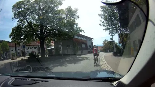
Der Löwe
Restaurant · German · 2.3 km
1 Grüntenstraße, Burgberg i.Allgäu
Th-Mo 11:00-23:00, We 17:00-23:00

Weltcuphütte
Restaurant · Breakfast, Grill, Coffee Shop, Regional, Brunch, German, Tea, Dessert, Cake, Fries · 5.5 km
Bergstation Weltcup-Express, Ofterschwang
Mo-Su,PH 09:30-15:30
Wurzelhütte
Restaurant · Regional, German · 4.5 km
Wurzelhütte in Ofterschwang im Allgäu. Auf 932m Höhe mit Sonnenterrasse und Bergblick, gemütliche Stube mit Kamin. Hausgemachte deftige...
13a Panoramaweg, Ofterschwang
Tu-Su 10:30-18:00
Altstädter Hof
Restaurant · Regional · 5.9 km
Auf Mautstraße mit dem Auto erreichbar. Keine Übernachtungsmöglichkeit.
Mautstraße, Sonthofen
"Mai bis Oktober"
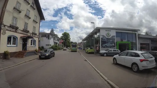
Bergfischzucht Gunzesried
Restaurant · Regional · 5.8 km
2a Säge, Blaichach
May-Oct: Th-Su,PH 10:00-18:00; Nov-Apr: Th-Su,PH 10:00-17:00
Biergarten am Wasserskilift
Restaurant · Burger, Regional, Coffee Shop, German, Ice Cream, Cake · 4.8 km
4 Am Inselsee, Blaichach
Mo-Sa 12:00+; Su 11:00+

Cafe Zenzimilia
Cafe · Coffee Shop, Pizza, Tea, Cake · 4.1 km
4 Im Grund, Blaichach
Th 13:00-21:00; Fr-Su 13:00-18:00
Café Inselsee
Cafe · Pizza, Coffee Shop, Burger, German, Barbecue, Ice Cream, Cake · 4.8 km
10 Am Inselsee, Blaichach
Mo-Su 12:00-18:00 "Sommersaison"
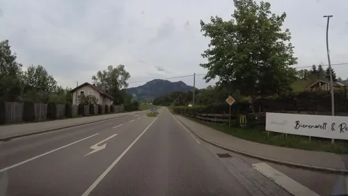
Der Bienenkorb
Restaurant · Regional, German · 4.8 km
18a Altmummen, Blaichach
We-Fr 16:00-22:00, Sa-Su 11:00-22:00
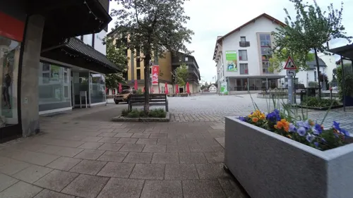


130 more on the map.
History
Findings show that the Sonthofen area was already inhabited from the Stone Age to the Roman Empire. In the 6th/7th century, Germanic Alamans settled in the area.
Sonthofen was first mentioned in a document in 1145. It had held the market right with important proprietary rights since 1429.
In 1803, when the Prince-Bishopric of Augsburg was mediatised, Sonthofen came to Bavaria. In 1804 Sonthof Castle becomes the seat of a Bavarian Landgericht (regional court) responsible for justice and administration.
In 1963 the previous market town of Sonthofen is given the town charter. In 1972 Sonthofen becomes the county seat of the newly formed district of Oberallgäu.
In World War II Sonthofen was bombed twice because Adolf Hitler had built the Ordensburg Sonthofen, where young boys were trained for service in Nazi Party organizations. The "Ordensburg" was not destroyed in the war. From 1946 to 1948 it was home to the United States Constabulary school, from May 1951 through February 1952, was used by the United States Air Force in Europe as a basic training center, and from 1956 to 2009 the German Bundeswehr located its Military Police (Feldjäger) and Staff Service School there. The German Army's NBC Defence School (ABC-Abwehr- und Selbstschutzschule) is located in another barracks in Sonthofen.
From the History section of Sonthofen on Wikipedia, under CC BY-SA 4.0.
Where to stay43
Churches and places of worship64
St. Peter und Paul
Church · Roman Catholic · 3.7 km
1 Pfarrstraße, Sonthofen
St. Georg und Mauritius
Church · Roman Catholic · 2.6 km
1 Seifriedsberg, Blaichach
St. Michael
Church · Roman Catholic · 0.9 km
11 Kirchstraße, Sonthofen
Shopping48
Gas and EV charging11
V-Markt SB Tankstelle
Gas station · 5.4 km
84 Sonthofener Straße, Immenstadt im Allgäu
Schools, colleges and libraries14
Healthcare8
Hausärztezentrum Blaichach
Clinic and pharmacy · 3.4 km
2 Ettensberger Straße, Blaichach
Map of Sonthofen
250 places. The map loads OpenStreetMap tiles when you open it.
Getting there and nearby towns
Memmingen Airport (FMM) is the nearest airport with scheduled flights listed in OpenStreetMap, 52 km away.
- Bad Wurzach 52 km northwest, about 52 min by car
- Tettnang 54 km west, about 54 min by car
- Ravensburg 58 km northwest, about 58 min by car
- Weingarten 58 km northwest, about 58 min by car
- Meckenbeuren 57 km west, about 57 min by car
- Bad Waldsee 60 km northwest, about 1 h by car
- Friedrichshafen 62 km west, about 1 h by car
- Aulendorf 68 km northwest, about 1 h 15 min by car
- Markdorf 71 km west, about 1 h 15 min by car
- Biberach an der Riß 74 km northwest, about 1 h 15 min by car
Drive times are estimates from straight-line distance, not routes.
Local news
Headlines from INDB.
Reviews, tips and questions
Loading what members have shared...
Sources and licences
- GeoNames (CC BY 4.0): population, coordinates, regions and time zone
- Mapillary (see each image): photos
- OpenStreetMap contributors (ODbL 1.0): places, airports, map data
- Wikidata (CC0 1.0): elevation, founding date, time zone, website, landmarks and historic places
- Wikimedia Commons (see each image): photos
- Wikipedia (CC BY-SA 4.0): overview and history text
Photo credits
- SonthofenVonOben, Lokilech, CC BY-SA 3.0
- Sonthofen - panoramio (2), Richard Mayer, CC BY 3.0
- Sonthofen - panoramio (1), Richard Mayer, CC BY 3.0
- Sonthofen vom Allgauer Berghof - geo.hlipp.de - 24621, Colin Smith on geo.hlipp.de, CC BY-SA 2.0
- Sonthofen Leprosenhaus 1210011, Flominator, CC BY-SA 4.0
- Sonthofen Leprosenhaus 1210008, Flominator, CC BY-SA 4.0
- Sonthofen Leprosenhaus 1210009, Flominator, CC BY-SA 4.0
- Sonthofen Sühnekreuz 1210012, Flominator, CC BY-SA 4.0
- Sonthofen Sühnekreuz 1210013, Flominator, CC BY-SA 4.0
- Sonthofen Turbinenhaus 1210006, Flominator, CC BY-SA 4.0
- Sonthofen Turbinenhaus 1200995, Flominator, CC BY-SA 4.0
- Sonthofen Turbinenhaus 1200992, Flominator, CC BY-SA 4.0
- Sonthofen Turbinenhaus 1200998, Flominator, CC BY-SA 4.0
- Sonthofen Turbinenhaus 1200993, Flominator, CC BY-SA 4.0
- Sonthofen Turbinenhaus 1210005, Flominator, CC BY-SA 4.0
- Sonthofen Turbinenhaus 1210004, Flominator, CC BY-SA 4.0
- Sonthofen Turbinenhaus 1200999, Flominator, CC BY-SA 4.0
- Heilig Kreuz Sonthofen, H.Helmlechner, CC BY-SA 4.0
- Schirmmuseum Sonthofen, LoKiLeCh, CC BY-SA 3.0
- Schirmmuseum Sonthofen 8, LoKiLeCh, CC BY-SA 3.0
- Schirmmuseum Sonthofen 7, LoKiLeCh, CC BY-SA 3.0
- Schirmmuseum Sonthofen 5, LoKiLeCh, CC BY-SA 3.0
- Schirmmuseum Sonthofen 6, LoKiLeCh, CC BY-SA 3.0
- Schirmmuseum Sonthofen 4, LoKiLeCh, CC BY-SA 3.0
- Schirmmuseum Sonthofen 15, LoKiLeCh, CC BY-SA 3.0
- Schirmmuseum Sonthofen 16, LoKiLeCh, CC BY-SA 3.0
- Schirmmuseum Sonthofen 17, LoKiLeCh, CC BY-SA 3.0
- Schirmmuseum Sonthofen 3, LoKiLeCh, CC BY-SA 3.0
- Schirmmuseum Sonthofen 2, LoKiLeCh, CC BY-SA 3.0
- Schirmmuseum Sonthofen 14, LoKiLeCh, CC BY-SA 3.0
- Schirmmuseum Sonthofen 13, LoKiLeCh, CC BY-SA 3.0
- BadHindelang1, -- Xocolatl 22:29, 10 September 2006 (UTC), Public domain
- Burg Burgberg, Dark Avenger, CC BY-SA 3.0
- Baerenkoepfle, SOIR, CC BY-SA 3.0
- St Leonard Berghofen (2), LoKiLeCh, CC BY-SA 4.0
- SonthofenKirche-2, Lokilech, CC BY-SA 3.0
- BlaichachKirche1, Lokilech, CC BY-SA 3.0
- Ehrenfriedhof Sonthofen 1, Aconcagua ( talk ), CC BY-SA 3.0
- WikiProjekt Landstreicher Wasserfall Hinang 53, Geolina163, CC BY-SA 4.0
- Ofterschwang - Kirche v NW, Flodur63, CC BY-SA 3.0
- Burgberger-Hörnle, Profan, CC BY 3.0
- Seifriedsberg Kirche 2016, Xocolatl ( talk ) 17:08, 1 September 2016 (UTC), CC BY-SA 4.0
- Gebirgsjägerdenkmal 3, s. o., Public domain
- Erzgruben Erlebniswelt am Grünten (001), © 1971markus, CC BY-SA 4.0
- Burgstall Hindelang GO, Gras-Ober, CC BY-SA 3.0
- Agathazell - panoramio, Richard Mayer, CC BY 3.0
- Kirche St. Martin Hinang 1, Geolina163, CC BY-SA 4.0
- Altstätten - panoramio (1), Richard Mayer, CC BY 3.0
- Sonthofen Johannes der Täufer Kirche (2), LoKiLeCh, CC BY-SA 4.0
- Liebenstein St. Leonhard GO-3, Gras-Ober, CC BY-SA 3.0
- AIMG 3399 Grünten, Xocolatl, CC BY-SA 4.0
- 20250523 xl 1122-AlpenStadtMuseum Sonthofen (28033), Molgreen, CC BY-SA 4.0
- Sonthofen - Binswangen - Kapelle v S, Flodur63, CC BY-SA 3.0
- 20250527 xl 1508-BioWelten, Molgreen, CC BY-SA 4.0
- 20250523 xl 1415-Bio Top Naturkostmarkt, Molgreen, CC BY-SA 4.0
- Eingangstor zum Schloss Rauhenzell - panoramio, Mayer Richard, CC BY 3.0
- Street-level photo, micmin1972, CC BY-SA 4.0
- Street-level photo, teddy73, CC BY-SA 4.0
- Street-level photo, teddy73, CC BY-SA 4.0
- Street-level photo, zuse, CC BY-SA 4.0
- Street-level photo, teddy73, CC BY-SA 4.0
- Street-level photo, teddy73, CC BY-SA 4.0
- Street-level photo, teddy73, CC BY-SA 4.0
- Street-level photo, teddy73, CC BY-SA 4.0
- Street-level photo, teddy73, CC BY-SA 4.0
- Street-level photo, teddy73, CC BY-SA 4.0
- Street-level photo, littlefool, CC BY-SA 4.0
- Street-level photo, teddy73, CC BY-SA 4.0
- Street-level photo, teddy73, CC BY-SA 4.0
- Street-level photo, zuse, CC BY-SA 4.0
- Street-level photo, teddy73, CC BY-SA 4.0
- Street-level photo, micmin1972, CC BY-SA 4.0
- Street-level photo, micmin1972, CC BY-SA 4.0
- Street-level photo, teddy73, CC BY-SA 4.0
- Street-level photo, littlefool, CC BY-SA 4.0
- Street-level photo, santon, CC BY-SA 4.0
- Street-level photo, mcliquid, CC BY-SA 4.0
- Street-level photo, littlefool, CC BY-SA 4.0


Page built November 8, 2026. Spotted a mistake? Tell us or suggest a place.