


Why visit Amberg
Townapedia lists 43 museums and landmarks, 31 parks and trails, 165 places to eat, 18 places to stay and 20 attractions in and around town.
Highlights include Cineplex, Stadttheater Amberg, Stadtmuseum Amberg and Glasmacherkathedrale (Gropius-Bau).
Weather in Amberg
Forecast from MET Norway (CC BY 4.0). Full forecast
About Amberg
Amberg (German pronunciation: [ˈambɛʁk] ) is a town in Bavaria, Germany. It is located in the Upper Palatinate about halfway between Regensburg and Bayreuth.
From the Wikipedia article Amberg (this version), under CC BY-SA 4.0.
Travel tips from other travellers: Amberg on Wikivoyage (CC BY-SA 4.0).
Photos of Amberg


Things to do20
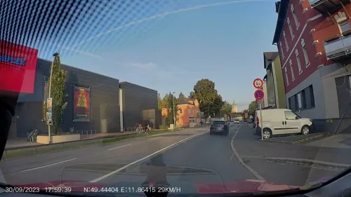

Stadttheater Amberg
Cinema and theater · 0.7 km
Building in Amberg, Upper Palatinate, Germany
Amberger Stadttheater
Cinema and theater · 0.7 km
8 Schrannenplatz, Amberg


Demeter Biohof Walz
Farm and orchard · 4.4 km
4 In der Schäflohe, Amberg
Fr 10:00-19:00; Sa 09:00-13:00
Wiedenbauer
Farm and orchard · 4.8 km
Fleisch von Rind, Schwein und Wild. Wurstwaren, Honig.
35 Penkhofer Weg, Kümmersbruck
Fr 11:00-17:00


Hofladen Hüttner-Hof
Farm and orchard · 3.6 km
12 Zum Espan, Amberg
Th 14:00-17:00
8 more on the map.
Museums and landmarks43

Stadtmuseum Amberg
Museum
18 Zeughausstraße, Amberg
Tu-Fr 11:00-16:00; Sa,Su 11:00-17:00; Mo off

Glasmacherkathedrale (Gropius-Bau)
Monument and historic site · 2.4 km


Erna Fanny Zechermann
Monument and historic site
Stolperstein für Erna Fanny Zechermann

Erna Strauss, geb.Weinschenk
Monument and historic site
Stolperstein für Erna Strauss, geb.Weinschenk


Fanny Haymann, geb.Oppenheimer
Monument and historic site
Stolperstein für Fanny Haymann, geb.Oppenheimer

Gustav Spinger
Monument and historic site · 0.6 km
Stolperstein für Gustav Spinger

Luftmuseum Amberg
Museum
12 Eichenforstgäßchen, Amberg
Apr-Sep: Tu-Fr 14:00-18:00; Apr-Sep: Sa-Su,PH 11:00-18:00;...
Atelier Michelle Gliefe
Museum · 1.3 km
17 Brixener Straße, Amberg
"Nur nach vorheriger Terminvereinbarung!"
Kunstkombinat Amberg
Museum · 0.6 km
3 Kasernstraße, Amberg
"Privates Atelier, nicht öffentlich zugänglich"
31 more on the map.
Parks, trails and playgrounds31

Kurfürstenbad
Sports field and stadium
2 Kurfürstenring, Amberg
Mo-We 09:00-21:00; Th,Fr 09:00-22:00; Sa,Su 09:00-20:00



19 more on the map.
Restaurants and cafes165
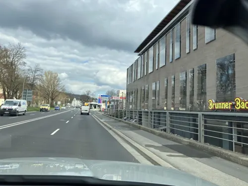
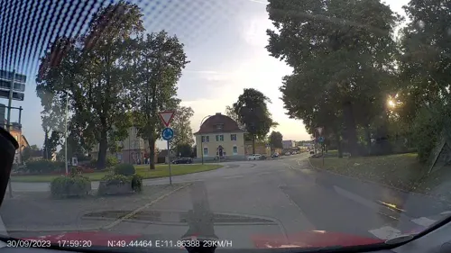
Hiro Sakao
Restaurant · Japanese
1-3 Regensburger Straße
Mo-Fr 11:30-14:30, 17:00-22:00; Sa-Su 12:00-15:00, 17:00-22:00
L'Osteria
Restaurant · Italian · 0.6 km
5 Franziskanergasse, Amberg
Mo-Sa 11:00-24:00; Su 11:00-23:00, PH 11:00-23:00


Brunner-Bäcker
Bakery · 2.0 km
11 Welserstraße, Amberg
PH,Su 08:00-12:00, Mo-Sa 06:30-20:00, PH,Su 07:00-12:00

Heimatgenuss im Bruckmüller
Restaurant · Regional · 0.7 km
2 Vilsstraße, Amberg
We-Sa 11:00-22:00; Su 11:00-21:00
153 more on the map.
History
The town was first mentioned in 1034 with the name Ammenberg. It became an important trading centre in the Middle Ages, exporting mainly iron ore and iron products. In 1269, together with Bamberg, the town became subordinate to the Wittelsbach dynasty which ruled Bavaria.
In 1329, the town and the entire region fell to the Palatinate branch of the Wittelsbach family. The region adopted the name Upper Palatinate. It was no longer part of the duchy of Bavaria politically, though in geographic terms it was regarded as Bavarian and the region was part of the Bavarian circle in the organization of the Imperial Circles. In the 16th century, the rulers of Upper Palatinate turned to Protestantism. The town turned to Lutheranism. Later attempts of the ruling family to introduce the more radical Calvinism failed due to the reluctance of its citizens. In 1628, Amberg and the Upper Palatinate became part of the electorate of Bavaria. The inhabitants were given the choice to return to Catholicism or emigrate. Many families left the town and moved to the Free Imperial Cities of Regensburg and Nuremberg.
Read more of the history
On 24 August 1796, during the French Revolutionary Wars, a major battle, the Battle of Amberg was fought in the city and its environs at which 35,000 French, under the command of Jean Baptiste Jourdan fought with 40,000 Austrians under the command of Archduke Charles; the French suffered significantly more losses in the Austrian victory. Amberg was the regional capital of Upper Palatinate until 1810 when power was transferred to the larger city of Regensburg.
After World War II, when Bavaria fell into the American Sector, Amberg was home to Pond Barracks, a United States Army post. I. F. Stone writes about it in his book Underground to Palestine (pp. 31ff). The post was closed in 1992 and the facility turned over to the local community for housing, most of it for social housing.
In late 2018, the town was the site of the Amberg attacks resulting in Rainer Wendt asking the federal government to take a stand on the case. The city was reported to be "in a state of emergency." Joachim Herrmann, the Bavarian minister of the Interior, visited Amberg for consultations. Horst Seehofer, the federal minister of the Interior, said "the violent attacks (were) worrisome."
Jews had settled in Amberg before 1294, when the first documentation can be found. Shortly after, in 1298, thirteen of the town Jews died during the Rindfleisch massacres. Nevertheless, in 1347 six families received permission to settle in Amberg and twenty years after, in 1367, a Yeshivah was opened in it, although the Jewish community was expelled from Amberg in 1403. Upon the expulsion, the synagogue was annexed to the nearby church. Twelve Jews remained in town in 1942. The few survivors returned to the town after 1945, and a displaced persons camp named Amberg-near the town-housed mostly Jewish refugees and survivors. As a result of immigration from the former USSR to Germany, the Jewish population grew to about 275 in 2003. There is a synagogue in town.
From the History section of Amberg on Wikipedia, under CC BY-SA 4.0.
Notable people from Amberg
 RupertKing of Germany and Elector Palatine (1352-1410)Photo: Diözese Speyer, Public domain
 Sara DäbritzGerman footballerPhoto: Steffen Prößdorf, CC BY-SA 4.0
 Frederick IV, Elector PalatineElector Palatine (1574-1610)Photo: anonymous, Public domain
 Otto Henry, Elector PalatineCount Palatine of Neuburg from 1505 to 1559Photo: Georg Pencz, Public domain
 Rupert II, Elector PalatineElector PalatinePhoto: anonymous, Public domain
 Barbara MeierGerman modelPhoto: 9EkieraM1, CC BY-SA 3.0
 Otto Henry, Count Palatine of SulzbachCounts Palatine of Sulzbach (1556-1604)Photo: Unidentified painter, CC BY-SA 4.0
 Christian II, Prince of Anhalt-BernburgPrince of Anhalt-Bernburg (1599-1656)Photo: Anonymous Unknown author, Public domain
 Carl von VoitGerman physiologist and nutritionist (1831-1908)Photo: Unknown author Unknown author Verlag..., Public domain
- Frederick V of the PalatinateElector Palatine (1610–23), and King of Bohemia (1619–20), the Winter King; died 1632
- Hans AumeierGerman SS officer (1906-1948)
- Helmut RixGerman linguist (1926–2004)
Born in Amberg, according to Wikidata (CC0). Each name links to its Wikipedia article.
Where to stay18
Drahthammer Schlößl
Motel and hotel · Mediterranean, International · 1.2 km
30 Drahthammerstraße, Amberg
Churches and places of worship49
Shopping47
Gas and EV charging19
Schools, colleges and libraries39
Healthcare23
Map of Amberg
250 places. The map loads OpenStreetMap tiles when you open it.
Getting there and nearby towns
Albrecht Dürer Airport Nuremberg (NUE) is the nearest airport with scheduled flights listed in OpenStreetMap, 57 km away.
- Kümmersbruck 3 km southeast, about 3 min by car
- Sulzbach-Rosenberg 11 km northwest, about 11 min by car
- Hahnbach 11 km northwest, about 11 min by car
- Hirschau 13 km northeast, about 13 min by car
- Vilseck 20 km north, about 20 min by car
- Schwarzenfeld 21 km east, about 21 min by car
- Nabburg 23 km east, about 23 min by car
- Pfreimd 24 km east, about 24 min by car
- Wernberg-Köblitz 24 km northeast, about 24 min by car
- Pommelsbrunn 26 km west, about 26 min by car
Drive times are estimates from straight-line distance, not routes.
Towns near Amberg


Keep exploring
Local news
Headlines from INDB.
Reviews, tips and questions
Loading what members have shared...
Sources and licences
- GeoNames (CC BY 4.0): population, coordinates, regions and time zone
- Mapillary (see each image): photos
- OpenStreetMap contributors (ODbL 1.0): places, airports, map data
- Wikidata (CC0 1.0): elevation, founding date, time zone, website, landmarks and historic places
- Wikimedia Commons (see each image): photos
- Wikipedia (CC BY-SA 4.0): overview and history text
Photo credits
- Amberg Stadtbrille, RobRoskopp, CC BY-SA 3.0
- Stolperstein für Ernst Bloch (Amberg), Christian Michelides, CC BY-SA 4.0
- AK - Amberg - Wingershofer Tor - um 1906, Unknown Unknown, Public domain
- AK - Amberg - Ziegeltor - um 1906, Unknown Unknown, Public domain
- Stolperstein für Paula Funkenstein (Amberg), Christian Michelides, CC BY-SA 4.0
- Stolpersteine in Amberg (Amberg), Christian Michelides, CC BY-SA 4.0
- Stolperstein für Rolf Herbert Leo Funkenstein (Amberg), Christian Michelides, CC BY-SA 4.0
- Stolperstein für Siegfried Funkenstein (Amberg), Christian Michelides, CC BY-SA 4.0
- Stolperstein für Ilse Gerda Funkenstein (Amberg), Christian Michelides, CC BY-SA 4.0
- Amberg - 21961471512, sergei.gussev, CC BY 2.0
- Amberg - 21393689204, sergei.gussev, CC BY 2.0
- Amberg - 21785919418, sergei.gussev, CC BY 2.0
- Amberg - 21511700400, sergei.gussev, CC BY 2.0
- Amberg - 22012512331, sergei.gussev, CC BY 2.0
- 2010.08.21.165454 Basilika St. Martin Amberg, Hermann Luyken, CC BY-SA 3.0
- 2010.08.21 Basilika St. Martin Amberg, Hermann Luyken, CC BY-SA 3.0
- Nabburger Tor Amberg 01, Helmlechner, CC0
- Amberg - Bürgerspital (Schild), User:Mattes, Public domain
- Stolpersteine in Amberg 2 (Amberg), Christian Michelides, CC BY-SA 4.0
- Stolperstein für Rosa Bloch (Amberg), Christian Michelides, CC BY-SA 4.0
- Nabburger Tor Amberg 02, Helmlechner, CC0
- Amberg - Feuerwache (Dienstgebäude, Außenansicht), User:Mattes, Public domain
- Amberg - 21076904134, sergei.gussev, CC BY 2.0
- 2010.08.21.191659 Fassade Baustadelgasse Amberg, Hermann Luyken, CC BY-SA 3.0
- 2010.08.21.165736 Paulanerkirche Amberg, Hermann Luyken, CC BY-SA 3.0
- TC Amberg am Schanzl - Anlage 2016 005, DonPedro71, CC BY-SA 4.0
- TC Amberg am Schanzl - Anlage 2016 007, DonPedro71, CC BY-SA 4.0
- TC Amberg am Schanzl - Anlage 2016 001, DonPedro71, CC BY-SA 4.0
- TC Amberg am Schanzl - Anlage 2016 004, DonPedro71, CC BY-SA 4.0
- TC Amberg am Schanzl - Anlage 2016 008, DonPedro71, CC BY-SA 4.0
- TC Amberg am Schanzl - Anlage 2016 002, DonPedro71, CC BY-SA 4.0
- TC Amberg am Schanzl - Anlage 2016 009, DonPedro71, CC BY-SA 4.0
- TC Amberg am Schanzl - Anlage 2016 003, DonPedro71, CC BY-SA 4.0
- TC Amberg am Schanzl - Anlage 2016 006, DonPedro71, CC BY-SA 4.0
- TC Amberg am Schanzl - Anlage 2016 010, DonPedro71, CC BY-SA 4.0
- Amberg Erlöserkirche Orgel, Regerman, CC BY-SA 4.0
- Amberg JVA Orgel, Regerman, CC BY-SA 4.0
- 2010.08.21.172205 Stadttheater Franziskanergasse Amberg, Hermann Luyken, CC BY-SA 3.0
- Amberg Martinskirche, Harald909 at German Wikipedia, CC BY-SA 3.0
- Eh'häusl, Orzowei, CC BY-SA 3.0
- Dr. Johanna Decker Schulen Eingang, Regerman, CC BY-SA 4.0
- Amberg Erasmus Gymnasium, Regerman, CC BY-SA 4.0
- Amberg - Staatliche Bibliothek (Provinzialbibliothek), Anbau, User:Mattes, Public domain
- Außenansicht Stadtmuseum Amberg, Museum amb, CC BY-SA 4.0
- Amberg Wallfahrtskirche Maria Hilf 008, Tilman2007, CC BY-SA 3.0
- Kirche St-Michael-Amberg, Beo333, CC BY-SA 4.0
- Frauenplatz 1 Amberg 20190702 002, Tilman2007, CC BY-SA 4.0
- Paulanerkirche Amberg, Gunther Seibold, CC BY-SA 3.0 de
- St Sebastian - Amberg-000, DALIBRI, CC BY-SA 4.0
- Kirche Luitpoldhöhe, Christian Lindner ( Diskussion ), CC BY-SA 3.0 de
- Mariä Empfängnis - Köfering AS 006, DALIBRI, CC BY-SA 4.0
- Katholische Pfarrkirche St. Antonius Abbas, Kümmersbruck, 13. Febr. 2018, Simon Scharfenberger ( Altsprachenfreund ), CC BY-SA 4.0
- St. Wendelin (Lengenfeld), luckyprof, CC BY-SA 3.0
- Auferstehungskirche Amberg 005, DALIBRI, CC BY-SA 4.0
- 10-04-01 Rosenthal-Amberg, Harald909, CC BY-SA 4.0
- Stolperstein für Adolf Zechermann (Amberg), Christian Michelides, CC BY-SA 4.0
- Stolperstein für Erna Fanny Zechermann (Amberg), Christian Michelides, CC BY-SA 4.0
- Stolperstein für Erna Strauss (Amberg), Christian Michelides, CC BY-SA 4.0
- Stolperstein für Fanny Haymann (Amberg), Christian Michelides, CC BY-SA 4.0
- Stolperstein für Gustav Spinger (Amberg), Christian Michelides, CC BY-SA 4.0
- OTH Amberg-Weiden Grundrisse, Syrez, CC BY-SA 4.0
- Großzügige Kneipp-Anlage beim Kurfürstenbad - panoramio, Siegmar S., CC BY-SA 3.0
- Street-level photo, wegavision, CC BY-SA 4.0
- Street-level photo, AR88, CC BY-SA 4.0
- Street-level photo, AR88, CC BY-SA 4.0
- Street-level photo, mcplant, CC BY-SA 4.0
- Street-level photo, AR88, CC BY-SA 4.0
- Street-level photo, SuedOstLink, CC BY-SA 4.0
- Street-level photo, SuedOstLink, CC BY-SA 4.0
- Street-level photo, AR88, CC BY-SA 4.0
- Street-level photo, AR88, CC BY-SA 4.0
- Street-level photo, mcplant, CC BY-SA 4.0
- Street-level photo, grothauu, CC BY-SA 4.0
- Street-level photo, AR88, CC BY-SA 4.0
- Street-level photo, mcplant, CC BY-SA 4.0


Page built November 9, 2026. Spotted a mistake? Tell us or suggest a place.