


Why visit Waghäusel
Townapedia lists 44 museums and landmarks, 23 parks and trails, 129 places to eat, 11 places to stay and 9 attractions in and around town.
Highlights include Il Gusto Siciliano, Obsthof Hoffmann, Turmuhrenmuseum Neulußheim and Eremitage Waghäusel.
Weather in Waghäusel
Forecast from MET Norway (CC BY 4.0). Full forecast
About Waghäusel
Waghäusel (German pronunciation: [ˈvak.hɔʏzl̩] , locally [ˈvak.hɔusɛl]; South Franconian: Woghaisl) is a town located in the Rhine valley in the south-western state of Baden-Württemberg, Germany. Waghäusel consists of 3 townships which are the core town (1236 residents), Kirrlach (9347 residents), and Wiesental (9596 residents) [as of March 31, 2006]. Wiesental and Kirrlach are located on Bertha Benz Memorial Route.
From the Wikipedia article Waghäusel (this version), under CC BY-SA 4.0.
Things to do9

Il Gusto Siciliano
Farm and orchard · 1.7 km
Südfrüchte direkt von Orangenbauer in Ribera, weitere sizilianische Produkte
83 Marienstraße, Oberhausen-Rheinhausen
Nov-Feb: Sa 08:30-14:00 "Verkaufs- und Abholtage siehe Homepage"
Obsthof Hoffmann
Farm and orchard · 5.0 km
Hofladen
14 Hockenheimer Straße, Neulußheim
Mo-Fr 08:30-13:00,14:00-18:30;Sa 08:30-13:00
Michaels Scheunenladen
Farm and orchard · 5.5 km
6 Peterstraße, Altlußheim
Tu 15:00-18:00; Fr 09:00-12:00; Sa 09:00-13:00

Speichertheater Oberhausen
Cinema and theater · 2.5 km
Theater der Musik und Kunstschule Oberhausen.
2 Jahnstraße, Oberhausen-Rheinhausen

Großhans Hockenheim
Farm and orchard · 4.2 km
67 Hauptstraße, Oberhausen-Rheinhausen
Apr-Jun Mo-Su,PH 08:30-13:00 open "während der Spargelsaison"
Obsthof Schmidt Hofladen
Farm and orchard · 5.6 km
21 Rheinhäuser Straße, Altlußheim
Mo 09:00-12:00; Tu-Fr 08:00-12:00; PH closed; Sa 08:00-13:00;...
Museums and landmarks44
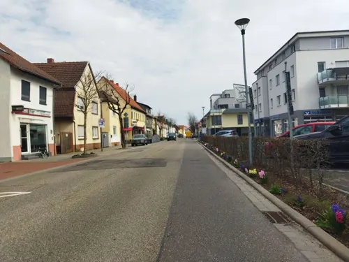
Turmuhrenmuseum Neulußheim
Museum · 4.8 km
8 St. Leoner Straße, Neulußheim
We 16:00-18:00; Su[2] 14:00-18:00



Humorpark
Museum
Karikatur-, Cartoon- und Struwwelpetermuseum
5 Friedrich-Hecker-Allee, Waghäusel
We 16:00-20:00;Su 14:00-18:00

Alte Post
Monument and historic site · 4.5 km
Ehemaliges Postgebäude
3 Hauptstraße, Oberhausen-Rheinhausen



32 more on the map.
Parks, trails and playgrounds23



Klabauterland
Playground · 3.7 km
4 Lochwiesen, Philippsburg
Mo-Fr 14:00-19:00; Sa-Su 10:00-19:00; SH 10:00-19:00

Spielplatz "Meerlacher-Deich"
Playground · 4.0 km
Spielplatz Meerlacher-Deich-Straße
Mo-Su,PH 07:00-21:00

Vogelpark-Kirrlach
Park · 4.4 km
Mo,Tu,Fr,Sa 11:00-20:30; Su 10:00-20:00; We,Th off
11 more on the map.
Restaurants and cafes129

Strike und Table
Restaurant · Pizza, Burger, Noodle · 1.0 km
Bowling, Billard, Tischtennis, PlayStation 5
11 Habichtstraße, Waghäusel
Mo,We-Su 11:00-03:00; Tu off
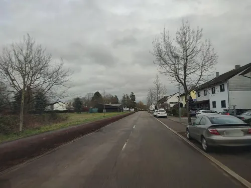
Adria
Restaurant · Croatian · 2.5 km
81 Philippsburger Straße, Waghäusel
Tu-Fr 11:00-14:00,16:30-23:00; Sa 16:30-23:00; Su 11:00-14:00,16:30-22:00
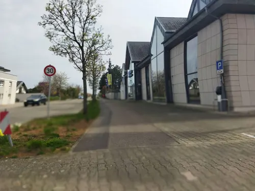
Blautannen
Restaurant · German · 5.4 km
2 Blautannenstraße, Altlußheim
Mo,Th-Su 08:30-14:00, 17:00-21:00; Tu 08:30-14:00; We off
Cavallino
Restaurant · Italian, Italian Pizza · 4.9 km
45 Sankt-Leoner-Straße, Neulußheim
Tu-Su 09:00-14:00, 17:30-18:00
Cindys Treff
Restaurant · German, Filipino · 0.7 km
5 Gymnasiumstraße, Waghäusel
Tu-Sa 17:00-23:00; Su 11:00-14:30,17:00-21:00; Mo off
Da Mario
Restaurant · Italian · 1.1 km
3 Habichtstraße, Waghäusel
Tu-Fr 11:30-14:00, 18:00-23:00; Sa 18:00-23:00; Su,Mo off
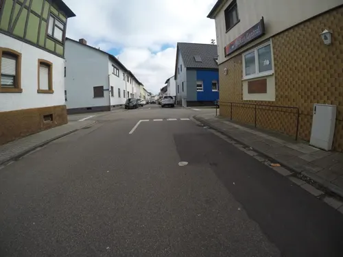
Dani's Diner
Restaurant · Burger, American · 4.4 km
29 Udenheimer Straße, Philippsburg
Th-Su 17:00-22:00
Knossos
Restaurant · Greek · 2.5 km
98 Jahnstraße, Oberhausen-Rheinhausen
Tu-Sa 11:00-14:30,17:00-22:00; Su,PH 11:00-22:00
La Fontana di Capri
Restaurant · Italian Pizza · 4.9 km
1 Hockenheimer Straße, Neulußheim
Mo-Tu,Th-Sa 11:30-14:00,17:30-22:30; Su 17:00-22:00; We off
Mr. Meng
Restaurant · Asian · 4.1 km
10 Altreutweg, Neulußheim
Tu-Sa 11:30-15:00,17:00-21:30; Sa,PH 11:30-20:30; Mo off


Naturfreundehaus Wagbachhäus'l
Restaurant · Greek · 4.3 km
1 Haustückerweg, Altlußheim
We-Sa 17:00-21:00; Su 11:30-14:00, 17:00-21:00
Rusticana 2000
Restaurant · German · 2.5 km
9 Carl-Zeiss-Straße, Waghäusel
Th-Fr, Su 11:30-14:00, 17:30+; Sa 17:30+; Mo-We off
117 more on the map.
Where to stay11
Naturfreundehaus Waldfrieden
Motel and hotel · 2.2 km
12 Seppl-Herberger-Ring, Waghäusel
Churches and places of worship27
Wallfahrtskirche "Zur Mutter mit dem gütigen Herzen"
Church · Roman Catholic · 0.6 km
2 Bischof-von-Rammung-Straße, Waghäusel
Shopping27
Gas and EV charging13
Aral
Gas station · 0.8 km
1a Hoeber-und-Mandelbaum-Straße, Oberhausen-Rheinhausen
Schools, colleges and libraries23
Gemeinschaftsschule Oberhausen-Rheinhausen
School · 1.5 km
1 Am Schwarzen Weg, Oberhausen-Rheinhausen
Healthcare10
Map of Waghäusel
250 places. The map loads OpenStreetMap tiles when you open it.
Getting there and nearby towns
City-Airport Mannheim (MHG) is the nearest airport with scheduled flights listed in OpenStreetMap, 25 km away.
- Walldorf 11 km northeast, about 11 min by car
- Wiesloch 14 km east, about 14 min by car
- Heidelberg 22 km northeast, about 22 min by car
- Ludwigshafen am Rhein 26 km north, about 26 min by car
- Mannheim 27 km north, about 27 min by car
- Karlsruhe 28 km south, about 28 min by car
- Weinheim 35 km north, about 35 min by car
- Pforzheim 43 km south, about 43 min by car
- Heilbronn 53 km east, about 53 min by car
- Stuttgart 71 km southeast, about 1 h 15 min by car
Drive times are estimates from straight-line distance, not routes.
Local news
Headlines from INDB.
Reviews, tips and questions
Loading what members have shared...
Sources and licences
- GeoNames (CC BY 4.0): population, coordinates, regions and time zone
- Mapillary (see each image): photos
- OpenStreetMap contributors (ODbL 1.0): places, airports, map data
- Wikidata (CC0 1.0): elevation, founding date, time zone, website
- Wikimedia Commons (see each image): photos
- Wikipedia (CC BY-SA 4.0): overview and history text
Photo credits
- Die Eremitage in Waghäusel ist ein durch Damian Hugo Philipp von Schönborn ab 1724 errichtetes barockes Jagd- und Lustschloss. - panoramio, Immanuel Giel, CC BY 3.0
- Eremitage Waghäusel - panoramio, Immanuel Giel, CC BY 3.0
- Altlußheim Museum Autovision, Wleiter, CC BY-SA 4.0
- 20110812Waghaeusel17, AnRo0002, CC0
- Wallfahrtskirche-Waghausel-09, Immanuel Giel, CC BY-SA 3.0
- Wagbachniederung, Rolf Thum, CC BY-SA 2.0 de
- PhilippsburgJuedischerFriedhof04, LigaDue, CC BY-SA 4.0
- 20111004Wagbachkastell3, AnRo0002, CC0
- 2020-08-16 140506 Radrennbahn Oberhausen, Tim Rademacher, CC BY-SA 4.0
- 20150627Gewann Frankreich-Wiesental3, AnRo0002, CC0
- Bau 2, Copernicus-Gymnasium, CC BY-SA 4.0
- Wiesental St. Jodokus 20110228, Rudolf Stricker, Attribution
- 20110826St Kornelius und Cyprian Kirrlach01, AnRo0002, CC0
- 20110923St Maria Philippsburg2, AnRo0002, CC0
- 20130303St Nikolaus Neulussheim4, AnRo0002, CC0
- Wiesental Erlöserkirche 20110228, Rudolf Stricker, Attribution
- 20110831Alte Post Rheinhausen1, AnRo0002, CC0
- Kirche-Oberhausen-Oberhausen-01, Immanuel Giel, CC BY-SA 3.0
- Neulussheim Evangelische Kirche 20100719, Rudolf Stricker, Attribution
- Kirrlach St. Kornelius und Cyprian 20110228, Rudolf Stricker, Attribution
- 20110923St Maria Philippsburg1, AnRo0002, CC0
- 20110923Ev Kirche Philippsburg1, AnRo0002, CC0
- 20110831St Laurentius Rheinhausen05, AnRo0002, CC0
- Kloster Waghäusel von Süden, Claus Ableiter, CC BY-SA 4.0
- Morgennebel in der Wagbachniederung, Tanja Weiß, CC BY-SA 4.0
- Museum Autovision NSU Oldtimer, Claus Ableiter, CC BY-SA 4.0
- PhilippsburgJuedischerFriedhof01, LigaDue, CC BY-SA 4.0
- RadbahnOberhausen2013, Herr Tunichgut, CC BY-SA 3.0
- Waghaeusel-Eremitage-90-Allee von Sueden-Zentralbau-2026-gje, Gerd Eichmann, CC BY 4.0
- Waghaeusel-Eremitage-04-Kavaliershaus suedost-2026-gje, Gerd Eichmann, CC BY 4.0
- Waghaeusel-Eremitage-10-Kavaliershaus suedost-2026-gje, Gerd Eichmann, CC BY 4.0
- Waghaeusel-Eremitage-12-Kavaliershaus suedost-2026-gje, Gerd Eichmann, CC BY 4.0
- Waghaeusel-Eremitage-06-Zentralbau-sued-2026-gje, Gerd Eichmann, CC BY 4.0
- Waghaeusel-Eremitage-02-Kavaliershaus suedwest-2026-gje, Gerd Eichmann, CC BY 4.0
- Waghaeusel-Eremitage-08-Zentralbau-sued-2026-gje, Gerd Eichmann, CC BY 4.0
- Waghaeusel-Eremitage-64-Allee von Osten-2026-gje, Gerd Eichmann, CC BY 4.0
- Waghaeusel-Eremitage-56-Torhaus-2026-gje, Gerd Eichmann, CC BY 4.0
- Waghaeusel-Eremitage-48-Denkmal der badischen Revolution-2026-gje, Gerd Eichmann, CC BY 4.0
- Waghaeusel-Eremitage-60-Allee von Osten-2026-gje, Gerd Eichmann, CC BY 4.0
- Waghaeusel-Eremitage-66-Allee von Osten-Zentralbau-2026-gje, Gerd Eichmann, CC BY 4.0
- Street-level photo, changchun1, CC BY-SA 4.0
- Street-level photo, wegavision, CC BY-SA 4.0
- Street-level photo, ramap, CC BY-SA 4.0
- Street-level photo, wegavision, CC BY-SA 4.0
- Street-level photo, wegavision, CC BY-SA 4.0
- Street-level photo, karthoo, CC BY-SA 4.0
- Street-level photo, wegavision, CC BY-SA 4.0
- Street-level photo, wegavision, CC BY-SA 4.0
- Street-level photo, wegavision, CC BY-SA 4.0
- Street-level photo, mfa, CC BY-SA 4.0
- Street-level photo, teddy73, CC BY-SA 4.0
- Street-level photo, dns_vlpt, CC BY-SA 4.0
- Street-level photo, changchun1, CC BY-SA 4.0
- Street-level photo, changchun1, CC BY-SA 4.0
- Street-level photo, changchun1, CC BY-SA 4.0
- Street-level photo, wegavision, CC BY-SA 4.0
- Street-level photo, mfa, CC BY-SA 4.0
- Street-level photo, karthoo, CC BY-SA 4.0
- Street-level photo, wegavision, CC BY-SA 4.0
- Street-level photo, wegavision, CC BY-SA 4.0
- Street-level photo, wegavision, CC BY-SA 4.0
- Street-level photo, changchun1, CC BY-SA 4.0
- Street-level photo, wegavision, CC BY-SA 4.0
- Street-level photo, changchun1, CC BY-SA 4.0
- Street-level photo, nakaner, CC BY-SA 4.0


Page built November 8, 2026. Spotted a mistake? Tell us or suggest a place.