


Wasserburg am Inn, Germany
Wasserburg am Inn is a town of 12,375 people in Bavaria, Germany.
Why visit Wasserburg am Inn
Townapedia lists 24 museums and landmarks, 8 parks and trails, 63 places to eat, 8 places to stay and 8 attractions in and around town.
Highlights include Utopia, Dirnecker´s Hofladen, Städtisches Museum Wasserburg and Schloss Weikertsham.
Weather in Wasserburg am Inn
Forecast from MET Norway (CC BY 4.0). Full forecast
About Wasserburg am Inn
Wasserburg am Inn (German pronunciation: [ˈvasɐbʊʁk ʔam ˈʔɪn] , lit. 'Wasserburg on the Inn'; Central Bavarian: Wassabuag am Inn) is a town in Rosenheim district in Upper Bavaria, Germany. The historic centre is a peninsula formed by the meandering river Inn. Many Medieval structures remain intact, giving the city a unique view.
From the Wikipedia article Wasserburg am Inn (this version), under CC BY-SA 4.0.
Things to do8
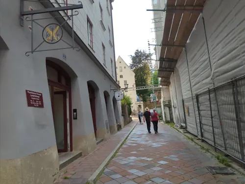





Schöne Aussicht
Scenic view · 1.2 km
Sehr schöner Blick hinab auf die Innschleife und die Wasserburger Altstadt.

Museums and landmarks24

Städtisches Museum Wasserburg
Museum · 1.2 km
15 Herrengasse, Wasserburg am Inn
Oct-Apr Tu-Su 13:00-16:00; May-Sep Tu-Su 13:00-17:00




Pulverturm
Monument and historic site · 1.0 km
2 Am Pulverturm, Wasserburg am Inn



Ehem. Stadtbahnhof Wasserburg
Monument and historic site · 1.2 km
14 Bahnhofsplatz, Wasserburg am Inn
12 more on the map.
Parks, trails and playgrounds8



Restaurants and cafes63
Gasthof Höhensteiger
Restaurant · Regional, International · 2.1 km
10 Ameranger Straße, Eiselfing
We off
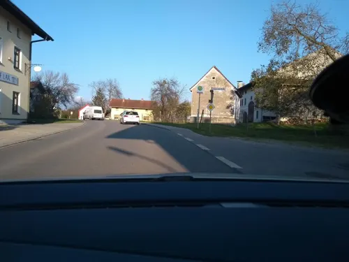
Osteria da Christian
Restaurant · Italian · 2.8 km
6 Hauptstraße, Eiselfing
We-Sa 11:00-14:30, 17:30-23:00; Su 11:00-22:30; Mo-Tu off

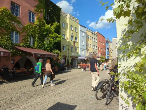
Deliano
Cafe · Breakfast · 1.3 km
13 Hofstatt, Wasserburg am Inn
Mo-Fr 06:00-18:00; Sa 06:30-18:00; Su,PH 07:00-18:00

Gasthof Huberwirt am Kellerberg
Restaurant · Regional, Bavarian, Balkan · 1.1 km
25 Salzburger Straße, Wasserburg am Inn
Mo,We-Th,Sa-Su 11:00-21:00; Tu,Fr off
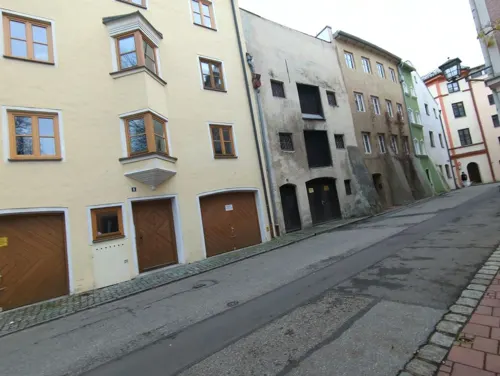
Jujhar's
Restaurant · Indian, Italian · 1.3 km
1 Palmanostraße, Wasserburg am Inn
Mar-Sep: Sa-Th 11:30-23:00;Fr 17:00-23:00; Oct-Apr: Sa-Th...
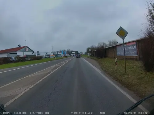
LandWirtschaft im Gut Staudham
Restaurant · Regional · 3.8 km
30 Münchner Straße, Wasserburg am Inn
Mo-Su 07:30-24:00; Tu off
Masala Haus
Restaurant · Indian · 1.3 km
3 Salzsenderzeile, Wasserburg am Inn
Tu-Sa 11:00-15:00,17:30-22:30; Su 12:00-22:00
Perla di Calabria
Restaurant · Italian · 1.1 km
17 Schustergasse, Wasserburg am Inn
Mo-Sa 11:30-14:30,17:00-22:00; Su,PH 11:30-22:00

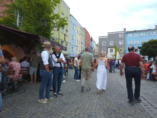


Green 18
Restaurant · 2.8 km
4 Seestraße, Babensham
We-Th 09:00-14:00, 17:30-22:00; Fr-Su 09:00-22:00; Mo-Tu off
51 more on the map.
History
The town was claimed to have been first mentioned in a document (now considered to be a fake) in 1137, when Hallgraf Engelbert moved his residence from the nearby castle Limburg to his "Wasserburg" (Water Castle).
It is one of the most historic towns of Old Bavaria – somewhat older than Munich, continually fought over by the Bavarian nobility and, up to the 16th century, on an equal footing with larger cities. The privileges afforded by this enabled the salt trade to flourish right into the 19th century. At the junction of the main overland route with the main water route, Wasserburg became the most important trade centre with the Balkans, Austria and Italy, a means of attaining power and wealth for the shipping owners and merchants.
In the early days, Wasserburg was an important hub in the salt trade. Its bridge was the only possibility to cross the river Inn for 30 km in both directions. On its shore the salt, mined in Berchtesgaden or produced in the Saline (saltern) at Bad Reichenhall and shipped from there by cart, could be loaded on ships travelling on the Inn River. Up to the 17th century Wasserburg was used as the port of the capital Munich.
Up until 1972, when it was merged with the district Rosenheim, Wasserburg was a district capital on its own.
From the History section of Wasserburg am Inn on Wikipedia, under CC BY-SA 4.0.
Where to stay8
Wohnmobilparkplätze am Gries
Campground · 1.3 km
2 Max-Emanuel-Platz, Wasserburg am Inn
Churches and places of worship26
Burgkapelle St. Ägidien
Church · Catholic · 1.0 km
5 Auf der Burg, Wasserburg am Inn
Max-Emanuel-Kapelle
Church · Roman Catholic · 1.3 km
8 Max-Emanuel-Platz, Wasserburg am Inn
St. Antonius von Padua
Church · Roman Catholic · 2.6 km
11 Bahnhofstraße, Wasserburg am Inn
Adventgemeinde im HopeCenter Wasserburg
Church · Seventh Day Adventist · 0.9 km
1 Magdalenenweg, Wasserburg am Inn
Shopping25
Häringer GmbH Garten- & Landschaftsbau
Shop · 1.2 km
1 Eichhornweg, Wasserburg am Inn
Gas and EV charging5
Schools, colleges and libraries12
Staatliche Fachoberschule und Berufsoberschule Wasserburg
School · 0.6 km
4 Bürgermeister-Winter-Straße, Wasserburg am Inn
Staatliche Landwirtschaftsschule Wasserburg
School · 0.6 km
22 Ponschabaustraße, Wasserburg am Inn
Luitpold-Gymnasium Wasserburg
School · 0.7 km
11 Salzburger Straße, Wasserburg am Inn
Healthcare5
Apotheke am Burgerfeld
Clinic and pharmacy
3 Pfarrer-Neumair-Straße, Wasserburg am Inn
Map of Wasserburg am Inn
184 places. The map loads OpenStreetMap tiles when you open it.
Getting there and nearby towns
Munich International Airport (MUC) is the nearest airport with scheduled flights listed in OpenStreetMap, 47 km away.
- Eiselfing 2 km southeast, about 2 min by car
- Babensham 5 km northeast, about 5 min by car
- Schönberg 5 km east, about 5 min by car
- Breitbrunn 5 km west, about 5 min by car
- Soyen 6 km north, about 6 min by car
- Waldkraiburg 22 km northeast, about 22 min by car
- Munich 49 km west, about 49 min by car
- Wolfratshausen 62 km west, about 1 h by car
- Wolnzach 76 km northwest, about 1 h 15 min by car
- Weilheim 83 km west, about 1 h 30 min by car
Drive times are estimates from straight-line distance, not routes.
Local news
Headlines from INDB.
Reviews, tips and questions
Loading what members have shared...
Sources and licences
- GeoNames (CC BY 4.0): population, coordinates, regions and time zone
- Mapillary (see each image): photos
- OpenStreetMap contributors (ODbL 1.0): places, airports, map data
- Wikidata (CC0 1.0): elevation, founding date, time zone, website
- Wikimedia Commons (see each image): photos
- Wikipedia (CC BY-SA 4.0): overview and history text
Photo credits
- Aerial image of Wasserburg am Inn, Carsten Steger, CC BY-SA 4.0
- Wasserburg am Inn Schloss, Helmlechner, CC BY-SA 4.0
- Wasserburg-Gabersee-Klinik-Verwaltung 01, Chked, CC BY-SA 4.0
- Schloss Weikertsham, luckyprof, CC BY-SA 3.0
- Wasserburg Stadt und Kirchen 03, Burkhard Mücke, CC BY-SA 4.0
- Kapelle St. Laurentius Freiham Eiselfing-1, Rufus46, CC BY-SA 4.0
- St. Laurentius Zell 28 (bearb Sp), Edelmauswaldgeist, CC0
- Wasserburg-Achatzstrasse-6 03, Chked ( Diskussion ), CC BY-SA 3.0
- Am Gries 1 Wasserburg-4, Rufus46, CC BY-SA 4.0
- 20230518 Burgkapelle St. Ägidius Wasserburg am Inn, Flocci Nivis, CC BY 4.0
- Bruckgasse 4 Hl. Geist-Spitalkirche Wasserburg-1, Rufus46, CC BY-SA 3.0
- Wasserburg Brucktor, Aconcagua ( talk ), CC BY-SA 3.0
- Herrengasse 19 Wasserburg-1, Rufus46, CC BY-SA 3.0
- St.Jakob Wasserburg am Inn 001, Sven.petersen, Public domain
- Marienplatz 4 Frauenkirche Wasserburg-2, Rufus46, CC BY-SA 3.0
- Wasserburg am Inn, Max-Emanuel-Kapelle 1, Aisano, CC BY-SA 3.0
- Th Haf1-Mutter Erde fec, Mutter Erde, Attribution
- Schmidzeile 28 Kapelle St. Michael Wasserburg-1, Rufus46, CC BY-SA 3.0
- Reitmehring, St. Antonius (2), Cmcmcm1, CC BY-SA 4.0
- Wasserburg am Inn, Schöne Aussicht (2), Manfred Schröter, Berga, CC BY-SA 4.0
- Reitmehring, St. Antonius (1), Cmcmcm1, CC BY-SA 4.0
- Wening B016b Penzing, Schloss, Michael Wening, Public domain
- Mapillary (osmplus org) 2026-03-22 10H01M40S916 (1617561142866600 at kl82LxGvmnW9UcHNg5ZIPj), osmplus_org, CC BY-SA 4.0
- Mapillary (osmplus org) 2026-03-22 10H01M40S625 (26943627541901066 at kl82LxGvmnW9UcHNg5ZIPj), osmplus_org, CC BY-SA 4.0
- Mapillary (osmplus org) 2026-03-22 10H01M41S208 (912685391741620 at kl82LxGvmnW9UcHNg5ZIPj), osmplus_org, CC BY-SA 4.0
- Mapillary (osmplus org) 2026-03-22 10H01M40S333 (1440083557858209 at kl82LxGvmnW9UcHNg5ZIPj), osmplus_org, CC BY-SA 4.0
- Mapillary (osmplus org) 2026-03-22 10H01M41S500 (1972046060076062 at kl82LxGvmnW9UcHNg5ZIPj), osmplus_org, CC BY-SA 4.0
- Mapillary (osmplus org) 2026-03-22 10H01M40S041 (1432671757953161 at kl82LxGvmnW9UcHNg5ZIPj), osmplus_org, CC BY-SA 4.0
- Mapillary (osmplus org) 2026-03-22 10H01M41S791 (1821406605218344 at kl82LxGvmnW9UcHNg5ZIPj), osmplus_org, CC BY-SA 4.0
- Mapillary (osmplus org) 2026-03-22 10H01M39S750 (1476864710504255 at kl82LxGvmnW9UcHNg5ZIPj), osmplus_org, CC BY-SA 4.0
- Mapillary (osmplus org) 2026-03-22 10H01M42S083 (1653165072354871 at kl82LxGvmnW9UcHNg5ZIPj), osmplus_org, CC BY-SA 4.0
- Mapillary (osmplus org) 2026-03-22 10H01M39S500 (1986137578668942 at kl82LxGvmnW9UcHNg5ZIPj), osmplus_org, CC BY-SA 4.0
- Mapillary (osmplus org) 2026-03-22 10H01M42S375 (1596807308268372 at kl82LxGvmnW9UcHNg5ZIPj), osmplus_org, CC BY-SA 4.0
- Mapillary (osmplus org) 2026-03-22 10H01M39S250 (1759222111932597 at kl82LxGvmnW9UcHNg5ZIPj), osmplus_org, CC BY-SA 4.0
- Mapillary (osmplus org) 2026-03-22 10H01M42S666 (1293156639354129 at kl82LxGvmnW9UcHNg5ZIPj), osmplus_org, CC BY-SA 4.0
- Mapillary (osmplus org) 2026-03-22 10H01M39S000 (1940933009851326 at kl82LxGvmnW9UcHNg5ZIPj), osmplus_org, CC BY-SA 4.0
- Mapillary (osmplus org) 2026-03-22 10H01M42S958 (1137931758426430 at kl82LxGvmnW9UcHNg5ZIPj), osmplus_org, CC BY-SA 4.0
- Mapillary (osmplus org) 2026-03-22 10H01M38S750 (1298791025503668 at kl82LxGvmnW9UcHNg5ZIPj), osmplus_org, CC BY-SA 4.0
- Mapillary (osmplus org) 2026-03-22 10H01M43S250 (1468717164862810 at kl82LxGvmnW9UcHNg5ZIPj), osmplus_org, CC BY-SA 4.0
- Mapillary (osmplus org) 2026-03-22 10H01M38S500 (1630278687892241 at kl82LxGvmnW9UcHNg5ZIPj), osmplus_org, CC BY-SA 4.0
- Blick von der Schanze auf WS - 2021-10-10 - 226a, Martinus KE, CC BY-SA 4.0
- Wasserburg am Inn Auf der Burg 9 034, Jacquesverlaeken, CC BY-SA 4.0
- Pulverturm Wasserburg, Ricardalovesmonuments, CC BY-SA 4.0
- Street-level photo, ente, CC BY-SA 4.0
- Street-level photo, ledermann, CC BY-SA 4.0
- Street-level photo, xlayer, CC BY-SA 4.0
- Street-level photo, gbauer, CC BY-SA 4.0
- Street-level photo, ente, CC BY-SA 4.0
- Street-level photo, ente, CC BY-SA 4.0
- Street-level photo, ente, CC BY-SA 4.0
- Street-level photo, soulcover, CC BY-SA 4.0
- Street-level photo, ente, CC BY-SA 4.0
- Street-level photo, ente, CC BY-SA 4.0
- Street-level photo, ente, CC BY-SA 4.0
- Street-level photo, ente, CC BY-SA 4.0
- Street-level photo, ledermann, CC BY-SA 4.0
- Street-level photo, xlayer, CC BY-SA 4.0
- Street-level photo, ente, CC BY-SA 4.0
- Street-level photo, flofuchs22, CC BY-SA 4.0
- Street-level photo, ente, CC BY-SA 4.0


Page built November 8, 2026. Spotted a mistake? Tell us or suggest a place.