


Why visit Bad Nenndorf
Townapedia lists 48 museums and landmarks, 29 parks and trails, 67 places to eat, 7 places to stay and 12 attractions in and around town.
Highlights include Rittergut Wichtringhausen, Obst und Gemüsediele Steege, Agnes-Miegel-Haus and Ernst Blumenberg.
Weather in Bad Nenndorf
Forecast from MET Norway (CC BY 4.0). Full forecast
About Bad Nenndorf
Bad Nenndorf (German pronunciation: [baːt ˈnɛnˌdɔʁf] ; Northern Low Saxon: Nenndörpe) is a small town in the district of Schaumburg, Lower Saxony, Germany. Its population is 10,210 (2005). It is situated approximately 12 km east of Stadthagen, and 25 km west of Hanover, at the southern edge of the North German Plain and the northern edge of the Deister ridge. The area of the town includes the outlying villages of Riepen, Horsten and Waltringhausen.
From the Wikipedia article Bad Nenndorf (this version), under CC BY-SA 4.0.
Things to do12


Obst und Gemüsediele Steege
Farm and orchard · 2.9 km
60 Hauptstraße, Rodenberg
Mo-Fr 09:00-18:00; Sa 09:00-13:00
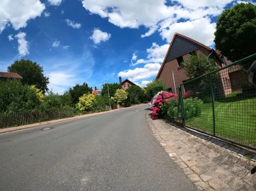
Obsthof Brüggenwirth
Farm and orchard · 3.0 km
2 Im Winkel, Hohnhorst
Mo-Fr 09:00-18:00; Sa 08:30-13:00

Belvedereturm
Scenic view · 2.2 km
Leider sind die Bäume d'rumherum mittlerweile höher als der Turm :-(


Museums and landmarks48


Densinghauser Quelle
Monument and historic site · 1.4 km
Ehemalige Quellanlage, jetziges Fledermausquartier


36 more on the map.
Parks, trails and playgrounds29




17 more on the map.
Restaurants and cafes67


Landgasthaus Fischer
Restaurant · German · 2.5 km
11 Auf der Riehe, Suthfeld
Mo-Sa 17:30-22:00; Su 12:00-14:00,17:30-21:00
Mooshütte
Restaurant · German · 2.4 km
1, Bad Nenndorf
Tu-Sa 11:00-19:00; Su 10:00-19:00; Mo off; PH 10:00-19:00

Bäckerei Frenzel
Bakery · 0.6 km
Namensähnlich: Konditorei Frenkel in der Bahnhofstraße mit vormaligem Central-Cafe in Hauptstraße
1 Haster Straße, Bad Nenndorf
Mo-Fr 06:00-18:00; Sa 06:00-13:00
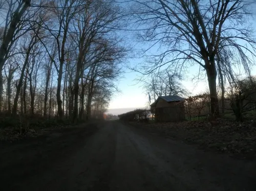
Deister Alm
Restaurant · German, Regional, Bavarian · 3.2 km
50 Luttringhäuser Weg, Barsinghausen
Mo off; Tu-Th 11:00-17:00; Fr-Su 11:00-20:00
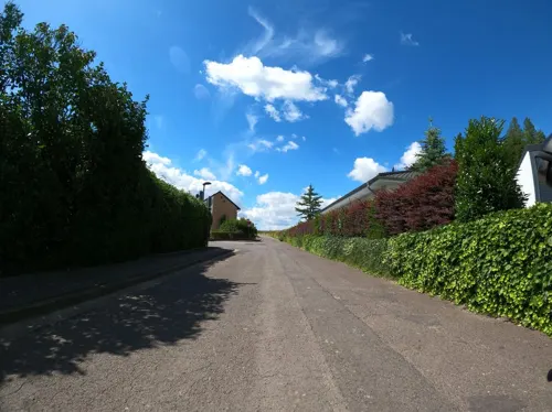


Hotel & Restaurant Buchenfürst
Restaurant · 1.2 km
44 Buchenallee, Bad Nenndorf
Tu-Th 17:30-21:00; Fr-Su 11:30-14:00,17:30-21:00
Konditorei Frenkel
Cafe
Central-Cafe Frenkel in Hauptstraße 10 war eine Zweigstelle. Namensähnlich: Bäckerei Frenzel in Haster Straße und in Waltringhausen
11 Bahnhofstraße
Fr-Sa 09:00-17:00; Su 10:00-17:00
Kotelett-Schmiede
Restaurant · Regional · 1.5 km
2 Auf dem Wachtlande, Bad Nenndorf
Mo-Fr 09:30-17:00; Sa 10:00-17:00
La Viletta
Restaurant · Italian, Pizza, Pasta
4D Kurhausstraße, Bad Nenndorf
Tu-Su 12:00-14:30,18:00-22:30
Ratskeller
Restaurant · German · 3.2 km
42 Lange Straße, Rodenberg
We, Fr-Sa 17:00-23:00; Su 11:30-14:30, 17:00-23:00; Th...
Restaurant Sokrates
Restaurant · Greek · 1.1 km
31 Rodenberger Allee
Tu-Fr 17:00-23:00; Sa, Su 11:30-14:30, 17:00-23:00
Waldgaststätte Teufelsbrücke
Restaurant · German · 4.0 km
1 Heisterburg, Rodenberg
Mo-Tu off; We-Fr 11:00-18:00; Sa-Su, PH 10:00-18:00
55 more on the map.
History
The village, probably dating from the beginning of the 9th century, is first recorded as Nyanthorpe in the records of Corvey Abbey in 936.
The first church was erected in 1136. The village was the property of the Counts of Schaumburg from 1311. Following the establishment of another small settlement to the SW of the village, the distinction was drawn between Gross Nenndorf and Klein Nenndorf. A further settlement by the name of Densinghausen, in the area of the modern town, was destroyed in the Thirty Years' War. After the division of the county of Schaumburg in 1647, Nenndorf belonged to Hesse-Kassel (or Hesse-Cassel).
The healing power of the sulphur springs, situated between Gross Nenndorf and Klein Nenndorf, and first recorded in 1546, was first generally recognised in the mid-18th century. On the initiative of Landgrave Wilhelm IX of Hesse-Kassel, the 'estate district' of Nenndorf, with bathing installations and spa park, was initiated in 1787. The sulphur springs, which until then had been despised as devil's excrement on account of their pungent odour, were reckoned among the most powerful in Europe, and could now finally be applied with great success for rheumatism, arthritis and skin complaints. Soon Nenndorf was one of the leading German spas. In 1866 Bad Nenndorf became the Royal Prussian state spa, and financial support from Berlin enabled it to expand further.
From the History section of Bad Nenndorf on Wikipedia, under CC BY-SA 4.0.
Where to stay7
Churches and places of worship14
Maria vom heiligen Rosenkranz
Church · Catholic · 0.6 km
11 Wilhelmstraße, Bad Nenndorf
Shopping16
Gas and EV charging9
Schools, colleges and libraries10
Gymnasium Bad Nenndorf
School · 0.7 km
42 Horster Straße, Bad Nenndorf
Schule Schlaffhorst-Andersen für Atem-, Sprech- und Stimmlehre
School
20 Bornstraße, Bad Nenndorf
Healthcare5
Map of Bad Nenndorf
217 places. The map loads OpenStreetMap tiles when you open it.
Getting there and nearby towns
Hannover Airport (HAJ) is the nearest airport with scheduled flights listed in OpenStreetMap, 25 km away.
- Obernkirchen 18 km southwest, about 18 min by car
- Rehburg-Loccum 19 km northwest, about 19 min by car
- Hannover 24 km east, about 24 min by car
- Salzhemmendorf 33 km southeast, about 33 min by car
- Hildesheim 44 km southeast, about 44 min by car
- Hambühren 52 km northeast, about 52 min by car
- Bockenem 63 km southeast, about 1 h by car
- Bielefeld 67 km southwest, about 1 h by car
- Salzgitter 73 km east, about 1 h 15 min by car
- Braunschweig 78 km east, about 1 h 15 min by car
Drive times are estimates from straight-line distance, not routes.
Local news
Headlines from INDB.
Reviews, tips and questions
Loading what members have shared...
Sources and licences
- GeoNames (CC BY 4.0): population, coordinates, regions and time zone
- Mapillary (see each image): photos
- OpenStreetMap contributors (ODbL 1.0): places, airports, map data
- Wikidata (CC0 1.0): elevation, founding date, time zone, website
- Wikimedia Commons (see each image): photos
- Wikipedia (CC BY-SA 4.0): overview and history text
Photo credits
- BadNenndorf, Tortuosa at German Wikipedia, CC BY-SA 3.0
- St. Godehardi-Kirche Bad Nenndorf, Lutzto, CC BY-SA 4.0
- Stolperstein Bad Nenndorf Hauptstraße 14 Ernst Blumenberg, Tomtom10, CC BY-SA 4.0
- Bad Nenndorf 08-13 img03 StGodehardi, A.Savin, CC BY-SA 3.0
- Hauptstraße Bad Nenndorf, Hannoversche Volksbank, Gerd Fahrenhorst, CC BY 4.0
- Bad Nenndorf, die St. Godehardi-Kirche, Dguendel, CC BY 4.0
- Frau mit Ziege (Bad Nenndorf), Gerd Fahrenhorst, CC BY 4.0
- Brunnen Hauptstraße in Bad Nenndorf, Gerd Fahrenhorst, CC BY 4.0
- Bushaltestelle Am Thermalbad, 1, Bad Nenndorf, Landkreis Schaumburg, GeorgDerReisende, CC BY-SA 4.0
- Hauptstraße 18, Bad Nenndorf, Sparkasse, Gerd Fahrenhorst, CC BY 4.0
- Stolperstein Bad Nenndorf Hauptstraße 27 Franziska Kahn, Den man tau, CC BY-SA 4.0
- Stolpersteine Bad Nenndorf Hauptstraße 27, Den man tau, CC BY-SA 4.0
- Stolperstein Bad Nenndorf Hauptstraße 27 Jeanette Apolant, Den man tau, CC BY-SA 4.0
- Gedenktafel Bad Nenndorf Hauptstraße 14, Tomtom10, CC BY-SA 4.0
- Kampstraße 17, 1, Bad Nenndorf, Landkreis Schaumburg, GeorgDerReisende, CC BY-SA 4.0
- Bad Nenndorf 08-13 img04 Haus Hannover, A.Savin, CC BY-SA 3.0
- Hauptstraße 13, Bad Nenndorf, Gerd Fahrenhorst, CC BY 4.0
- Hauptstraße 13, Bad Nenndorf, Eingang, Gerd Fahrenhorst, CC BY 4.0
- Stolpersteinlage Bad Nenndorf Hauptstraße 27, Tomtom10, CC BY-SA 4.0
- Stolpersteinlage Bad Nenndorf Hauptstraße 14, Tomtom10, CC BY-SA 4.0
- Bushaltestelle Am Thermalbad, 2, Bad Nenndorf, Landkreis Schaumburg, GeorgDerReisende, CC BY-SA 4.0
- Gefallenen-Gedenkstätte Bad Nenndorf (3), Lutz Lange ( talk ), CC BY-SA 4.0
- Gefallenen-Gedenkstätte Bad Nenndorf (4), Lutz Lange ( talk ), CC BY-SA 4.0
- Gefallenen-Gedenkstätte Bad Nenndorf (2), Lutz Lange ( talk ), CC BY-SA 4.0
- Bad Nenndorf 08-13 img01 StGodehardi, A.Savin, CC BY-SA 3.0
- St. Godehardi (Bad Nenndorf) Tür, Gerd Fahrenhorst, CC BY 4.0
- An der Kirche Bad Nenndorf (1), Lutz Lange ( talk ), CC BY-SA 4.0
- An der Kirche Bad Nenndorf (2), Lutz Lange ( talk ), CC BY-SA 4.0
- Bad Nenndorf, die Hauptstraße, Dguendel, CC BY 4.0
- Gefallenen-Gedenkstätte Bad Nenndorf (5), Lutz Lange ( talk ), CC BY-SA 4.0
- Gefallenen-Gedenkstätte Bad Nenndorf (1), Lutz Lange ( talk ), CC BY-SA 4.0
- Bad Nenndorf, im Zentrum, Dguendel, CC BY 4.0
- Bad Nenndorf 08-13 img02 StGodehardi, A.Savin, CC BY-SA 3.0
- Bad Nenndorf Berliner Meilenstein, TeWeBs, CC BY-SA 4.0
- Landgrafentherme Bad Nenndorf 2024-01 Foto 1, Gerd Fahrenhorst, CC BY 4.0
- Tafel Hauptstraße 6 Bad Nenndorf, Lutz Lange ( talk ), CC BY-SA 4.0
- Landgrafentherme Bad Nenndorf 2024-01 Foto 2, Gerd Fahrenhorst, CC BY 4.0
- Kurhaus Bad Nenndorf 2024-01 Foto 1, Gerd Fahrenhorst, CC BY 4.0
- Kurhausstraße 15, Bad Nenndorf, seitlich, Gerd Fahrenhorst, CC BY 4.0
- Landgrafen Therme Bad Nenndorf, Gerd Fahrenhorst, CC BY 4.0
- Agnes-Miegel-Haus Bad Nenndorf IMG 6791 retouched, losch, Attribution
- Gymnasium Bad Nenndorf, Lutz Lange, CC BY-SA 4.0
- Bad Nenndorf St. Maria vom hl. Rosenkranz, Rabanus Flavus, CC0
- Hohnhorst St. Petrus Canisius 2, Rabanus Flavus, CC0
- Rodenberg St. Mariä Himmelfahrt 1, Rabanus Flavus, CC0
- Schloss Rodenberg Ständehaus Burggraben, Axel Hindemith, CC BY 3.0
- Rodenberg - St. Jacobi - Außenansicht, Misburg3014, CC BY-SA 3.0
- BadNenndorf10, Tortuosa, CC BY-SA 3.0
- Strutzbergstollen-Mundloch, Den man tau, CC BY-SA 4.0
- Mooshüttestollen (2), Den man tau, CC BY-SA 4.0
- Belvedereturm Deister, AxelHH, CC BY 3.0
- 2019-05-21 121316 Naturwald Steinbrink, Tim Rademacher, CC BY-SA 4.0
- Bad Nenndorf, view to the little palace, Dguendel, CC BY 4.0
- St. Thomas Kirche in Hohenbostel (Barsinghausen) IMG 3176, Losch, CC BY-SA 3.0
- KircheHohnhorst, Tortuosa at German Wikipedia im Juli 2005, CC BY-SA 3.0
- Bantorf-St-Alexandri-Kirche, Den man tau, CC BY-SA 4.0
- KircheBeckedorf, Tortuosa at de.wikipedia, CC BY-SA 3.0
- Bad Nenndorf Grandhotel Esplanade - ehemaliges Schwefelbadehaus, Rabanus Flavus, CC0
- Mooshüttestollen (1), Den man tau, CC BY-SA 4.0
- Rodenberger Windmühle, Den man tau, CC BY-SA 4.0
- Rodenberg Staendehaus, No machine-readable author provided. Warrior071~commonswiki assumed (based on copyright claims)., Public domain
- Wichtringhausen-Wichmarstrasse-Rittergut, Den man tau, CC BY-SA 4.0
- Stolperstein Rodenberg Echternstraße 19 Paul Jost, Tomtom10, CC BY-SA 4.0
- Podbielski Denkmal-Bad Nenndorf (1), Lutz Lange ( talk ), CC BY-SA 4.0
- Densinghäuser Quelle, Raugeier, CC BY-SA 3.0
- Street-level photo, grobin, CC BY-SA 4.0
- Street-level photo, grobin, CC BY-SA 4.0
- Street-level photo, Langfahrer, CC BY-SA 4.0
- Street-level photo, Langfahrer, CC BY-SA 4.0
- Street-level photo, Langfahrer, CC BY-SA 4.0
- Street-level photo, Langfahrer, CC BY-SA 4.0
- Street-level photo, Schmarvis, CC BY-SA 4.0
- Street-level photo, Langfahrer, CC BY-SA 4.0
- Street-level photo, Langfahrer, CC BY-SA 4.0


Page built November 8, 2026. Spotted a mistake? Tell us or suggest a place.