


Wülfrath, Germany
Wülfrath is a town of 20,731 people in North Rhine-Westphalia, Germany.
Why visit Wülfrath
Townapedia lists 73 museums and landmarks, 32 parks and trails, 87 places to eat, 10 places to stay and 11 attractions in and around town.
Highlights include Thalia-Theater, Bio-Hofladen Bredtmann, Schloss Lüntenbeck and Villa Petershall.
Weather in Wülfrath
Forecast from MET Norway (CC BY 4.0). Full forecast
About Wülfrath
Wülfrath (German pronunciation: [ˈvʏlfʁaːt] ) is a town in the district of Mettmann (district), in North Rhine-Westphalia, Germany. A variety of the Limburgish language, known locally as Wülfrother Platt is spoken through all generations in the town.
From the Wikipedia article Wülfrath (this version), under CC BY-SA 4.0.
Things to do11

Thalia-Theater
Cinema and theater · 8.0 km
Former theatre in Elberfeld, Wuppertal, Germany



Langensiepen
Farm and orchard · 3.5 km
Bauernlädchen und Imkerei
Th-Fr 15:00-17:00; Sa 10:00-12:00


Grube Schöller
Scenic view · 4.4 km
Aussicht über den Steinbruch ist samstags und sonntags geöffnet.
Museums and landmarks73

Schloss Lüntenbeck
Monument and historic site · 4.7 km
Die ehemalige Wasserburg war eins von 12 Rittergütern im Amt Solingen. Das Gut ist eines der ältesten Bauwerke Wuppertals.
1 Lüntenbeck, Wuppertal

Villa Petershall
Monument and historic site · 4.3 km
1 Lukasstraße, Velbert

Aprather Mühle
Monument and historic site · 2.5 km
3 Düsseler Feld, Wülfrath

Haus Düssel
Monument and historic site · 2.6 km
2 Haus Düssel, Wülfrath

Marienberg
Monument and historic site · 5.1 km
Bernsaustraße, Velbert

Marienkapelle / Bergfried
Monument and historic site · 4.1 km
2 Zur Düssel, Wuppertal

Schloß Hardenberg
Monument and historic site · 5.1 km
4 Zum Hardenberger Schloß, Velbert

Zeittunnel
Museum · 1.0 km
5 Hammerstein, Wülfrath
Apr-Oct: Tu-Su 10:00-18:00; Apr-Oct: Mo off; Nov-Mar: Mo-Su off


Schloß Aprath
Monument and historic site · 2.5 km
Mittelalterlicher Rittersitz, bis Anfang 18 Jhdt Wasserburg, ab 1810 Bürgerlicher Besitz, 1880 Abgeordneter und Kaufmann Carl Rumpff...
9 Aprath, Wülfrath

Von der Heydt Museum
Museum · 8.0 km
Art museum in Wuppertal, Germany
61 more on the map.
Parks, trails and playgrounds32




Schlupkothen
Hiking and trails · 2.1 km
Schild: Naturschutzgebiet betreten strengstens verboten. Geldbuße bis 50.000 Euro

20 more on the map.
Restaurants and cafes87


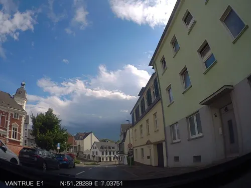
Indochina Restaurant
Restaurant · Thai
84 Wilhelmstraße, Wülfrath
We-Fr,Su 12:00-14:30,17:30-22:30; Sa 17:30-22:30; Mo,Tu off
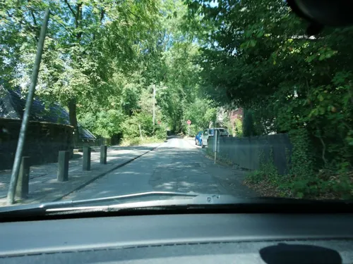
Schlosscafé Lüntenbeck
Restaurant · International · 4.7 km
1 Lüntenbeck, Wuppertal
Mo off, Tu-Sa 11:30-15:00,17:00-22:30, Su 11:30-21:00
Berger Stübchen da Monticciolo
Restaurant · Italian · 4.5 km
2 Jacob-Lüneschloß-Straße
Tu-Sa 17:00-22:00; Su 16:30-21:30
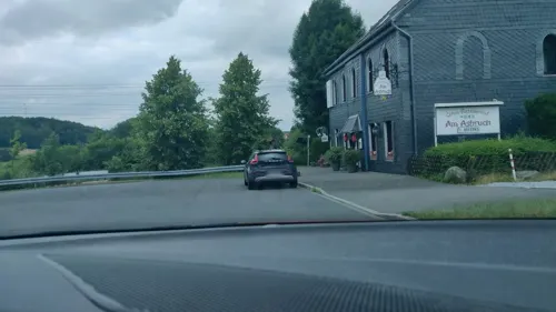
China Restaurant Am Asbruch
Restaurant · Chinese · 4.4 km
Mo-Sa 11:30-15:00,17:30-23:00;Tu off;Su,PH 11:30-23:00
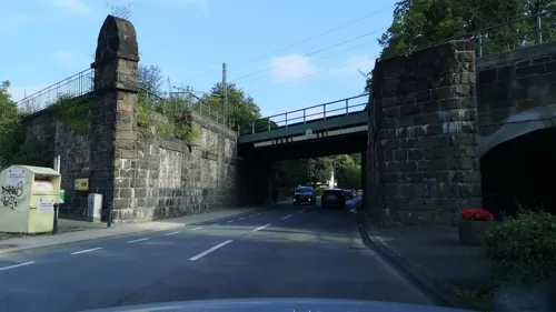
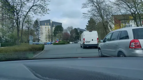
In Vino Veritas
Restaurant · Italian, Mediterranean · 5.0 km
Nov-Apr Tu-Th 16:00-22:00; Nov-Apr Fr-Sa 16:00-23:00; Nov-Apr Su...
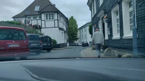

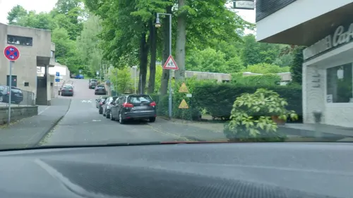
Wohnzimmer Neviges
Restaurant · 4.9 km
4 Klosterstraße, Velbert
We 12:00-18:30; Th-Sa 12:00-22:00; Su 10:00-18:30


75 more on the map.
History
Wülfrath was one of the first settlements to be made in a clearing in the great Imperial forest of the early Middle Ages. The name means clearing of a man named Wolf and its date of origin is thought to be about 713. Around this has grown up the legend of a settler called Wolf who had been expelled from his clan and who is supposed to have made a clearing in the then luxuriant forest on the site of the present village centre.
In 875 the hundreds (Honnschaften) and present suburbs of Flandersbach (Flatmarasbeki, i.e., Flattmar's brook) and Rützkausen (Hrotsteninghuson, i.e., the houses of Hrotse's people) are named in a description of the places owing tithes to Werden Abbey on the Ruhr. In around 1100 the placename Wülfrath (Wolverothe) itself is at last mentioned in a document written in a monk's hand at the religious house at Kaiserswerth.
From the History section of Wülfrath on Wikipedia, under CC BY-SA 4.0.
Where to stay10
Akropolis zur Wilhelmshöhe
Motel and hotel · 1.2 km
137 Mettmanner Straße, Wülfrath
Churches and places of worship28
Shopping19
Gas and EV charging18

Schools, colleges and libraries22
Healthcare6
Map of Wülfrath
250 places. The map loads OpenStreetMap tiles when you open it.
Getting there and nearby towns
Flughafen Essen-Mülheim (ESS) is the nearest airport with scheduled flights listed in OpenStreetMap, 15 km away.
- Wuppertal 8 km east, about 8 min by car
- Solingen 12 km south, about 12 min by car
- Remscheid 16 km southeast, about 16 min by car
- Düsseldorf 19 km west, about 19 min by car
- Essen 20 km north, about 20 min by car
- Duisburg 25 km northwest, about 25 min by car
- Bochum 25 km northeast, about 25 min by car
- Gelsenkirchen 25 km north, about 25 min by car
- Oberhausen 25 km northwest, about 25 min by car
- Neuss 26 km west, about 26 min by car
Drive times are estimates from straight-line distance, not routes.
Local news
Headlines from INDB.
Reviews, tips and questions
Loading what members have shared...
Sources and licences
- GeoNames (CC BY 4.0): population, coordinates, regions and time zone
- Mapillary (see each image): photos
- OpenStreetMap contributors (ODbL 1.0): places, airports, map data
- Wikidata (CC0 1.0): elevation, founding date, time zone, website, landmarks and historic places
- Wikimedia Commons (see each image): photos
- Wikipedia (CC BY-SA 4.0): overview and history text
Photo credits
- Wuelfrath ansicht zentrum, Hans Peter Schaefer, CC BY-SA 3.0
- Wülfrath-Zeittunnel-Eingang, Dat doris, CC BY-SA 4.0
- Siedler Wolf Wülfrath, Just611, CC0
- Plantenfrau Wülfrath, Just611, CC0
- Wülfrath - Ev. Kindergarten Hundertwasser Düsseler Str. 60 - panoramio, Edgar El, CC BY 3.0
- Wülfrath-Zeittunnel-Mitmachstation Ausführung, Dat doris, CC BY-SA 4.0
- Wülfrath-Zeittunnel-Kalknutzung, Dat doris, CC BY-SA 4.0
- Wülfrath-Zeittunnel-Sprengschutzbunker, Dat doris, CC BY-SA 4.0
- Wülfrath-Zeittunnel-Steile Treppe, Dat doris, CC BY-SA 4.0
- Wülfrath-Zeittunnel-Höhlenbärschädel, Dat doris, CC BY-SA 4.0
- Wülfrath-Zeittunnel-Bochumer Bruch 03, Dat doris, CC BY-SA 4.0
- Wülfrath-Zeittunnel-Fossil Eulenkopf, Dat doris, CC BY-SA 4.0
- Wülfrath-Zeittunnel-Calcit, Dat doris, CC BY-SA 4.0
- Wülfrath-Zeittunnel-Mitmachstation Info, Dat doris, CC BY-SA 4.0
- Wülfrath-Zeittunnel-Bochumer Bruch 02, Dat doris, CC BY-SA 4.0
- Wülfrath-Zeittunnel-Ausgang Bochumer Bruch, Dat doris, CC BY-SA 4.0
- Wülfrath-Zeittunnel-Sprengunterstand, Dat doris, CC BY-SA 4.0
- Wülfrath-Zeittunnel-Bochumer Bruch 01, Dat doris, CC BY-SA 4.0
- Wülfrath-Zeittunnel-Zeitinsel Kreide, Dat doris, CC BY-SA 4.0
- Wülfrath-Zeittunnel-Kalksteinkörnung, Dat doris, CC BY-SA 4.0
- Wülfrath-Zeittunnel-Fossil Nudelsalat, Dat doris, CC BY-SA 4.0
- Wülfrath-Zeittunnel-Kalksteinabbau Geschichte, Dat doris, CC BY-SA 4.0
- Wülfrath-Zeittunnel-Kalksteinabbau früher, Dat doris, CC BY-SA 4.0
- Flehenberg 101 (Wülfrath) (5), DiAuras, CC BY-SA 4.0
- Flehenberg 101 (Wülfrath) (4), DiAuras, CC BY-SA 4.0
- Flehenberg 101 (Wülfrath) (1), DiAuras, CC BY-SA 4.0
- Flehenberg 101 (Wülfrath) (3), DiAuras, CC BY-SA 4.0
- Flehenberg 101 (Wülfrath) (2), DiAuras, CC BY-SA 4.0
- Unterdüssel 30 (Wülfrath) (5), DiAuras, CC BY-SA 4.0
- Unterdüssel 30 (Wülfrath) (4), DiAuras, CC BY-SA 4.0
- Wuppertal Thalia-Theater 1, The original uploader was Pitichinaccio at German Wikipedia . ( Original text: unbekannt/ de:Benutzer:Pitichinaccio ), Public domain
- Wuppertal Elberfeld - Rex 01 ies, Frank Vincentz, CC BY-SA 3.0
- Wuppertal vdheydtmuseum, Fotograf: Daniel Jünger, CC BY-SA 3.0
- Empfangsgebäude Zoo Wuppertal, Norbert Sdunzik, CC BY-SA 3.0
- Aprather-Muehle-2013, Tuxyso, CC BY-SA 3.0
- BurgHardenbergGrundriss, Gerhard August Fischer (1833-1906) (?), Public domain
- Tönisheide, evangelische kerk foto3 2012-03-27 13.36, Michielverbeek, CC BY-SA 3.0
- Wülfrath Düssel - Evangelische Kirche zu Düssel 01 ies, Frank Vincentz, CC BY-SA 3.0
- Wuppertal Lüntenbecker Weg 0158, Atamari, CC BY-SA 3.0
- Wülfrath Dorfstraße 2013 022, Atamari, CC BY-SA 3.0
- Wülfrath - Aprath + Schloss 02 ies, Frank Vincentz, CC BY-SA 3.0
- Gottfried böhm, pilgrimage church, neviges 1963-1972 01, seier+seier, CC BY 2.0
- Dorf Düssel - Kirche St. Maximin, Ilion, CC BY-SA 3.0
- Bibliothek Velbert, Stadtbücherei Velbert, CC BY-SA 4.0
- Villa Petershall Westseite, Lennox21, CC BY-SA 3.0
- Wuppertal, Velbert - Kleine Höhe 01, Morty, CC BY-SA 3.0
- Wuppertal Zur Düssel 2008 002, Atamari, CC BY-SA 3.0
- Wülfrath-Zeittunnel-Rundweg Schlupkothen 03, Dat doris, CC BY-SA 4.0
- Evangelische Stadtkirche (Neviges) (03), Chris06, CC BY-SA 4.0
- St. Mariä Empfängnis (Neviges) (2), Chris06, CC BY-SA 4.0
- Schlosshardenberg1, O. Glasmacher ( Alterbergbau ), CC BY-SA 3.0
- Velbert-Neviges, Marienberg (16), Dülmener Kapelle, freudenreicher Rosenkranz, 5. Geheimnis, Im Fokus, CC BY-SA 4.0
- Wülfrath, St. Petrus Canisius, von W, Im Fokus, CC BY-SA 4.0
- Wülfrath, Stadtkirche, von S, Im Fokus, CC BY-SA 4.0
- Wuppertal - Schöllerweg - evangelische Kirche ex 01 ies, Frank Vincentz, CC BY-SA 3.0
- Pfarrkirche Sankt Antonius Tönisheide, Saintambroise, CC BY-SA 4.0
- Kapelle des Marienbergs Neviges 2, Saintambroise (changes by Rabanus Flavus ), CC BY-SA 4.0
- Pfarrkirche von Neviges und Kloster, Saintambroise, CC BY-SA 4.0
- Street-level photo, cuspis, CC BY-SA 4.0
- Street-level photo, hiwi234, CC BY-SA 4.0
- Street-level photo, thoschi, CC BY-SA 4.0
- Street-level photo, wladimir, CC BY-SA 4.0
- Street-level photo, mighty_eighty, CC BY-SA 4.0
- Street-level photo, mighty_eighty, CC BY-SA 4.0
- Street-level photo, mighty_eighty, CC BY-SA 4.0
- Street-level photo, mighty_eighty, CC BY-SA 4.0
- Street-level photo, mighty_eighty, CC BY-SA 4.0
- Street-level photo, cuspis, CC BY-SA 4.0
- Street-level photo, mighty_eighty, CC BY-SA 4.0
- Street-level photo, wladimir, CC BY-SA 4.0
- Street-level photo, wladimir, CC BY-SA 4.0
- Street-level photo, wladimir, CC BY-SA 4.0
- Street-level photo, mighty_eighty, CC BY-SA 4.0
- Street-level photo, poxonline, CC BY-SA 4.0
- Street-level photo, mighty_eighty, CC BY-SA 4.0
- Street-level photo, mighty_eighty, CC BY-SA 4.0
- Street-level photo, mighty_eighty, CC BY-SA 4.0
- Street-level photo, mighty_eighty, CC BY-SA 4.0
- Street-level photo, thoschi, CC BY-SA 4.0
- Street-level photo, mighty_eighty, CC BY-SA 4.0
- Street-level photo, mighty_eighty, CC BY-SA 4.0
- Street-level photo, heetENkoel, CC BY-SA 4.0
- Street-level photo, phitec, CC BY-SA 4.0


Page built November 8, 2026. Spotted a mistake? Tell us or suggest a place.