
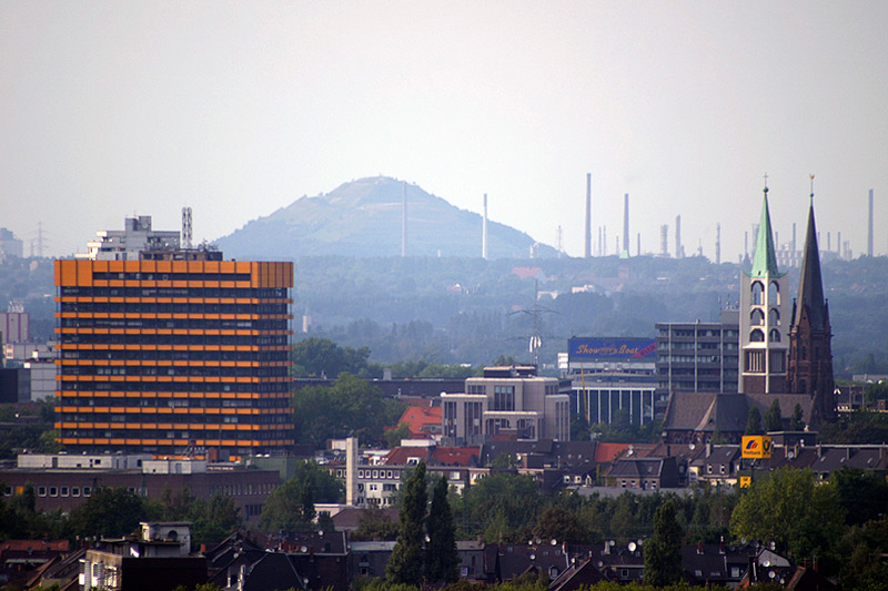


Gelsenkirchen, Germany
Gelsenkirchen is a city of 270,028 people in North Rhine-Westphalia, Germany.
Why visit Gelsenkirchen
Townapedia lists 69 museums and landmarks, 50 parks and trails, 201 places to eat, 8 places to stay and 21 attractions in and around town.
Highlights include Musiktheater im Revier, Aalto Theatre, Bismarckturm Essen and Dortmannhof.
Weather in Gelsenkirchen
Forecast from MET Norway (CC BY 4.0). Full forecast
About Gelsenkirchen
Gelsenkirchen (; German: [ˌɡɛlzn̩ˈkɪʁçn̩] ; Westphalian: Gelsenkiärken) is the 26th-most populous city of Germany and the 12th-most populous in the state of North Rhine-Westphalia with a population of 266,199 as of 2025. On the Emscher River (a tributary of the Rhine), it lies at the centre of the Ruhr area, the largest urban area of Germany, of which it is the fifth-largest city after Dortmund, Essen, Duisburg and Bochum. The Ruhr is located in the Rhine-Ruhr metropolitan region, the second-biggest metropolitan region by GDP in the European Union. Gelsenkirchen is the fifth-largest city of Westphalia after Dortmund, Bochum, Bielefeld and Münster, and it is one of the southernmost cities in the Low German dialect area.
From the Wikipedia article Gelsenkirchen (this version), under CC BY-SA 4.0.
Travel tips from other travellers: Gelsenkirchen on Wikivoyage (CC BY-SA 4.0).
Things to do21

Musiktheater im Revier
Cinema and theater · 1.1 km
Opera house in Gelsenkirchen, North Rhine-Westphalia, Germany
1 Kennedyplatz, Gelsenkirchen

Aalto Theatre
Cinema and theater · 8.7 km
Opera house in Essen, Germany

Colosseum Theater
Cinema and theater · 8.3 km
Theater in Essen, Germany

Das Kleine Theater Essen
Cinema and theater · 8.0 km
German private theater based in Essen, Northrhine-Westphalia

Grillo-Theater
Cinema and theater · 8.1 km
Theatre in Essen, Germany, used by the municipal drama company

Prinzregenttheater
Cinema and theater · 10.3 km
Theatre in Bochum, Germany

Rottstraße 5 Theater
Cinema and theater · 8.6 km
Theatre in Bochum, Germany

Stratmanns Theater Europahaus
Cinema and theater · 8.1 km
Theatre in Essen, Germany, former town hall

Tetrahedron in Bottrop
Monument and historic site · 9.8 km
Sculpture and observation tower in Bottrop


9 more on the map.
Museums and landmarks69

Bismarckturm Essen
Monument and historic site · 2.9 km
Feuersäule zu Ehren von Otto von Bismarck
Nettelnbusch, Essen


Jugendhalle Schonnebeck
Monument and historic site · 3.3 km
52 Saatbruchstraße, Essen

Kolonie Ottenkampshof
Monument and historic site · 3.1 km
138 - 144, 146 - 152 Katernberger Straße

Kolonie Zollverein III (Schlägel & Eisen)
Monument and historic site · 3.2 km
Jüngste Zechenkolonie in Essen-Katernberg


Pestalozzidorf "Im Grund"
Monument and historic site · 3.3 km
Nach 1952 als Wohnsiedlung für Jugendliche, die nach den Grundsätzen des Pädagogen Johann Heinrich Pestalozzi errichtet wurde.

Schacht Oberschuir
Monument and historic site · 1.2 km
32 Boniverstraße

Zeche Holland
Monument and historic site · 3.2 km
13 Lyrenstraße, Bochum


Montagsloch
Monument and historic site · 11.4 km
Memorial in Essen, Germany

57 more on the map.
Parks, trails and playgrounds50

Alma Park
Sports field and stadium · 1.3 km
39 Almastraße, Gelsenkirchen
Mo-Fr 15:00-22:00; Sa-Su,PH,SH 10:00-22:00



ZOOM Erlebniswelt
Park · 4.5 km
Zoological garden in Gelsenkirchen, in Germany


Lohrheidestadion
Sports field and stadium · 2.6 km
82 Lohrheidestraße, Bochum-Wattenscheid

Gesundheitspark Nienhausen
Sports field and stadium · 2.1 km
Mo-Th 09:00-22:00; Fr, Sa 09:00-23:00; PH, Su 09:00-21:00

38 more on the map.
Restaurants and cafes201

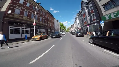
Pizzeria Bella Italia
Restaurant · Pizza · 2.5 km
Telefon nummber is Fax too.
185 Bismarckstraße, Gelsenkirchen
Tu-Th 17:00-22:00; Fr 12:00-22:00; Sa 12:00-22:00; Su,PH 12:00-24:00
Cafe & Bar Celona
Restaurant · Burger, Coffee Shop, International · 0.6 km
1 Neumarkt, Gelsenkirchen
Su-Th 09:00-00:00, Fr-Sa 09:00-01:00, PH 09:00+

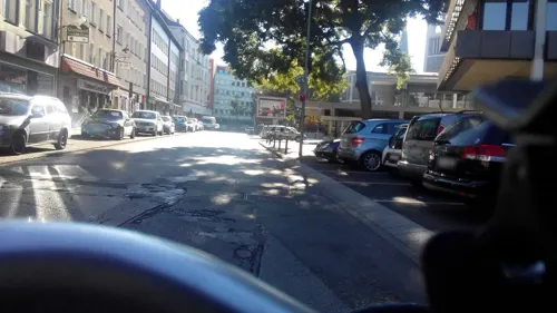
Dionysos
Restaurant · Greek · 0.7 km
14 Alter Markt, Gelsenkirchen
Mo,We-Sa 11:30-23:00; Su,PH 12:00-23:00; Tu off
Diosmos
Restaurant · Greek
9 Rotthauser Straße, Gelsenkirchen
Mo 12:00-23:00, Tu off; We-Fr 12:00-14:30,17:00-23:00, Sa...
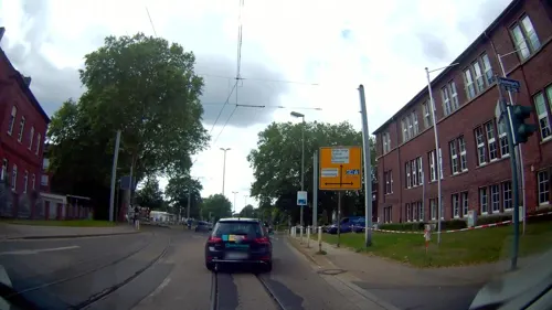
Kohinoor
Restaurant · Indian · 1.0 km
1 Wanner Straße, Gelsenkirchen
Tu-Sa 11:30-14:30,17:00-22:30; Su,PH 11:30-22:30; Mo off
PHUC LOC GOURMET
Restaurant · Asian, Noodle, Sushi, Pizza, Burger · 1.9 km
26 Karl-Meyer-Straße, Gelsenkirchen
Tu-Sa 11:00-21:00; Su,PH 13:00-21:00
Ristorante Trulli
Restaurant · Italian
6 Von-der-Recke-Straße, Gelsenkirchen
Mo,Tu,Th,Fr 12:00-14:30,17:00-23:00; Sa,Su 12:00-23:00; PH 12:00-23:00


Savarona
Restaurant · Turkish · 0.9 km
50 Hauptstraße
We,Th 16:00-23:00, Fr,Sa 16:00-24:00, Su 16:00-22:30; Mo,Tu off
Swaad
Restaurant · Indian · 1.3 km
79 Florastraße
Tu-Th 11:30-15:00, 17:00-22:00; Fr 11:30-15:00, 17:00-22:30; Sa-Su...
189 more on the map.
Where to stay8
Hotel Bochum Wattenscheid Affiliated By Meliá
Motel and hotel · 3.3 km
1 Josef-Haumann-Straße, Bochum
Naturfreundehaus Fritz Bohne
Motel and hotel · 1.0 km
25 Holbeinstraße, Gelsenkirchen
Churches and places of worship49
Propsteikirche Sankt Augustinus
Church · Roman Catholic
4 Bahnhofstraße, Gelsenkirchen
Shopping77
Gas and EV charging27
Schools, colleges and libraries65
Evangelical Comprehensive School Gelsenkirchen-Bismarck (EGG)
School · 2.9 km
41 Laarstraße, Gelsenkirchen
Healthcare34
Map of Gelsenkirchen
250 places. The map loads OpenStreetMap tiles when you open it.
Getting there and nearby towns
Flughafen Essen-Mülheim (ESS) is the nearest airport with scheduled flights listed in OpenStreetMap, 16 km away.
- Herne 10 km northeast, about 10 min by car
- Recklinghausen 14 km northeast, about 14 min by car
- Oberhausen 16 km west, about 16 min by car
- Wuppertal 28 km south, about 28 min by car
- Hagen 31 km southeast, about 31 min by car
- Moers 33 km west, about 33 min by car
- Solingen 37 km south, about 37 min by car
- Remscheid 37 km south, about 37 min by car
- Krefeld 42 km southwest, about 42 min by car
- Neuss 45 km southwest, about 45 min by car
Drive times are estimates from straight-line distance, not routes.
Local news
Headlines from INDB.
Reviews, tips and questions
Loading what members have shared...
Sources and licences
- GeoNames (CC BY 4.0): population, coordinates, regions and time zone
- Mapillary (see each image): photos
- OpenStreetMap contributors (ODbL 1.0): places, airports, map data
- Wikidata (CC0 1.0): elevation, founding date, time zone, website, landmarks and historic places
- Wikimedia Commons (see each image): photos
- Wikipedia (CC BY-SA 4.0): overview and history text
Photo credits
- Gelsenkirchen aug2004 002, Thomas Robbin, CC BY-SA 3.0
- Fernsehturm-Gelsenkirchen, Matthias Wiegandt, CC BY-SA 4.0
- Gelsenkirchen, Baudenkmal 140 Gertrud-Bäumer-Realschule Rotthauser Strasse 2-Zeppelinallee 1 - Altstadt, Dr. W. Strickling, CC BY-SA 4.0
- Gelsenkirchen Baudenkmal 140 Gertrud-Bäumer-Realschule Rotthauser Strasse 2-Zeppelinallee 1 5534, User:Creosoph, CC BY-SA 4.0
- Gelsenkirchen, Sozialamt, 2016-07 CN-04, Steffen Schmitz, CC BY-SA 4.0
- Gelsenkirchen, Sozialamt, 2016-07 CN-03, Steffen Schmitz, CC BY-SA 4.0
- Gelsenkirchen, Sozialamt, 2016-07 CN-02, Steffen Schmitz, CC BY-SA 4.0
- Bahnhofstraße Gelsenkirchen, Wikiwanni, CC BY-SA 4.0
- Stolperstein Gelsenkirchen Augustastraße Annemarie Zorek, Gmbo 2013, CC0
- Stolpersteine Gelsenkirchen Augustastraße, Gmbo 2013, CC0
- Stolpersteinlage Gelsenkirchen Augustastraße, Gmbo 2013, CC0
- Stolperstein Gelsenkirchen Augustastraße Margit Zorek, Gmbo 2013, CC0
- Gelsenkirchen – altes Postamt, heute Verwaltungsgericht - panoramio, giggel, CC BY 3.0
- Gelsenkirchen, Sozialamt, 2016-07 CN-01, Steffen Schmitz, CC BY-SA 4.0
- Gelsenkirchen, Baudenkmal 059 Haus Augustastrasse 11 - Altstadt, Dr. W. Strickling, CC BY-SA 4.0
- Gelsenkirchen, Baudenkmal 170 Haus Bokermühlstrasse 25 - Neustadt 2020-04-25, W.Strickling, CC BY-SA 4.0
- Ehemaliges Postamt Gelsenkirchen, Wikiwanni, CC BY-SA 4.0
- Stolpersteinlage Gelsenkirchen Arminstraße 3, Gmbo 2013, CC0
- Stolpersteine Gelsenkirchen Arminstraße 3, Gmbo 2013, CC0
- Stolperstein Gelsenkirchen Arminstraße 3 Lotte Posner, Gmbo 2013, CC0
- Stolperstein Gelsenkirchen Arminstraße 3 Liselotte Margot Elikan, Gmbo 2013, CC0
- Stolperstein Gelsenkirchen Arminstraße 3 Ella Posner, Gmbo 2013, CC0
- Stolperstein Gelsenkirchen Arminstraße 3 Werner de Vries, Gmbo 2013, CC0
- Stolperstein Gelsenkirchen Arminstraße 3 Carl Posner, Gmbo 2013, CC0
- Gelsenkirchen, Baudenkmal 151 Haus Beskenstrasse 27 - Altstadt, Dr. W. Strickling, CC BY-SA 4.0
- Gelsenkirchen, Baudenkmal 145 Werkstattgebäude Beskenstrasse 38 - Altstadt, Dr. W. Strickling, CC BY-SA 4.0
- Auferstehungskirche Gelsenkirchen, Tohma ( talk ), CC BY-SA 4.0
- Gelsenkirchen, Baudenkmal 208 Wohnhaus Josefstrasse 31 - Neustadt 2020-04-25, W.Strickling, CC BY-SA 4.0
- Marienschrein Damenstift Aloysianum Husemannstrasse 52 - Altstadt Gelsenkirchen-5535, Dr. W. Strickling, CC BY-SA 4.0
- Gelsenkirchen Baudenkmal 123 Damenstift Aloysianum Husemannstrasse 52 30, User:Creosoph, CC BY-SA 4.0
- Gelsenkirchen, Baudenkmal 040 Augustinuskirche Innenansicht, Dr. W. Strickling, CC BY-SA 4.0
- Gelsenkirchen, Baudenkmal 040 Augustinuskirche Westschiff, Dr. W. Strickling, CC BY-SA 4.0
- Gelsenkirchen, Baudenkmal 040 Augustinuskirche Ostschiff, Dr. W. Strickling, CC BY-SA 4.0
- Abellio Flirt, Gelsenkirchen (LRM 20200604 120528), Matti Blume, CC BY-SA 4.0
- Abellio Flirt, Gelsenkirchen (LRM 20200604 120526), Matti Blume, CC BY-SA 4.0
- Gelsenkirchen, Baudenkmal 143 Wiehagen-Schule Josefstrasse 26-28 - Neustadt 2020-04-25, W.Strickling, CC BY-SA 4.0
- Gelsenkirchen, Baudenkmal 145 Haus Beskenstrasse 38 - Altstadt, Dr. W. Strickling, CC BY-SA 4.0
- MiR außen ganz, MiR Gelsenkirchen, CC BY-SA 3.0
- Aalto-Theater-Abends-02-2014, Tuxyso, CC BY-SA 3.0
- Colosseum Theater Essen 2011, Wiki05, CC0
- Kleines Theater Essen Gaensemarkt, Kungfuman, CC BY-SA 3.0
- Grillo-Theater-2012, Tuxyso, CC BY-SA 3.0
- PRINZREGENTTHEATER BOCHUM, PRINZREGENTTHEATER, CC BY-SA 4.0
- Kennedyplatz, Essen 06, Wiki05, CC BY-SA 4.0
- Bottrop, Tetraeder -- 2019 -- 0242, Dietmar Rabich, CC BY-SA 4.0
- Herne Mondpalast Autostitch, The original uploader was Stahlkocher at German Wikipedia ., CC BY-SA 3.0
- Bergbaumuseum Sommer 2013, Christian Nawrot, CC BY-SA 3.0
- Montagsloch Essen, Grugapark 02, Wiki05, CC BY-SA 3.0
- Alte Synagoge Essen 2014, Tuxyso, CC BY-SA 3.0
- Grugapark Essen, Wiki05, CC0
- Gelsenkirchen - Nordsternpark - Kohlenbunker+Bandbrücke+Kohlenmischanlage (Pyramide) 03 ies, Frank Vincentz, CC BY-SA 3.0
- Gelsenkirchen - Zoom - Afrika - African Queen 06 ies, Frank Vincentz, CC BY-SA 3.0
- Dom-Essen-mit-Burgplatz-und-Rathaus-2016, Tuxyso, CC BY-SA 3.0
- Bochum Technische Fachhochschule Georg Agricola, Unknown author, CC BY-SA 3.0
- Universität Duisburg Essen, Wiki05, CC BY-SA 3.0
- Foerdergerüst Zeche Holland Wattenscheid, Thorsten Bachner, Public domain
- Schalke GlueckaufKampfbahn1, Unknown author, CC BY-SA 3.0
- Bahnhofscenter Gelsenkirchen, No machine-readable author provided. Marc Schuelper assumed (based on copyright claims)., CC BY-SA 3.0
- Lohrheidestadion2025, JTCEPB, CC BY-SA 4.0
- Klaus-Steilmann-Haus, Thommek, CC BY-SA 3.0
- Neue Synagoge Gelsenkirchen, Daniel Ullrich, Threedots, CC BY-SA 3.0
- Halde Rheinelbe 01, Arnoldius, CC BY-SA 3.0
- Gelsenkirchen - NSG + Halde Rheinelbe nord+süd (Mechtenberg) 02 ies, Frank Vincentz, CC BY-SA 3.0
- Marienhospital Gelsenkirchen, Stahlkocher, CC BY-SA 3.0
- Gelsenkirchen St. Augustinus 3, Gelsenkirchen_Altstadt_Panorama.jpg : Jesse Krauß derivative work: Rabanus Flavus ( talk ), Public domain
- BTG Berufskolleg für Technik und Gestaltung 2016 05158, CLUX, CC BY-SA 4.0
- Carl-Friedrich-Gauß-Gymnasium Haupteingang Gelsenkirchen Bulmke-Hüllen, Wikimediaergaenzung, CC BY-SA 4.0
- Erlöserkirche Gelsenkirchen, Wikimediaergaenzung, CC BY-SA 4.0
- Gelsenkirchen, Baudenkmal 068 Nicolai-Kirche Ückendorfer Strasse 106 - Ückendorf 2020-04-25, W.Strickling, CC BY-SA 4.0
- Friedenskirche Schalke, Christian Hellmann, CC BY-SA 4.0
- Evangelische Kreuzkirche Gelsenkirchen, Edgar El (changes by Rabanus Flavus ), CC BY 3.0
- Gelsenkirchen Schacht Oberschuir, Doris Antony , Berlin, CC BY-SA 4.0
- Ev. Kirche in Gelsenkirchen - Rotthausen - panoramio, Edgar El, CC BY 3.0
- Bochum-Leithe Ev Gemeindezentrum, Raenmaen, CC BY-SA 3.0
- Gelsenkirchen, Baudenkmal 110 St. Josef Ückendorfer Strasse 124 - Ückendorf 2020-04-25, W.Strickling, CC BY-SA 4.0
- Bismarckturm Essen-Kray, Kungfuman, CC BY-SA 3.0
- Essen-Katernberg Dortmannhof, Es-Punkt-Ge-Punkt, CC0
- Essen JugendhalleSchonnebeck03, NatiSythen, CC BY-SA 3.0
- NienhuserBuschEssen Straßenfront3, NatiSythen, CC BY-SA 3.0
- Essen-Katernberg Kolonie Zollverein III Schlaegelstrasse, Es-Punkt-Ge-Punkt, CC0
- Essen-Katernberg Im Grund 16 14 12, Es-Punkt-Ge-Punkt, CC0
- Wanderweg durch das Naturschutzgebiet, W.brinck, CC BY-SA 4.0
- Reisemobilstellplatz Revierpark Nienhausen, Gelsenkirchen-2389, Raimond Spekking, CC BY-SA 4.0
- Bergmannsdom, Abbatissa, CC BY 3.0
- Street-level photo, bravewaffle, CC BY-SA 4.0
- Street-level photo, avikdor, CC BY-SA 4.0
- Street-level photo, avikdor, CC BY-SA 4.0
- Street-level photo, avikdor, CC BY-SA 4.0
- Street-level photo, avikdor, CC BY-SA 4.0
- Street-level photo, geogladbecker, CC BY-SA 4.0
- Street-level photo, klaus100000, CC BY-SA 4.0
- Street-level photo, geogladbecker, CC BY-SA 4.0
- Street-level photo, geogladbecker, CC BY-SA 4.0
- Street-level photo, avikdor, CC BY-SA 4.0
- Street-level photo, klaus100000, CC BY-SA 4.0
- Street-level photo, geogladbecker, CC BY-SA 4.0
- Street-level photo, bravewaffle, CC BY-SA 4.0
- Street-level photo, bravewaffle, CC BY-SA 4.0
- Street-level photo, geogladbecker, CC BY-SA 4.0
- Street-level photo, hiwi234, CC BY-SA 4.0
- Street-level photo, heetENkoel, CC BY-SA 4.0


Page built November 8, 2026. Spotted a mistake? Tell us or suggest a place.