


Zerbst, Germany
Zerbst/Anhalt
Zerbst is a town of 21,124 people in Saxony-Anhalt, Germany.
Why visit Zerbst
Townapedia lists 178 museums and landmarks, 40 parks and trails, 89 places to eat, 32 places to stay and 16 attractions in and around town.
Highlights include Anhaltisches Theater, Cinema Barby, Schloss Leitzkau and Feuersäule.
Weather in Zerbst
Forecast from MET Norway (CC BY 4.0). Full forecast
About Zerbst
Zerbst (German pronunciation: [ˈtsɛʁpst] ) is a town in the district of Anhalt-Bitterfeld, in Saxony-Anhalt, Germany. Until an administrative reform in 2007, Zerbst was the capital of the former Anhalt-Zerbst district.
From the Wikipedia article Zerbst (this version), under CC BY-SA 4.0.
Things to do16

Anhaltisches Theater
Cinema and theater · 17.7 km
Theatre and opera house in Dessau, Germany

Cinema Barby
Cinema and theater · 13.8 km
8 Goethestraße, Barby
"öffnungszeiten zu Veranstaltungen: www.cinema-barby.de"


Gartenbau Wallwitz
Farm and orchard · 1.9 km
92 Magdeburger Straße, Zerbst/Anhalt
Mo-Fr 08:30-18:00, Sa 08:00-12:00

4 more on the map.
Museums and landmarks178

Schloss Leitzkau
Monument and historic site · 14.2 km
4 Am Schloß, Gommern
Tu-Th 09:00-13:00; Fr 12:00-16:00; "Schlossführungen März-Oktober,...

Feuersäule
Monument and historic site · 1.9 km
Das Denkmal wurde errichtet 1913 zur 100-jährigen Wiederkehr der Völkerschlacht bei Leipzig


Dessauer Torturm
Monument and historic site · 12.6 km
33 Dessauer Straße, Aken (Elbe)


Wasserturm Aken
Monument and historic site · 13.5 km
Wasserturm, Am Wasserturm in Aken


166 more on the map.
Parks, trails and playgrounds40


Georgium
Park · 16.8 km
Castle and sculpture garden in Dessau, Germany







Marina Elbterrassen zu Brambach
Marina and boat launch · 11.1 km

28 more on the map.
Restaurants and cafes89
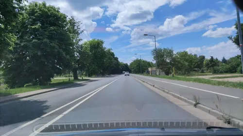
Am Schloßgarten
Restaurant · Italian · 14.5 km
19 Am Schloßgarten, Dessau-Roßlau
Mo off; Tu-Sa 17:00-22:00; Su 11:30-14:00, 17:00-22:00

Athos
Restaurant · Greek · 13.4 km
44 Köthener Chaussee, Aken (Elbe)
Tu-Su,PH 11:30-14:30, 17:30-23:00
Elbterassen Brambach
Restaurant · German · 11.0 km
2 An der Elbe, Dessau-Roßlau
Mo 15:00+; Tu-Fr 12:00+; Sa-Su 11:30+; PH 11:30+; Dec 24 off; Dec...
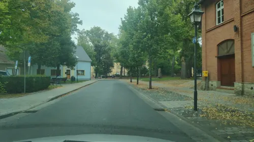
Gasthof zum Rautenkranz
Restaurant · Regional · 13.7 km
29 Schloßstraße, Barby
Mo off; Tu-Sa 11:00-14:00,17:00-22:00; Su 10:00-14:00
Taverna Zorbas
Restaurant · Greek · 14.3 km
43a Brambacher Straße, Dessau-Roßlau
Mo off; Tu-Th 17:30-23:30; Fr-Su,PH 11:30-14:30,17:30-23:30
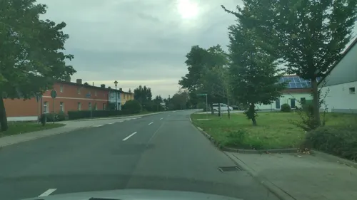
Gaststätte "Zur Biethe"
Restaurant · 13.3 km
40 Clara-Zetkin-Straße, Dessau-Roßlau
Tu-Sa 17:00-22:00; Su 11:00-15:00
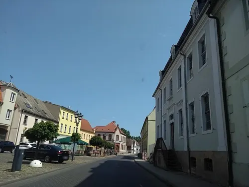

Eiscafe Palermo
Cafe · Ice Cream · 14.0 km
24 Hauptstraße, Dessau-Roßlau
Mo-Fr 10:00-21:00; Sa 11:00-21:00; Su 12:00-21:00


Parkrestaurant Vogelherd
Restaurant · International · 3.4 km
78 Lindauer Straße, Zerbst/Anhalt
77 more on the map.
History
In the 8th century the area east of the Elbe was settled by Polabian Slavs (Lusatian Serbs), and the city was named Serbst after them, which evolved into Zerbst. Part of the border region with the adjacent Saxon region around Magdeburg in the west, it was incorporated into the Gau Ciervisti of the Saxon Eastern March (Marca Geronis) about 937 in the course of the German Ostsiedlung.
It is not clear when Zerbst was founded; however, the name Ciervisti mentioned as early as 949 may already refer to a fortified Slavic settlement. The chronicles by Prince-Bishop Thietmar of Merseburg recorded the first mention of a town as Zirwisti urbs in 1018, giving an account of the occupation by the Polish duke Bolesław I Chrobry during the German–Polish War with King Henry II in 1007. In the early 12th century the Ascanian ruler Albert the Bear had the fortress rebuilt, and the adjacent settlement was first fortified with town walls about 1250.
In 1307 Prince Albert I of Anhalt acquired the city of Zerbst from the Barby comital family, starting a centuries-long rule by the Ascanian princely House of Anhalt. His descendants continued to rule the Principality of Anhalt-Zerbst until in 1396 it was divided between Prince Sigismund I and his brother Albert IV, and the residence was moved to Dessau.
In 1375 Zerbster Bitterbier was first mentioned; by the Middle Ages the town had 600 breweries.
From the History section of Zerbst on Wikipedia, under CC BY-SA 4.0.
Where to stay32
Churches and places of worship54
Shopping29
Gas and EV charging12
Schools, colleges and libraries14
Anhaltische Landesbücherei - Ludwig-Lipmann-Bibliothek
Library · 13.9 km
11 Hauptstraße, Dessau-Roßlau
Healthcare13
Map of Zerbst
250 places. The map loads OpenStreetMap tiles when you open it.
Getting there and nearby towns
Flugplatz Köthen (KOQ) is the nearest airport with scheduled flights listed in OpenStreetMap, 29 km away.
- Magdeburg 36 km northwest, about 36 min by car
- Bad Belzig 40 km northeast, about 40 min by car
- Halle (Saale) 54 km south, about 54 min by car
- Brandenburg an der Havel 59 km northeast, about 59 min by car
- Premnitz 65 km north, about 1 h by car
- Beelitz 68 km northeast, about 1 h 15 min by car
- Jüterbog 68 km east, about 1 h 15 min by car
- Leipzig 72 km south, about 1 h 15 min by car
- Rathenow 73 km north, about 1 h 15 min by car
- Potsdam 82 km northeast, about 1 h 15 min by car
Drive times are estimates from straight-line distance, not routes.
Local news
Headlines from INDB.
Reviews, tips and questions
Loading what members have shared...
Sources and licences
- GeoNames (CC BY 4.0): population, coordinates, regions and time zone
- Mapillary (see each image): photos
- OpenStreetMap contributors (ODbL 1.0): places, airports, map data
- Wikidata (CC0 1.0): elevation, founding date, time zone, website, landmarks and historic places
- Wikimedia Commons (see each image): photos
- Wikipedia (CC BY-SA 4.0): overview and history text
Photo credits
- Zerbst Bartholomäikirche, mazbln, CC BY-SA 3.0
- Zerbst,Wasserjette Infotafel, M_H.DE (Foto), Infotafel vom Heimatverein Zerbst, CC BY-SA 3.0
- Zerbst,Wasserjette, M_H.DE, CC BY-SA 3.0
- Zerbst (Anhalt), Marktplatz mit Wappenbaum, M_H.DE, CC BY-SA 4.0
- Zerbst,Wappenbaum, M_H.DE, CC BY-SA 3.0
- Zerbst,Wappenbaum 2, M_H.DE, CC BY-SA 3.0
- Zerbst (Anhalt), Mühlenbrücke 57, M_H.DE, CC BY-SA 4.0
- Zerbst,Fasch-Gedenkstein, M_H.DE, CC BY-SA 3.0
- Zerbst-01-Rudolf-Knobloch-1932, Q140185287, CC0
- Zerbst (Anhalt), Mühlenbrücke 60, Infotafel Friederike Caroline Neuber, M_H.DE, CC BY-SA 4.0
- Zerbst (Anhalt), Mühlenbrücke 65, M_H.DE, CC BY-SA 4.0
- Zerbst (Anhalt), Mühlenbrücke 60, Portal, M_H.DE, CC BY-SA 4.0
- Zerbst (Anhalt), Mühlenbrücke 60, M_H.DE, CC BY-SA 4.0
- Zerbst,Stolpersteine Oskar und Helene Kariel, M_H.DE, CC BY-SA 3.0
- Zerbst (Anhalt), Markt 25, M_H.DE, CC BY-SA 4.0
- Zerbst (Anhalt), Markt 24, M_H.DE, CC BY-SA 4.0
- Zerbst (Anhalt), Mühlenbrücke 69, M_H.DE, CC BY-SA 4.0
- Zerbst (Anhalt), Markt 22, M_H.DE, CC BY-SA 4.0
- Zerbst (Anhalt), Mühlenbrücke 73, M_H.DE, CC BY-SA 4.0
- Zerbst (Anhalt), Mühlenbrücke 67, M_H.DE, CC BY-SA 4.0
- Zerbst Marktplatz Fassade, Oberlausitzerin64, CC BY-SA 4.0
- Zerbst (Anhalt), Markt 23, M_H.DE, CC BY-SA 4.0
- Zerbst (Anhalt), Mühlenbrücke 64, M_H.DE, CC BY-SA 4.0
- Zerbst (Anhalt), Mühlenbrücke 75, M_H.DE, CC BY-SA 4.0
- Zerbst (Anhalt), Markt 20, M_H.DE, CC BY-SA 4.0
- Zerbst (Anhalt), Mühlenbrücke, (Straßenzug), M_H.DE, CC BY-SA 4.0
- Zerbst,Gedenktafel Polnische Häftlinge, M_H.DE, CC BY-SA 3.0
- Zerbst (Anhalt), Markt 21, M_H.DE, CC BY-SA 4.0
- Zerbst,Denkmal Opfer Faschismus, M_H.DE, CC BY-SA 3.0
- Zerbst (Anhalt), Brüderstraße 1, Ruine am Giebel, M_H.DE, CC BY-SA 4.0
- Dessau,Anhaltisches Theater, M_H.DE, CC BY-SA 3.0
- Dessau Bauhaus neu, Lelikron, CC BY-SA 3.0
- Woerlitzpark81, Erbanor at German Wikipedia ( Original text: Erbanor ), Public domain
- Dorfkirche Jütrichau, No machine-readable author provided. Olaf2 assumed (based on copyright claims)., CC BY-SA 3.0
- Sankt-Benedikt-Kirche Güterglück Apsis, Olaf Meister, CC BY-SA 3.0
- St. Trinitatis Zerbst 20180812 002, Tilman2007, CC BY-SA 4.0
- Zerbst,Francisceum, M_H.DE, CC BY-SA 3.0
- Steckby kirche, Z thomas, CC BY 3.0
- Dessau-Roßlau, NSG Buchholz, M_H.DE, CC BY-SA 4.0
- Leitzkau Hobeck castle, Doris Antony , Berlin, CC BY-SA 3.0
- DobritzEhemKapelle, Global Fish, CC BY-SA 4.0
- Friedrich Prinz von Anhalt-Dessau,Gedenkstein am Weinberghaus im Kühnauer Park, M_H.DE, CC BY-SA 3.0
- Lindau,Zerbst(Anhalt)Kirche, M H.DE, CC BY-SA 4.0
- Gödnitz-village church, Dguendel, CC BY 3.0
- Kühren, Aken (Elbe),Gefallenendenkmal, M_H.DE, CC BY-SA 4.0
- Zerbst(Anhalt)Trüben,ev.Dorfkirche, M_H.DE, CC BY-SA 4.0
- Dorfkirche St. Trinitatis in Eichholz, Ortsteil von Zerbst, Feldstein, CC BY-SA 4.0
- Kirche Bornum 01, Olaf2, CC BY-SA 4.0
- Leitzkauschloss, Picman, Public domain
- Zerbst,Feuersäule, M_H.DE, CC BY-SA 3.0
- Susigke,Denkmal, M_H.DE, CC BY-SA 3.0
- Aken,Dessauer Torturm, M_H.DE, CC BY-SA 3.0
- Zerbst,Wehrturm Kiekinpott, M_H.DE, CC BY-SA 3.0
- Aken Wasserturm 2023, Oberlausitzerin64, CC BY-SA 4.0
- Aken,Burgtorturm, M_H.DE, CC BY-SA 3.0
- Zerbst,Glockenturm,Dicker Turm, M_H.DE, CC BY-SA 3.0
- Eichen Diebzig, BennyBriard, CC BY-SA 4.0
- Jütrichauer Busch 3, Rollorot, CC BY-SA 3.0
- Elberadweg zwischen Badetz und Steckby, Meiert, CC BY-SA 3.0
- Neeken,Kirche, M_H.DE, CC BY-SA 3.0
- Jütrichau Kirche, M_H.DE, CC BY-SA 3.0
- Breitenhagen,Kirche, M_H.DE, CC BY-SA 3.0
- Thießen,Kita Rosselspatzen,Schule, M_H.DE, CC BY-SA 3.0
- Dessau-Roßlau,Rodleben,Spitzberg, M_H.DE, CC BY-SA 3.0
- Bauhaus Dessau (Nordflügel und Brücke) - panoramio, © R.Möhler, CC BY-SA 3.0
- Dessau,Georgium Blumengartenhaus, M_H.DE, CC BY-SA 3.0
- Street-level photo, spanholz, CC BY-SA 4.0
- Street-level photo, hotteliene, CC BY-SA 4.0
- Street-level photo, spanholz, CC BY-SA 4.0
- Street-level photo, hotteliene, CC BY-SA 4.0
- Street-level photo, dsmm, CC BY-SA 4.0
- Street-level photo, dsmm, CC BY-SA 4.0
- Street-level photo, surveyor99, CC BY-SA 4.0
- Street-level photo, surveyor99, CC BY-SA 4.0
- Street-level photo, thetornado76, CC BY-SA 4.0
- Street-level photo, thetornado76, CC BY-SA 4.0
- Street-level photo, tobiaso, CC BY-SA 4.0
- Street-level photo, spanholz, CC BY-SA 4.0
- Street-level photo, hotteliene, CC BY-SA 4.0
- Street-level photo, tobiaso, CC BY-SA 4.0


Page built November 8, 2026. Spotted a mistake? Tell us or suggest a place.