


Why visit Bad Belzig
Townapedia lists 65 museums and landmarks, 19 parks and trails, 72 places to eat, 23 places to stay and 43 attractions in and around town.
Highlights include Gut Schmerwitz - Hofladen, Hagelberg, Roger-Loewig-Museum and Burg Eisenhardt.
Weather in Bad Belzig
Forecast from MET Norway (CC BY 4.0). Full forecast
About Bad Belzig
Bad Belzig (German pronunciation: [baːt ˈbɛltsɪç] ), until 2010 Belzig, is a historic town in Brandenburg, Germany located about 70 km (43 mi) southwest of Berlin. It is the capital of the Potsdam-Mittelmark district.
From the Wikipedia article Bad Belzig (this version), under CC BY-SA 4.0.
Things to do43

Gut Schmerwitz - Hofladen
Farm and orchard · 7.5 km
8 Schmerwitz, Wiesenburg/Mark
Mo-Fr 09:00-17:00; Sa 09:00-16:00

Hofladen Lütte
Farm and orchard · 6.3 km
48 Chausseestraße, Bad Belzig
Fr 10:00-17:00, Sa 07:00-13:00
Paradiesplatz
Farm and orchard · 2.0 km
10 Waldsiedlung, Bad Belzig
Mo-Su 08:00-18:00



31 more on the map.
Museums and landmarks65


Burg Eisenhardt
Monument and historic site · 0.7 km
14 Wittenberger Straße, Bad Belzig
We-Fr 13:00-17:00; Sa,Su 11:00-16:00; Mo,Tu off

Kursächsische Postmeilensäule
Monument and historic site · 10.3 km
Kursächsische Postmeilensäule-Distanzsäule, Lindenstraße Ecke Wittenberger Straße in Niemegk

Landwehrschlacht von Hagelberg
Monument and historic site · 5.1 km
Frankreich & Sachsen gegen Preußen & Russland (Sieger)


Heimatmuseum in der Burg Eisenhardt
Museum · 0.8 km
14 Wittenberger Straße, Bad Belzig
We-Fr 13:00-17:00; Sa-Su 11:00-16:00


Burg Rabenstein
Monument and historic site · 12.0 km
Sa,Su 11:00-16:00

Schloss Wiesenburg
Monument and historic site · 10.1 km
1a Schlossstraße, Wiesenburg/Mark

Altes Hagelbergdenkmal
Monument and historic site · 5.1 km
Ursprüngliche Inschrift: Der heldenmutigen Landwehr welche am 27. August 1813 von Vaterlandsliebe begeistert hier einen glänzenden Sieg...
53 more on the map.
Parks, trails and playgrounds19






Freizeit- und Erlebnisbad Bad Belzig
Sports field and stadium
8 Weitzgrunder Straße, Bad Belzig
7 more on the map.
Restaurants and cafes72

Familienhotel Brandtsheide
Restaurant · Regional · 11.6 km
8 c Bahnhofsallee, Wiesenburg/Mark
Mo-Su 11:00-20:00
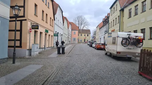
Anokha
Restaurant · Indian
16 Wiesenburger Straße, Bad Belzig
Mo-Fr 11:00-23:00; Sa-Su 12:00-23:00; PH 12:00-23:00

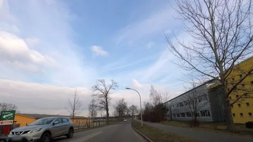
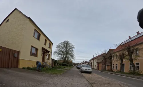
Kochtopf
Restaurant · Regional · 10.0 km
Vegetarisches Bistro & Catering
2 Hauptstraße, Brück
We 18:00-20:00; Sa,Su "siehe Monatsplan"
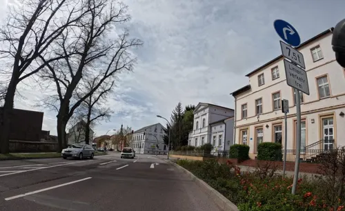
Korfu
Restaurant · Greek
53 Straße der Einheit, Bad Belzig
Mo, We-Sa, PH 11:30-14:30, 17:30-23:00; Su 11:00-14:30, 17:00-22:00
Restaurant "Dippmannsdorfer Paradies"
Restaurant · Regional · 8.8 km
10 Am Sportplatz, Bad Belzig
We-Su,PH 11:00+ || "nach Vereinbarung"



60 more on the map.
History
A Slavic fort of Belizi was first mentioned in a 997 deed issued by Emperor Otto III in favour of the Archbishopric of Magdeburg. Whether this denotation refers to Bad Belzig or the neighbouring town of Beelitz has not been conclusively established. Nevertheless, both towns celebrated their 1000 years anniversary in 1997.
The estates however had actually already been lost in the Slavic uprising of 983 and were not conquered again until 1153 by Albert the Bear from the House of Ascania. In 1251 the castle (Burg Eisenhardt) and the adjacent settlement became part of Saxe-Wittenberg under Albert's successor Duke Albert I. However it was claimed by the archbishops of Magdeburg, whose forces devastated Belzig in 1406. The rebuilt castle was again seized by the Hussite general Prokop the Great when he invaded Saxony in 1429, after which Elector Ernest of Saxony from the House of Wettin enlarged it to a fortress. During the Thirty Years' War it was seized by the troops of the Swedish Empire in 1636, after Elector John George I had allied with Emperor Ferdinand II in the Peace of Prague.
From the History section of Bad Belzig on Wikipedia, under CC BY-SA 4.0.
Where to stay23
Churches and places of worship35
Dorfkirche Rottstock
Church · Protestant · 11.3 km
33a Straße der Einheit, Brück
Neuapostolische Kirche Gemeinde Fläming
Church · New Apostolic · 0.9 km
3F Brücker Landstraße, Bad Belzig
Shopping18
Gas and EV charging7
Schools, colleges and libraries18
Kreiskrankenhaus Belzig, Fach- und Patientenbibliothek
Library
45 Niemegker Straße, Bad Belzig
ZEGG - Zentrum für Experimentelle Gesellschaftsgestaltung
School · 1.7 km
89 Rosa-Luxemburg-Straße, Bad Belzig
Healthcare6
Map of Bad Belzig
250 places. The map loads OpenStreetMap tiles when you open it.
Getting there and nearby towns
Flugplatz Köthen (KOQ) is the nearest airport with scheduled flights listed in OpenStreetMap, 64 km away.
- Beelitz 28 km northeast, about 28 min by car
- Brandenburg an der Havel 31 km north, about 31 min by car
- Michendorf 35 km northeast, about 35 min by car
- Jüterbog 37 km southeast, about 37 min by car
- Luckenwalde 40 km east, about 40 min by car
- Potsdam 43 km northeast, about 43 min by car
- Premnitz 46 km north, about 46 min by car
- Ludwigsfelde 48 km east, about 48 min by car
- Stahnsdorf 50 km northeast, about 50 min by car
- Kleinmachnow 52 km northeast, about 52 min by car
Drive times are estimates from straight-line distance, not routes.
Local news
Headlines from INDB.
Reviews, tips and questions
Loading what members have shared...
Sources and licences
- GeoNames (CC BY 4.0): population, coordinates, regions and time zone
- Mapillary (see each image): photos
- OpenStreetMap contributors (ODbL 1.0): places, airports, map data
- Wikidata (CC0 1.0): elevation, founding date, time zone, website
- Wikimedia Commons (see each image): photos
- Wikipedia (CC BY-SA 4.0): overview and history text
Photo credits
- Stolperstein Bad Belzig Straße der Einheit 8 Dagobert Bornheim, Gmbo 2013, CC0
- Bad Belzig - Mauerstrasse (Wall Street) - geo.hlipp.de - 36456, Colin Smith on geo.hlipp.de, CC BY-SA 2.0
- Bad Belzig Gertraudenkapelle Westansicht, Assenmacher, CC BY-SA 4.0
- Bad Belzig Gertraudenkapelle Südwestansicht, Assenmacher, CC BY-SA 4.0
- Bad Belzig Gertraudenkapelle Nordansicht, Assenmacher, CC BY-SA 4.0
- Bad Belzig Gertraudenkapelle Ostansicht, Assenmacher, CC BY-SA 4.0
- Bad Belzig - Mauerreste (Wall Remains) - geo.hlipp.de - 36457, Colin Smith on geo.hlipp.de, CC BY-SA 2.0
- Bad Belzig - Mauerstrasse (Wall Street) - geo.hlipp.de - 36455, Colin Smith on geo.hlipp.de, CC BY-SA 2.0
- Bad Belzig - Strasse der Einheit - geo.hlipp.de - 36454, Colin Smith on geo.hlipp.de, CC BY-SA 2.0
- Straße der Einheit 14 Bad Belzig, Clemensfranz, CC BY-SA 4.0
- Stadtkirche St Marien Bad Belzig, Clemensfranz, CC BY-SA 4.0
- Stolpersteinlage Bad Belzig Straße der Einheit 8, Gmbo 2013, CC0
- Bad Belzig - Marktplatz (Market Square) - geo.hlipp.de - 36447, Colin Smith on geo.hlipp.de, CC BY-SA 2.0
- Berliner Straße 4 Gutshaus Koreuber Bad Belzig 2022CF, Clemensfranz, CC BY-SA 4.0
- Bad Belzig - Sandberger Strasse - geo.hlipp.de - 36458, Colin Smith on geo.hlipp.de, CC BY-SA 2.0
- Stolpersteine Bad Belzig Sandberger Straße 10, Gmbo 2013, CC0
- Stolperstein Bad Belzig Sandberger Straße 10 Rudi Sachs, Gmbo 2013, CC0
- Stolperstein Bad Belzig Sandberger Straße 10 Ida Sachs, Gmbo 2013, CC0
- Stolpersteinlage Bad Belzig Sandberger Straße 10, Gmbo 2013, CC0
- Bad Belzig - Rathaus (Town Hall) - geo.hlipp.de - 36446, Colin Smith on geo.hlipp.de, CC BY-SA 2.0
- Bad Belzig Feuerwehr, Doris Antony , Berlin, CC BY-SA 4.0
- Belziger Bach im Stadtkern von Bad Belzig, Assenmacher, CC BY 4.0
- Magdeburger Straße 16 Bad Belzig 2020, Clemensfranz, CC BY-SA 4.0
- Hagelberg B1, Lienhard Schulz, CC BY 2.5
- Aerial image of Schloss Wiesenburg (view from the south), Carsten Steger, CC BY-SA 4.0
- Burg eisenhardt torhaus und burgfried, Gregor Rom, CC BY-SA 3.0
- Burgfried torhaus außen rabenstein, Gregor Rom, CC BY-SA 3.0
- Карта к статье «Гагельберг». Военная энциклопедия Сытина (Санкт-Петербург, 1911-1915), « Военная энциклопедия » Ивана Дмитриевича Сытина . ( Санкт-Петербург ; Том 7, 1912 год )., Public domain
- Rottstock KIrche600NO, Ulamm, CC BY-SA 4.0
- Gut Schmerwitz, Gregor Rom, CC BY-SA 4.0
- View on the Belziger Landschaftswiesen from compost works Baitz, Leonhard Lenz, CC BY-SA 4.0
- Klein1 Briesener Bach, Lienhard Schulz, CC BY 2.5
- Schweizer Haus Loewig Museum, Chronistpm02, CC BY-SA 3.0
- Dorfkirche Grabow (Mühlenfließ) 2018 SE, Hans G. Oberlack, CC BY-SA 4.0
- Dorfkirche Schlamau Südansicht, Assenmacher, CC BY-SA 4.0
- Dorfkirche Baitz Südostansicht, Assenmacher, CC BY-SA 4.0
- Lühnsdorf, Dorfkirche (29), Subbass1, CC BY-SA 4.0
- Dorfkirche Kranepuhl Südostansicht, Assenmacher, CC BY-SA 4.0
- St Bonifatius Bad Belzig, Bernd Schade, CC BY 3.0
- Belzig Burg8, Lienhard Schulz, CC BY 2.5
- Niemegk Postmeilensaeule, Radler59 ( talk ), CC BY-SA 4.0
- Fotothek df rp-b 0120020 Belzig-Hagelberg. Plan "Zum Treffen bei Hagelberg 27. Aug. 1813, Ausschnitt, Unknown author, CC BY-SA 3.0 de
- Bad Belzig Postmeilensäule, Radler59, CC BY-SA 3.0
- Wiesenburg palace2, Lienhard Schulz, CC BY 2.5
- Stützpunkt Hofcafe, Vielseitenhof Trebitz, CC BY-SA 4.0
- Baitz Tagungshaus, Lienhard Schulz, CC BY 2.5
- Goemnigk church3, Lienhard Schulz, CC BY 2.5
- Dorfkirche Grabow (Mühlenfließ) 2018 S, Hans G. Oberlack, CC BY-SA 4.0
- Brueck-Rottstock-Dorfkirche-II, Bildarbeiter, CC BY 4.0
- Brueck-Trebitz-Dorfkirche, Bildarbeiter, CC BY 4.0
- Belzig,St.Bricciuskirche, M_H.DE, CC BY-SA 3.0
- Haus 1 Fläming Gym, Hobbit9797, CC BY-SA 3.0
- Belzig Marienkirche, Doris Antony , Berlin, CC BY-SA 3.0
- Street-level photo, britiger, CC BY-SA 4.0
- Street-level photo, dsmm, CC BY-SA 4.0
- Street-level photo, fdmap, CC BY-SA 4.0
- Street-level photo, rausk, CC BY-SA 4.0
- Street-level photo, fdmap, CC BY-SA 4.0
- Street-level photo, dsmm, CC BY-SA 4.0
- Street-level photo, dsmm, CC BY-SA 4.0
- Street-level photo, britiger, CC BY-SA 4.0
- Street-level photo, britiger, CC BY-SA 4.0
- Street-level photo, dsmm, CC BY-SA 4.0
- Street-level photo, moenk, CC BY-SA 4.0
- Street-level photo, dsmm, CC BY-SA 4.0
- Street-level photo, fdmap, CC BY-SA 4.0
- Street-level photo, fdmap, CC BY-SA 4.0
- Street-level photo, ber319, CC BY-SA 4.0
- Street-level photo, dsmm, CC BY-SA 4.0
- Street-level photo, dsmm, CC BY-SA 4.0
- Street-level photo, britiger, CC BY-SA 4.0
- Street-level photo, dsmm, CC BY-SA 4.0
- Street-level photo, ber319, CC BY-SA 4.0
- Street-level photo, dsmm, CC BY-SA 4.0
- Street-level photo, moenk, CC BY-SA 4.0
- Street-level photo, moenk, CC BY-SA 4.0
- Street-level photo, moenk, CC BY-SA 4.0
- Street-level photo, dsmm, CC BY-SA 4.0
- Street-level photo, ankeric, CC BY-SA 4.0


Page built November 8, 2026. Spotted a mistake? Tell us or suggest a place.