


Brandenburg an der Havel, Germany
Brandenburg an der Havel is a town of 59,826 people in Brandenburg, Germany.
Why visit Brandenburg an der Havel
Townapedia lists 70 museums and landmarks, 76 parks and trails, 199 places to eat, 32 places to stay and 33 attractions in and around town.
Highlights include Friedenswarte, Brandenburger Theater, Museum im Frey-Haus and Dominikanerkloster und Kirche St. Pauli.
Weather in Brandenburg an der Havel
Forecast from MET Norway (CC BY 4.0). Full forecast
About Brandenburg an der Havel
Brandenburg an der Havel (German pronunciation: [ˈbʁandn̩bʊʁk ʔan deːɐ̯ ˈhaːfl̩] ) is a town in the federal state of Brandenburg, Germany, which served as the capital of the Margraviate of Brandenburg until it was replaced by Berlin in 1417.
From the Wikipedia article Brandenburg an der Havel (this version), under CC BY-SA 4.0.
Travel tips from other travellers: Brandenburg an der Havel on Wikivoyage (CC BY-SA 4.0).
Photos of Brandenburg an der Havel


Things to do33

Friedenswarte
Scenic view
3 Marienberg, Brandenburg an der Havel
Apr 01-Jun 30: Mo-We off; Apr 01-Jun 30: Th-Su,PH 10:00-17:00; Jul...



Hofladen "Bauer Lau"
Farm and orchard · 3.2 km
Brielower Grenze, Brandenburg an der Havel
Fr 10:00-18:00; Sa 09:00-12:00


21 more on the map.
Museums and landmarks70


Dominikanerkloster und Kirche St. Pauli
Monument and historic site · Catholic · 1.5 km
Dominikanerkloster und Kirche St. Pauli
28 Neustädtische Heidestraße, Brandenburg an der Havel

Gedenkstätte für die Opfer der Euthanasie-Morde in Brandenburg an der Havel
Museum · 0.6 km
28 Nicolaiplatz, Brandenburg an der Havel
Mo-We off; Th-Fr 13:00-17:00; Sa-Su 10:00-17:00

Gedenkstätte Zuchthaus Brandenburg-Görden
Museum · 5.6 km
38 Anton-Saefkow-Allee, Brandenburg an der Havel
Th-Fr 13:00-17:00; Sa-Su, PH 10:00-17:00

Industriemuseum Brandenburg
Museum · 3.0 km
5 August-Sonntag-Straße, Brandenburg an der Havel
Tu-Su,PH 10:00-17:00; Nov-Feb: Tu-Su,PH 10:00-16:00


Archäologisches Landesmuseum Brandenburg
Museum · 1.5 km
Paulikloster: Klausur & Kreuzgang; Datierung 1286, Erweiterung 1311, Umbau 1497.
28 Neustädtische Heidestraße
Tu-Su,PH 10:00-17:00; Jan 01,easter -2 days,Dec 24,Dec 31 off
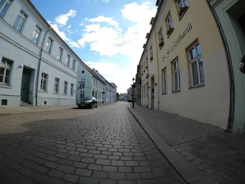
DRUCK-LADEN (Galerie Sonnensegel)
Museum
55 Mühlentorstraße, Brandenburg an der Havel
Mo-Th 08:00-16:00
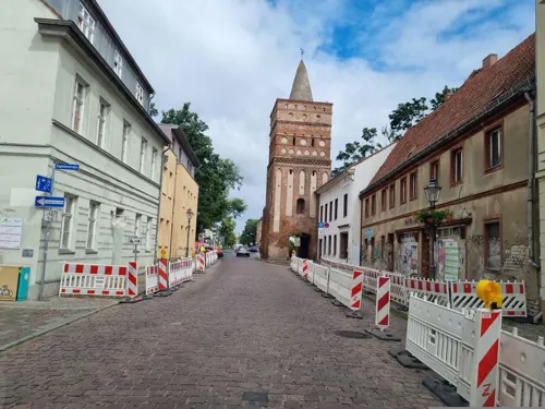
Kinder-und Jugendgalerie Sonnensegel
Museum
5 Gotthardtkirchplatz, Brandenburg an der Havel
Mo-Th 08:00-18:00; Fr 08:00-16:00



Psychiatriemuseum
Museum · 4.7 km
2 Anton-Saefkow-Allee, Brandenburg an der Havel
Tu,Th,Sa,Su 10:00-17:00; "Führungen nach tel. Vereinbarung"
58 more on the map.
Parks, trails and playgrounds76



Landschafts- und Kunstverein Rietzer Berg
Park · 5.1 km
Ein Landschaftspark mit Stauden- und Gemüsebeeten, die nach Permakultur-Richtlinien angelegt wurden. Es leben Esel, Schafe, Laufenten...
11 Rietzer Siedlung, Kloster Lehnin
Mo-Fr 09:00-15:00

Schoners Wehr
Marina and boat launch · 1.9 km
Marine & Yachtcharter
29a Krakauer Straße, Brandenburg an der Havel

Wasserwanderrastplatz »Am Slawendorf«
Marina and boat launch · 0.8 km
Km 58, Reservierungen möglich, Tel. erreichbar April bis Oktober 9 - 18 Uhr, Tel. oben. Versorgung: Wasser 100 ltr. 1 € , Strom,...
Marina am Dom
Marina and boat launch · 1.2 km
Am Grillendamm 4 14776 Brandenburg an der Havel Telefon: +49 3381 213943 Gastliegeplätze direkt am rauschenden Wehr, Stromsäulen ca. 20...
64 more on the map.
Restaurants and cafes199
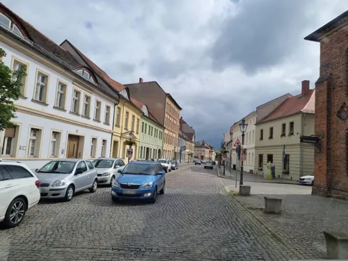
Inspektorenhaus
Restaurant · International
Küchenschluss: 21.30 Uhr
9-11 Altstädtischer Markt, Brandenburg an der Havel
We-Sa 17:30-23:00
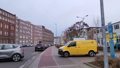
Arado Treff
Restaurant · German · 1.9 km
36 Geschwister-Scholl-Straße, Brandenburg an der Havel
Mo-Fr 06:00-14:00; Sa off; Su off
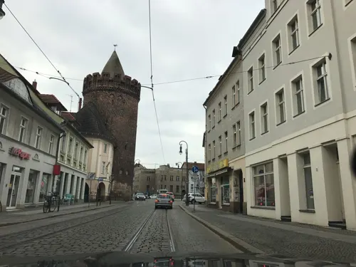
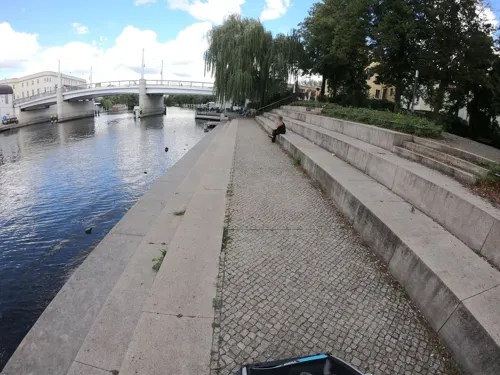

Buhnenhaus
Restaurant · German, Fish · 4.8 km
1 Buhnenhaus, Brandenburg an der Havel
Mo-Su 11:00-21:00; Tu off
Asia Cuisine
Restaurant · Asian, Vietnamese · 0.6 km
5 Nicolaiplatz, Brandenburg an der Havel
Su-Th 11:00-21:00; Fr,Sa,PH 11:00-22:00; Mo off
Bitsushi
Restaurant · Japanese, Sushi · 2.1 km
2 Rosa-Luxemburg-Allee, Brandenburg an der Havel
Tu,Th-Su 12:00-22:00; We off
BonSai Bar & BBQ
Restaurant · Asian, Sushi, Vietnamese · 2.2 km
56 Kopenhagener Straße, Brandenburg an der Havel
Mo, We-Th 11:00-15:00, 17:00-21:00; Fr-Su 12:00-16:00, 17:00-22:00

Bäckerei Thonke
Bakery
46a Willi-Sänger-Straße, Brandenburg an der Havel
Mo-Fr 06:00-18:00; Sa 07:00-17:00; Su 07:00-10:30

Café am Pfaffe Kai
Cafe · Breakfast, Ice Cream, Tea, Cake, Coffee Shop · 1.3 km
24 Neustädtische Wassertorstraße, Brandenburg an der Havel
Mo,We-Sa 14:00-18:00; Tu off; Su 14:00-18:00
187 more on the map.
History
The name of the city is a combination of two words braniti – to protect/defend and bor – forest/wood.
Brenna, which had been a fort of the West Slavic tribe Stodoranie, was conquered in 929 after the Battle of Lenzen by the German King Henry the Fowler of Saxony. It was at this time first mentioned in documents as Brennaburg. By the death of King Henry all the tribes between the Middle Elbe and Middle Oder paid tribute to the German King. At the Magdeburg Assembly of Princes in 948 the Bishoprics of Brandenburg and Havelburg were established. The Holy Roman Emperor Otto I took control of these new sees. In Slavic revolt of 983 there was a major Slav uprising involving numerous tribes and until the middle of the 12th century the area east of the Elbe remained under their control. During this period the area was ruled by Slavic chiefs of the Hevelli tribe. The last of them, Pribislav, died in 1150.
Read more of the history
Following Pribislav's death his widow Petrissa enabled Albert I of Brandenburg to take over Brenna. Albert was driven out of Brenna by Jaksa of Kopanica and returned there after a long siege only in 1157 by agreement and provide it with a joint German-Slav garrison. Albert now styled himself Margrave of Brandenburg. By 1160 systematic settlement of the Elbe-Havel-Spree basin by nobility, burghers, and peasants from the Schwabengau area (Harz), the Netherlands, the Rhineland, and Westphalia was in progress. In 1165 the foundation stone for a cathedral was laid on the cathedral island of Brandenburg. It was consecrated five years later in the presence of Albert the Bear and his sons. The town was restricted to the western bank of the Havel until 1196, when it was extended to the eastern side. The parts on either side of the river were regarded as three towns (Old Town, New Town and Brandenburg cathedral district) for centuries.
In 1314–1315 the Old and New Towns joined the Hanseatic League. In the Thirty Years' War (1618–1648) the towns suffered plundering and destruction; this caused Potsdam to become the new capital, and the court left the town of Brandenburg. In 1715, Old Town and New Town were merged to form a single town. In 1928, the Brandenburg cathedral district was added.
In the late 19th century Brandenburg an der Havel became a very important industrial center in the German Empire. Steel industries settled there, and several bicycle brands such as Brennabor, Corona and Excelsior were manufactured in the city. A toy industry was also established. A giant industrial complex belonging to Deutsche Reichsbahn (German Imperial Railways) was located in Brandenburg-Kirchmöser between the two world wars and under the former GDR.
In 1933/34, a concentration camp, one of the first in Nazi Germany, was located on Neuendorfer Straße in Brandenburg Old Town. After closing this inner city concentration camp, the Nazis used the Brandenburg-Görden Prison, located in the suburb of Görden. Later the old jail became the Brandenburg Euthanasia Centre where the Nazis murdered people with psychiatric disorders, including children. This programme later came to be known as "Action T4" because of the Berlin address, Tiergartenstraße 4, the headquarters of this planned and well-organized forced euthanasia organisation. Brandenburg an der Havel was one of the first locations in Nazi Germany where the Nazis experimented with murdering their victims by gas. The lessons here were later applied for mass murders in Auschwitz and other extermination camps.
In 1934, the Arado Aircraft Company (Arado Flugzeugwerke), which originated in Warnemünde, built a satellite factory in Brandenburg that began producing planes in 1935. The factory was expanded over the next five years, and produced trainers and other aircraft for the Luftwaffe during World War II. The existence of this factory was one of the reasons Brandenburg was heavily bombed in later stages of the war; by 1945, 70% of the city was destroyed.
Friedrich Fromm, a German officer involved in the 20 July plot to assassinate Adolf Hitler, was executed here in March 1945 for his part in the plot, even though Fromm betrayed those conspirators he knew and ordered their execution.
On 25 July 1952 Plaue and Kirchmöser were incorporated in the city of Brandenburg an der Havel.
After German reunification the city's population declined from around 100,000 in 1989 to roughly 75,000 in 2005 through emigration. The migration was mainly by young people.
From the History section of Brandenburg an der Havel on Wikipedia, under CC BY-SA 4.0.
Notable people from Brandenburg an der Havel
 Kurt von SchleicherGerman chancellor (1882-1934)Photo: Robert Sennecke, Public domain
 Friedrich de la Motte FouquéGerman writer (1777-1843)Photo: Louise Seidler, Public domain
 Gustav NoskeGerman politician (1868-1946)Photo: Unknown author Unknown author, Public domain
 LoriotGerman humorist, cartoonist, film director and actor (1923–2011)Photo: Pacific11, CC BY 2.0
 Steffen FreundGerman footballerPhoto: Sven Mandel, CC BY-SA 4.0
 Paul MatschieGerman zoologist (1861–1926)Photo: Unknown author Unknown author, Public domain
 Christian Konrad SprengelGerman botanist (1750-1816)Photo: Christian Konrad Sprengel, Public domain
 Katrin Wagner-AugustinOlympic canoeistPhoto: Oliver Strubel, CC BY-SA 3.0
 Lutz EigendorfGerman footballer (1956-1983)Photo: Thomas Lehmann, CC BY-SA 3.0 de
 Dieter KrauseEast German canoe racer (1936-2020)Photo: Trapper54, CC0
- Paul HausserGerman Waffen SS general (1880-1972)
- Birgit FischerEast German kayaker
Born in Brandenburg an der Havel, according to Wikidata (CC0). Each name links to its Wikipedia article.
Where to stay32
Pension am Pfaffe Kai
Motel and hotel · 1.3 km
24 Neustädtische Wassertorstraße, Brandenburg an der Havel
Camping- und Freizeitpark am Plauer See
Campground · 8.1 km
200 Plauer Landstraße, Brandenburg - Plaue
Campingclub & Yachthafen EDEN
Campground · 6.7 km
4 Straße zum Wassersportheim, Brandenburg an der Havel
Churches and places of worship31
Heilige Dreifaltigkeit
Church · Roman Catholic · 1.5 km
24 Neustädtische Heidestraße, Brandenburg an der Havel
Dorfkirche Wilhelmsdorf
Church · Protestant · 5.8 km
8 Wilhelmsdorf, Brandenburg an der Havel
St. Bernhard Gemeinschaftskirche
Church · Catholic · 2.7 km
68 Thüringer Straße, Brandenburg an der Havel
Dorfkirche Gollwitz
Church · Protestant · 6.6 km
103 Schlossallee, Brandenburg an der Havel
Shopping57
Gas and EV charging15
SB-Markttankstelle
Gas station · 4.6 km
20 An der Bundesstraße 1, Brandenburg an der Havel
Günstig Tanken
Gas station · 1.9 km
19 Brielower Landstraße, Brandenburg an der Havel
Schools, colleges and libraries33
Medizinische Hochschule Brandenburg Theodor Fontane
School · 0.7 km
19 Nicolaiplatz, Brandenburg an der Havel
THW Ausbildungszentrum Brandenburg/Havel
School · 1.5 km
11 Fohrder Landstraße, Brandenburg an der Havel
Healthcare22
Apotheke am Neustädtischen Markt
Clinic and pharmacy · 1.3 km
7-8 Neustädtischer Markt, Brandenburg an der Havel
Apotheke im Beetzsee Center
Clinic and pharmacy · 1.8 km
19 Brielower Landstraße, Brandenburg an der Havel
Bremers Apotheke Hohenstücken
Clinic and pharmacy · 2.8 km
2 Walther-Ausländer-Straße, Brandenburg an der Havel
König & Semper Apotheken
Clinic and pharmacy · 2.0 km
1 Johann-Carl-Sybel-Straße, Brandenburg an der Havel
Map of Brandenburg an der Havel
250 places. The map loads OpenStreetMap tiles when you open it.
Getting there and nearby towns
Berlin Brandenburg Airport "Willy Brandt" (BER) is the nearest airport with scheduled flights listed in OpenStreetMap, 65 km away.
- Premnitz 19 km northwest, about 19 min by car
- Rathenow 26 km northwest, about 26 min by car
- Genthin 27 km west, about 27 min by car
- Nauen 30 km northeast, about 30 min by car
- Bad Belzig 31 km south, about 31 min by car
- Wustermark 30 km northeast, about 30 min by car
- Michendorf 35 km east, about 35 min by car
- Potsdam 35 km east, about 35 min by car
- Beelitz 35 km southeast, about 35 min by car
- Brieselang 36 km northeast, about 36 min by car
Drive times are estimates from straight-line distance, not routes.
Towns near Brandenburg an der Havel


Keep exploring
Local news
Headlines from INDB.
Reviews, tips and questions
Loading what members have shared...
Sources and licences
- GeoNames (CC BY 4.0): population, coordinates, regions and time zone
- Mapillary (see each image): photos
- OpenStreetMap contributors (ODbL 1.0): places, airports, map data
- Wikidata (CC0 1.0): elevation, founding date, time zone, website, landmarks and historic places
- Wikimedia Commons (see each image): photos
- Wikipedia (CC BY-SA 4.0): overview and history text
Photo credits
- St. Johannis in Brandenburg an der Havel 2, Queryzo derivative work: Regi51, CC BY-SA 4.0
- Blick von der Friedenswarte auf Brandenburg an der Havel, Assenmacher, CC BY-SA 3.0
- Friedenswarte Brandenburg an der Havel, Jumbo1435, CC BY-SA 3.0
- Tor fh brandenburg, Gregor Rom, CC BY-SA 4.0
- Paulikloster, Sommer, CC BY-SA 3.0
- Industriemuseum, Judith Richmann, CC BY-SA 4.0
- Brandenburg St-Katharinenkirche 18 (MK), Mathias Krumbholz, CC BY-SA 3.0
- Evangelisches Gymnasium Brandenburg, Gregor Rom, CC BY-SA 4.0
- St. nicolai brb, Gregor Rom, CC BY-SA 4.0
- Sankt gotthard brb, Gregor Rom, CC BY-SA 4.0
- Brandenburg, Zuchthaus, Hauptgebäude En : Main building, Brandenburg Zuchthaus, Georg Pahl, CC BY-SA 3.0 de
- Wredowsche zeichenschule und jakobskapelle, Gregor Rom, CC BY-SA 4.0
- Marienberg brandenburg 2, Gregor Rom, CC BY-SA 4.0
- Christuskirche brandenburg, Gregor Rom, CC BY-SA 4.0
- Sankt bernhard brandenburg, Gregor Rom, CC BY-SA 4.0
- Stelisabeth, Gregor Rom, CC BY-SA 3.0
- Auferstehungskirchebrb, Gregor Rom, CC BY-SA 3.0 de
- Fohrder berg, Gregor Rom, CC BY-SA 4.0
- Eichbergschwarzerberggallberg, Gregor Rom, CC BY-SA 4.0
- Hasselberg butzow-radewege, gregor rom, CC BY-SA 3.0
- Städtisches klinikum brb von friedenswarte, Gregor Rom, CC BY-SA 4.0
- Kirche wilhelmsdorf brb, Gregor Rom, CC BY-SA 4.0
- Haus der offiziere brb, Gregor Rom, CC BY-SA 4.0
- Von saldern-gymnasium III, Gregor Rom, CC BY-SA 4.0
- Fontanegrundschule brandenburg, gregor rom, CC BY-SA 4.0
- Jüdischer Friedhof Brb 3, Gregor Rom, CC BY-SA 4.0
- Freyhaus Brandenburg, Gregor, CC BY-SA 4.0
- Schulfoto 1.1 mehr 2, Stjonas, CC0
- Dorfkirche Gollwitz Nordostansicht, Assenmacher, CC BY-SA 4.0
- Sowjetische Ehrenmal Grabenpromenade Brandenburg an der Havel 4, Clemensfranz, CC BY-SA 4.0
- Gedenkstätte in der JVA Brandenburg an der Havel 07, Wald1siedel, CC BY-SA 4.0
- Havelschule, Judith Richmann, CC BY-SA 4.0
- Steinklopferin 2 Grabenpromenade Brandenburg, Clemensfranz, CC BY-SA 4.0
- Kloster St. Pauli (Brandenburg an der Havel) (MK) 02, Mathias Krumbholz, CC BY-SA 3.0
- Sowjetische Ehrenmal Grabenpromenade Brandenburg an der Havel 6, Clemensfranz, CC BY-SA 4.0
- Dom zu Brandenburg, Lichterfelder, CC BY-SA 3.0
- Heilige drei, Gregor Rom, CC BY-SA 3.0
- St. johannis brandenburg, Gregor Rom, CC BY-SA 4.0
- Studentengruppe, Grossel, CC BY-SA 3.0
- Luftbild Sankt Katharinen, Gregor Rom, CC BY-SA 4.0
- Brandenburger Theater 4, Gregor Rom, CC BY-SA 4.0
- Friedenswarte Brandenburg (MK), Leviathan1983, CC BY-SA 3.0
- Street-level photo, dsmm, CC BY-SA 4.0
- Street-level photo, dsmm, CC BY-SA 4.0
- Street-level photo, Langfahrer, CC BY-SA 4.0
- Street-level photo, poxonline, CC BY-SA 4.0
- Street-level photo, poxonline, CC BY-SA 4.0
- Street-level photo, ramap, CC BY-SA 4.0
- Street-level photo, tordans, CC BY-SA 4.0
- Street-level photo, dsmm, CC BY-SA 4.0
- Street-level photo, tordans, CC BY-SA 4.0
- Street-level photo, tordans, CC BY-SA 4.0
- Street-level photo, tb4711, CC BY-SA 4.0
- Street-level photo, tb4711, CC BY-SA 4.0
- Street-level photo, thetornado76, CC BY-SA 4.0
- Street-level photo, tb4711, CC BY-SA 4.0
- Street-level photo, tb4711, CC BY-SA 4.0
- Street-level photo, eserte, CC BY-SA 4.0
- Street-level photo, dsmm, CC BY-SA 4.0
- Street-level photo, dsmm, CC BY-SA 4.0
- Street-level photo, dsmm, CC BY-SA 4.0
- Street-level photo, eserte, CC BY-SA 4.0
- Street-level photo, tb4711, CC BY-SA 4.0
- Street-level photo, kaschirei, CC BY-SA 4.0
- Street-level photo, dsmm, CC BY-SA 4.0


Page built November 9, 2026. Spotted a mistake? Tell us or suggest a place.