


Why visit Zittau
Townapedia lists 98 museums and landmarks, 29 parks and trails, 123 places to eat, 23 places to stay and 113 attractions in and around town.
Highlights include Filmpalast, Gerhart-Hauptmann-Theater, Fleischbänke and Die Sibirischen ^..^ Husky-Touren etc..
Weather in Zittau
Forecast from MET Norway (CC BY 4.0). Full forecast
About Zittau
Zittau (German: [ˈtsɪtaʊ] ; Upper Sorbian: Žitawa [ˈʒitawa] ; Lower Sorbian: Žytawa [ˈʒɨtawa]; Polish: Żytawa [ˈʐɨtava] ; Czech: Žitava; Upper Lusatian dialect: Sitte) is a city in the German state of Saxony, belonging to the district of Görlitz, Germany's easternmost district.
From the Wikipedia article Zittau (this version), under CC BY-SA 4.0.
Travel tips from other travellers: Zittau on Wikivoyage (CC BY-SA 4.0).
Things to do113

Filmpalast
Cinema and theater
9 Markt
Mo 16:45-20:15; Tu 14:30-20:15; We 16:45-20:15; Th 16:45-20:15; Fr...



Oberlausitzer Bauernhof-Eis
Farm and orchard · 5.2 km
Hinterer Weg, Mittelherwigsdorf
Tu,Th-Fr 14:00-18:00





101 more on the map.
Museums and landmarks98

Fleischbänke
Monument and historic site
Baugeschichtlich, städtebaulich und ortsgeschichtlich von Bedeutung, die Fleischbänke unter einem Kolonnadengang (eines der letzten...
8 Reichenberger Straße, Zittau

Die Sibirischen ^..^ Husky-Touren etc.
Monument and historic site · 4.9 km
18 Dorfstraße, Zittau
08:00-22:00

IHI Zittau Haus 3 (IHI)
Monument and historic site
Baugeschichtlich, künstlerisch und städtebaulich von Bedeutung, prächtiges Barockhaus in der rechten Achse reich geschmücktes barockes...
21 Markt, Zittau

Zur Goldenen Sonne
Monument and historic site
Baugeschichtlich, ortsgeschichtlich, künstlerisch und städtebaulich von Bedeutung, prächtiges Barockhaus, üppiges Barockportal mit...
9 Markt, Zittau


Haberkorndenkmal
Monument and historic site
Einzeldenkmal der Sachgesamtheit Ringanlagen; künstlerisch und ortsgeschichtlich von Bedeutung, Dr. Ludwig Haberkorn (1811–1901) war...




86 more on the map.
Parks, trails and playgrounds29




Turnhalle Bertsdorf
Sports field and stadium · 6.0 km
115 Hauptstraße, Bertsdorf-Hörnitz


17 more on the map.
Restaurants and cafes123

Felsenkeller
Restaurant · German · 4.6 km
3 Schänkgasse, Bertsdorf-Hörnitz
Mo,Th-Fr 16:00+; Sa 11:00-14:00,16:00+, Su 11:00-15:00

Töpferbaude
Restaurant · Regional, German, Fish, Ice Cream · 6.3 km
17 Töpferstraße, Oybin
Jan-Mar: Th-Su 10:00-17:00; Apr-Oct: We-Mo 11:30-18:00; Nov-Dec:...

Mister Bales
Restaurant · Burger, Pizza
Handmade Burger, Pizza & more
1 Theodor-Korselt-Straße, Zittau
Tu-Su 17:00-21:00; Mo off

Der GenussSchmuggler
Cafe · International, Regional, Sandwich
20 Bahnhofstraße, Zittau
Mo-Th 10:30-15:00; Fr 10:30-14:00
Kaiserkrone
Restaurant · German, Regional · 6.7 km
97 Talstraße, Hainewalde
Mo-Fr 11:00-14:00; Su 11:00-14:00
Lust Bäckerei & Cafe
Cafe · Ice Cream
6 Markt, Zittau
Mo,Tu,Th,Fr 10:00-17:00; We 09:00-17:00; Sa,Su,PH off
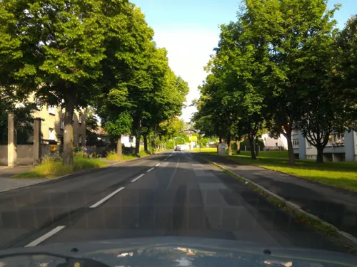
Marathon Athen
Restaurant · Greek · 0.8 km
77 Leipziger Straße, Zittau
Mo-Su 12:00-22:00; PH 12:00-22:00
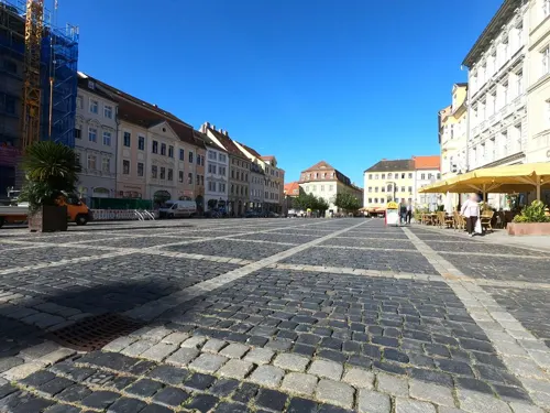


111 more on the map.
History
The history of the city dates back to a 12th-century Slavic settlement. The area belonged to the Czech (Bohemian) Duchy (and later Kingdom) from the 11th century. It was first mentioned under the Latinized name Sitavia in 1238. It was granted town rights in 1255 by King Ottokar II of Bohemia, who also built defensive walls. In 1319 it passed to the Piast-ruled Duchy of Jawor of then-fragmented Poland, and after the death of Duke Henry I of Jawor in 1346, it became part of the Czech (Bohemian) Crown again. The city's coat of arms still shows a Czech Lion and a Silesian Piast Eagle. In 1346 the city became one of the members of the Six-City League of Upper Lusatia. At that time the city was granted a special title—it was called "Die Reiche" ("the Rich") because of its high proportion of well-to-do citizens. In 1359 and 1422 it suffered great fires. In 1469, together with the Lusatian League, the city recognized Hungarian King Matthias Corvinus as rightful ruler, thus passing to Hungary, and after his death in 1490 the city returned to the Bohemian Crown, then under the rule of Polish prince Vladislaus II. It remained part of it until 1635 when it passed to the Electorate of Saxony.
From the History section of Zittau on Wikipedia, under CC BY-SA 4.0.
Where to stay23
Churches and places of worship22
Bertsdorfer Kirche
Church · Lutheran · 5.2 km
7 Am Kirchberg, Bertsdorf-Hörnitz
Katholisch-Apostolische Kapelle
Church · Catholic Apostolic
10 Marschnerstraße, Zittau
Ev.-luth. Kirche Olbersdorf
Church · Protestant · 4.3 km
3 Am Butterhübel, Olbersdorf
Kościół pw. Niepokalanego Poczęcia Najświętszej Maryi Panny
Church · Roman Catholic · 2.6 km
21 Piastowska, Sieniawka
Shopping42
Gas and EV charging13
Schools, colleges and libraries20
Healthcare11
Wojewódzki Szpital dla Nerwowo i Psychicznie Chorych w Sieniawce
Hospital · 2.3 km
25 Rolnicza, Sieniawka
Map of Zittau
250 places. The map loads OpenStreetMap tiles when you open it.
Getting there and nearby towns
Dresden Airport (DRS) is the nearest airport with scheduled flights listed in OpenStreetMap, 77 km away.
- Eckartsberg 3 km north, about 3 min by car
- Mittelherwigsdorf 4 km northwest, about 4 min by car
- Neustadt in Sachsen 44 km west, about 44 min by car
- Niesky 44 km north, about 44 min by car
- Bischofswerda 51 km northwest, about 51 min by car
- Ottendorf-Okrilla 75 km northwest, about 1 h 15 min by car
- Dresden 77 km west, about 1 h 15 min by car
- Bannewitz 77 km west, about 1 h 15 min by car
- Dippoldiswalde 80 km west, about 1 h 15 min by car
- Senftenberg 90 km northwest, about 1 h 30 min by car
Drive times are estimates from straight-line distance, not routes.
Local news
Headlines from INDB.
Reviews, tips and questions
Loading what members have shared...
Sources and licences
- GeoNames (CC BY 4.0): population, coordinates, regions and time zone
- Mapillary (see each image): photos
- OpenStreetMap contributors (ODbL 1.0): places, airports, map data
- Wikidata (CC0 1.0): elevation, founding date, time zone, website, landmarks and historic places
- Wikimedia Commons (see each image): photos
- Wikipedia (CC BY-SA 4.0): overview and history text
Photo credits
- Zittau Panorama, Jürgen Lindert, Lindi44, CC BY-SA 3.0 de
- ZittauKlosterkirche, Jwaller, CC BY-SA 3.0
- Klosterplatz 3-4 Zittau, Freddo213, CC BY 4.0
- ZittauPortalKlosters, Jwaller, CC BY-SA 3.0
- Klosterplatz 3-2 Zittau, Freddo213, CC BY 4.0
- ZittauKlosterkEpit1, Jwaller, CC BY-SA 3.0
- Allegory of Knowledge and Wisdom by Balthasar Permoser (Church of St. Peter and Paul, Zittau), Eleiodromos, CC BY-SA 4.0
- ZittauKlosterkEpit2, Jwaller, CC BY-SA 3.0
- Zittau Pfarrstraße (9923), TMg, CC BY-SA 3.0 de
- Klosterplatz 3-3 Zittau, Freddo213, CC BY 4.0
- Klosterplatz 3 Zittau, Freddo213, CC BY 4.0
- Zittau Rathaus (9919), TMg, CC BY-SA 3.0 de
- Zittau - Kirchstraße 7 (November 2024) (2), MartinVeselka, CC BY-SA 4.0
- Zittau - Kirchstraße 1 (November 2024) (1), MartinVeselka, CC BY-SA 4.0
- Zittau - Kirchstraße 7 (November 2024) (1), MartinVeselka, CC BY-SA 4.0
- ZittauJohannisAGymn, Jwaller, CC BY-SA 3.0
- ZittauHeffterbau, Jwaller, CC BY-SA 3.0
- Zittau - Pfarrstraße 14 (November 2024) (4), MartinVeselka, CC BY-SA 4.0
- Zittau - Pfarrstraße 14 (November 2024) (3), MartinVeselka, CC BY-SA 4.0
- Zittau - Kirchstraße 4, MartinVeselka, CC BY-SA 4.0
- Zittau - Kirchstraße 3, MartinVeselka, CC BY-SA 4.0
- Zittau - Kirchstraße 5 (November 2024), MartinVeselka, CC BY-SA 4.0
- Zittau - Kirchstraße 2 (November 2024), MartinVeselka, CC BY-SA 4.0
- Zittau Klosterkirche Turm (9925), TMg, CC BY-SA 3.0 de
- Zittau - Johannisstraße 13 (Dezember 2024) (2), MartinVeselka, CC BY-SA 4.0
- Zittau - Johannisstraße 19 (Dezember 2024) (2), MartinVeselka, CC BY-SA 4.0
- Zittau - Kirchstraße 4 und 2 (Dezember 2024), MartinVeselka, CC BY-SA 4.0
- Zittau – Kirchstraße 7, Julian Nyča, CC BY-SA 3.0
- ZittauKlosterstr4, Jwaller, CC BY-SA 3.0
- Zittau, die Klosterkirche Dm09270345 IMG 7324 2018-08-09 14.22, Michielverbeek, CC BY-SA 4.0
- ZittauBrunnenKlosterpl, Jwaller, CC BY-SA 3.0
- Statue von Hl. Wenzel, Zittau, Eleiodromos, CC BY-SA 4.0
- Zittau - Sinnesgarten in der Pfarrstraße (November 2023) (1), MartinVeselka, CC BY-SA 4.0
- ZittauPortalMus, Jwaller, CC BY-SA 3.0
- Zittau-06.IV.07-113, Botaurus stellaris, CC BY-SA 3.0
- TöpferFelsen6, Jwaller, CC BY-SA 4.0
- Oybin z Grosse Gase, Zp at cs.wikipedia, CC BY-SA 3.0
- Tierpark Zittau 11, Frank Lehmann, CC BY-SA 4.0
- Christian-Weise-Bibliothek 1, Eleiodromos, CC BY-SA 4.0
- Zittau Christian Weise Gymnasium 05, Jan-Herm Janßen, CC BY-SA 4.0
- Hutberg Oderwitz 2010 08 01 00, Moritz Wickendorf, CC BY-SA 3.0
- Schloss Alt-Hoernitz, Jürgen Lindert, Lindi44, CC BY-SA 3.0 de
- Postkarte vom Weinaupark 1904 von Verlag Carl Boess, Zittau, Carl Boess, Zittau, Public domain
- ZittauWeinaustadion, Jwaller, CC BY-SA 3.0
- Olbersdorf-evangelisch, Jwaller, CC BY-SA 3.0
- Oybin Scharfenstein lub 2024-08-09 img04 Aussicht, Britta Beck, CC BY 4.0
- SieniawkaKirche, Jwaller, CC BY-SA 3.0 pl
- ZittauTheater, Jwaller, CC BY-SA 3.0
- Neustadt (Zittau), Manecke, CC BY-SA 3.0
- RvSOS, Richard-von-Schlieben-Oberschule Zittau, CC BY-SA 4.0
- Zittau - Kronenkino, Äußere Weberstraße 17 (Oktober 2024) (1), MartinVeselka, CC BY-SA 4.0
- Weberkirche(Süd) Zittau, Jwaller, CC BY-SA 3.0
- Zittau Frauenkirche (18), Frank Lehmann, CC BY-SA 4.0
- ZittauParkschule, Jwaller, CC BY-SA 3.0
- Kirche (Zittau 3), Manecke, CC BY-SA 3.0
- Zittau-Weinauschule, Jwaller, CC BY-SA 3.0
- Olbersdorf Schulweg 13 15, RoesslerP, CC BY-SA 4.0
- Bertsdorf Schänkgasse 3 1, RoesslerP, CC BY-SA 4.0
- Oybin Töpferbaude 5, RoesslerP, CC BY-SA 4.0
- ZittauFleischbänke, Jwaller, CC BY-SA 3.0
- ZittauMarkt21-23, Jwaller, CC BY-SA 3.0
- ZittauGoldeneSonne, Jwaller, CC BY-SA 3.0
- Blumenuhr Sommer, Jwaller, CC BY-SA 3.0
- ZittauHaberkorn, Jwaller, CC BY-SA 3.0
- ZittauHefftergiebel, Jwaller, CC BY-SA 3.0
- ZittauMandaukaserne, Jwaller, CC BY-SA 3.0
- ZI-Neustadt28, Jwaller, CC BY-SA 4.0
- Oybin Teufelsmühle Mike Krüger 100822 1, Mike Krüger, CC BY-SA 3.0
- ZittauKreuzkirche, Jwaller, CC BY-SA 3.0
- BertsdorfKirche3, Jwaller, CC BY-SA 3.0
- ZittauKathApostol, Jwaller, CC BY-SA 3.0
- Zittau Katholische Kirche, Jürgen Lindert, Lindi44, CC BY-SA 3.0 de
- 20031003500DR Zittau Johanneum Gymnasium, Jörg Blobelt, CC BY-SA 4.0
- Kirche (Zittau 6), Manecke, CC BY-SA 3.0
- Zittau - Kleindenkmal im Zusammenhang mit der Schule im Bürgerpark, Clara-Zetkin-Straße (November 2022) (3), MartinVeselka, CC BY-SA 4.0
- Street-level photo, carlheinz, CC BY-SA 4.0
- Street-level photo, ubahnverleih, CC BY-SA 4.0
- Street-level photo, carlheinz, CC BY-SA 4.0
- Street-level photo, fell3, CC BY-SA 4.0
- Street-level photo, fell3, CC BY-SA 4.0
- Street-level photo, fell3, CC BY-SA 4.0
- Street-level photo, maxim752, CC BY-SA 4.0
- Street-level photo, fell3, CC BY-SA 4.0
- Street-level photo, atze02, CC BY-SA 4.0
- Street-level photo, fell3, CC BY-SA 4.0
- Street-level photo, fell3, CC BY-SA 4.0
- Street-level photo, fell3, CC BY-SA 4.0
- Street-level photo, carlheinz, CC BY-SA 4.0
- Street-level photo, fell3, CC BY-SA 4.0
- Street-level photo, atze02, CC BY-SA 4.0
- Street-level photo, fell3, CC BY-SA 4.0
- Street-level photo, fell3, CC BY-SA 4.0
- Street-level photo, fell3, CC BY-SA 4.0
- Street-level photo, fell3, CC BY-SA 4.0
- Street-level photo, atze02, CC BY-SA 4.0
- Street-level photo, fell3, CC BY-SA 4.0
- Street-level photo, fell3, CC BY-SA 4.0
- Street-level photo, voltadino, CC BY-SA 4.0
- Street-level photo, fell3, CC BY-SA 4.0
- Street-level photo, fell3, CC BY-SA 4.0
- Street-level photo, fell3, CC BY-SA 4.0
- Street-level photo, fell3, CC BY-SA 4.0


Page built November 8, 2026. Spotted a mistake? Tell us or suggest a place.