


Why visit Bischofswerda
Townapedia lists 59 museums and landmarks, 19 parks and trails, 50 places to eat, 4 places to stay and 52 attractions in and around town.
Highlights include Tier-und Kulturpark Bischofswerda, Hofladen Obstbau Menzel, Rittergut Niederschmölln and Barockschloss Rammenau.
Weather in Bischofswerda
Forecast from MET Norway (CC BY 4.0). Full forecast
About Bischofswerda
Bischofswerda (German: [bɪʃɔfsˈvɛʁda] ; Upper Sorbian: Biskopicy) is a small town in eastern Germany at the western edge of Upper Lusatia in Saxony.
From the Wikipedia article Bischofswerda (this version), under CC BY-SA 4.0.
Things to do52

Tier-und Kulturpark Bischofswerda
Zoo and aquarium
3 Sinzstraße, Bischofswerda
Nov-Mar 09:00-17:00; Apr-Oct 09:00-18:00
Hofladen Obstbau Menzel
Farm and orchard · 3.4 km
55 Hauptstraße, Rammenau
Mo-We,Fr 09:00-18:00; Th 08:00-19:00; Sa 09:00-13:00; PH,Su off





40 more on the map.
Museums and landmarks59

Rittergut Niederschmölln
Monument and historic site · 3.9 km
Rittergut
1 Am Rittergut, Schmölln-Putzkau


Gasthof der goldne Löwe
Monument and historic site · 1.8 km
Gasthof, im Zusammenhang mit der späteren Entstehung der Kasernenanlage Nutzung als Offizierskasino sowie als Hauptgebäude der Anlage

Hentschelmühle
Monument and historic site · 1.7 km
Die beiden Bogenbrücken stehen unter Denkmalschutz. Die Ruine nicht mehr 2013 abgebrannt.

Kursächsische Postmeilensäule
Monument and historic site
Kursächsische Postmeilensäule-Distanzsäule


Friderike Hoffmann
Monument and historic site
Stolperstein für Friderike Hoffmann, geb. Dehnbsky

47 more on the map.
Parks, trails and playgrounds19

Freibad Bischofswerda
Sports field and stadium
19a Dresdener Straße, Bischofswerda
May-Aug Mo-Su 09:00-20:00; Sep 10:00-19:00
Freibad Burkau
Sports field and stadium · 4.8 km
2 Wiesenweg, Burkau
Mo-Fr 10:00-20:00; Sa-Su 09:00-20:00 || 09:00-20:00 "Sommerferien...





7 more on the map.
Restaurants and cafes50

Butterberg Berggasthof
Restaurant · German · 3.1 km
1 Butterberg, Bischofswerda
Su-Mo 11:00-17:00; Tu-Fr 11:00-21:00; Sa 11:00-22:00
EIS Galerie
Ice cream
Eis-Café Präsentation von Werken lokaler Künstler-Innen (Galerie)
27 Altmarkt, Bischofswerda
Mar-Oct We-Fr 11:00-18:00; Sa,Su,PH 11:00-19:00

Wätzlich
Restaurant · Regional · 4.2 km
41 Hauptstraße, Rammenau
We-Sa 11:00-14:00,17:00-22:00; PH,Su 11:00-14:00; Mo,Tu off

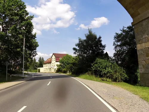
Bäckerei Fehrmann
Bakery · 0.9 km
31 Belmsdorfer Straße, Bischofswerda
Mo-Sa 06:00-20:00; Su 07:00-10:00
Bäckerei Konditorei Thomschke
Bakery · 5.1 km
10 Zittauer Straße, Schmölln-Putzkau
Mo-Fr 06:30-18:00; Sa 06:30-11:00; Su,PH off

Eispavillon am Mühlteich
Cafe · Ice Cream
5 Am Mühlteich, Bischofswerda
Mo-Sa 14:00-18:00; Su 13:00-18:00; PH 13:00-18:00

Jagdhütte am Butterberg
Restaurant · 2.9 km
3 Butterberg, Bischofswerda
We-Sa 11:00-22:00, Su,PH 11:00-18:00
Jägerhof Putzkau
Restaurant · 3.9 km
44 Dresdener Straße, Schmölln-Putzkau
We-Fr 11:00-14:00, 17:00-22:00, Sa 11:00-14:00, 17:00+, Su...


L´Auberge Gutshof
Restaurant · 1.8 km
33 Alte Belmsdorfer Straße, Bischofswerda
Mo, Tu, Fr 17:00-22:00; Sa 17:00-23:00; Su 11:30-21:00
38 more on the map.
History
The first documentary evidence of the existence of Bischofswerda dates from 1227. Nominally the town was founded by the Bishops of Meissen, though it may have existed before that point. In 1288 city walls were constructed. The first mention of Bischofswerda as a city is in a document dating from 1361. The town remained under the authority of the Bishops of Meissen until 1559 when power was transferred to Augustus, Elector of Saxony, who introduced Protestantism. The city arms are based on a 14th-century seal and consist of two crossed bishop's croziers and four stars. The significance of the stars is not known. One of two main routes connecting Warsaw and Dresden ran through the town in the 18th century and Kings Augustus II the Strong and Augustus III of Poland often traveled that route.
Like many late medieval towns, Bischofswerda suffered from periodic fires that damaged the town. Fires are recorded in 1429, 1469, 1528, 1583, 1596, 1641, 1671 and 1813. The last fire was the worst. During the War of the Sixth Coalition, Napoleonic forces had occupied Bischofswerda when a fire broke out within the town walls on 12 May 1813, destroying most of the medieval town. However the town was rebuilt on an order of Frederick Augustus I of Saxony in a manner closely following the earlier layout, and this remains to this day.
From the History section of Bischofswerda on Wikipedia, under CC BY-SA 4.0.
Where to stay4
Churches and places of worship14
Christuskirche
Church · Protestant · 4.8 km
3 August-Bebel-Straße, Demitz-Thumitz
Shopping15
Gas and EV charging7
Schools, colleges and libraries15
Oberlausitzer Berufsfachschule für Pflegeberufe
School · 0.7 km
12 Neustädter Straße, Bischofswerda
Healthcare6
Map of Bischofswerda
241 places. The map loads OpenStreetMap tiles when you open it.
Getting there and nearby towns
Dresden Airport (DRS) is the nearest airport with scheduled flights listed in OpenStreetMap, 29 km away.
- Neustadt in Sachsen 11 km south, about 11 min by car
- Ottendorf-Okrilla 25 km west, about 25 min by car
- Dresden 32 km west, about 32 min by car
- Weinböhla 43 km west, about 43 min by car
- Dippoldiswalde 44 km southwest, about 44 min by car
- Senftenberg 46 km north, about 46 min by car
- Niesky 48 km northeast, about 48 min by car
- Lauchhammer 49 km northwest, about 49 min by car
- Großräschen 52 km north, about 52 min by car
- Cottbus 71 km north, about 1 h 15 min by car
Drive times are estimates from straight-line distance, not routes.
Local news
Headlines from INDB.
Reviews, tips and questions
Loading what members have shared...
Sources and licences
- GeoNames (CC BY 4.0): population, coordinates, regions and time zone
- Mapillary (see each image): photos
- OpenStreetMap contributors (ODbL 1.0): places, airports, map data
- Wikidata (CC0 1.0): elevation, founding date, time zone, website
- Wikimedia Commons (see each image): photos
- Wikipedia (CC BY-SA 4.0): overview and history text
Photo credits
- BIW Rathaus, WikiAnika, CC BY 3.0 de
- Mediaturm (Bischofswerda) 01, Derbrauni, CC BY 4.0
- Mediaturm (Bischofswerda) 02, Derbrauni, CC BY 4.0
- 14342-Bischofswerda-1912-Am Schwanenteich-Brück & Sohn Kunstverlag, Brück & Sohn Kunstverlag Meißen, CC0
- 33360-Bischofswerda-2008-Stadtansichten-Brück & Sohn Kunstverlag, Skala, B. Schaarschmidt, Foto Schaarschmidt, CC BY-SA 4.0
- 31877-Bischofswerda-1997-historische Mappe-Brück & Sohn Kunstverlag, Brück & Sohn, CC BY-SA 4.0
- 04158-Bischofswerda-1903-Butterberg - Aussichtsturm-Brück & Sohn Kunstverlag, Brück & Sohn Kunstverlag Meißen, CC0
- 10460-Bischofswerda-1908-Am Mühlteich-Brück & Sohn Kunstverlag, Brück & Sohn Kunstverlag Meißen, CC0
- 15474-Bischofswerda-1913-Carolastraße-Brück & Sohn Kunstverlag, Brück & Sohn Kunstverlag Meißen, CC0
- 13008-Bischofswerda-1911-Bautzner Straße-Brück & Sohn Kunstverlag, Brück & Sohn Kunstverlag Meißen, CC0
- 11885-Bischofswerda-1910-Bautzner Straße-Brück & Sohn Kunstverlag, Brück & Sohn Kunstverlag Meißen, CC0
- 30269-Bischofswerda-1980-Markt mit Rathaus und Kirche-Brück & Sohn Kunstverlag, Brück & Sohn Kunstverlag Meißen, CC BY-SA 3.0
- 30272-Bischofswerda-1980-Markt - Stadtbad-Brück & Sohn Kunstverlag, Brück & Sohn Kunstverlag Meißen, CC BY-SA 3.0
- 24942-Bischofswerda-1929-Markt-Brück & Sohn Kunstverlag, Brück & Sohn Kunstverlag Meißen, CC BY-SA 3.0
- 10344-Bischofswerda-1908-Am Mühlteiche-Brück & Sohn Kunstverlag, Brück & Sohn Kunstverlag Meißen, CC0
- 24067-Bischofswerda-1927-Blick auf Bischofswerda-Brück & Sohn Kunstverlag, Brück & Sohn Kunstverlag Meißen, CC BY-SA 3.0
- 18679-Bischofswerda-1915-Markt, Paradiesbrunnen-Brück & Sohn Kunstverlag, Brück & Sohn Kunstverlag Meißen, CC0
- 04895-Bischofswerda-1903-Einzelne Wohnhäuser-Brück & Sohn Kunstverlag, Brück & Sohn Kunstverlag Meißen, CC0
- 14640-Bischofswerda-1912-Parkanlagen am Bischofsplatz-Brück & Sohn Kunstverlag, Brück & Sohn Kunstverlag Meißen, CC0
- 30266-Bischofswerda-1980-verschiedene Stadtansichten-Brück & Sohn Kunstverlag, Brück & Sohn Kunstverlag Meißen, CC BY-SA 3.0
- 24063-Bischofswerda-1927-Bautzner Straße mit Turnhalle-Brück & Sohn Kunstverlag, Brück & Sohn Kunstverlag Meißen, CC BY-SA 3.0
- 14638-Bischofswerda-1912-Mühlteich-Brück & Sohn Kunstverlag, Brück & Sohn Kunstverlag Meißen, CC0
- 14642-Bischofswerda-1912-Partie am Mühlteich-Brück & Sohn Kunstverlag, Brück & Sohn Kunstverlag Meißen, CC0
- 14854-Bischofswerda-1912-Markt mit Rathaus-Brück & Sohn Kunstverlag, Brück & Sohn Kunstverlag Meißen, CC0
- 04157-Bischofswerda-1903-Markt mit Rathaus-Brück & Sohn Kunstverlag, Brück & Sohn Kunstverlag Meißen, CC0
- 31872-Bischofswerda-1997-historische Mappe-Brück & Sohn Kunstverlag, Brück & Sohn, CC BY-SA 4.0
- 14322-Bischofswerda-1912-Lehrerseminar-Brück & Sohn Kunstverlag, Brück & Sohn Kunstverlag Meißen, CC0
- 14641-Bischofswerda-1912-Mühlteich-Brück & Sohn Kunstverlag, Brück & Sohn Kunstverlag Meißen, CC0
- 04151-Bischofswerda-1903-Blick nach Bischofswerda von Süden-Brück & Sohn Kunstverlag, Brück & Sohn Kunstverlag Meißen, CC0
- 24068-Bischofswerda-1927-Schule-Brück & Sohn Kunstverlag, Brück & Sohn Kunstverlag Meißen, CC BY-SA 3.0
- 04160-Bischofswerda-1903-Markt mit Rathaus-Brück & Sohn Kunstverlag, Brück & Sohn Kunstverlag Meißen, CC0
- 18680-Bischofswerda-1915-Markt-Brück & Sohn Kunstverlag, Brück & Sohn Kunstverlag Meißen, CC0
- 14700-Bischofswerda-1912-Lehrerseminar-Brück & Sohn Kunstverlag, Brück & Sohn Kunstverlag Meißen, CC0
- 24065-Bischofswerda-1927-Deutsche Oberschule-Brück & Sohn Kunstverlag, Brück & Sohn Kunstverlag Meißen, CC BY-SA 3.0
- 10346-Bischofswerda-1908-im Friedrich-August-Park-Brück & Sohn Kunstverlag, Brück & Sohn Kunstverlag Meißen, CC0
- 14633-Bischofswerda-1912-Königliches Lehrerseminar-Brück & Sohn Kunstverlag, Brück & Sohn Kunstverlag Meißen, CC0
- 11394-Bischofswerda-1910-Markt-Brück & Sohn Kunstverlag, Brück & Sohn Kunstverlag Meißen, CC0
- 04154-Bischofswerda-1903-am Mühlteich-Brück & Sohn Kunstverlag, Brück & Sohn Kunstverlag Meißen, CC0
- 31871-Bischofswerda-1997-historische Mappe-Brück & Sohn Kunstverlag, Brück & Sohn, CC BY-SA 4.0
- 13009-Bischofswerda-1911-Diakonissenheim und Museum-Brück & Sohn Kunstverlag, Brück & Sohn Kunstverlag Meißen, CC0
- Butterberg (Bischofswerda), DB111, CC BY-SA 3.0
- Kleppischberg2, DB111, CC BY-SA 3.0
- Goldbach Marienkirche Südwest 2010, TMg, CC BY-SA 3.0 de
- Martinskirche Grossdrebnitz, The original uploader was Sebus1 at German Wikipedia . ( Original text: Sebastian Führer ), CC BY-SA 2.0 de
- Hutberg, Conny, CC BY-SA 3.0
- Hutberg (Neustadt in Sachsen) 03, Gumideck, CC BY-SA 4.0
- BIW Postmeilensäule W, WikiAnika, CC BY 3.0 de
- Bischofswerda Alte Gasse 2010, TMg, CC BY-SA 3.0 de
- BIW Kreuzkirche S, WikiAnika, CC BY 3.0 de
- Bischofswerdastbenno, Unukorno, CC BY-SA 3.0
- BIW Kulturhaus (1), WikiAnika, CC BY 3.0 de
- Marienkirche Putzkau April 2017 (1), Frank Lehmann, CC BY-SA 4.0
- Walkmühle (1), Conny, CC BY-SA 3.0
- Heydelberg 01, Gumideck, CC BY-SA 4.0
- BIW-Napoleonstein-1, SchiDD, CC BY-SA 4.0
- 2018 Rammenau Kleppischberg, Geri-oc, CC0
- 20060401135DR Schmölln (Putzkau-Schmölln) Rittergut Schloß, Jörg Blobelt, CC BY-SA 4.0
- Rammenau - Barockschloss ex 07 ies, Frank Vincentz, CC BY-SA 3.0
- Ehem Gasthaus Goldener Löwe Bischofswerda 2016-05-06 IMG 6214, WikiAnika, CC BY 3.0
- An der Schutzhütte Schlossblick Rammenau, Geri-oc, CC BY-SA 3.0 de
- Garten des Barock-Schlosses Rammenau, Geri-oc, CC BY-SA 3.0 de
- Gasthof und Fleischerei Wätzlich in Rammenau, Geri-oc, CC BY-SA 3.0 de
- Jagdhütte Butterberg, Geri-oc, CC0
- 2019 Großharthau DS Hotel und Gaststätte Kyffhäuser, Geri-oc, CC0
- BIW-Christuskirche-2, SchiDD, CC BY-SA 4.0
- Kirche in Rammenau, Geri-oc, CC BY-SA 3.0 de
- 20060408050DR Schmölln (Schmölln-Putzkau) Ev Kirche, Jörg Blobelt, CC BY-SA 4.0
- Burkau-Kirche-1, SchiDD, CC BY 4.0
- Kirche Pohla AB 2011 11, Paulis, CC BY-SA 3.0
- 2019 Großharthau NORMA, Geri-oc, CC0
- Grizzlybärin Jane im Tierpark Bischofswerda, Juliane Gude, CC BY-SA 3.0
- BIW-Goethepark, SchiDD, CC BY-SA 4.0
- Street-level photo, utack, CC BY-SA 4.0
- Street-level photo, bejotel, CC BY-SA 4.0
- Street-level photo, bejotel, CC BY-SA 4.0
- Street-level photo, fell3, CC BY-SA 4.0
- Street-level photo, fell3, CC BY-SA 4.0
- Street-level photo, bufonto, CC BY-SA 4.0
- Street-level photo, fell3, CC BY-SA 4.0
- Street-level photo, moenk, CC BY-SA 4.0
- Street-level photo, bejotel, CC BY-SA 4.0
- Street-level photo, fell3, CC BY-SA 4.0
- Street-level photo, bufonto, CC BY-SA 4.0
- Street-level photo, bufonto, CC BY-SA 4.0
- Street-level photo, utack, CC BY-SA 4.0
- Street-level photo, rausk, CC BY-SA 4.0
- Street-level photo, rausk, CC BY-SA 4.0
- Street-level photo, utack, CC BY-SA 4.0
- Street-level photo, autobahn42, CC BY-SA 4.0
- Street-level photo, bejotel, CC BY-SA 4.0
- Street-level photo, moenk, CC BY-SA 4.0
- Street-level photo, moenk, CC BY-SA 4.0


Page built November 8, 2026. Spotted a mistake? Tell us or suggest a place.