


Why visit Zons
Townapedia lists 96 museums and landmarks, 31 parks and trails, 137 places to eat, 17 places to stay and 12 attractions in and around town.
Highlights include Bauernkäserei Heuser, Rheinfelder Hof, Kreismuseum Zons and Haus Bürgel.
Weather in Zons
Forecast from MET Norway (CC BY 4.0). Full forecast
About Zons
Zons (German pronunciation: [tsons]), formerly known as Feste Zons (Fortress Zons), today officially called Stadt Zons (Zons Town) is an old town in Germany on the west bank of the Lower Rhine between Cologne and Düsseldorf. It has been a part (Stadtteil) of the town of Dormagen since 1975. In 2020 its population was 5,452.
From the Wikipedia article Zons (this version), under CC BY-SA 4.0.
Things to do12

Bauernkäserei Heuser
Farm and orchard · 1.4 km
200 Schulstraße, Dormagen
Th,Fr 09:00-13:00,15:00-18:30; Sa 09:00-13:00
Rheinfelder Hof
Farm and orchard · 2.3 km
7 Andreasstraße, Dormagen
Mo-Fr 08:30-12:30,14:30-17:30; We,Sa 08:30-12:30




Museums and landmarks96

Kreismuseum Zons
Museum · 0.6 km
1 Schloßstraße, Dormagen
Tu-Fr 14:00-18:00; Sa-Su 11:00-18:00; PH 11:00-17:00




Der Steinklopfer
Monument and historic site
24 Schloßstraße, Dormagen
Mo-Sa 12:00-18:00
Internationales Phono & Radio Museum
Museum · 3.2 km
4 Bahnhofstraße, Dormagen
Open in Google Maps · Wikipedia · +49 2133 80848; +49 2133 280334

84 more on the map.
Parks, trails and playgrounds31


Rheinaue Zons-Rheinfeld und Altrheinschlinge Zons
Hiking and trails · 1.4 km


Wahler Berg, Hannepützheide und Martinsee
Hiking and trails · 1.8 km


„Binnenhafen“ Am Sportplatz
Playground · 3.4 km
Größe: 504 m² Zielgruppe: 3 bis 10 Jahre, 10 bis 14 Jahre Spielgeräte: Spielhaus, Wippe, Karussell Ausstattung: Sitzgruppe mit Tisch,...
Am Lingenkamp
Playground · 2.5 km
Größe: 356 m² Zielgruppe: 0 bis 3 Jahre, 3 bis 10 Jahre, 10 bis 14 Jahre Spielgeräte: Schaukel, Kleinkindschaukel, Federwippgerät,...

Spielplatz Holzweg
Playground · 3.3 km
Größe: 580 m² Zielgruppe: 10 bis 14 Jahre Spielgeräte: Kletterspinne, Kletterwand, Hangelgerät, Hängematte Dieser Spielplatz mit...

Ataşehir-Park
Park · 3.5 km
Als Zeichen der Partnerschaft wurde im Mai 2017 der Ataşehir-Park im Stadtteil Baumberg im Beisein des Bürgermeisters aus Ataşehir,...
19 more on the map.
Restaurants and cafes137


Altes Fischerhaus 1817
Restaurant · International · 3.2 km
83 Am Alten Rhein, Düsseldorf
We-Su 12:00-23:00; Su 11:30-14:30,17:00-22:00; Mo,Tu off
Chopsticks
Restaurant · Asian · 3.0 km
56 Hauptstraße, Monheim am Rhein
Mo,We-Sa 11:00-15:00,17:00-22:00; Su,PH 12:00-22:00
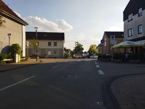
Dionysos im Rheinischen Hof
Restaurant · Greek · 3.1 km
36 Hauptstraße, Monheim am Rhein
Mo,We,Th 16:30-23:00, Fr,Sa 16:30-24:00, Su 12:00-23:00
Extratour Zum Alten Rhein
Restaurant · International · 2.7 km
4 Drängenburger Straße, Düsseldorf
Tu-Su,PH 12:00-24:00+; Mo off
Family Sushi
Restaurant · Sushi, Vietnamese, Thai · 3.1 km
1 Am Weißen Stein, Dormagen
Mo-Sa 11:00-22:00; Su,PH 14:00-22:00
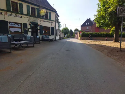

Haus Dick
Restaurant · German, Regional · 2.4 km
26 Piwipper Straße, Dormagen
We-Th 17:00-22:00; Fr-Sa 17:00-00:00; Su 17:00-22:00


125 more on the map.
Where to stay17
Churches and places of worship29
Herz-Jesu-Kirche
Church · Roman Catholic · 3.3 km
111 Urdenbacher Allee, Düsseldorf
Shopping31
Gas and EV charging9
Schools, colleges and libraries25
Städtische Katholische Grundschule Josef-Kleesattel-Straße
School · 3.9 km
13 Josef-Kleesattel-Straße, Düsseldorf
Healthcare15
Map of Zons
250 places. The map loads OpenStreetMap tiles when you open it.
Getting there and nearby towns
Düsseldorf Airport (DUS) is the nearest airport with scheduled flights listed in OpenStreetMap, 19 km away.
- Dormagen 3 km south, about 3 min by car
- Monheim am Rhein 5 km southeast, about 5 min by car
- Langenfeld 7 km east, about 7 min by car
- Hilden 8 km northeast, about 8 min by car
- Düsseldorf 12 km north, about 12 min by car
- Erkrath 12 km north, about 12 min by car
- Leichlingen 12 km east, about 12 min by car
- Opladen 13 km southeast, about 13 min by car
- Neuss 14 km northwest, about 14 min by car
- Leverkusen 14 km southeast, about 14 min by car
Drive times are estimates from straight-line distance, not routes.
Local news
Headlines from INDB.
Reviews, tips and questions
Loading what members have shared...
Sources and licences
- GeoNames (CC BY 4.0): population, coordinates, regions and time zone
- Mapillary (see each image): photos
- OpenStreetMap contributors (ODbL 1.0): places, airports, map data
- Wikidata (CC0 1.0): elevation, founding date, time zone, website, landmarks and historic places
- Wikimedia Commons (see each image): photos
- Wikipedia (CC BY-SA 4.0): overview and history text
Photo credits
- Gärten in Zons - panoramio, Ralf Houven, CC BY 3.0
- Zons-Urdenbach - Flussfähre Niederrhein -, Horst J. Meuter, CC BY-SA 4.0
- Zons TurmKroetschen, Beckstet, CC BY-SA 3.0
- Zons Kapelle und Rheinturm - panoramio, Ralf Houven, CC BY 3.0
- Zons Stadtwall - panoramio, Ralf Houven, CC BY 3.0
- Zons Stadtbefestigung NW 7658 201705, Matthias Nonnenmacher, CC BY-SA 4.0
- Zons - panoramio - Ralf Houven (1), Ralf Houven, CC BY 3.0
- Zons Hinterhof an der Mühlenstraße - panoramio, Ralf Houven, CC BY 3.0
- Dekoration in Zons - panoramio, Ralf Houven, CC BY 3.0
- Zons östliche Stadtmauer - panoramio (1), Ralf Houven, CC BY 3.0
- Zons Grünwaldstraße - panoramio, Ralf Houven, CC BY 3.0
- Zons Südtor - panoramio, Ralf Houven, CC BY 3.0
- Zons das Hohe Örtchen entlang - panoramio, Ralf Houven, CC BY 3.0
- Bei Zons - panoramio, Ralf Houven, CC BY 3.0
- Zons Südtor - panoramio (1), Ralf Houven, CC BY 3.0
- Zons - panoramio (7), Ralf Houven, CC BY 3.0
- Zons Freilichtbühne beim Südtor - panoramio, Ralf Houven, CC BY 3.0
- Bei Zons - panoramio (1), Ralf Houven, CC BY 3.0
- Zons an St. Martinus - panoramio, Ralf Houven, CC BY 3.0
- Rheinschleife am Zonser Grind, Maximilian Schönherr, CC BY-SA 4.0
- Burg Friedestrom Kernburg Westseite, Sir Gawain, CC BY-SA 3.0
- Dietrich-Bonhoeffer-Kirche in Duesseldorf-Garath, von Sueden, Wiegels, CC BY 3.0
- Saint-Norbert D-Garath, OnkelRalf, CC BY 3.0
- Monheim am Rhein, Haus Bürgel, 2013-02 CN-04, kaʁstn Disk / Cat, CC BY-SA 3.0 de
- Herz-Jesu-Kirche Urdenbach 3, noebse, CC BY-SA 2.5
- Zons Burg Friedestrom Herrenhaus 49, GFreihalter, CC BY-SA 3.0
- Stadtbibliothek Dormagen (28240914915), Fachstelle für Öffentliche Bibliotheken NRW, CC BY 2.0
- Zons StMartinu from South, Beckstet, CC BY-SA 3.0
- Friedenskirche Baumberg - Winter, Peter Becker, CC BY 4.0
- 2018-05-14-NSG Schlosspark Benrath-Blick in einen vom Hippodrom abgehenden Weg, Daskupa, CC BY-SA 4.0
- 2017-10-08-NSG Urdenbacher Altrhein-Blick Richtung Kämpe-mit der Srömung, Daskupa, CC BY-SA 4.0
- NSG Am Kirberger Loch (14), DiAuras, CC BY-SA 4.0
- NSG Rheinufer- Urdenbacher Altrhein bei Baumberg (11), DiAuras, CC BY-SA 4.0
- Christuskirche (Dormagen) (6), Chris06, CC BY-SA 4.0
- Lukaskirche (Stürzelberg) (2), Chris06, CC BY-SA 4.0
- Friedenskirche (Zons) (1), Chris06, CC BY-SA 4.0
- St. Aloysius (Stürzelberg) (2), Chris06, CC BY-SA 4.0
- Fährhaus Pitt-Jupp, Stürzelberg (3), Chris06, CC BY-SA 4.0
- Zons Freilichtbuehne 01, gheeke, CC BY-SA 2.0
- Burg Friedestrom Vorburg Herrenhaus Suedseite 02, Sir Gawain, CC BY-SA 3.0
- 4.35 Wohnhaus, Mauerstraße 48 (Zons), Käthe u. Bernd Limburg, www.limburg-bernd.de, CC BY-SA 3.0 de
- 4.71 Wohn- und Geschäftshaus, Turmstraße 2 (Zons), Käthe u. Bernd Limburg, www.limburg-bernd.de, CC BY-SA 3.0 de
- 4.33 Wohnhaus, Mauerstraße 10 (Zons), Käthe u. Bernd Limburg, www.limburg-bernd.de, CC BY-SA 3.0 de
- 4.65 Wohn-und Geschäftshaus, Schloßstraße 24 (Zons), Käthe u. Bernd Limburg, www.limburg-bernd.de, CC BY-SA 3.0 de
- Zons, Pfefferbüchsen (eine von zwei) 2008 c, Michael Reschke, CC BY-SA 3.0
- NSG Am Kirberger Loch (23), DiAuras, CC BY-SA 4.0
- NSG Rheinaue Zons-Rheinfeld und Altrheinschlinge Zons - Luftaufnahme-0068, Raimond Spekking, CC BY-SA 4.0
- Schlosspark Benrat, Tatiana Kurilas, CC BY-SA 4.0
- NSG Urdenbacher Altrhein und Baumberger Aue (3), DiAuras, CC BY-SA 4.0
- D-003 - Urdenbacher Kämpe - Altrheinarm - vor Renaturierungsmaßnahme, Bernhard40, CC BY-SA 4.0
- 4.70 Gasthof Zur Post (Zons), Käthe u. Bernd Limburg, www.limburg-bernd.de, CC BY-SA 3.0 de
- Urdenbacher Dorfkirche in Duesseldorf-Urdenbach, von Nordwesten, Jörg Wiegels, CC BY-SA 3.0
- 0.10 (1)Pfarrkirche, Hubertusstraße 1a (Zons), Käthe u. Bernd Limburg, www.limburg-bernd.de, CC BY-SA 3.0 de
- Dormagen StMichael-2, Dormagen_StMichael.jpg : de:User:Senfi derivative work: Rabanus Flavus ( talk ), CC BY-SA 2.0 de
- Benrather Krankenhaus, noebse, CC BY-SA 2.5
- NSG NE-004 Hannepützheide (23), DiAuras, CC BY-SA 4.0
- NSG NE-004 Wahler Berg (3), DiAuras, CC BY-SA 4.0
- Deusser-Haus, noebse, CC BY-SA 3.0
- Street-level photo, changchun1, CC BY-SA 4.0
- Street-level photo, 5rmft, CC BY-SA 4.0
- Street-level photo, 5rmft, CC BY-SA 4.0
- Street-level photo, changchun1, CC BY-SA 4.0
- Street-level photo, mfa, CC BY-SA 4.0
- Street-level photo, mfa, CC BY-SA 4.0
- Street-level photo, changchun1, CC BY-SA 4.0
- Street-level photo, changchun1, CC BY-SA 4.0
- Street-level photo, mfa, CC BY-SA 4.0
- Street-level photo, changchun1, CC BY-SA 4.0
- Street-level photo, changchun1, CC BY-SA 4.0
- Street-level photo, mfa, CC BY-SA 4.0
- Street-level photo, VIA_KK, CC BY-SA 4.0
- Street-level photo, jenz, CC BY-SA 4.0
- Street-level photo, bigpapa2908, CC BY-SA 4.0
- Street-level photo, bigpapa2908, CC BY-SA 4.0
- Street-level photo, DerMaster0815, CC BY-SA 4.0
- Street-level photo, Henry572, CC BY-SA 4.0
- Street-level photo, DerMaster0815, CC BY-SA 4.0
- Street-level photo, raymond, CC BY-SA 4.0
- Street-level photo, VIA_KK, CC BY-SA 4.0
- Street-level photo, raymond, CC BY-SA 4.0
- Street-level photo, 5rmft, CC BY-SA 4.0
- Street-level photo, ramap, CC BY-SA 4.0
- Street-level photo, bigpapa2908, CC BY-SA 4.0
- Street-level photo, poxonline, CC BY-SA 4.0
- Street-level photo, changchun1, CC BY-SA 4.0
- Street-level photo, Henry572, CC BY-SA 4.0
- Street-level photo, raymond, CC BY-SA 4.0
- Street-level photo, changchun1, CC BY-SA 4.0
- Street-level photo, poxonline, CC BY-SA 4.0


Page built November 9, 2026. Spotted a mistake? Tell us or suggest a place.