


Leverkusen, Germany
Leverkusen is a city of 162,738 people in North Rhine-Westphalia, Germany, founded in 1930.
Why visit Leverkusen
Townapedia lists 57 museums and landmarks, 39 parks and trails, 265 places to eat, 17 places to stay and 15 attractions in and around town.
Highlights include Forum Leverkusen, Wildpark Reuschenberg, Schloss Morsbroich and Bayer-Kreuz.
Weather in Leverkusen
Forecast from MET Norway (CC BY 4.0). Full forecast
About Leverkusen
Leverkusen (German: [ˈleːvɐˌkuːzn̩] ) is a city in North Rhine-Westphalia, Germany, on the eastern bank of the Rhine. To the south, Leverkusen borders the city of Cologne, and to the north the state capital, Düsseldorf. The city is part of the Rhine-Ruhr Metropolitan Region, one of Europe's largest urban areas.
From the Wikipedia article Leverkusen (this version), under CC BY-SA 4.0.
Travel tips from other travellers: Leverkusen on Wikivoyage (CC BY-SA 4.0).
Things to do15



Obstgut Morsbroich
Farm and orchard · 3.4 km
2 Auerweg, Leverkusen
We 08:00-13:00; Th-Fr 08:00-18:00; Sa 08:00-13:00; Jan-Apr Mo-Tu...

Bühne der Kulturen
Cinema and theater · 9.8 km
Intercultural theatre in Cologne, Germany

Cathedral Bridge
Bridge · 10.0 km
Former road and rail bridge in Cologne, Germany (1859–1909)

Kasselberger Hühnerhof
Farm and orchard · 3.0 km
Eier, Geflügel, Kartoffeln, Äpfel u.v.m
115 Kasselberger Weg
Mo 09:00-13:00,14:00-18:00; We-Fr 09:00-13:00,14:00-18:00; Sa 09:00-13:00

Mülheim Bridge
Bridge · 7.4 km
Bridge on the river Rhine in Western Germany

Musical Dome
Cinema and theater · 9.8 km
Musical theater building in Cologne, Germany


Theater Tiefrot
Cinema and theater · 9.3 km
Theater in Cologne, North Rhine-Westphalia, Germany
3 more on the map.
Museums and landmarks57

Schloss Morsbroich
Museum · 3.5 km
Schlossgebäude Morsbroich mit Vorburg (Remisen) sowie Schlossgraben und die durch diesen umschlossene Parkanlage, Innenräume im Stil des...
80 Gustav-Heinemann-Straße, Leverkusen
Tu-Su 11:00-17:00; Th 11:00-21:00; PH Th 11:00-17:00



Ara Ubiorum
Monument and historic site · 10.1 km
Roman federal altar, around which formed Col. Claudia Ara Agrippinensium, precursor of Köln, Germany

Colonia Claudia Ara Agrippinensium
Monument and historic site · 10.4 km
Roman colony, today Cologne in Germany
Dampfbahn Leverkusen e.V.
Monument and historic site · 0.9 km
Gemeinnütziger Gartenbahnverein mit einer ca. 380m großen Anlage (Spurweiten: 5 und 7¼ Zoll) Fahrtage i.d.R.: Jeden ersten Sonntag im...
37 Am Stadtpark, Leverkusen


German Dance Archives Cologne
Museum · 9.5 km
Archive, Library and Museum of present and past Art of Dancing

memorial to gay and lesbian victims of National Socialism
Monument and historic site · 10.1 km
Memorial in Koln

Museum für Angewandte Kunst
Museum · 10.3 km
Applied art museum in Cologne, Germany


45 more on the map.
Parks, trails and playgrounds39




Family Paradise
Playground · 3.9 km
283 Quettinger Straße, Leverkusen
Mo,Tu,Th,Fr 14:00-19:00; Sa,Su 10:00-19:00; PH, SH 11:00-19:00

Japanischer Garten
Park · 2.1 km
Apr-Oct: Mo-Fr 09:00-20:00, Sa,Su,PH 09:30-20:00; Nov-Mar: Mo-Fr...

Rheinpark
Park · 9.0 km
Park in Cologne, North Rhine-Westphalia, Germany


27 more on the map.
Restaurants and cafes265

Gallodini
Restaurant · International · 4.2 km
21 Werkstättenstraße
Mo-Th 12:00-15:00, 17:00-23:00; Fr 12:00-15:00, 17:00-00:00; Sa...
Haus Reuschenberg
Restaurant · Croatian · 2.5 km
225 Alte Landstraße, Leverkusen
Tu-Sa 11:30-15:00,17:30-23:00; Su,PH 11:30-23:00
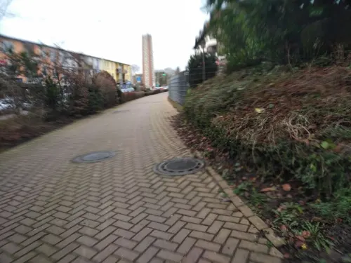
Agapi
Restaurant · Greek · 3.5 km
1 Alkenrather Straße, Leverkusen
Mo,We-Th 17:00-23:00; Fr-Su,PH 11:30-14:30,17:00-23:00
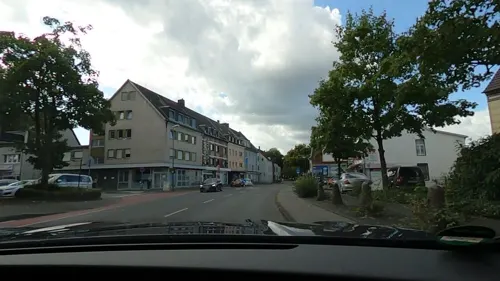
Brauhaus Manforter Hof
Restaurant · Regional · 1.6 km
247 Manforter Straße, Leverkusen
Tu-Fr 16:00-00:00; Sa,Su 11:00-00:00; Mo off
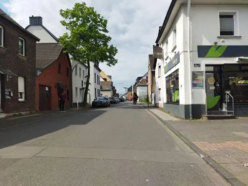
Bäckerei Grüttner
Bakery · 1.9 km
Bioland Partner
170 Merkenicher Hauptstraße, Köln
Mo-Fr 06:00-15:00; Sa 06:00-13:00; Su 07:00-12:00
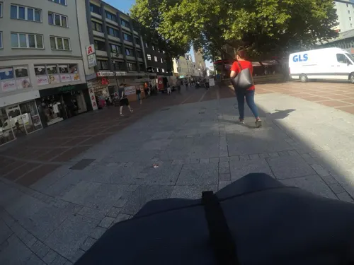
Cafe Extrablatt
Cafe · Coffee Shop
48 Wiesdorfer Platz, Leverkusen
Mo-Sa 08:00-24:00; Su,PH 09:00-24:00
Casa Portuguesa
Restaurant · Portuguese · 4.2 km
20 Werkstättenstraße, Leverkusen
Mo-Th 18:00-22:00, Fr,Sa 18:00-23:00; Su off
Chinesische Mauer
Restaurant · Chinese · 0.6 km
2d Dhünnstraße, Leverkusen
Mo-Fr 11:30-15:00,17:30-23:00; Sa,Su 11:30-23:00


Curry'n'Spice
Restaurant · Indian
69 Hauptstraße, Leverkusen
Mo-Fr 11:30-14:30,17:00-22:00; Sa,Su 16:00-21:00
Do Sushi
Restaurant · Japanese, Vietnamese
2 Heinrich-von-Stephan-Straße, Leverkusen
Tu-Th 11:30-15:30,16:30-22:30; Fr-Sa 11:30-22:30
Dos Y Dos
Restaurant · Mexican
108 Hauptstraße, Leverkusen
Mo-Th 11:30-01:00, Fr 11:30-02:00, Sa 12:30-02:00, Su 16:30-24:00
253 more on the map.
History
The heart of what is now Leverkusen was Wiesdorf, a village on the Rhine, which dates back to the 12th century. With the surrounding villages which have now been incorporated, the area also includes the rivers Wupper and Dhünn, and has suffered a lot from flooding, notably in 1571 and 1657, the latter resulting in Wiesdorf being moved East from the river to its present location.
Leverkusen was ravaged during the Cologne War (1583 to 1588). The entire area was rural until the late 19th century, when industry prompted the development that led to the city of Leverkusen, and to its becoming one of the most important centres of the German chemical industry.
The chemist Carl Leverkus, looking for a place to build a dye factory, chose Wiesdorf in 1860. He built a factory for the production of artificial ultramarine blue at the Kahlberg in Wiesdorf in 1861, and called the emerging settlement "Leverkusen" after his family home in Lennep. The factory was taken over by the Bayer company in 1891; Bayer moved its headquarters to Wiesdorf in 1912. After asset confiscation at the end of the First World War, it became IG Farben. The city of Leverkusen proper was founded in 1930 by merging Wiesdorf, Schlebusch, Steinbüchel and Rheindorf, and was posthumously named for Carl Leverkus.
From the History section of Leverkusen on Wikipedia, under CC BY-SA 4.0.
Where to stay17
Churches and places of worship43
Christ-König Kirche
Church · Roman Catholic · 2.1 km
67 Windthorststraße, Leverkusen
St. Antonius
Church · Roman Catholic · 0.7 km
Kleine Kirchstraße, Leverkusen
St. Stephanus
Church · Roman Catholic · 2.1 km
Heinrich-Brüning-Straße, Leverkusen
Church of the Immaculate Conception of the Blessed Virgin Mary in Cologne
Church · 10.3 km
Shopping71
Gas and EV charging27
Schools, colleges and libraries42
Healthcare25
Map of Leverkusen
250 places. The map loads OpenStreetMap tiles when you open it.
Getting there and nearby towns
Cologne Bonn Airport (CGN) is the nearest airport with scheduled flights listed in OpenStreetMap, 21 km away.
- Opladen 4 km north, about 4 min by car
- Köln 11 km south, about 11 min by car
- Solingen 17 km northeast, about 17 min by car
- Remscheid 22 km northeast, about 22 min by car
- Wuppertal 28 km northeast, about 28 min by car
- Neuss 28 km northwest, about 28 min by car
- Oberhausen 51 km north, about 51 min by car
- Moers 53 km northwest, about 53 min by car
- Recklinghausen 67 km north, about 1 h by car
- Siegen 75 km east, about 1 h 15 min by car
Drive times are estimates from straight-line distance, not routes.
Local news
Headlines from INDB.
Reviews, tips and questions
Loading what members have shared...
Sources and licences
- GeoNames (CC BY 4.0): population, coordinates, regions and time zone
- Mapillary (see each image): photos
- OpenStreetMap contributors (ODbL 1.0): places, airports, map data
- Wikidata (CC0 1.0): elevation, founding date, time zone, website, landmarks and historic places
- Wikimedia Commons (see each image): photos
- Wikipedia (CC BY-SA 4.0): overview and history text
Photo credits
- Schloss Morsbroich (Leverkusen) (1), DiAuras, CC BY-SA 4.0
- Pfarrer-Schmitz-Straße 9 (Leverkusen)-1, Velopilger, CC0
- Dönhoffstraße 2 (Leverkusen)-1, Velopilger, CC0
- Dönhoffstraße 2 (Leverkusen)-2, Velopilger, CC0
- Markt in Leverkusen - Wiesdorf.2013 - panoramio, Валерий Дед, CC BY 3.0
- Markt in Leverkusen - panoramio, Валерий Дед, CC BY 3.0
- Christuskirche (Leverkusen-Wiesdorf)-2, Velopilger, CC0
- Dönhoffstraße 2 (Leverkusen)-3, Velopilger, CC0
- Christuskirche (Leverkusen-Wiesdorf)-3, Velopilger, CC0
- Christuskirche (Leverkusen-Wiesdorf)-1, Velopilger, CC0
- Moskauer-Strasse-Leverkusen-photo-5, Velopilger, CC0
- Feuerwache-Wiesdorf-Leverkusen-photo-7, Velopilger, CC0
- Moskauer-Strasse-Leverkusen-photo-4, Velopilger, CC0
- Feuerwache-Wiesdorf-Leverkusen-photo-3, Velopilger, CC0
- Feuerwache-Wiesdorf-Leverkusen-photo-6, Velopilger, CC0
- Feuerwache-Wiesdorf-Leverkusen-photo-2, Velopilger, CC0
- Feuerwache-Wiesdorf-Leverkusen-photo-5, Velopilger, CC0
- Feuerwache-Wiesdorf-Leverkusen-photo-4, Velopilger, CC0
- Feuerwache-Wiesdorf-Leverkusen-photo-1, Velopilger, CC0
- Moskauer-Strasse-Leverkusen-photo-2, Velopilger, CC0
- Moskauer-Strasse-Leverkusen-photo-1, Velopilger, CC0
- Moskauer-Strasse-Leverkusen-photo-3, Velopilger, CC0
- Arkadaş Theater, Köln-5172, Raimond Spekking, CC BY-SA 4.0
- Dombruecke 1850, Unknown author, Public domain
- 00 7344 Köln - Hohenzollernbrücke, W. Bulach, CC BY-SA 4.0
- MuelheimerBrueckeKoeln, Túrelio, CC BY-SA 2.5
- .00 3349 Oper am Dom - Köln, W. Bulach, CC BY-SA 4.0
- Senftöpfchen Köln-0778, Raimond Spekking, CC BY-SA 4.0
- Kapitol Köln front1, Own work, CC BY 3.0 de
- Farina-Haus Köln (4213-15), Raimond Spekking, CC BY-SA 4.0
- MediaPark Köln, Haus 7 (Komed)-0392, Raimond Spekking, CC BY-SA 4.0
- GER Köln, Rheingarten 0014, -wuppertaler, CC BY 4.0
- Museum für Angewandte Kunst Köln - Minoritenkirche, Raimond Spekking, CC BY-SA 4.0
- Museum Ludwig 001, Thomas Robbin, CC BY-SA 3.0
- Museum Morsbroich, Leverkusen, Jeppe Hein (Foto und gezeigtes Werk), CC BY-SA 4.0
- Kölner Zoo (Flight over Cologne), Neuwieser, CC BY-SA 2.0
- Cologne Rheinpark view to SW, Till Niermann, CC BY-SA 3.0
- Köln-Neustadt-Nord Elsa-Brändström-Straße 9 Rückseite, HOWI - Horsch, Willy, CC BY 3.0
- Worringerbruch03, A.Savin, CC BY-SA 3.0
- Minoritenkirche Köln im Frühling (1892-94), Raimond Spekking, CC BY-SA 4.0
- Hochschule für Musik und Tanz Köln-5617, Raimond Spekking, CC BY-SA 4.0
- Rheinische Fachhochschule Köln, Schaevenstr. 1b-8807, Raimond Spekking, CC BY-SA 4.0
- Bayarena Leverkusen 2020, Arne Müseler, CC BY-SA 3.0 de
- Bayer-Kreuz, H005, Public domain
- Schloss Morsbroich, Marcin-Janek, CC BY 3.0
- Christus König Küppersteg 01, A.Savin, CC BY-SA 3.0
- Christuskirche (Wiesdorf) (4), Chris06, CC BY-SA 4.0
- Leverkusen Kaiser-Wilhelm-Allee 0064, Atamari, CC BY-SA 3.0
- PICT7465 Hoffnungskirche Rheindorf, DrTom, CC BY-SA 3.0
- LLGEing1994, Thomas Hermes, CC BY-SA 2.5
- Realschule am Stadtpark Leverkusen, User:Jo!Hannes, CC BY-SA 4.0
- Herz-Jesu (Wiesdorf) (1), Chris06, CC BY-SA 4.0
- LEV-Manfort Johanneskirche, A.Savin, CC BY-SA 3.0
- Ulrich-Haberland-Stadion 2013-12-08 main stand, Hobby-Fotograf2013, CC BY-SA 3.0
- St. Stephanus Leverkusen-Bürrig2, Chris06, CC BY-SA 3.0
- Lev-krankenhaus, A.Savin, CC BY-SA 3.0
- LEV-Buerrig Petruskirche, A.Savin, CC BY-SA 3.0
- Rheinkassel Amandus3, Chris06, Public domain
- St. Antonius (Wiesdorf) (1), Chris06, CC BY-SA 4.0
- St. Joseph Manfort, Tohma ( talk ), CC BY-SA 4.0
- Leverkusen Wildpark Reuschenberg Vogelvolieren, Thomas Hermes, CC BY 2.5
- Wupperinsel, Vikipediafreak, CC BY-SA 4.0
- Kolonie-Museum in Leverkusen, von Westen, Jörg Wiegels, CC BY-SA 4.0
- Am Gruenen Kuhweg, Mabit1, CC BY-SA 4.0
- NSG LEV-014 Wupper (2), DiAuras, CC BY-SA 4.0
- Levforum, R.R.Hirsch LEV, CC BY-SA 3.0
- Chorweiler Zentralmoschee, Kölscher Jung, CC BY-SA 3.0
- LEV Rathaus Galerie 2010, A.Savin, CC BY-SA 3.0
- Street-level photo, mfa, CC BY-SA 4.0
- Street-level photo, mfa, CC BY-SA 4.0
- Street-level photo, mfa, CC BY-SA 4.0
- Street-level photo, GoProNerd, CC BY-SA 4.0
- Street-level photo, GoProNerd, CC BY-SA 4.0
- Street-level photo, changchun1, CC BY-SA 4.0
- Street-level photo, GoProNerd, CC BY-SA 4.0
- Street-level photo, klemo, CC BY-SA 4.0
- Street-level photo, mapforus, CC BY-SA 4.0
- Street-level photo, heetENkoel, CC BY-SA 4.0
- Street-level photo, derlipper, CC BY-SA 4.0
- Street-level photo, mapforus, CC BY-SA 4.0
- Street-level photo, raymond, CC BY-SA 4.0
- Street-level photo, mfa, CC BY-SA 4.0


Page built November 8, 2026. Spotted a mistake? Tell us or suggest a place.