


Langenfeld, Germany
Langenfeld is a town of 59,112 people in North Rhine-Westphalia, Germany.
Why visit Langenfeld
Townapedia lists 68 museums and landmarks, 54 parks and trails, 236 places to eat, 14 places to stay and 10 attractions in and around town.
Highlights include Wenzelnberg, Rex Kino, Schloss Garath and Wegkreuz Dückeburg.
Weather in Langenfeld
Forecast from MET Norway (CC BY 4.0). Full forecast
About Langenfeld
Langenfeld (German pronunciation: [ˈlaŋənfɛlt] ; Ripuarian: Langefääl) is a town in North Rhine-Westphalia (Germany) in the district of Mettmann. The suburban city is located between Düsseldorf and Cologne. Langenfeld was formed from the two localities of Richrath and Reusrath and received city rights in 1948.
From the Wikipedia article Langenfeld, Rhineland (this version), under CC BY-SA 4.0.
Photos of Langenfeld


Things to do10


Rex Kino
Cinema and theater
122 Hauptstraße, Langenfeld (Rheinland)
"Das Kino öffnet 30 Minuten vor der ersten Vorstellung."

Frisch vom Bauernhof
Farm and orchard · 3.0 km
Es gibt auch einen Verkaufsautomaten, hauptsächlich für Eier.
We 09:00-14:00; Th,Fr 09:00-18:30; Sa 09:00-14:00
Hofaden Marseille
Farm and orchard · 2.8 km
19 Alte Schulstraße, Langenfeld
Fr 09:00-17:30
Hoflädchen
Farm and orchard · 3.9 km
Verkaufshäuschen vom Bauernhof, hat auch einen Milch-Automaten. Hier gibt es u.a. Eis im Becher mit Holz-Löffel für Spaziergänger und...
Linde, Solingen
Mo-Fr 07:00-20:00; Sa-Su 08:00-20:00; PH 09:00-17:00
EMOTION
Cinema and theater · 4.5 km
5 Ingeborg-Friebe-Platz, Monheim am Rhein
"wir öffnen 30min vor Beginn der ersten Vorstellung des Tages"

Museums and landmarks68


Wegkreuz Dückeburg
Monument and historic site · 2.4 km
Unter der Nummer B 013 in der Denkmalliste, Az: 514-41-14.2 wird in der Gemarkung Reusrath, Flur 16, Flurstück 65 das Wegekreuz...
Alte Schulstraße, Langenfeld


Schloss Laach
Monument and historic site · 3.3 km
60, 62 Schleiderweg, Monheim am Rhein


Altes Rathaus
Monument and historic site · 4.6 km
5 Neukirchener Straße, Leichlingen

Falter
Museum
Https://marktkarree.de/shops/kunstausstellung-falter/
We,Th 17:00-19:00; Fr 11:00-13:00,17:00-19:00; Sa 12:00-16:00
Galerie Ernst Ulrich Kühn
Museum
14 Marktplatz, Langenfeld (Rheinland)
Th-Fr 15:00-18:30; Sa 11:00-15:00
56 more on the map.
Parks, trails and playgrounds54






„Binnenhafen“ Am Sportplatz
Playground · 4.1 km
Größe: 504 m² Zielgruppe: 3 bis 10 Jahre, 10 bis 14 Jahre Spielgeräte: Spielhaus, Wippe, Karussell Ausstattung: Sitzgruppe mit Tisch,...
42 more on the map.
Restaurants and cafes236
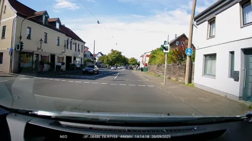
Alexander Palace
Restaurant · Greek · 3.1 km
128 Opladener Straße, Langenfeld
Mo off; Tu-Th 17:30-22:30; Fr,Sa 17:30-23:00; PH,Su 11:30-21:30
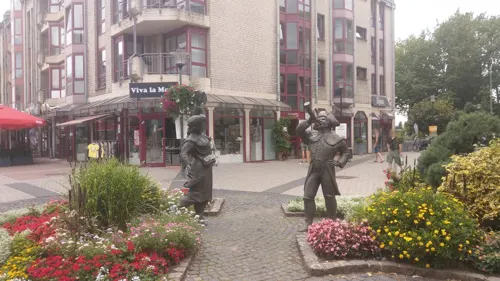
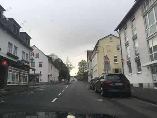
Cafe Büchel
Cafe · Cake · 4.3 km
20 Bahnhofstraße, Leichlingen (Rheinland)
Tu-Sa 06:00-18:00; Su 07:30-18:00
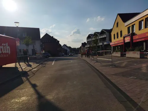
Chopsticks
Restaurant · Asian · 4.5 km
56 Hauptstraße, Monheim am Rhein
Mo,We-Sa 11:00-15:00,17:00-22:00; Su,PH 12:00-22:00
Dionysos im Rheinischen Hof
Restaurant · Greek · 4.3 km
36 Hauptstraße, Monheim am Rhein
Mo,We,Th 16:30-23:00, Fr,Sa 16:30-24:00, Su 12:00-23:00
Eiscafé Simonetti
Cafe · Ice Cream
54 Solinger Straße, Langenfeld (Rheinland)
Mo-Sa 09:00+; Su, PH 11:00+

Bayram Sofrasi
Restaurant · Turkish · 4.7 km
10 Ernst-Reuter-Platz, Monheim am Rhein
Tu-Su 11:00-22:00

Cafe Extrablatt
Cafe · Coffee Shop · 4.6 km
29 Ingeborg-Friebe-Platz, Monheim am Rhein
Mo-Sa 08:30-23:00; PH,Su 09:00-24:00
Die Wildgans
Restaurant · German, Austrian, Italian · 4.6 km
10 Mittelstraße, Leichlingen
Mo off; Nov-Dec Mo 17:00-21:30; Tu off; We off; Apr-Oct We...
Dionysos
Restaurant · Greek · 2.6 km
21 Haus Gravener Straße, Langenfeld
Mo-Su 17:00-22:00; Su 12:00-14:00; PH 12:00-22:00

Eiscafé Cristallo
Ice cream · Ice Cream
38 Hauptstraße, Langenfeld (Rheinland)
Mo-Sa 10:00-19:00; Su 12:00-17:00
Hotte-Hü
Restaurant · Regional · 4.2 km
71 Rudolf-Breitscheid-Straße, Düsseldorf
Mo,Tu off; We,Th 17:00-22:00; Fr 15:00-23:00; Sa,Su 12:00-21:30
224 more on the map.
Notable people from Langenfeld
 Christian MenzelGerman racing driverPhoto: www.msp-germany.de, Public domain
 Herbert ReulGerman politicianPhoto: Foto-AG Melle, CC BY-SA 3.0 de
 Cora SchumacherGerman television personalityPhoto: 9EkieraM1, CC BY-SA 3.0
 Sanaa KoubaaGerman athletePhoto: Elke Wetzig, CC BY-SA 4.0
 Senad Jarovićassociation football playerPhoto: @8Dodo8, CC BY 4.0
 Dirk RehbeinGerman footballerPhoto: Bernd Settnik, CC BY-SA 3.0 de
 Thomas HübenerGerman footballerPhoto: X-Weinzar, CC BY-SA 2.5
 Arnold KrekelUnited States federal judgePhoto: Unknown, No restrictions
- Shelley ThompsonGerman Association footballer
- Stefan BergerGerman historian
- Björn JoppienGerman badminton player
- Rudolf MellinghoffGerman judge
Born in Langenfeld, according to Wikidata (CC0). Each name links to its Wikipedia article.
Where to stay14
Campingplatz Naturfreunde Leichlingen
Campground · 3.0 km
4 Am Block, Leichlingen
Landhotel Lohmann
Motel and hotel · 2.2 km
19 Opladener Straße, Langenfeld (Rheinland)
Rheinländer Seehotel
Motel and hotel · 4.5 km
168 Langenfelder Straße, Leverkusen
Wasserski Camping Langenfeld
Campground · 2.8 km
88 Baumberger Straße, Langenfeld
Churches and places of worship44
Shopping65
Gas and EV charging21
Schools, colleges and libraries32
Öffentliche Bücherei der katholischen Kirchengemeinde St. Josef und Martin (KÖB)
Library · 1.6 km
25 Treibstraße, Langenfeld
Healthcare30
Map of Langenfeld
250 places. The map loads OpenStreetMap tiles when you open it.
Getting there and nearby towns
Düsseldorf Airport (DUS) is the nearest airport with scheduled flights listed in OpenStreetMap, 24 km away.
- Monheim am Rhein 4 km southwest, about 4 min by car
- Leichlingen 5 km east, about 5 min by car
- Opladen 6 km southeast, about 6 min by car
- Hilden 7 km north, about 7 min by car
- Dormagen 8 km west, about 8 min by car
- Zons 7 km west, about 7 min by car
- Leverkusen 9 km south, about 9 min by car
- Haan 11 km northeast, about 11 min by car
- Solingen 12 km northeast, about 12 min by car
- Burscheid 12 km east, about 12 min by car
Drive times are estimates from straight-line distance, not routes.
Towns near Langenfeld


Keep exploring
Local news
Headlines from INDB.
Reviews, tips and questions
Loading what members have shared...
Sources and licences
- GeoNames (CC BY 4.0): population, coordinates, regions and time zone
- Mapillary (see each image): photos
- OpenStreetMap contributors (ODbL 1.0): places, airports, map data
- Wikidata (CC0 1.0): elevation, founding date, time zone, website, landmarks and historic places
- Wikimedia Commons (see each image): photos
- Wikipedia (CC BY-SA 4.0): overview and history text
Photo credits
- St-Barbara-Langenfeld, Fabian Köster, CC BY-SA 3.0
- Alte-Synagoge-Langenfeld-photo-5, Velopilger, CC0
- Alte-Synagoge-Langenfeld-photo-3, Velopilger, CC0
- Haus Arndt (Langenfeld-Rheinland) photo-4, Velopilger, CC0
- Alte-Synagoge-Langenfeld-photo-4, Velopilger, CC0
- Haus Arndt (Langenfeld-Rheinland) photo-3, Velopilger, CC0
- Alte-Synagoge-Langenfeld-photo-6, Velopilger, CC0
- Alte-Synagoge-Langenfeld-photo-7, Velopilger, CC0
- Wegestundenstein Langenfeld (Rheinland)-5, Velopilger, CC0
- Wegestundenstein Langenfeld (Rheinland)-6, Velopilger, CC0
- Taubenhausstundensäule Langenfeld, Manfred Schröter, Berga, CC BY-SA 4.0
- Wegestundenstein Langenfeld (Rheinland)-4, Velopilger, CC0
- Alte-Synagoge-Langenfeld-photo-2, Velopilger, CC0
- Alte-Synagoge-Langenfeld-photo-1, Velopilger, CC0
- Langenfeld (Rheinland), Solinger Str. 19, Platz vor der Nordseite von St. Josef, Mahnmal für Opfer von Krieg und Gewalt 'Verzweifelt, Gefangen, Geschändet'-2, Velopilger, CC0
- Galkhausener-Bach-Langenfeld-photo-8, Velopilger, CC0
- Galkhausener-Bach-Langenfeld-photo-9, Velopilger, CC0
- 2021-11-19-Düsseldorfer-Straße-(Mettmann-Langenfeld)-photo-21, Velopilger, CC BY-SA 4.0
- 2021-11-19-Düsseldorfer-Straße-(Mettmann-Langenfeld)-photo-13, Velopilger, CC BY-SA 4.0
- 2021-11-19-Düsseldorfer-Straße-(Mettmann-Langenfeld)-photo-16, Velopilger, CC BY-SA 4.0
- Konrad-Adenauer-Platz-(Langenfeld-Rheiland)-photo-2, Velopilger, CC0
- 2021-11-19-Düsseldorfer-Straße-(Mettmann-Langenfeld)-photo-14, Velopilger, CC BY-SA 4.0
- 2021-11-19-Düsseldorfer-Straße-(Mettmann-Langenfeld)-photo-15, Velopilger, CC BY-SA 4.0
- Rathaus-Langenfeld 2024-09-25 MTh3, MTheiler, CC BY-SA 3.0
- 2021-11-19-Düsseldorfer-Straße-(Mettmann-Langenfeld)-photo-12, Velopilger, CC BY-SA 4.0
- Konrad-Adenauer-Platz-(Langenfeld-Rheiland)-photo-1, Velopilger, CC0
- Rathaus Langenfeld Rheinland photo -5, Velopilger, CC0
- Rathaus-Langenfeld 2024-09-25 MTh2, MTheiler, CC BY-SA 3.0
- Rathaus-Langenfeld 2024-09-25 MTh1, MTheiler, CC BY-SA 3.0
- Galkhausener-Bach-Langenfeld-photo-7, Velopilger, CC0
- Rathaus Langenfeld Rheinland photo -10, Velopilger, CC0
- Rathaus Langenfeld Rheinland photo -9, Velopilger, CC0
- Rathaus Langenfeld Rheinland photo -11, Velopilger, CC0
- Friedenskirche Baumberg - Winter, Peter Becker, CC BY 4.0
- Langenfeld Haus Graven 0015, Atamari, CC BY-SA 3.0
- Schloss Eicherhof 01, Sebastian Mehlmacher, CC BY-SA 3.0
- Erloeserkirche L-feld, Ritter-pitter at German Wikipedia, CC BY-SA 3.0
- NSG Further Moor 2015-12-01 14.00.59 LR, KellerWolke, CC BY-SA 4.0
- Schloss-garath, A.Savin, CC BY-SA 3.0
- Wenzelnberg, Ritter-pitter, Public domain
- Markt Karree Langenfeld BAU, Jean-Pierre Hecht, CC BY-SA 3.0
- Monheim am Rhein, Schloss Laach, 2013-02 CN-01, kaʁstn Disk / Cat, CC BY-SA 3.0 de
- Lukaskirche (Richrath) (1), Chris06, CC BY-SA 4.0
- NSG GL-053 Grünland- und Waldflächen bei Rothenberg (26), DiAuras, CC BY-SA 4.0
- NSG GL-055 Hülserbruch (1), DiAuras, CC BY-SA 4.0
- Leichlingen Evangelische Kirche, Torsten Kaiser 111, CC BY-SA 4.0
- Kapelle, Garather Schlossallee, Düsseldorf-Garath (06), Kürschner ( talk ) 12:03, 29 May 2021 (UTC), CC0
- Langenfeld Wegkreuz Dückeburg DSCN1666, Domspetz, CC BY-SA 4.0
- Langenfeld Wegkreuz Virneburg DSCN2420, Domspetz, CC BY-SA 4.0
- NSG Altabgrabung Klingenberger-3, Velopilger, CC0
- NSG Further Moor Heideweiher (6), DiAuras, CC BY-SA 4.0
- Naturschutzgebiet in Monheim, Kularymineto, CC BY-SA 3.0
- NSG Oerkhaussee (ME-015) (1), DiAuras, CC BY-SA 4.0
- NSG Urdenbacher Altrhein und Baumberger Aue (3), DiAuras, CC BY-SA 4.0
- Deusser-Haus, noebse, CC BY-SA 3.0
- Leichlingen Altes Rathaus, Torsten Kaiser 111, CC BY-SA 4.0
- Street-level photo, rororo, CC BY-SA 4.0
- Street-level photo, 5rmft, CC BY-SA 4.0
- Street-level photo, littlefool, CC BY-SA 4.0
- Street-level photo, rororo, CC BY-SA 4.0
- Street-level photo, rororo, CC BY-SA 4.0
- Street-level photo, rororo, CC BY-SA 4.0
- Street-level photo, TechniPorter, CC BY-SA 4.0
- Street-level photo, mfa, CC BY-SA 4.0
- Street-level photo, saschahaberkorn, CC BY-SA 4.0
- Street-level photo, moogulator, CC BY-SA 4.0
- Street-level photo, changchun1, CC BY-SA 4.0
- Street-level photo, DerMaster0815, CC BY-SA 4.0
- Street-level photo, changchun1, CC BY-SA 4.0
- Street-level photo, moogulator, CC BY-SA 4.0
- Street-level photo, moogulator, CC BY-SA 4.0
- Street-level photo, changchun1, CC BY-SA 4.0


Page built November 9, 2026. Spotted a mistake? Tell us or suggest a place.