

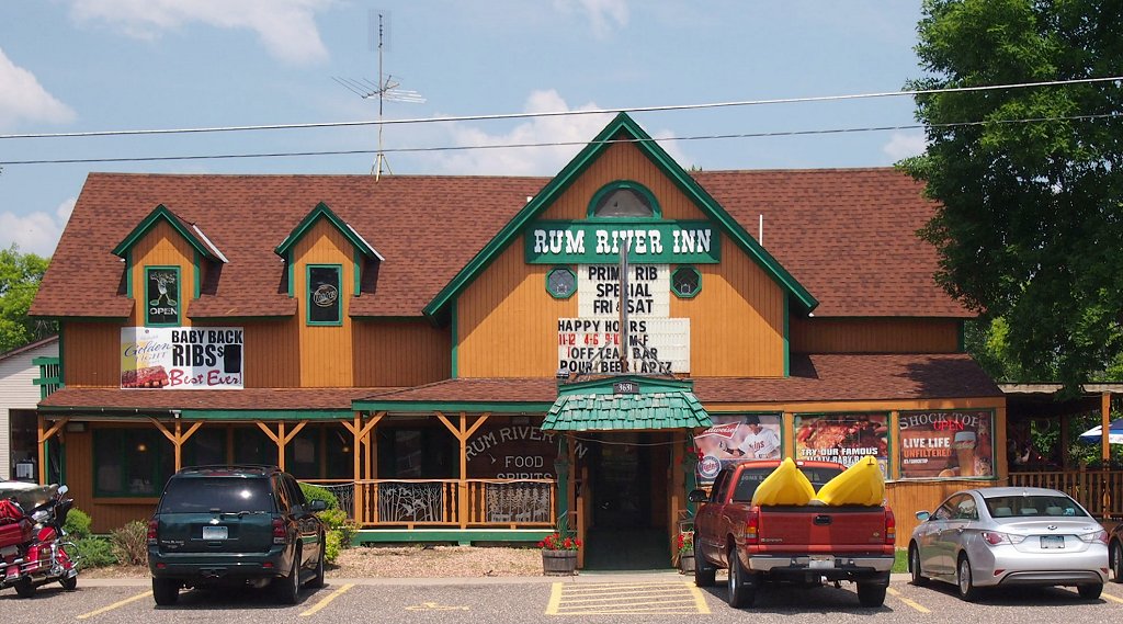


East Bethel, Minnesota
East Bethel is a city of 12,115 people in Anoka County, Minnesota.
Why visit East Bethel
Townapedia lists 4 museums and landmarks, 21 parks and trails, 9 places to eat and 1 attraction in and around town.
Highlights include East Bethel 10, Carlos Avery Game Farm, Crescent Grange Hall No. 512 and Cedar Creek Ecosystem Science Reserve.
July is the warmest month, with average highs of 80°F; January lows average 6°F, and about 64 inches of snow fall in a normal year.
Weather in East Bethel
Forecast from the National Weather Service. Full forecast
About East Bethel
East Bethel is a city in Anoka County, Minnesota, United States. The population was 11,786 at the 2020 census.
From the Wikipedia article East Bethel, Minnesota (this version), under CC BY-SA 4.0.
Things to do1

Museums and landmarks4

Carlos Avery Game Farm
Monument and historic site · National Register of Historic Places · 6.3 mi
Historic district in Minnesota, United States

Crescent Grange Hall No. 512
Monument and historic site · National Register of Historic Places · 6.1 mi
Building in Linwood Township, Minnesota, United States


Henry G. Leathers House
Monument and historic site · National Register of Historic Places · 7.2 mi
Historic house in St. Francis, Minnesota
Riverside Hotel
Monument and historic site · National Register of Historic Places · 7.2 mi
Historic former hotel in St. Francis, Minnesota
Parks, trails and playgrounds21



Bethel Haunted Forest Bike Trail
Park · 3.3 mi
23249 University Ave Extended Northeast, Bethel
DNR Natural Area and Lake Access
Park · 1.4 mi
Natural area with small craft lake access by portage/hand. Gate blocking vehicles. rustic trail with launch and dock.
9 more on the map.
Restaurants and cafes9


Route 65 Bar and Grill
Restaurant · Wings, Burger, Pizza · 3.5 mi
18407 Highway 65 Frontage Road, East Bethel


Subway
Fast food · Sandwich · 3.3 mi
23705 Highway 65 Northeast, East Bethel
Mo-Fr 07:00-21:00; Sa 09:00-21:00; Su 11:00-20:00
History
East Bethel was incorporated as a village on June 7, 1957, and was incorporated as the city of East Bethel on January 1, 1974.
The current boundaries of the City of East Bethel belonged to the Chippewa Indians until 1837, when the United States bought their lands east of the Mississippi River in what was later to become the State of Minnesota. Settlers began arriving in the area in the 1850s and the area was incorporated as a Township in 1858, the same year Minnesota was admitted to the Union. The Township was originally incorporated as the Township of Bethel, the name derived from the Bible and meaning the "House of God."
Situated in the northeast portion of Anoka County, the Quakers were the first settlers in Bethel in 1856. The group quickly established a school and a church, but left the area following the Indian Massacre of 1862. The Quakers took their families to Anoka and Minneapolis and never returned to the area. Other settlers that left during the Indian Wars did return to the area and became farmers, tradesmen, and merchants. The Township of Bethel exhibited a slow but steady growth from 423 in 1880 to 1,286 in 1957.
From the History section of East Bethel, Minnesota on Wikipedia, under CC BY-SA 4.0.
Churches and places of worship2
Swedish Evangelical Lutheran Church
Church · National Register of Historic Places · 4.1 mi
Gas and EV charging1
Schools, colleges and libraries9
Star of The North Academy Charter S
School · 2.4 mi
1562 Viking Blvd, East Bethel
Map of East Bethel
47 places. The map loads OpenStreetMap tiles when you open it.
Climate by month
Monthly table
| Month | High | Low | Rain | Snow |
|---|---|---|---|---|
| Jan | 23°F | 6°F | 0.9 in | 13.8 in |
| Feb | 28°F | 10°F | 1.0 in | 10.7 in |
| Mar | 41°F | 22°F | 1.8 in | 11.2 in |
| Apr | 56°F | 34°F | 3.3 in | 4.1 in |
| May | 69°F | 47°F | 4.3 in | 0.0 in |
| Jun | 77°F | 56°F | 4.6 in | 0.0 in |
| Jul | 80°F | 62°F | 4.8 in | 0.0 in |
| Aug | 78°F | 59°F | 4.1 in | 0.0 in |
| Sep | 71°F | 51°F | 3.1 in | 0.0 in |
| Oct | 57°F | 39°F | 3.1 in | 0.9 in |
| Nov | 41°F | 25°F | 1.9 in | 12.7 in |
| Dec | 27°F | 13°F | 1.5 in | 10.5 in |
U.S. Climate Normals 1991-2020 for Cedar (4 mi away), NOAA NCEI.
People and cost of living
American Community Survey 5-year estimates, 2020-2024, U.S. Census Bureau. Estimates have margins of error, larger for small towns.
Disaster history
Anoka County has had 6 federal disaster declarations since 2000, most often for biologicals.
- 2020-04-07: Covid-19 Pandemic (Biological)
- 2020-03-13: Covid-19 (Biological)
- 2011-06-07: Severe Storms And Tornadoes (Severe Storm)
- 2005-09-13: Hurricane Katrina Evacuation (Hurricane)
- 2001-05-16: Severe Winter Storms, Flooding, And Tornadoes (Flood)
- 2000-10-20: Mn - Carlos Edge Fire Complex - 10/19/2000 (Fire)
OpenFEMA disaster declarations summaries.
Getting there and nearby towns
Crystal Airport (MIC) is the nearest airport with scheduled flights listed in OpenStreetMap, 21 miles away.
- Andover 9 mi southwest, about 15 min by car
- Blaine 13 mi south, about 20 min by car
- Coon Rapids 13 mi south, about 21 min by car
- Anoka 13 mi southwest, about 21 min by car
- Cambridge 14 mi north, about 23 min by car
- Champlin 15 mi southwest, about 24 min by car
- Brooklyn Park 18 mi south, about 29 min by car
- Brooklyn Center 20 mi south, about 33 min by car
- Columbia Heights 21 mi south, about 34 min by car
- Crystal 23 mi south, about 37 min by car
Drive times are estimates from straight-line distance, not routes.
Local news
Headlines from INDB, the NEMICO news database.
Reviews, tips and questions
Loading what members have shared...
Sources and licences
- NCES EDGE (Public domain): public schools
- NOAA NCEI U.S. Climate Normals 1991-2020 (Public domain): climate by month
- OpenFEMA (Public domain): disaster declarations
- OpenStreetMap contributors (ODbL 1.0): places, airports, map data
- U.S. Census Bureau (Public domain): population, income, housing, education, commute
- Wikidata (CC0 1.0): elevation, founding date, time zone, website, landmarks and historic places
- Wikimedia Commons (see each image): photos
- Wikipedia (CC BY-SA 4.0): overview and history text
Photo credits
- 2013-0326-CrescentGrangeHall, Bobak Ha'Eri, CC BY 3.0
- Rum River Inn, McGhiever, CC BY-SA 3.0
- 2013-0326-CarlosAveryGameFarm, Bobak Ha'Eri, CC BY 3.0
- H. G. Leathers House, McGhiever, CC BY-SA 4.0
- ISS036-E-29367 - View of Earth, Earth Science and Remote Sensing Unit , Lyndon B. Johnson Space Center, Public domain
- ISS054-E-50213 - View of Earth, Earth Science and Remote Sensing Unit, NASA Johnson Space Center, Public domain
- ISS054-E-50214 - View of Earth, Earth Science and Remote Sensing Unit, NASA Johnson Space Center, Public domain
- ISS054-E-51066 - View of Earth, Earth Science and Remote Sensing Unit, NASA Johnson Space Center, Public domain
- Swedish Evangelical Lutheran Church winter, McGhiever, CC BY-SA 4.0
- Swedish Evangelical Lutheran Church summer, McGhiever, CC BY-SA 4.0
- Pomeranian-Husky mix breed known as a "Pomski" or "Pomsky" with heterochromia. 3 years old., Emlythk, CC BY-SA 4.0
- Ham Lake, MN 55304, USA - panoramio (8), SCOTT WUERTZ, CC BY 3.0
- Ham Lake, MN 55304, USA - panoramio (4), SCOTT WUERTZ, CC BY 3.0
- Ham Lake, MN 55304, USA - panoramio (10), SCOTT WUERTZ, CC BY 3.0
- Ham Lake, MN 55304, USA - panoramio (5), SCOTT WUERTZ, CC BY 3.0
- Ham Lake, MN 55304, USA - panoramio (20), SCOTT WUERTZ, CC BY 3.0
- Ham Lake, MN 55304, USA - panoramio (19), SCOTT WUERTZ, CC BY 3.0
- Ham Lake, MN 55304, USA - panoramio (17), SCOTT WUERTZ, CC BY 3.0
- Ham Lake, MN 55304, USA - panoramio (18), SCOTT WUERTZ, CC BY 3.0
- Ham Lake, MN 55304, USA - panoramio (2), SCOTT WUERTZ, CC BY 3.0
- Ham Lake, MN 55304, USA - panoramio (1), SCOTT WUERTZ, CC BY 3.0
- Ham Lake, MN 55304, USA - panoramio (16), SCOTT WUERTZ, CC BY 3.0
- Ham Lake, MN 55304, USA - panoramio (13), SCOTT WUERTZ, CC BY 3.0
- Ham Lake, MN 55304, USA - panoramio (12), SCOTT WUERTZ, CC BY 3.0
- Ham Lake, MN 55304, USA - panoramio (15), SCOTT WUERTZ, CC BY 3.0
- Ham Lake, MN 55304, USA - panoramio, SCOTT WUERTZ, CC BY 3.0
- Ham Lake, MN 55304, USA - panoramio (14), SCOTT WUERTZ, CC BY 3.0
- ISS034-E-13733 - View of Earth, Earth Science and Remote Sensing Unit , Lyndon B. Johnson Space Center, Public domain
- ISS054-E-51065 - View of Earth, Earth Science and Remote Sensing Unit, NASA Johnson Space Center, Public domain
- ISS021-E-34830 - View of Earth, Earth Science and Remote Sensing Unit , Lyndon B. Johnson Space Center, Public domain
- Ham Lake, MN 55304, USA - panoramio (11), SCOTT WUERTZ, CC BY 3.0
- Ham Lake, MN 55304, USA - panoramio (22), SCOTT WUERTZ, CC BY 3.0
- Ham Lake, MN 55304, USA - panoramio (9), SCOTT WUERTZ, CC BY 3.0
- Ham Lake, MN 55304, USA - panoramio (3), SCOTT WUERTZ, CC BY 3.0


Page built October 30, 2026. Spotted a mistake? Tell us or suggest a place.