




East Rancho Dominguez, California
East Rancho Dominguez is a community of 14,603 people in Los Angeles County, California.
Why visit East Rancho Dominguez
Townapedia lists 3 museums and landmarks, 18 parks and trails and 27 places to eat in and around town.
Highlights include Dominguez Rancho Adobe, Lynwood Pacific Electric Railway Depot, Spane Park and 72nd Street Equestrian Park and Arena.
August is the warmest month, with average highs of 83°F; December lows average 47°F.
Weather in East Rancho Dominguez
Forecast from the National Weather Service. Full forecast
About East Rancho Dominguez
East Rancho Dominguez, () also known as East Compton, is an unincorporated community and census-designated place (CDP) located in southern Los Angeles County, California, United States. The population was 15,114 at the 2020 census, down from 15,135 at the 2010 census. East Rancho Dominguez is an accepted city name according to the United States Postal Service, and shares the 90221 ZIP Code with Compton.
From the Wikipedia article East Rancho Dominguez, California (this version), under CC BY-SA 4.0.
Museums and landmarks3


Dominguez Rancho Adobe
Monument and historic site · National Register of Historic Places · 2.3 mi
Building in California, United States
Lynwood Pacific Electric Railway Depot
Monument and historic site · National Register of Historic Places · 2.3 mi
Railway station of the Pacific Electric Railway, located in Lynwood, California
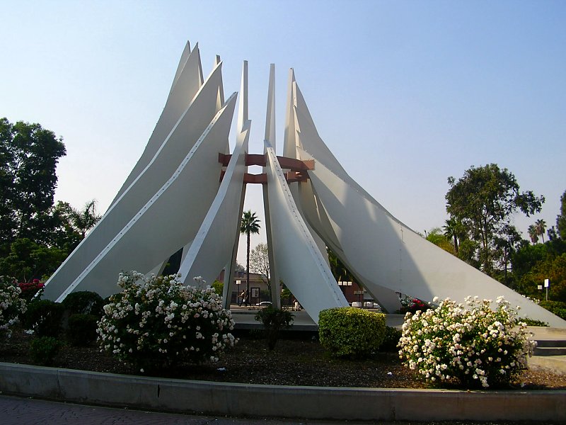
Martin Luther King, Jr. Memorial
Monument and historic site · 1.7 mi
Sculpture in Compton, California, USA
Parks, trails and playgrounds18

6 more on the map.
Restaurants and cafes27

Robert Earl's BBQ
Restaurant · 1.5 mi
703 East Artesia Boulevard, Long Beach
Tu,Th 11:00-19:00; We 11:00-16:00; Fr,Sa 11:00-21:00; Su...



15 more on the map.
Churches and places of worship50

38 more on the map.
Shopping4
Gas and EV charging10
Schools, colleges and libraries67
St. Philip Neri Catholic School
School · Roman Catholic · 1.0 mi
12522 North Stoneacre Avenue, Lynwood
Healthcare4
Map of East Rancho Dominguez
183 places. The map loads OpenStreetMap tiles when you open it.
Climate by month
Monthly table
| Month | High | Low | Rain |
|---|---|---|---|
| Jan | 67°F | 47°F | 2.9 in |
| Feb | 67°F | 48°F | 3.0 in |
| Mar | 69°F | 51°F | 1.6 in |
| Apr | 71°F | 54°F | 0.6 in |
| May | 73°F | 58°F | 0.3 in |
| Jun | 76°F | 61°F | 0.1 in |
| Jul | 81°F | 65°F | 0.1 in |
| Aug | 83°F | 66°F | 0.0 in |
| Sep | 82°F | 64°F | 0.1 in |
| Oct | 78°F | 59°F | 0.5 in |
| Nov | 72°F | 52°F | 0.8 in |
| Dec | 67°F | 47°F | 2.1 in |
U.S. Climate Normals 1991-2020 for Long Beach Daugherty Fld 72297 (6 mi away), NOAA NCEI.
People and cost of living
American Community Survey 5-year estimates, 2020-2024, U.S. Census Bureau. Estimates have margins of error, larger for small towns.
Disaster history
Los Angeles County has had 67 federal disaster declarations since 2000, most often for fires.
- 2025-08-08: Canyon Fire (Fire)
- 2025-01-08: Wildfires And Straight-Line Winds (Fire)
- 2025-01-08: Eaton Fire (Fire)
- 2025-01-08: Hurst Fire (Fire)
- 2025-01-07: Palisades Fire (Fire)
- 2024-12-10: Franklin Fire (Fire)
OpenFEMA disaster declarations summaries.
Getting there and nearby towns
Compton / Woodley Airport (CPM) is the nearest airport with scheduled flights listed in OpenStreetMap, 2 miles away.
- Paramount 2 mi east, about 3 min by car
- Compton 2 mi west, about 3 min by car
- Lynwood 2 mi north, about 3 min by car
- Willowbrook 3 mi northwest, about 5 min by car
- South Gate 3 mi north, about 5 min by car
- Bellflower 4 mi east, about 6 min by car
- West Rancho Dominguez 4 mi west, about 7 min by car
- Downey 5 mi northeast, about 8 min by car
- Carson 5 mi southwest, about 8 min by car
- Cudahy 5 mi north, about 8 min by car
Drive times are estimates from straight-line distance, not routes.
Local news
Headlines from INDB, the NEMICO news database.
Reviews, tips and questions
Loading what members have shared...
Sources and licences
- NCES EDGE (Public domain): public schools
- NOAA NCEI U.S. Climate Normals 1991-2020 (Public domain): climate by month
- OpenFEMA (Public domain): disaster declarations
- OpenStreetMap contributors (ODbL 1.0): places, airports, map data
- U.S. Census Bureau (Public domain): population, income, housing, education, commute
- Wikidata (CC0 1.0): elevation, founding date, time zone, website, landmarks and historic places
- Wikimedia Commons (see each image): photos
- Wikipedia (CC BY-SA 4.0): overview and history text
Photo credits
- Dominguez Rancho Adobe Museum, Vanesser III, CC BY-SA 2.0
- Lynwood Pacific Electric Railway Depot (Lynwood, CA), John F. Meyerpeter, HABS photographer, Public domain
- Compton martin luther king monument, Epolk at English Wikipedia, CC BY 3.0
- ISS060-E-78523 - View of Earth, Earth Science and Remote Sensing Unit, NASA Johnson Space Center, Public domain
- ISS027-E-28808 - View of California, Earth Science and Remote Sensing Unit , Lyndon B. Johnson Space Center, Public domain
- ISS061-E-28693 - View of Earth, Earth Science and Remote Sensing Unit, NASA Johnson Space Center, Public domain
- ISS065-E-350552 - View of Earth, Earth Science and Remote Sensing Unit , Lyndon B. Johnson Space Center, Public domain
- Colin P. Kelly Elementary School (Compton, California), Jengod, CC BY-SA 4.0
- Dale's Donuts 15904 S. Atlantic Ave Compton CA 03, Jengod, CC BY-SA 4.0
- Dale's Donuts 15904 S. Atlantic Ave Compton CA 02, Jengod, CC BY-SA 4.0
- Dale's Donuts 15904 S. Atlantic Ave Compton CA 01, Jengod, CC BY-SA 4.0
- Maersk shipping container, Epolk, CC BY-SA 4.0
- Compton Unified School District school bus 2024, Jengod, CC BY-SA 4.0
- Compton, CA, USA - panoramio, peter boy12qq12, CC BY 3.0
- Franklin D. Roosevelt Middle School (Compton, California) 02, Jengod, CC BY-SA 4.0
- Franklin D. Roosevelt Middle School (Compton, California) 01, Jengod, CC BY-SA 4.0
- 7140 Myrtle Avenue - probably 1950 - panoramio, strib1946, CC BY 3.0
- STG logistics container, Eric Polk, CC BY-SA 4.0
- STG shipping container, Epolk, CC BY-SA 4.0
- 20230424 125151-edit-20230424131614, Dluisd74, CC BY-SA 4.0
- California SR 91 at I-710, Eric Polk, CC BY-SA 4.0
- 91 WEST and 710, Spandido, CC BY-SA 3.0
- Alameda corridor trench, Thomas Brightbill, CC BY 2.0
- Powerloop semi-trailer, Eric Polk, CC BY-SA 4.0


Page built October 30, 2026. Spotted a mistake? Tell us or suggest a place.