



Why visit Birdham
Townapedia lists 6 museums and landmarks, 5 parks and trails, 8 places to eat and 3 places to stay in and around town.
Highlights include Fishbourne Roman Palace, Hazardous, Nutborne Marshes and Pilsey Island.
Weather in Birdham
Forecast from MET Norway (CC BY 4.0). Full forecast
About Birdham
Birdham is a village and civil parish in the Chichester District of West Sussex, England. It is located on the Manhood Peninsula, c. 5 miles (8.0 km) south-west of the city of Chichester. The parish church is dedicated to St Benjamin, although the dedication was to St.
From the Wikipedia article Birdham (this version), under CC BY-SA 4.0.
Museums and landmarks6

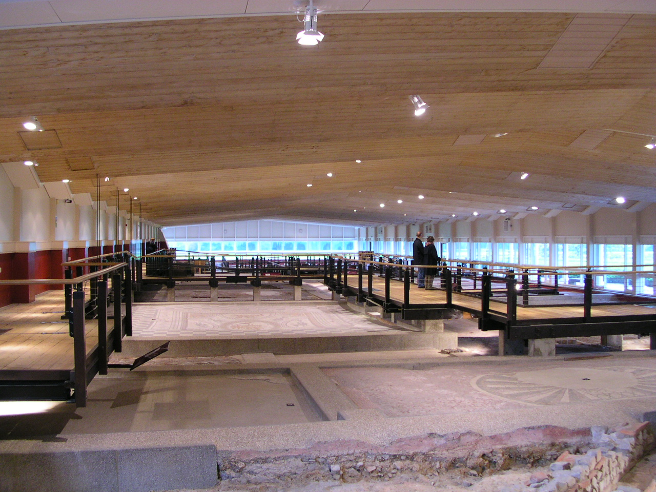
Fishbourne Roman Palace
Museum · 2.9 mi
Roman palace and museum near Chichester in Sussex, United Kingdom

Hazardous
Monument and historic site · 3.3 mi
Shipwreck in Bracklesham Bay, West Sussex, England, UK

Novium Museum
Museum · 3.6 mi
Museum in Chichester, Sussex, England, United Kingdom

Pallant House Gallery
Museum · 3.6 mi
Art gallery in Chichester, West Sussex, United Kingdom

Noviomagus Reginorum
Monument and historic site · 3.6 mi
Roman settlement in West Sussex, England, United Kingdom
Appledram Airfield
Monument and historic site · 1.7 mi
A former military airfield, opened in 1943 and closed in 1944. It was situated south of Appledram / Apuldram on the east bank of the...
Parks, trails and playgrounds5



Restaurants and cafes8


Where to stay3

Willow House Bed And Breakfast
Motel and hotel · 1.7 mi
Piggery Hall Lane, Chichester

History
Birdham's name derives from the Old English bridd and hām, and means a settlement frequented by young birds.
The only evidence of prehistoric settlement is a Bronze Age settlement.
Birdham is first mentioned in a series of Anglo-Saxon charters relating to land grants to the See of Selsey. Unfortunately, most of these are forgeries, Birdham was located in the ancient hundred of Wittering in Sussex according to the Domesday Book of 1086. The settlement comprised 16 households valued at three pounds five shillings.
Birdham is an area of dispersed settlements with no defined centre with a single store and no pubs. The enclosure of Manhood Common led to the development of small farms but the rapid rise in population only began in the 1930s.
During World War III, the tide mill and associated boat yards became HMS Sea Serpent in 1942. The various holiday camps in the area were used as billets for troops training for amphibious landings, especially D Day.
From the History section of Birdham on Wikipedia, under CC BY-SA 4.0.
Churches and places of worship10
Shopping1
Gas and EV charging2
Schools, colleges and libraries1
Map of Birdham
36 places. The map loads OpenStreetMap tiles when you open it.
Getting there and nearby towns
Goodwood Aerodrome (QUG) is the nearest airport with scheduled flights listed in OpenStreetMap, 6 miles away.
- Chichester 4 mi northeast, about 6 min by car
- Selsey 5 mi southeast, about 7 min by car
- Emsworth 6 mi northwest, about 9 min by car
- Hayling Island 6 mi west, about 10 min by car
- South Hayling 6 mi west, about 10 min by car
- Bognor Regis 7 mi east, about 11 min by car
- Havant 8 mi northwest, about 13 min by car
- Barnham 9 mi east, about 14 min by car
- Waterlooville 10 mi northwest, about 17 min by car
- Portsmouth 11 mi west, about 18 min by car
Drive times are estimates from straight-line distance, not routes.
Towns near Birdham


Keep exploring
Local news
Headlines from INDB.
Reviews, tips and questions
Loading what members have shared...
Sources and licences
- GeoNames (CC BY 4.0): population, coordinates, regions and time zone
- Mapillary (see each image): photos
- OpenStreetMap contributors (ODbL 1.0): places, airports, map data
- Wikidata (CC0 1.0): elevation, founding date, time zone, website, landmarks and historic places
- Wikimedia Commons (see each image): photos
- Wikipedia (CC BY-SA 4.0): overview and history text
Photo credits
- Birdham Pool, Charlesdrakew, Public domain
- Fishbourne palace north wing, Charlesdrakew, Public domain
- Keith Williams Architects Novium Museum Chichester, ACT124, CC BY-SA 4.0
- Pallant House Gallery h, A bit iffy, Public domain
- Former St Andrew's Church, Oxmarket, Chichester, The Voice of Hassocks, CC0
- St John the Evangelist's Church, Chichester, Tim Sheerman-Chase, CC BY 2.0
- St Leodegar's Church, Hunston, The Voice of Hassocks, CC0
- St Mary's Church, Sidlesham (NHLE Code 1233271), The Voice of Hassocks, CC0
- St Richard of Chichester's Church, Cawley Road, Chichester (NHLE Code 1392318), The Voice of Hassocks, CC0
- Holy Trinity Church, Bosham (NHLE Code 1354443), The Voice of Hassocks, CC0
- StJames from south, Kinnerton, CC BY-SA 3.0
- West Itchenor Church, Charlesdrakew, Public domain
- HMS Hazardous wreck site, Eddohaddock, CC BY-SA 4.0
- Street-level photo, richardc, CC BY-SA 4.0
- Street-level photo, noid, CC BY-SA 4.0
- Street-level photo, richardc, CC BY-SA 4.0
- Street-level photo, richardc, CC BY-SA 4.0
- Street-level photo, noid, CC BY-SA 4.0
- Street-level photo, richardc, CC BY-SA 4.0


Page built November 10, 2026. Spotted a mistake? Tell us or suggest a place.