




Emsworth, United Kingdom
Emsworth is a town of 18,777 people in England, United Kingdom.
Why visit Emsworth
Townapedia lists 7 museums and landmarks, 15 parks and trails, 45 places to eat, 5 places to stay and 3 attractions in and around town.
Highlights include Langstone Bridge, Southbourne Farm Shop, Emsworth Museum and Spring Arts and Heritage Centre.
Weather in Emsworth
Forecast from MET Norway (CC BY 4.0). Full forecast
About Emsworth
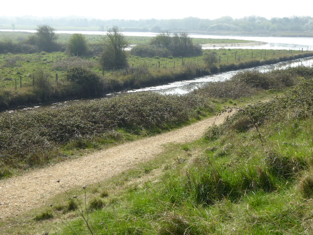
Emsworth is a town in the Borough of Havant in the county of Hampshire, on the south coast of England near the border with West Sussex. It lies at the north end of an arm of Chichester Harbour, a large and shallow inlet from the English Channel, and is equidistant between Portsmouth and Chichester.
From the Wikipedia article Emsworth (this version), under CC BY-SA 4.0.
Travel tips from other travellers: Emsworth on Wikivoyage (CC BY-SA 4.0).
Things to do3


Museums and landmarks7


Spring Arts and Heritage Centre
Museum · 1.8 mi
Arts centre in Hampshire, United Kingdom


Parks, trails and playgrounds15


Stansted Park
Park · 2.8 mi
Park in Stoughton, Chichester, West Sussex, England, UK

Staunton Country Park
Park · 2.9 mi
Parkland and forest in Hampshire, England, UK





3 more on the map.
Restaurants and cafes45
Darbar
Restaurant · Indian
36 North Street, Emsworth
Su-Th 17:30-22:00; Mo-Su 12:00-14:00; Fr-Sa 17:30-22:30
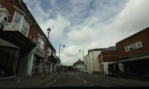
Cafe Moka
Cafe
23C North Street, Emsworth
Mo-Fr 08:30-16:30; Sa 08:30-16:00; Su 10:00-15:00
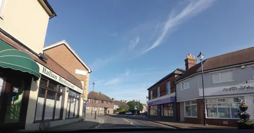
Our Little Place
Cafe · Coffee Shop, Cake · 1.4 mi
Main Road, Southbourne, Emsworth
Mo-Sa 08:00-17:00, Su 08:00-16:00

Spice Village
Restaurant · Indian
47 High Street, Emsworth
Su-Mo 17:00-23:30; We-Th 17:00-23:30; Fr-Sa 17:00-24:00


Taste of India
Restaurant · Indian
45 High Street, Emsworth
Su-Th 17:30-23:30; Fr-Sa 17:30-00:00
33 more on the map.
History
In prehistoric and early historical times the River Ems was tidal as far as Westbourne and the Westbrook creek reached to Victoria Road, leaving Emsworth almost isolated at high tide. A coastal route developed that led from Hayling Island through Havant and Rowlands Castle to the Downs. A part of the coastal route followed the Portsdown ridgeway and from Chichester to Belmont Hill in Bedhampton probably skirted the heads of the various creeks which entered the harbour, passing through country still covered with the original thick forest of oak and beech.
In Roman times a villa existed to the south of the road to Noviomagus Reginorum in the fields of what is now Warblington Castle Farm. Archaeological finds show that the building was a sizeable brick and stone edifice, with floors paved with red brick and coloured sandstone and a view of the harbour and wooded shores of Hayling Island. The fertile landscape suggests the area to have been under continuous cultivation for 1500–1800 years.
Saxons began settling the area after AD 500. Charters were granted by Kings Æthelstan and Æthelred in AD 935 and AD 980 establishing and confirming the boundaries of Warblington. From AD 980–1066 the manor was held by Godwin, Earl of Wessex and his son Harold Godwinson.
Read more of the history
After the Norman Conquest, the Manor of Warblington was given to Roger de Montgomery, Earl of Shrewsbury as part of the manor of Westbourne. The Domesday Book lists the latter with two churches, a mill, 29 families and two slaves (about 120 people). There were also seven plough teams, indicating about 850 acres of land under cultivation.
The first recorded mention of Emsworth as a separate entity was in AD 1216, when King John divided the manor of Warblington, accepting annual rent of 'a pair of gilt spurs yearly' from William Aguillon for land at Emelsworth. In AD 1239, Henry III granted the town a weekly market on Wednesdays and an annual fair on 7 July. The town was mentioned in a patent roll of a hospital in the Hermitage area in AD 1251.
In AD 1341 Emsworth was designated as one of five English towns required to provide a ship for defence of the Channel Islands. It was designated as a customs landing for Chichester in AD 1346 and in AD 1348 was investigated by a special commission for smuggling.
During the 18th and 19th centuries, Emsworth was still a port. Emsworth was known for shipbuilding, boat building and rope making. Grain from the area was ground into flour by tidal mills and transported by ship to places such as London and Portsmouth. Timber from the area was also exported in the 18th and 19th centuries. The River Ems, which is named after the town (not, as often believed, the town being named after the river), flows into the Slipper millpond. The mill itself is now used as offices.
In the 19th century Emsworth had as many as 30 pubs and beer houses; today, only nine remain.
At the beginning of the 19th century, Emsworth had a population of less than 1,200 but it was still considered a large village for the time. By the end of the 18th century, it became fashionable for wealthy people to spend the summer by the sea. In 1805 a bathing house was built where people could have a bath in seawater.
St Peter's Chapel was completed in 1790, later becoming Emsworth Town Hall. The parish Church of St James was built in 1840 to a design by John Elliott. It was expanded in the late 1850s this time to a design by John Colson. Colson's designs were again used in an expansion of 1865. A final round of building took place in the early 1890s this time to a design by Arthur Blomfield. The reredos added in the 1920s features a painting by Percy George Bentham.
Queen Victoria visited Emsworth in 1842, resulting in Queen Street and Victoria Road being named after her. In 1847 the London, Brighton and South Coast Railway (now the West Coastway line) came to Emsworth, with a railway station built to serve the town.
Hollybank House to the north of the town was built in 1825 and is now a hotel.
Emsworth became part of Warblington Urban District which held its first meeting in 1895. The Urban District was abolished in 1932. Emsworth subsequently became part of Havant Urban District.
By 1901 the population of Emsworth was about 2,000. It grew rapidly during the 20th century to about 5,000 by the middle of the century. In 1906 construction began on the post office, with local cricketer George Wilder laying an inscribed brick. The renamed Emsworth Recreation Ground dates from 1909 and is the current home of Emsworth Cricket Club, which was founded in 1811. Cricket in Emsworth has been played at the same ground, Cold Harbour Lawn, since 1761.
From the History section of Emsworth on Wikipedia, under CC BY-SA 4.0.
More about Emsworth
Arts and culture
Emsworth Library was considered for closure in 2020 but following public consultation, was reprieved.
Emsworth Museum is administered by the Emsworth Maritime & Historical Trust.
The town is twinned with Saint-Aubin-sur-Mer in Normandy, France.
Local landmark Thorney Island is home to a detachment of the Sussex Army Cadet Force, a volunteer youth organisation, sponsored by the Ministry of Defence, which accepts cadets aged between 12 and 18 years of age.
1st Emsworth Scouts meet several times per week with different sections aimed at different age groups and abilities.
In 2014 retired Royal Navy Captain Clifford "John" Caughey drove his car into the clubhouse of Emsworth Sailing Club, causing an explosion and requiring thirty firefighters to put out the fire.
From the Wikipedia article Emsworth, under CC BY-SA 4.0.
Notable people from Emsworth
 Joel WardEnglish association football player (born 1989)Photo: jamesboyes @ Flickr, CC BY 2.0
 Hugh GilbertCatholic bishopPhoto: Scottish Government, CC BY 2.0
 Peter DanckwertsGeorge Cross recipient in World War II and chemical engineerPhoto: William Dring, Public domain
- Nicholas LyndhurstBritish actor (born 1961)
- Tony HoarBritish cyclist (1932–2019)
- Denise BlackBritish actress
- Billy EamesEnglish footballer (born 1957)
- Donald WisemanEnglish scholar (1918-2010)
- Harry George GaltBritish colonial official
- William WhitcherEnglish cricketer (1832-1910)
- Malcolm WaldronEnglish footballer (born 1956)
- Edmund Phipps-HornbyRecipient of the Victoria Cross (1857-1947)
Born in Emsworth, according to Wikidata (CC0). Each name links to its Wikipedia article.
Where to stay5
Churches and places of worship13
St John the Baptist, Westbourne
Church · Anglican · 1.0 mi
Westbourne Road, Emsworth
Emsworth Methodist Church and Pastoral Centre
Church · Methodist
High Street, Emsworth
Shopping9
Gas and EV charging5
Schools, colleges and libraries10
St James Church of England Controlled Primary School
School · Anglican · 0.6 mi
Bellevue Lane, Emsworth
Healthcare5
Map of Emsworth
117 places. The map loads OpenStreetMap tiles when you open it.
Getting there and nearby towns
Goodwood Aerodrome (QUG) is the nearest airport with scheduled flights listed in OpenStreetMap, 7 miles away.
- South Hayling 5 mi southwest, about 7 min by car
- Portsmouth 8 mi southwest, about 12 min by car
- Selsey 10 mi southeast, about 16 min by car
- Petersfield 11 mi north, about 17 min by car
- Ryde 13 mi southwest, about 21 min by car
- Sandown 17 mi southwest, about 27 min by car
- Newport 18 mi southwest, about 30 min by car
- Rustington 19 mi east, about 31 min by car
- Haslemere 19 mi northeast, about 31 min by car
- Southampton 21 mi west, about 33 min by car
Drive times are estimates from straight-line distance, not routes.
Towns near Emsworth


Keep exploring
Local news
Headlines from INDB.
Reviews, tips and questions
Loading what members have shared...
Sources and licences
- GeoNames (CC BY 4.0): population, coordinates, regions and time zone
- Mapillary (see each image): photos
- OpenStreetMap contributors (ODbL 1.0): places, airports, map data
- Wikidata (CC0 1.0): elevation, founding date, time zone, website, landmarks and historic places
- Wikimedia Commons (see each image): photos
- Wikipedia (CC BY-SA 4.0): overview and history text
Photo credits
- Emsworth Victoria Cottage Hospital built 1897 re-purposed as a Medical Practice (2096o), Djm-leighpark, CC BY-SA 4.0
- Langstone harbour bridgeside view 2011, Geni, CC BY-SA 4.0
- The Spring Arts and Heritage Centre, Geni, CC BY-SA 4.0
- Eames Farm (5), Dudley Miles, CC BY-SA 4.0
- Southmoor Nature Reserve, Havant 01, Simon Burchell, CC BY-SA 4.0
- Stansted Park 11, Simon Burchell, CC BY-SA 4.0
- St John the Baptist's Church, The Grove, Westbourne (NHLE Code 1026167), The Voice of Hassocks, CC0
- Warblington castle tower from churchyard, Geni, CC BY-SA 4.0
- WrblSchP1010042, Bashereyre at English Wikipedia, Public domain
- St James's Church, North Street, Emsworth (NHLE Code 1340210) (March 2012) (9), Hassocks5489, CC0
- St. John the Evangelist's Church, Southbourne 02, Simon Burchell, CC BY-SA 4.0
- Leigh water from the site of the old house, geni, CC BY-SA 4.0
- St Alban's Church, Martin Road, Leigh Park (May 2019) (1), Hassocks5489, CC0
- Tuppenny Barn project model, Djm-leighpark, CC BY-SA 4.0
- Emsworth Museum 20210418 114557, Dcs57, CC BY-SA 4.0
- TEK-DEK Emsworth Marina showroom, Longdagger, CC BY-SA 4.0
- Street-level photo, tallguy, CC BY-SA 4.0
- Street-level photo, tallguy, CC BY-SA 4.0
- Street-level photo, tallguy, CC BY-SA 4.0
- Street-level photo, tallguy, CC BY-SA 4.0
- Street-level photo, noid, CC BY-SA 4.0
- Street-level photo, tallguy, CC BY-SA 4.0
- Street-level photo, tallguy, CC BY-SA 4.0
- Street-level photo, tallguy, CC BY-SA 4.0
- Street-level photo, tallguy, CC BY-SA 4.0
- Street-level photo, tallguy, CC BY-SA 4.0
- Street-level photo, tallguy, CC BY-SA 4.0
- Street-level photo, tallguy, CC BY-SA 4.0
- Street-level photo, tallguy, CC BY-SA 4.0
- Street-level photo, noid, CC BY-SA 4.0
- Street-level photo, tallguy, CC BY-SA 4.0
- Street-level photo, tallguy, CC BY-SA 4.0
- Street-level photo, noid, CC BY-SA 4.0


Page built November 10, 2026. Spotted a mistake? Tell us or suggest a place.