


Why visit Denbigh
Townapedia lists 13 museums and landmarks, 6 parks and trails, 38 places to eat, 3 places to stay and 2 attractions in and around town.
Highlights include Theatr Twm o'r Nant, Denbigh Castle, Wireless in Wales and Pierce Memorial Garden.
Weather in Denbigh
Forecast from MET Norway (CC BY 4.0). Full forecast
About Denbigh
Denbigh ( DEN-bee; Welsh: Dinbych [ˈdɪnbɨχ]) is a market town and a community in Denbighshire, Wales. It was the original county town of the historic county of Denbighshire created in 1536. Denbigh's Welsh name (Dinbych) translates to "Little Fortress"; a reference to its historic castle. Denbigh lies near the Clwydian Hills.
From the Wikipedia article Denbigh (this version), under CC BY-SA 4.0.
Travel tips from other travellers: Denbigh on Wikivoyage (CC BY-SA 4.0).
Photos of Denbigh

Things to do2


Museums and landmarks13

Denbigh Castle
Monument and historic site
Grade I listed castle in Denbigh, Denbighshire, Wales
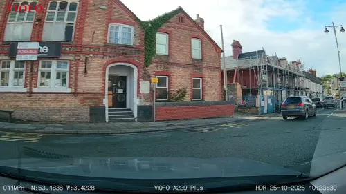




1 more on the map.
Parks, trails and playgrounds6



Restaurants and cafes38
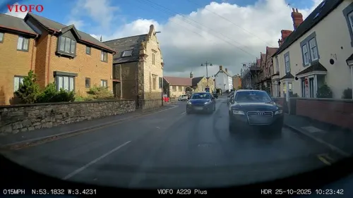





26 more on the map.
History
Denbigh anciently formed part of the cantref of Rhufoniog. For much of its history, Rhufoniog was subordinate to the Kingdom of Gwynedd, but it also spent periods under English control during the 12th and 13th centuries. By the 13th century, Denbigh was the main town of Rhufoniog. In 1284, following the Conquest of Wales by Edward I, Rhufoniog was made part of a new marcher lordship called Denbigh or Denbighland, which Edward initially granted to Henry de Lacy, Earl of Lincoln.
As part of his campaign to take and retain control of the area, Edward I decided to fortify Denbigh, ordering the construction of Denbigh Castle and town walls, which were begun in 1282. The Burgess Gate, whose twin towers adorn the symbol on Denbigh's civic seal, was once the main entrance into the town. The town was involved in the revolt of Madog ap Llywelyn in 1294–1295; the castle was captured in the autumn and, on 11 November 1294, a relieving force was defeated by the Welsh rebels. The town was recaptured by Edward I in December. Denbigh was also burnt in 1400 during the revolt of Owain Glyndŵr.
During the Wars of the Roses (1455–1487), the town within the walls was largely destroyed. The focus of the settlement then shifted to a site immediately outside the old town walls to the north-east, centred on a market place along High Street.
Read more of the history
In 1536, the new county of Denbighshire was created under the Laws in Wales Act 1535, comprising the old lordship of Denbighland plus other territories. Denbigh was declared to be the county town, with the county's courts directed to be held alternately at Denbigh and Wrexham. The County Hall (now the library) was built in 1572 to serve as the town's main public building, functioning as a market hall, town hall and courthouse for when the county's courts sat in Denbigh.
Leicester's Church is an unfinished church. In 1579, Robert Dudley, 1st Earl of Leicester, who was also Baron of Denbigh, planned for there to be a cathedral. His intention was to move the status of city from neighbouring St Asaph. The project ran out of money and, when Robert Dudley died, it was left as ruins; it is now in the care of Cadw.
In 1643, during the English Civil War, Denbigh became a refuge for a Royalist garrison. Surrendering in 1646, the castle and town walls eventually fell into ruin.
The town grew around the textile industry in the 1600s, hosting specialist glovers, weavers, smiths, shoemakers, saddlers, furriers and tanners. Denbigh has been an important location for the agricultural industry throughout its history.
Denbigh railway station once served the town on the former London and North Western Railway, later part of the London, Midland and Scottish Railway.
It was a junction for the Vale of Clwyd Railway line, which lead north to St Asaph and Rhyl, and the Mold and Denbigh Junction Railway. The former was closed in 1955, leaving Denbigh on a lengthy branch running from Chester to Ruthin, via Mold, which subsequently closed in 1962. A southern continuation beyond Ruthin, linking up with the Great Western Railway at Corwen, had closed in 1952.
The station site has been redeveloped since into a small retail park; however, remains of a platform can still be seen beside the road.
The North Wales Hospital was established in the 1840s, caring for people with psychiatric illnesses. The hospital became the town's largest employer. The hospital closed in 1995 and has since fallen into disrepair. In October 2008, a special series of episodes of Most Haunted, titled Village of the Damned, was broadcast from the North Wales Hospital over 7 days. As of October 2018, the derelict building has passed into the ownership of Denbighshire County Council.
Denbigh had a town cinema on Love Lane. It opened as the Scala in 1928, before being re-branded as the Wedgwood Cinema in the late 1970s. It closed in October 1980. In 1995, Peter Moore reopened the cinema for a short period before being arrested and convicted of the murder of four men. The video rental store closed and the building is now in ruin awaiting redevelopment. Denbigh has no permanent cinema, though Denbigh Film Club regularly operates in Theatr Twm o'r Nant.
From the History section of Denbigh on Wikipedia, under CC BY-SA 4.0.
Notable people from Denbigh
 Henry Morton StanleyBritish journalist and explorer (1841–1904)Photo: Creator:J. Russel & Sons, Public domain
 Shefali ChowdhuryBritish actressPhoto: Shefali Chowdhury, CC BY-SA 3.0
 Rhoda BroughtonWelsh novelist (1840–1920)Photo: Helen C. Black Photograph by..., Public domain
 Amber DaviesBritish actress and television personalityPhoto: JaceMerlyn, CC BY-SA 4.0
 Thomas GeeBritish journalist (1815–1898)Photo: Unknown author Unknown author, Public domain
 Geraint JarmanWelsh musician and poet (1950-2025)Photo: GanMed64, CC BY 2.0
 William WilliamsWelsh poet and literary critic ("Caledfryn")Photo: unknown; scanned by myself, Public domain
 Humphrey LlwydWelsh cartographer, politician, author and antiquary (1527–1568)Photo: Unknown author Unknown author, Public domain
- Eleanor Mary ReidBritish palaeobotanist (1860-1953)
- Alice de Lacy, 3rd Countess of Lincoln4th Countess of Lincoln; born in Wales
- Ieuan Wyn JonesWelsh politician, leader of Plaid Cymru; MP 1987-2001; Assembly Member 1999-2013 (born 1949)
- Eric GriffithsBritish musician (1940-2005)
Born in Denbigh, according to Wikidata (CC0). Each name links to its Wikipedia article.
Where to stay3
Churches and places of worship19
Shopping12
Gas and EV charging1
Schools, colleges and libraries10
Healthcare4
Map of Denbigh
108 places. The map loads OpenStreetMap tiles when you open it.
Getting there and nearby towns
Hawarden Airport (CEG) is the nearest airport with scheduled flights listed in OpenStreetMap, 19 miles away.
- Saint Asaph 5 mi north, about 9 min by car
- Ruthin 6 mi southeast, about 10 min by car
- Rhuddlan 8 mi north, about 13 min by car
- Dyserth 8 mi north, about 13 min by car
- Rhyl 10 mi north, about 16 min by car
- Abergele 10 mi northwest, about 16 min by car
- Holywell 10 mi northeast, about 16 min by car
- Prestatyn 11 mi north, about 17 min by car
- Mold 11 mi east, about 18 min by car
- Flint 13 mi east, about 20 min by car
Drive times are estimates from straight-line distance, not routes.
Towns near Denbigh


Keep exploring
Local news
Headlines from INDB.
Reviews, tips and questions
Loading what members have shared...
Sources and licences
- GeoNames (CC BY 4.0): population, coordinates, regions and time zone
- Mapillary (see each image): photos
- OpenStreetMap contributors (ODbL 1.0): places, airports, map data
- Wikidata (CC0 1.0): elevation, founding date, time zone, website, landmarks and historic places
- Wikimedia Commons (see each image): photos
- Wikipedia (CC BY-SA 4.0): overview and history text
Photo credits
- Former Coop, Denbigh, Tyssil, CC BY-SA 4.0
- Great Hall, Howell's School, Denbigh (8199561927), Richard Ash, CC BY-SA 2.0
- Ysgol Howell's, Dinbych - Howell's School, Denbigh - today known as Myddelton College, Cymru (Wales) 03, Llywelyn2000, CC BY-SA 4.0
- Castell Dinbych, Dinbych, Sir Ddinbych (Denbigh Castle, Wales) - Grade 1 listed 15, Llywelyn2000, CC BY-SA 4.0
- Eglwys y Drindod Sanctaidd - Holy Trinity Church, Trefnant, Denbighshire, Wales 06, Llywelyn2000, CC BY-SA 4.0
- St Dyfnog Llanrhaeadr-yng-Nghinmeirch ger Rhuthun Sir Ddinbych 02, Llywelyn2000, CC BY-SA 3.0
- Tower of St Hilary's Church, Denbigh (8199394743), Richard Ash, CC BY-SA 2.0
- Awyrlun o Eglwys Dewi Sant, Dinbych - modern name Leicester's Church, Denbigh, Wales - 2024 06, Llywelyn2000, CC BY-SA 4.0
- Yr Eglwys Wen Dinbych St Marcella 07, Llywelyn2000, CC BY-SA 3.0
- DenbighFriary, JohnArmagh, Public domain
- Eglwys y Santes Fair Pwll y Grawys 03, Llywelyn2000, CC BY-SA 3.0
- Ysgol Howell's, Dinbych - Howell's School, Denbigh - today known as Myddelton College, Cymru (Wales) 01, Llywelyn2000, CC BY-SA 4.0
- Y Llew Aur - The Golden Lion, Dinbych, Denbigh, Cymru, Wales 03, Llywelyn2000, CC BY-SA 4.0
- Denbigh - Siop Clwyd - 20200809123725, GingerBeast, CC BY-SA 4.0
- Theatr Twm o'r Nant, Dinbych (Denbigh), Cymru 2024 09, Llywelyn2000, CC BY-SA 4.0
- Denbigh War Memorial, Bill Boaden, CC BY-SA 2.0
- Denbigh - The Plough Inn - 20200809123927, GingerBeast, CC BY-SA 4.0
- Leicester's Church from Leicester Terrace, Tim Heaton, CC BY-SA 2.0
- The Burgess Gate, Town Walls of Denbigh, North Wales, kitmasterbloke, CC BY 2.0
- Street-level photo, RyanBush, CC BY-SA 4.0
- Street-level photo, RyanBush, CC BY-SA 4.0


Page built November 10, 2026. Spotted a mistake? Tell us or suggest a place.