


Saint Asaph, United Kingdom
Saint Asaph is a town of 3,355 people in Wales, United Kingdom.
Why visit Saint Asaph
Townapedia lists 10 museums and landmarks, 1 park or trail, 20 places to eat, 4 places to stay and 2 attractions in and around town.
Highlights include Dyserth Waterfall, Bontnewydd Palaeolithic site and Ffynnon Beuno and Cae Gwyn Caves.
Weather in Saint Asaph
Forecast from MET Norway (CC BY 4.0). Full forecast
About Saint Asaph
St Asaph (; Welsh: Llanelwy [ɬanˈɛlʊɨ̯] "church on the Elwy") is a cathedral city and community on the River Elwy in Denbighshire, Wales. At the 2021 census the community had a population of 3,485, making it the second-smallest city in the United Kingdom in terms of population. It was historically in Flintshire.
From the Wikipedia article St Asaph (this version), under CC BY-SA 4.0.
Travel tips from other travellers: Saint Asaph on Wikivoyage (CC BY-SA 4.0).
Photos of Saint Asaph


Things to do2

Dyserth Waterfall
Waterfall · 3.2 mi
Waterfall in Denbighshire, Wales

Museums and landmarks10

Bontnewydd Palaeolithic site
Monument and historic site · 2.5 mi
Cave and archaeological site in Wales

Ffynnon Beuno and Cae Gwyn Caves
Monument and historic site · 3.3 mi
Site of Special Scientific Interest in Wales

Rhuddlan Castle
Monument and historic site · 2.3 mi
Castle in Rhuddlan, Denbighshire, Wales


The Old Bishop's Palace
Monument and historic site
The Bishop's Palace, St Asaph. A stone-built, two storey palace, the E, garden front of which is of 1791, whilst the W, entrance front...
Parks, trails and playgrounds1

Restaurants and cafes20
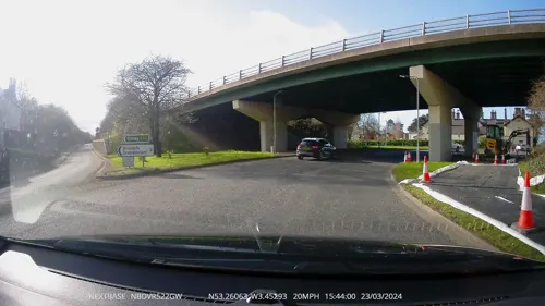
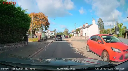
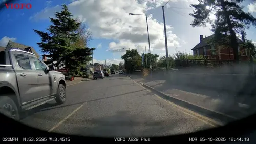


8 more on the map.
History
The earliest inhabitants of the vale of Elwy lived at the nearby Paleolithic site of Pontnewydd (Bontnewydd), which was excavated from 1978 by a team from the University of Wales, led by Stephen Aldhouse Green. Teeth and part of a jawbone excavated in 1981 were dated to 225,000 years ago. This site is the most north-western site in Eurasia for remains of early hominids and is considered of international importance. Based on the morphology and age of the teeth, particularly the evidence of taurodontism, the teeth are believed to belong to a group of Neanderthals who hunted game in the vale of Elwy in an interglacial period.
Later some historians postulate that the Roman fort of Varae sat on the site of the cathedral. However, the city is believed to have developed around a sixth-century Celtic monastery founded by Saint Kentigern, and is now home to the small 14th century St Asaph Cathedral. This is dedicated to Saint Asaph (also spelt in Welsh as Asaff), its second bishop.
The cathedral has had a chequered history. In the 13th century, the troops of Edward I of England burnt the cathedral almost to the ground, and in 1402 Owain Glyndŵr's troops went on the rampage, causing severe damage to the furnishings and fittings. Two hundred and fifty years later, during the Commonwealth, the building was used to house farm animals: pigs, cattle and horses.
From the History section of St Asaph on Wikipedia, under CC BY-SA 4.0.
Notable people from Saint Asaph
 Neil TaylorWelsh association football player (born 1989)Photo: Steindy ( talk ) 16:11, 10 November..., CC BY-SA 3.0
 Greg DaviesWelsh stand-up comedian and actorPhoto: PhilipRomanoPhoto, CC BY 4.0
 Chris MaxwellWelsh association football playerPhoto: Preston North End F.C., CC0
 James DaviesBritish politician (born 1980)Photo: David Woolfall, CC BY 3.0
 Mark WebsterWelsh darts playerPhoto: Sandro Halank, Wikimedia Commons, CC BY-SA 4.0
 Carl SargeantWelsh politician (1968-2017)Photo: National Assembly for Wales from Wales, CC BY 2.0
- Ian RushWelsh association football player and manager (born 1961)
- Ched EvansWelsh association football player
- Victoria ThornleyBritish rower
- Richard Ian CoxCanadian actor
- Julian HodgsonBritish chess player
- Craig MorganWelsh footballer (born 1985)
Born in Saint Asaph, according to Wikidata (CC0). Each name links to its Wikipedia article.
Where to stay4
Churches and places of worship9
Shopping2
Gas and EV charging1
Schools, colleges and libraries5
Healthcare3
Map of Saint Asaph
57 places. The map loads OpenStreetMap tiles when you open it.
Getting there and nearby towns
Hawarden Airport (CEG) is the nearest airport with scheduled flights listed in OpenStreetMap, 21 miles away.
- Rhyl 5 mi northwest, about 7 min by car
- Prestatyn 6 mi north, about 9 min by car
- Abergele 6 mi west, about 10 min by car
- Colwyn Bay 12 mi west, about 19 min by car
- Flint 13 mi east, about 21 min by car
- West Kirby 13 mi northeast, about 22 min by car
- Mold 14 mi southeast, about 23 min by car
- Hoylake 14 mi northeast, about 23 min by car
- Heswall 15 mi east, about 24 min by car
- Buckley 16 mi southeast, about 26 min by car
Drive times are estimates from straight-line distance, not routes.
Towns near Saint Asaph


Keep exploring
Local news
Headlines from INDB.
Reviews, tips and questions
Loading what members have shared...
Sources and licences
- GeoNames (CC BY 4.0): population, coordinates, regions and time zone
- Mapillary (see each image): photos
- OpenStreetMap contributors (ODbL 1.0): places, airports, map data
- Wikidata (CC0 1.0): elevation, founding date, time zone, website, landmarks and historic places
- Wikimedia Commons (see each image): photos
- Wikipedia (CC BY-SA 4.0): overview and history text
Photo credits
- Y Gadeirlan Llanelwy (cefndir morfa Rhuddlan - Bryniau Clwyd) - St Asaph with Bryniau Clwyd AONB in the background 06, Llywelyn2000, CC BY-SA 4.0
- Rhaeadr Dyserth Waterfall, Sir Ddinbych, Wales - Bryniau Clwyd AONB 13, Llywelyn2000, CC BY-SA 4.0
- Ogof Bontnewydd Cave Sir Ddinbych 11, Llywelyn2000, CC BY-SA 3.0
- Aerial images of Cae Du and Ffynnon Beuno Caves, Tremeirchion, Wales; 2022 17, Llywelyn2000, CC BY-SA 4.0
- Rhuddlan Castle, May 2012, Julie Anne Workman, CC BY-SA 3.0
- Eglwys y Drindod Sanctaidd - Holy Trinity Church, Trefnant, Denbighshire, Wales 06, Llywelyn2000, CC BY-SA 4.0
- Eglwys Farmor Bodelwyddan, Sir Ddinbych - The Marble Church of bodelwyddan, Denbighshire, Wales 08, Llywelyn2000, CC BY-SA 4.0
- Housedimcars, David Birchall, Public domain
- Eglwys Gadeiriol Llanelwy - St Asaph Cathedral, Mike Searle, CC BY-SA 2.0
- St Asaph Cathedral from the north-west, DeFacto, CC BY-SA 4.0
- Sant Cyndyrn a Sant Asaff - St. Kentigern & St. Asaph Parish Church, Llanelwy, Sir Ddinbych, Cymru (Wales) 36, Llywelyn2000, CC BY-SA 4.0
- Sant Cyndyrn a Sant Asaff - St. Kentigern & St. Asaph Parish Church, Llanelwy, Sir Ddinbych, Cymru (Wales) 57, Llywelyn2000, CC BY-SA 4.0
- Sant Cyndyrn a Sant Asaff - St. Kentigern & St. Asaph Parish Church, Llanelwy, Sir Ddinbych, Cymru (Wales) 22, Llywelyn2000, CC BY-SA 4.0
- Sant Cyndyrn a Sant Asaff - St. Kentigern & St. Asaph Parish Church, Llanelwy, Sir Ddinbych, Cymru (Wales) 39, Llywelyn2000, CC BY-SA 4.0
- Sant Cyndyrn a Sant Asaff - St. Kentigern & St. Asaph Parish Church, Llanelwy, Sir Ddinbych, Cymru (Wales) 37, Llywelyn2000, CC BY-SA 4.0
- Sant Cyndyrn a Sant Asaff - St. Kentigern & St. Asaph Parish Church, Llanelwy, Sir Ddinbych, Cymru (Wales) 46, Llywelyn2000, CC BY-SA 4.0
- Sant Cyndyrn a Sant Asaff - St. Kentigern & St. Asaph Parish Church, Llanelwy, Sir Ddinbych, Cymru (Wales) 53, Llywelyn2000, CC BY-SA 4.0
- Sant Cyndyrn a Sant Asaff - St. Kentigern & St. Asaph Parish Church, Llanelwy, Sir Ddinbych, Cymru (Wales) 42, Llywelyn2000, CC BY-SA 4.0
- Sant Cyndyrn a Sant Asaff - St. Kentigern & St. Asaph Parish Church, Llanelwy, Sir Ddinbych, Cymru (Wales) 59, Llywelyn2000, CC BY-SA 4.0
- Sant Cyndyrn a Sant Asaff - St. Kentigern & St. Asaph Parish Church, Llanelwy, Sir Ddinbych, Cymru (Wales) 08, Llywelyn2000, CC BY-SA 4.0
- Sant Cyndyrn a Sant Asaff - St. Kentigern & St. Asaph Parish Church, Llanelwy, Sir Ddinbych, Cymru (Wales) 63, Llywelyn2000, CC BY-SA 4.0
- Sant Cyndyrn a Sant Asaff - St. Kentigern & St. Asaph Parish Church, Llanelwy, Sir Ddinbych, Cymru (Wales) 69, Llywelyn2000, CC BY-SA 4.0
- Sant Cyndyrn a Sant Asaff - St. Kentigern & St. Asaph Parish Church, Llanelwy, Sir Ddinbych, Cymru (Wales) 30, Llywelyn2000, CC BY-SA 4.0
- Sant Cyndyrn a Sant Asaff - St. Kentigern & St. Asaph Parish Church, Llanelwy, Sir Ddinbych, Cymru (Wales) 44, Llywelyn2000, CC BY-SA 4.0
- Sant Cyndyrn a Sant Asaff - St. Kentigern & St. Asaph Parish Church, Llanelwy, Sir Ddinbych, Cymru (Wales) 34, Llywelyn2000, CC BY-SA 4.0
- Sant Cyndyrn a Sant Asaff - St. Kentigern & St. Asaph Parish Church, Llanelwy, Sir Ddinbych, Cymru (Wales) 55, Llywelyn2000, CC BY-SA 4.0
- Sant Cyndyrn a Sant Asaff - St. Kentigern & St. Asaph Parish Church, Llanelwy, Sir Ddinbych, Cymru (Wales) 21, Llywelyn2000, CC BY-SA 4.0
- Sant Cyndyrn a Sant Asaff - St. Kentigern & St. Asaph Parish Church, Llanelwy, Sir Ddinbych, Cymru (Wales) 35, Llywelyn2000, CC BY-SA 4.0
- Sant Cyndyrn a Sant Asaff - St. Kentigern & St. Asaph Parish Church, Llanelwy, Sir Ddinbych, Cymru (Wales) 31, Llywelyn2000, CC BY-SA 4.0
- Sant Cyndyrn a Sant Asaff - St. Kentigern & St. Asaph Parish Church, Llanelwy, Sir Ddinbych, Cymru (Wales) 01, Llywelyn2000, CC BY-SA 4.0
- Sant Cyndyrn a Sant Asaff - St. Kentigern & St. Asaph Parish Church, Llanelwy, Sir Ddinbych, Cymru (Wales) 05, Llywelyn2000, CC BY-SA 4.0
- Sant Cyndyrn a Sant Asaff - St. Kentigern & St. Asaph Parish Church, Llanelwy, Sir Ddinbych, Cymru (Wales) 11, Llywelyn2000, CC BY-SA 4.0
- Sant Cyndyrn a Sant Asaff - St. Kentigern & St. Asaph Parish Church, Llanelwy, Sir Ddinbych, Cymru (Wales) 50, Llywelyn2000, CC BY-SA 4.0
- Sant Cyndyrn a Sant Asaff - St. Kentigern & St. Asaph Parish Church, Llanelwy, Sir Ddinbych, Cymru (Wales) 67, Llywelyn2000, CC BY-SA 4.0
- Sant Cyndyrn a Sant Asaff - St. Kentigern & St. Asaph Parish Church, Llanelwy, Sir Ddinbych, Cymru (Wales) 52, Llywelyn2000, CC BY-SA 4.0
- Sant Cyndyrn a Sant Asaff - St. Kentigern & St. Asaph Parish Church, Llanelwy, Sir Ddinbych, Cymru (Wales) 61, Llywelyn2000, CC BY-SA 4.0
- Sant Cyndyrn a Sant Asaff - St. Kentigern & St. Asaph Parish Church, Llanelwy, Sir Ddinbych, Cymru (Wales) 17, Llywelyn2000, CC BY-SA 4.0
- Sant Cyndyrn a Sant Asaff - St. Kentigern & St. Asaph Parish Church, Llanelwy, Sir Ddinbych, Cymru (Wales) 64, Llywelyn2000, CC BY-SA 4.0
- Sant Cyndyrn a Sant Asaff - St. Kentigern & St. Asaph Parish Church, Llanelwy, Sir Ddinbych, Cymru (Wales) 70, Llywelyn2000, CC BY-SA 4.0
- Sant Cyndyrn a Sant Asaff - St. Kentigern & St. Asaph Parish Church, Llanelwy, Sir Ddinbych, Cymru (Wales) 19, Llywelyn2000, CC BY-SA 4.0
- Gabriel Goodman ar Gofeb Llanelwy, Sir Ddinbych Bible Translators' Memorial St Asaph, Wales 01, Llywelyn2000, CC BY-SA 4.0
- Street-level photo, RyanBush, CC BY-SA 4.0
- Street-level photo, RyanBush, CC BY-SA 4.0
- Street-level photo, RyanBush, CC BY-SA 4.0
- Street-level photo, RyanBush, CC BY-SA 4.0
- Street-level photo, RyanBush, CC BY-SA 4.0
- Street-level photo, RyanBush, CC BY-SA 4.0


Page built November 10, 2026. Spotted a mistake? Tell us or suggest a place.