


Why visit Flint
Townapedia lists 13 museums and landmarks, 9 parks and trails, 29 places to eat, 3 places to stay and 1 attraction in and around town.
Highlights include Flintshire Bridge, Flint Castle, Basingwerk Abbey and Burton Mere Wetlands.
Weather in Flint
Forecast from MET Norway (CC BY 4.0). Full forecast
About Flint
Flint (Welsh: Y Fflint) is a town and community in Flintshire, Wales, lying on the estuary of the River Dee. It is the former county town of Flintshire. According to the 2011 Census, the population of the community of Flint was 12,953, increasing to 13,732 at the 2021 census. The urban area including Holywell and Bagillt had a population of 26,442.
From the Wikipedia article Flint, Flintshire (this version), under CC BY-SA 4.0.
Travel tips from other travellers: Flint on Wikivoyage (CC BY-SA 4.0).
Photos of Flint


Things to do1

Museums and landmarks13

Flint Castle
Monument and historic site · 0.5 mi
Grade I listed castle in Flint, Wales

Basingwerk Abbey
Monument and historic site · 4.3 mi
Ruin of an abbey near Holywell, Flintshire, Wales
Celyn Wood Miniature Railway
Monument and historic site · 2.3 mi
Miniature railways is open most fine Sundays April-October
Apr-Oct Su 11:00-15:00
1 more on the map.
Parks, trails and playgrounds9

Burton Mere Wetlands
Park · 3.8 mi
Nature reserve in Cheshire, England, UK

Greenfield Valley Heritage Park
Park · 4.3 mi
Country park in Flintshire, Wales





Restaurants and cafes29
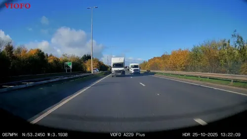



Caffi'r Hen Llys / The Old Court House Cafe
Cafe
34 Heol-yr-Eglwys / Church Street, Flint
17 more on the map.
History
The name refers to the stony platform on which the castle was built, and was first recorded in 1277 in the French form le Chaylou (cf modern French caillou, "gravel").
Edward I began to build Flint Castle in 1277, during his campaign to conquer Wales. Both castle and town were attacked by the forces of Madog ap Llywelyn during the revolt of 1294–95; the defenders of the town burnt it in order to deny its use to the Welsh.
Richard II was handed over to his enemy, and cousin, Henry Bolingbroke in the castle in 1399. As a consequence, it is the setting for Act III, Scene III of the Shakespeare play Richard II. The castle was the first of Edward I's 'iron ring' of royal castles to be built in Wales, and the design served as the basis for larger castles such as Harlech Castle and Rhuddlan Castle. Owain Glyndŵr unsuccessfully assaulted it at the commencement of his revolt in 1400.
The town did not have a wall, but a protective earthen and wooden palisaded ditch. The outline of this remained visible in the pattern of streets until the mid-1960s, and the medieval boundary can still be traced now. This can be seen in John Speed's map of Flintshire.
Flint Town Hall, the home of Flint Town Council, was erected in 1840. Until 1935 the Constable of Flint Castle served ex officio as Mayor of Flint.
Read more of the history
In 1969 Flint hosted the National Eisteddfod, and so the town has a circle of Gorsedd stones in the field adjacent to Gwynedd County Primary School. In July 2006 the stones were centre stage in the National Eisteddfod Proclamation Ceremony which formally announced Mold as the 2007 host town of the event. The Urdd National Eisteddfod was held in Flint in 2016.
From the History section of Flint, Flintshire on Wikipedia, under CC BY-SA 4.0.
More about Flint
Geography
Flint is located in north-east Wales, adjoining the estuary of the River Dee, to the north of the town of Mold. Across the estuary, the Wirral can be seen from Flint and views to the south of the town include Halkyn Mountain. As the crow flies, Flint is located less than 12 miles from the English urban area of Liverpool, and even closer to its metro area. However, the two estuaries in between make the distance travelling on land almost twice as long.
Arts and culture
In 2001 only 18% of the local population identified as Welsh, although this census controversially had no "Welsh" tick box.
In the census of 2011, 57.1% stated they had Welsh, or Welsh and other combined, identity. Many people in Flint have some knowledge of the Welsh language, although competence varies. Implementation of the European Union's freedom of movement provisions has led to a noticeable increase in the numbers of Polish-language speakers in Flint. Several retail businesses display information in Polish as well as in English and Welsh and the town has a number of Polish shops specialising in Polish products.
The Flint accent is frequently misidentified with that of Liverpool, although it has arisen in fact as a unique blending of the speech patterns of the area's Welsh speakers, earlier Irish settlers, and the residents of nearby Cheshire, Wirral, and the wider Merseyside region.
Education
The town has three high schools: St Richard Gwyn Catholic High School, Flint High School and Ysgol Maes Hyfryd. Primary schools in Flint include the Gwynedd School, Cornist Park School, Ysgol Croes Atti (Welsh medium), St Mary's Catholic Primary School and Ysgol Pen Coch.
From the Wikipedia article Flint, Flintshire, under CC BY-SA 4.0.
Notable people from Flint
 Ian Puleston-DaviesWelsh actorPhoto: Simon Richards, CC BY 3.0
 P. Ellis EytonMP for Flint Boroughs from 1874 to 1878Photo: Llywelyn2000, CC BY-SA 4.0
- Ian RushWelsh association football player and manager (born 1961)
- Ron HewittWelsh footballer (1928-2001)
- Brian GodfreyWelsh footballer and manager (1940-2010)
- Allan JonesFootballer born 1940
- William JacksonWelsh footballer, born 1876
- Andy HoldenWelsh footballer (born 1962)
- Neville PowellWelsh football player and manager (born 1963)
- Thomas BartleyWelsh footballer (1874-1951)
- Harold LloydFootballer (1920-1984)
- Trefor Owenassociation football player (1933-2001)
Born in Flint, according to Wikidata (CC0). Each name links to its Wikipedia article.
Where to stay3
Churches and places of worship19
Shopping7
Gas and EV charging3
Schools, colleges and libraries26
Healthcare3
Map of Flint
113 places. The map loads OpenStreetMap tiles when you open it.
Getting there and nearby towns
Hawarden Airport (CEG) is the nearest airport with scheduled flights listed in OpenStreetMap, 8 miles away.
- Neston 4 mi northeast, about 7 min by car
- Mold 5 mi south, about 9 min by car
- Heswall 6 mi north, about 9 min by car
- Hawarden 6 mi southeast, about 10 min by car
- Bebington 9 mi northeast, about 14 min by car
- Blacon 9 mi east, about 14 min by car
- Prenton 9 mi north, about 15 min by car
- Ellesmere Port Town 10 mi east, about 16 min by car
- Bromborough 10 mi northeast, about 15 min by car
- Birkenhead 11 mi northeast, about 18 min by car
Drive times are estimates from straight-line distance, not routes.
Towns near Flint


Keep exploring
Local news
Headlines from INDB.
Reviews, tips and questions
Loading what members have shared...
Sources and licences
- GeoNames (CC BY 4.0): population, coordinates, regions and time zone
- Mapillary (see each image): photos
- OpenStreetMap contributors (ODbL 1.0): places, airports, map data
- Wikidata (CC0 1.0): elevation, founding date, time zone, website, landmarks and historic places
- Wikimedia Commons (see each image): photos
- Wikipedia (CC BY-SA 4.0): overview and history text
Photo credits
- Benkid77 Church Street, Flint 290609, Rept0n1x, CC BY-SA 3.0
- YFflintLB04, Lesbardd, CC BY-SA 3.0
- YFflintLB18, Lesbardd, CC BY-SA 3.0
- YFflintLB09, Lesbardd, CC BY-SA 3.0
- YFflintLB12, Lesbardd, CC BY-SA 3.0
- YFflintLB07, Lesbardd, CC BY-SA 3.0
- YFflintLB13, Lesbardd, CC BY-SA 3.0
- YFflintLB11, Lesbardd, CC BY-SA 3.0
- YFflintLB08, Lesbardd, CC BY-SA 3.0
- YFflintLB05, Lesbardd, CC BY-SA 3.0
- YFflintLB17, Lesbardd, CC BY-SA 3.0
- YFflintLB03, Lesbardd, CC BY-SA 3.0
- YFflintLB19, Lesbardd, CC BY-SA 3.0
- YFflintLB14, Lesbardd, CC BY-SA 3.0
- YFflintLB10, Lesbardd, CC BY-SA 3.0
- YFflintLB16, Lesbardd, CC BY-SA 3.0
- YFflintLB01, Lesbardd, CC BY-SA 3.0
- YFflintLB02, Lesbardd, CC BY-SA 3.0
- YFflintLB06, Lesbardd, CC BY-SA 3.0
- YFflintLB15, Lesbardd, CC BY-SA 3.0
- Proclaiming Fflint National Eisteddfod (1526878), Geoff Charles, CC BY-SA 4.0
- Proclaiming Fflint National Eisteddfod (1526889), Geoff Charles, CC BY-SA 4.0
- Proclaiming Fflint National Eisteddfod (1526894), Geoff Charles, CC BY-SA 4.0
- Proclaiming Fflint National Eisteddfod (1526891), Geoff Charles, CC BY-SA 4.0
- Proclaiming Fflint National Eisteddfod (1526892), Geoff Charles, CC BY-SA 4.0
- Proclaiming Fflint National Eisteddfod (1526845), Geoff Charles, CC BY-SA 4.0
- Proclaiming Fflint National Eisteddfod (1526884), Geoff Charles, CC BY-SA 4.0
- Proclaiming Fflint National Eisteddfod (1526820), Geoff Charles, CC BY-SA 4.0
- Proclaiming Fflint National Eisteddfod (1526818), Geoff Charles, CC BY-SA 4.0
- Proclaiming Fflint National Eisteddfod (1526899), Geoff Charles, CC BY-SA 4.0
- InnerMarshFarm, Tigershrike, Public domain
- Greenfield Valley Heritage Park (27783078700), Alex Liivet from Chester, United Kingdom, CC0
- Bridge over Wepre Brook, Flintshire, Rept0n1x, CC BY-SA 2.0
- Church Of St Eurgain And St Peter, Northop, Pete Rigby, CC BY-SA 4.0
- Helygain - Eglwys y Santes Fair - St Mary's Church, Halkyn, Flintshire, Wales 38, Llywelyn2000, CC BY-SA 4.0
- St Davids Church Connah's Quay, Steventattum, CC BY 3.0
- Connahs Quay St Marks Church, Phil Williams, CC BY-SA 2.0
- St Mary's and St Helen's Church, Neston 2018-3, Rodhullandemu, CC BY-SA 4.0
- St Michael's Church, Brynford, Andrew, CC BY 2.0
- Eglwys Gatholig y Santes Gwenffrewi - St Winefride's Catholic Church, Holywell, Treffynnon, Wales 77, Llywelyn2000, CC BY-SA 4.0
- St Winefride's Well, Wales - Ffynnon Gwenffrewi, Treffynnon, Sir y Fflint 40, Llywelyn2000, CC BY-SA 4.0
- Flint - library and flats - Jul 2025, Dominic Nelson, CC BY-SA 4.0
- Flint - Ship Hotel pub - Jul 2025, Dominic Nelson, CC BY-SA 4.0
- Cae-y-Castell small stands, Jonny Keen, CC BY-SA 4.0
- Flintshire Bridge aerial view, DronePics.Wales, CC BY 4.0
- Street-level photo, RyanBush, CC BY-SA 4.0


Page built November 10, 2026. Spotted a mistake? Tell us or suggest a place.