


Glenrothes, United Kingdom
Glenrothes is a town of 38,360 people in Scotland, United Kingdom.
Why visit Glenrothes
Townapedia lists 29 museums and landmarks, 51 parks and trails, 90 places to eat, 11 places to stay and 8 attractions in and around town.
Highlights include Rothes Halls, The River Leven Suspension Bridge, Balfarg Henge and Balbirnie Stone Circle.
Weather in Glenrothes
Forecast from MET Norway (CC BY 4.0). Full forecast
About Glenrothes
Glenrothes ( glen-ROTH-iss; Scots: Glenrothes; Scottish Gaelic: Gleann Rathais, pronounced [kʲlən̪ˠˈrˠahɪʃ]) is a town situated in the heart of Fife, in east-central Scotland. It is the administrative capital of Fife, containing the headquarters of both Fife Council and Police Scotland Fife Division and is a major service and employment centre within the area. In the 2022 census, the town had a resident population of 37,468, making it the third-largest settlement in Fife and the 18th most populous locality in Scotland.
From the Wikipedia article Glenrothes (this version), under CC BY-SA 4.0.
Travel tips from other travellers: Glenrothes on Wikivoyage (CC BY-SA 4.0).
Photos of Glenrothes


Things to do8


The River Leven Suspension Bridge
Bridge · 0.9 mi
Bridge in Glenrothes, Fife, Scotland

Museums and landmarks29

Balfarg Henge
Monument and historic site · 1.5 mi
20m wide henge with only two stones left
The Henge
24/7

Balbirnie Stone Circle
Monument and historic site · 1.5 mi
Archaeological site in Fife, Scotland

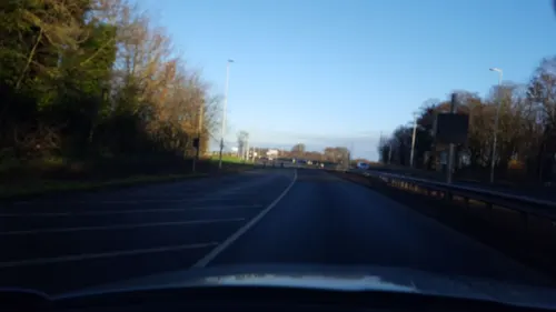
Balfarg Riding School enclosure
Monument and historic site · 1.6 mi
A reconstructed site interpreted as a mortuary enclosure on the site of Balfarg Riding School.


Balbirnie stone circle (original site)
Monument and historic site · 1.5 mi
Moved in 1970s to SE during road widening
17 more on the map.
Parks, trails and playgrounds51




39 more on the map.
Restaurants and cafes90
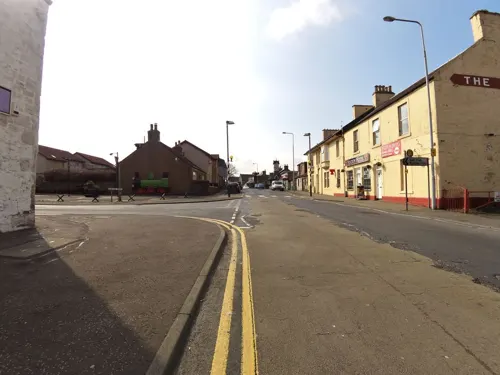
Debbie's Takeaway
Bakery · 2.2 mi
112 Main Street, Thornton
Mo-Fr 06:00-14:00; Sa 06:00-12:30
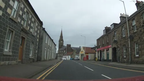
Mee Kee
Restaurant · Chinese · 1.5 mi
121 High Street, Glenrothes
Mo,We-Sa 16:00-22:30; Tu off
Rara Tal
Restaurant · Indian
Mo-Th 12:00-15:00,16:30-21:00; Fr,Sa 12:00-21:30; Su 15:00-21:00


Costa
Cafe · Coffee Shop
38 Lyon Way
Mo-Fr 08:00-17:30; Sa 08:00-17:00; Su 09:30-16:30

Reya Tandoori
Restaurant · Indian · 1.4 mi
95 High Street, Glenrothes
Mo-Th 12:00-14:00,17:00-22:30; Fr,Sa 12:00-15:00,17:00-23:00; Su...

Balgonie Arms
Bar and pub · 1.9 mi
42 Main Street
Th 16:00-23:00, Fr 12:00-24:00, Sa 11:30-24:00, Su 12:00-23:00
78 more on the map.
History
The decision on the town's name was taken by the Fife Planning Committee which met in Cupar on 4 July 1947. Twelve names were considered for the new town prior to its formal designation. From the list of names Glenrothes and Westwood tied with five ballot votes each. Cadham, Drostain, Thaines and Woodside each received a single vote. The name Westwood was proposed by Provost John Drummond, after Joseph Westwood, who was a strong advocate for the delivery of the new town, cut his political teeth in Fife and was Secretary of State for Scotland at the time. Glenrothes carried the day by eight votes to six on a second ballot despite the plea to recognise Westwood's “services to the country”. In a tragic twist of fate Joseph Westwood died 18 days later in a car accident.
The name Rothes comes from the association with the Earl of Rothes, of the Leslie family. This family historically owned much of the land on which Glenrothes has been built, residing in Leslie House and also giving the family name to the adjacent village of Leslie in 1455; the village was previously known as 'Fettykill' or 'Fythkill' (Fiodh Chill in Scottish Gaelic). "Glen" (from the Scottish Gaelic word gleann meaning valley) was added to prevent confusion with Rothes in Moray, and to reflect the location of the town within the River Leven valley.
Read more of the history
The different areas ("precincts") of Glenrothes have been named after the hamlets that were already established in the area (e.g. Cadham, Woodside), the farms which formally occupied the land (e.g. Caskieberran, Collydean, Rimbleton) or the historical estate homes in the area (e.g. Balbirnie, Balgeddie, Leslie Parks).
Despite being built out predominantly across the latter half of the 20th Century there was evidence of habitation and activity across the area prior to and up to the development of Glenrothes. The remains of ancient stone circles exist at Balbirnie and Balfarg in the northeast of the town. The Balfarg henge was constructed around 3000 BC and contains the remnants of a stone circle which has been partly reconstructed. The henge was excavated between 1977 and 1978 prior to the development of a new housing estate. The Balbirnie stone circle and cairn, only about 500 m away from Balfarg, was excavated between 1970 and 1971. To allow widening of the A92, the stones were moved a short distance to a new location at North Lodge and reconstructed as nearly as possible in the original way. The stone circle has been carbon dated as being from the Bronze Age. It is thought that the Balbirnie stone circle and the Balfarg circle once formed part of a larger ceremonial complex.
While the Balfarg Henge and Balbirnie Stone Circle are primarily Neolithic and Bronze Age ceremonial sites, archaeological evidence shows they retained significant cultural and ritual value for the Picts during the early medieval period. A Class I Pictish symbol stone, featuring a carved "Pictish Beast" and a crescent and V-rod motif, was discovered near the Balfarg complex. Archaeologists associate this local Pictish presence with the major contemporary power centre located just north of Glenrothes' town boundary at the East Lomond Hill. Recent excavations by the University of Aberdeen have confirmed a bustling late Roman Iron Age and Pictish settlement (c. 3rd–7th centuries AD) on East Lomond Hill, indicating that the ancient ritual monuments within Glenrothes sat directly within the economic and cultural orbit of the elite Pictish warrior class which ruled at the time.
There are a number of historical country houses in Glenrothes. Balbirnie House, a category-A listed Georgian period building, was bought along with its grounds in 1969 by the Glenrothes Development Corporation (GDC) from the Balfour family to be developed as Balbirnie Country Park and Golf Course. The house was later occupied and restored by the GDC in 1981, to stop the property falling into disrepair. This led to private investor interest, and the house was converted into a four-star hotel in 1989. The B-listed former stable block of the house was converted into a craft centre. Balgeddie House, a C-Listed former residence of Sir Robert Spencer Nairn located in the northwest of the town and built in the 1930s, has also been converted into a hotel. Leslie House, the category-A listed 17th century former home of the Earl of Rothes (Clan Leslie), became a care home for the elderly in 1945; owned by the Church of Scotland. The building was in the process of being renovated, when the interior and roof of the house were destroyed by a fire in February 2009. However, the mansion was restored by late 2024, sub-divided into flats and since re-occupied. Much of the former grounds of Leslie House have been used to create Riverside Park. Collydean precinct hosts a ruin of a 17th-century house called Pitcairn House which was built for and first occupied by Archibald Pitcairne, a famous Scottish physician.
The land which Glenrothes now occupies was largely agricultural, and once contained a number of small rural communities and the hamlets of Cadham, Carlton and Woodside. Cadham Village (formally known as Coalhill) was originally a colliery village where mining was carried out from before 1730 until the late 1800s. Tullis Russell Ltd further developed and expanded the settlement around the 1920s to house workers at its nearby paper mills. It was designated a Conservation Area in 1985. The area now known as Woodside was at one time two small settlements, Woodside and Carleton. Woodside developed north of the Woodside Inn, a coaching inn that established along the Kirkcaldy to Cupar (A92) road. Carlton was south of the Woodside Inn concentrated around Well Road and the Mustard Seed Hall. In 1841 Woodside was recorded as having 29 houses and 135 inhabitants and doubled in size during the Victorian period with further expansion in the 1920s.
From the History section of Glenrothes on Wikipedia, under CC BY-SA 4.0.
More about Glenrothes
Geography
Glenrothes lies inland and is located in mid-Fife between the agricultural Howe of Fife in the north and east and Fife's industrial heartland in the south and west. Its immediate neighbouring settlements are Coaltown of Balgonie, Leslie, Markinch and Thornton, whose boundaries are virtually indistinguishable from Glenrothes' forming a contiguous urban area. The villages of Kinglassie, Milton of Balgonie and Star are located slightly further away and are physically separated from Glenrothes by farmland, but are considered part of the Glenrothes Locality or Area.
The port and traditional industrial settlements at Kirkcaldy and Levenmouth are located approximately 6 miles (10 km) to the south and east on the coast of the Firth of Forth. Glenrothes is also located equidistant from two of Fife's historically important principal settlements, Dunfermline and St Andrews, at 19 and 21 miles (31 and 34 km) away. Two of Scotland's major cities, Edinburgh and Dundee, are located almost equidistantly from Glenrothes at 32 and 27 miles (51 and 43 km) away, respectively. The smaller Scottish city of Perth is located 23 miles (37 km) to the northwest.
Economy
The Glenrothes area's economy predominantly comprises manufacturing and engineering industries, service sector, health and public sector jobs. In 2023, around 22,000 people were employed in the Glenrothes area; approximately 16.3% of the 135,000 jobs in Fife. Glenrothes is recognised for having the main concentration of advanced manufacturing and engineering companies in Fife. There are a total of 46 "Top 200 Fife Businesses" located in Glenrothes and there was a recorded 532,100 square metres (5,727,477 ft2) of industrial and business floorpace within the town's employment areas following a survey carried out in 2014 with the largest concentrations of premises in the south of the town and around the town centre. Major employment areas in Glenrothes include: Bankhead, Eastfield, Pentland Park, Queensway, Southfield, Viewfield, Westwood Park and Whitehill.
Arts and culture
In 1968 Glenrothes was the first town in the UK to appoint a town artist. This is now recognised as playing a significant role, both in a Scottish and in an international context, in helping to create the idea of art being a key factor in creating a sense of place. Two town artists, David Harding (1968–78) and Malcolm Robertson (1978–91), were employed in the lifetime of the Glenrothes Development Corporation (GDC). Both artists, supported by a number of assistants, created a large variety of artworks and sculptures, around 140 pieces, that are scattered throughout the town. Malcolm Robertson produced the "Giant Irises" sculpture as Glenrothes' contribution to the Glasgow Garden Festival. The sculpture was the winner of the John Brown Clydebank award for the "Most Original and Amusing Artifact" and following the festival, it was re-erected at Leslie Roundabout.
Education
Early precincts in the town were served by their own primary schools which were to be provided on the basis of one school for every 1,000 houses. The first primary school to be opened in Glenrothes was Carleton Primary School, built in 1953 in Woodside. In total thirteen primary schools were developed in the town, twelve non-denominational and one to serve catholic pupils. In February 2014 Fife Council's executive committee voted to close one of Glenrothes' primary schools at Tanshall as part of a wider school estate review which sought to reduce costs. The closure faced considerable local opposition and the proposals were called-in by the Scottish Government, but ultimately the closure of the school went ahead as planned and Tanshall Primary School was demolished in 2016.
From the Wikipedia article Glenrothes, under CC BY-SA 4.0.
Notable people from Glenrothes
 Shannon Singhreality TV personalityPhoto: OnlyFans, CC BY 3.0
- Dougray ScottScottish actor
- David SpeedieScottish footballer (born 1960)
- Kevin McHattieScottish association football player
- Billy MacKayBritish association football player (born 1960)
- Neil JablonskiScottish footballer (born 1983)
- Martin GrehanScottish footballer (born 1984)
Born in Glenrothes, according to Wikidata (CC0). Each name links to its Wikipedia article.
Where to stay11
Churches and places of worship19
Coaltown of Balgonie United Reformed Church
Church · United Reformed · 1.9 mi
Main Street, Coaltown of Balgonie
St Margaret's Church
Church · Church Of Scotland · 0.9 mi
Woodside Road, Glenrothes
Shopping37
Gas and EV charging3
Schools, colleges and libraries25
Healthcare10
Map of Glenrothes
250 places. The map loads OpenStreetMap tiles when you open it.
Getting there and nearby towns
Leuchars Station (ADX) is the nearest airport with scheduled flights listed in OpenStreetMap, 17 miles away.
- Kirkcaldy 5 mi south, about 9 min by car
- Methil 6 mi east, about 9 min by car
- Rosyth 15 mi southwest, about 24 min by car
- Edinburgh 17 mi south, about 27 min by car
- Perth 17 mi northwest, about 27 min by car
- Saint Andrews 17 mi northeast, about 28 min by car
- Musselburgh 18 mi south, about 29 min by car
- Tranent 19 mi southeast, about 31 min by car
- Dundee 20 mi north, about 33 min by car
- Livingston 24 mi southwest, about 39 min by car
Drive times are estimates from straight-line distance, not routes.
Towns near Glenrothes


Keep exploring
Local news
Headlines from INDB.
Reviews, tips and questions
Loading what members have shared...
Sources and licences
- GeoNames (CC BY 4.0): population, coordinates, regions and time zone
- Mapillary (see each image): photos
- OpenStreetMap contributors (ODbL 1.0): places, airports, map data
- Wikidata (CC0 1.0): elevation, founding date, time zone, website, landmarks and historic places
- Wikimedia Commons (see each image): photos
- Wikipedia (CC BY-SA 4.0): overview and history text
Photo credits
- Glenrothes Aerial Picture, Yoostar, CC BY-SA 3.0
- Glenrothes Bus station, Mcwesty ( talk ), CC BY-SA 3.0
- Glenrothes Bus Station and sculpture, mcwesty2000, Public domain
- Stagecoach fife 17337 on 44 to Whitehill Glenrothes (14727374836), Calum Cape from glenrothes , United Kingdom, CC BY 2.0
- Glenrothes bus station line up (12102074986), Calum Cape from glenrothes , United Kingdom, CC BY 2.0
- Balbirnie Stone Circle, Kilnburn ( talk ) 18:49, 18 June 2009 (UTC), Attribution
- Park at Glenrothes, User:Victuallers, CC BY-SA 1.0
- New Auchmuty High School, Yoostar, CC BY-SA 3.0
- Balbirnie House, Michael Westwater ( Mcwesty ) at en.wikipedia, Public domain
- BalgonieCastle04, No machine-readable author provided. Supergolden assumed (based on copyright claims)., CC BY-SA 3.0
- Glenrothes High School, Mcwesty at English Wikipedia, Public domain
- Kingdom Shopping Centre - west entrance, Mcwesty at English Wikipedia, CC BY-SA 3.0
- PitcairnHouse, No machine-readable author provided. Supergolden assumed (based on copyright claims)., CC BY-SA 3.0
- St Pauls RC Church Glenrothes, Michael Westwater ( Mcwesty ) at en.wikipedia, CC BY-SA 3.0
- Balfarg Henge Remains, Glenrothes, RRRW001, CC BY-SA 4.0
- Auchmuty High School 2004, Mcwesty ( talk ), CC BY-SA 3.0
- Glenwood High School, Glenrothes, Scotland (2004), Mcwesty ( talk ), CC BY-SA 3.0
- Riverside Park, Glenrothes, Michael Westwater ( Mcwesty ) at en.wikipedia, CC BY-SA 3.0
- Stagecoach fife 27139 (15159746132), Calum Cape from glenrothes , United Kingdom, CC BY 2.0
- Stagecoach fife 16956 on a x54 to edinburgh ? (8624392564), Calum Cape from glenrothes , United Kingdom, CC BY 2.0
- Stagecoach fife ~ 16956 (8621622465), Calum Cape from glenrothes , United Kingdom, CC BY 2.0
- Moffat & Williamson MX58KZN (12085631875), Calum Cape from glenrothes , United Kingdom, CC BY 2.0
- Stagecoach fife SP57CNC (15517117817), Calum Cape from glenrothes , United Kingdom, CC BY 2.0
- Stagecoach fife -17584 (12086183914), Calum Cape from glenrothes , United Kingdom, CC BY 2.0
- Scottish bus park 25 July 2014 (1), Calum Cape from glenrothes , United Kingdom, CC BY 2.0
- Scottish bus park 25 July 2014 (2), Calum Cape from glenrothes , United Kingdom, CC BY 2.0
- Street-level photo, communitylinks, CC BY-SA 4.0
- Street-level photo, communitylinks, CC BY-SA 4.0
- Street-level photo, southglos, CC BY-SA 4.0
- Street-level photo, smsm1, CC BY-SA 4.0
- Street-level photo, southglos, CC BY-SA 4.0
- Street-level photo, southglos, CC BY-SA 4.0
- Street-level photo, smsm1, CC BY-SA 4.0
- Street-level photo, communitylinks, CC BY-SA 4.0
- Street-level photo, communitylinks, CC BY-SA 4.0
- Street-level photo, hobgoblin, CC BY-SA 4.0


Page built November 10, 2026. Spotted a mistake? Tell us or suggest a place.