


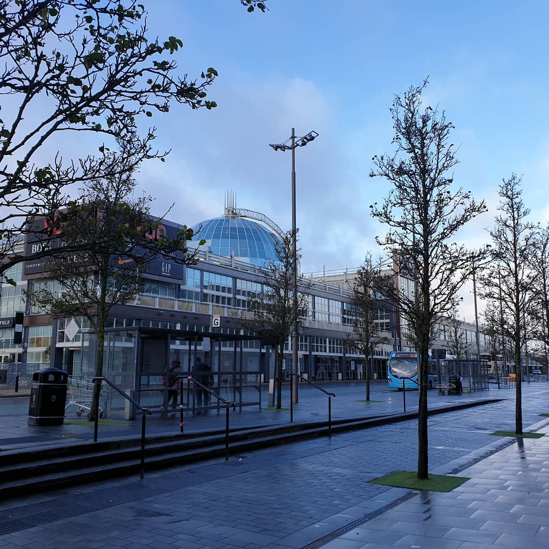

Livingston, United Kingdom
Livingston is a town of 56,840 people in Scotland, United Kingdom.
Why visit Livingston
Townapedia lists 9 museums and landmarks, 17 parks and trails, 78 places to eat, 4 places to stay and 8 attractions in and around town.
Highlights include Almondell Aqueduct, Almondell Bridge, Deer Park and Almondvale Stadium.
Weather in Livingston
Forecast from MET Norway (CC BY 4.0). Full forecast
About Livingston
Livingston (Scots: Leivinstoun, Scottish Gaelic: Baile Dhunlèibhe) is the largest town in West Lothian, Scotland. Designated in 1962, it is the fourth post-war new town to be built in Scotland. Taking its name from a village of the same name incorporated into the new town, it was originally developed in the then-counties of Midlothian and West Lothian along the banks of the River Almond. It is situated approximately fifteen miles (24 km) west of Edinburgh and thirty miles (48 km) east of Glasgow, and is close to the towns of Broxburn to the north-east and Bathgate to the north-west.
From the Wikipedia article Livingston, West Lothian (this version), under CC BY-SA 4.0.
Travel tips from other travellers: Livingston on Wikivoyage (CC BY-SA 4.0).
Photos of Livingston


Things to do8

Almondell Aqueduct
Bridge · 2.3 mi
Navigable aqueduct in West Lothian, Scotland
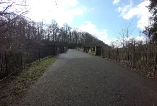
Almondell Bridge
Bridge · 2.4 mi
Road bridge in West Lothian, Scotland




Museums and landmarks9


Parks, trails and playgrounds17
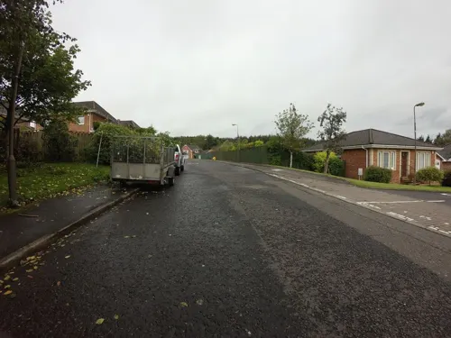

Almondvale Stadium
Sports field and stadium · 1.2 mi
Alderstone Road, Livingston


The Walled Garden
Park · 0.7 mi
Historic Walled Garden of Howden House Now a meeting point for Green Gym

5 more on the map.
Restaurants and cafes78
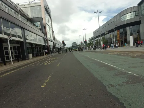
The Newyearfield
Bar and pub · 1.4 mi
Almondvale Avenue, Livingston
Mo-We 08:00-00:00; Th-Sa 08:00-01:00; Su 08:00-00:00
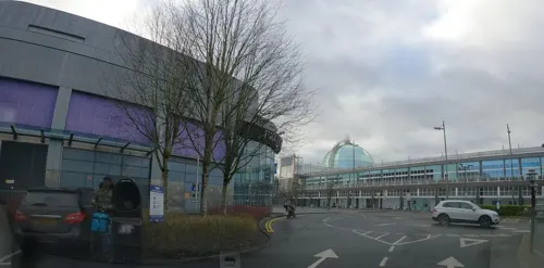
las IGUANAS
Restaurant · Mexican · 1.4 mi
Almondvale Avenue, Livingston
Mo-Th 11:00-21:00; Fr-Sa 11:00-22:00; Su 11:00-20:00
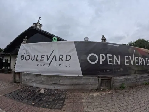
6 Buds Beerhouse
Bar and pub · 1.3 mi
Almondvale Boulevard, Livingston
Th,Su 11:30+; Fr,Sa 11:00-01:00
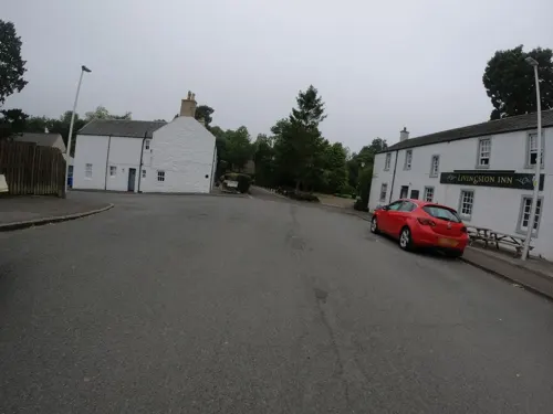
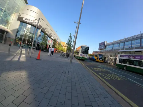
The Parry Lamp
Bar and pub · 1.4 mi
Unit 24, Livingston
Mo-Th 11:00-23:00; Fr,Sa 11:00-24:00; Su 12:30-23:00


Stirrup Stane
Bar and pub · 1.2 mi
Willow Grove, Livingston
Mo-Th 11:00-23:00; Fr-Sa 11:00-00:00; Su 12:30-23:00

Adolfo's
Restaurant · Fish And Chips, Italian
75 Cameron Way, Livingston
66 more on the map.
History
Livingston is first mentioned in an early 12th-century charter as Villa Levingi (Leving's town). In 1128, David I granted the newly founded Abbey of Holyrood control of the church at Livingston and its income in a charter that was witnessed by Turstani filii Levingi (Thurstan son of Leving). He built a fortified tower (Livingston Peel) which no longer survives. The settlement that grew up around it became known as Levingstoun, Layingston, and eventually fixed at Livingston. The Leving family controlled the area until dying out in 1512. From 1512 until 1671 the tower house was occupied by the Murrays of Elibank. In 1670, the Edinburgh botanic garden was founded by Dr. Robert Sibbald and Dr. Andrew Balfour using the plant collection from the Elibank private gardens of Sir Patrick Murray, 2nd Lord Elibank, following his death in September 1671. In the late 17th century, the Peel was demolished and replaced by a house called Livingston Place. The estate eventually passed from the Murray family to the Cunningham family and it was eventually acquired by the Earl of Rosebery in 1828 and demolished in 1840. The area of the former gardens and house is now a local garden and park, named Peel park. The formal layout and planting in the park reflect the historic gardens, and a new peel mound and moat was recreated to reflect the earlier history.
Read more of the history
The area around Livingston was historically an important shale oil area, and the world's first oil boom occurred in West Lothian. This was based on oil extracted from shale, and by 1870 over 3 million tons of shale were being mined each year in the area around Livingston. Output declined with the discovery of liquid oil reserves around the world in the early 1900s, but shale mining only finally ceased in 1962. The "bings" that characterise oil shale mining in West Lothian have largely been flattened. Two shale bings nearby are scheduled monuments – Five Sisters and Greendykes.
By 1898, the main Livingston village was recorded as having several houses, a mill, a Church of Scotland church, a United Free church, a school, and a coaching inn. The oldest church, Livingston Old Kirk, in its current form, dates from 1732 and is an example of plain Presbetryrian architecture from the Georgian period. It stands on the site of a pre-Reformation church which appears to have stood on the site from c. 1350 – c. 1650. The nearby coaching inn was built in 1760 and the poet Robert Burns is said to have been a guest. The nearby Livingston Mill was also built around the same date, in 1770 although there is evidence that suggests there may have been a mill on the site since the 14th or 15th century. Around one mile (1.5 kilometres) north of Livingston village, there was a railway station with a smaller settlement called Livingston Station which is now part of Deans. Livingston station was built as a settlement to serve the workforce and their families of the nearby Deans Oil Works, owned by the Pumpherston Oil Company. Livingston Station had six streets with homes, as well as a store, a small church and a works institute. The original Livingston railway station was operated by the Edinburgh and Bathgate Railway and opened on 12 November 1849. British Railways closed the station on 1 November 1948 following the ending of passenger services on the line. In the 1980s, a site was chosen for a new railway station on the line to the east of the original station and Livingston North station opened on 24 March 1986, concurrent with the re-introduction of passenger services. The Livingston Village and Livingston Station settlements were both subsequently incorporated into Livingston new town in the 20th century.
Under the New Towns Act of 1946, Livingston was designated as a New Town on 16 April 1962 in order to ease overcrowding in Glasgow. Livingston was the fourth new town of five in Scotland; the others were East Kilbride, Glenrothes, Cumbernauld and Irvine. Three villages (Livingston Village and Livingston Station in the old parish of Livingston and Bellsquarry in the parish of Mid Calder) and numerous farmsteads were incorporated into the Livingston new town. Published in July 1962, the first edition of the Livingston plan designated new areas for housing for up to 100,000 people, as well as areas for new industry and offices, marked by new roads, pathways, and recreational spaces, under an 84-square-mile (220-square-kilometre) survey led by Professors Donald Robertson and Sir Robert Matthew. Many of the initial houses were factory-built. A subsequent edition to the plan was published in 1966 with Livingston intended as the centre of a new population area of up to 250,000 persons in the Lothians. The new town plan envisaged Livingston as a focal point for economic growth in the Lothian region, incorporating 'overspill' population from Glasgow and Edinburgh. The design incorporated a vision of mixed development, connected by a new series of roads in a grid system by means of grade separated junctions and roundabouts. While the new town plan considered the car to be the principal form of transport, it also envisaged a series of core footpaths to connect communities under the Radburn design.
From the History section of Livingston, West Lothian on Wikipedia, under CC BY-SA 4.0.
More about Livingston
Geography
Livingston is the eighth-largest settlement and the third-largest town in Scotland. It is also the 171st largest settlement in the United Kingdom. It lies 30 miles (50 kilometres) from Glasgow and 15 miles (25 kilometres) from Edinburgh.
The Livingston new town was planned so that the River Almond, the namesake of the Almondvale district, runs through the town centre.
Outer Livingston districts include Wester Dechmont, Deans (including the Deans Industrial Estate), Kirkton, and Houston to the north, Craigshill to the east, Bellsquarry (including the Brucefield Industrial Estate) and Murieston to the south, and Adambrae and Kirkton Campus to the east of the town. Craigshill takes its name from the Scottish Gaelic word for the slopes of a hill.
Inner central districts in the town include Almondvale, Livingston Village, Eliburn, Howden, Ladywell, Knightsridge, and Dedridge. Ladywell takes its name from a historic well that was dedicated to Mary and was said to have been used by medieval Scottish Kings as a site for a yearly Royal touching ceremony.
Economy
The area where Livingston now sits was historically dominated by oil shale mining, which is evident from the bings which still exist on much of the surrounding landscape. The designation of Livingston as a new town in the 1960s attracted new light industries to the area, with high technology and pharmaceutical companies moving into the town. Livingston formed a major hub in Scotland's Silicon Glen with factories constructed in purpose-build business parks at Houston Industrial Estate and Kirkton Campus. Like most other areas, this went into a slow decline from the late 1990s with companies including Burroughs Corporation (now Unisys), Motorola and NEC closing down their factories. Several multi-national companies still have factories in the town, including Wyman Gordon who manufacture aircraft components on the Houston Industrial Estate. Other companies on the Houston Industrial Estate include Mitsubishi Electric (who have an electric air conditioning factory which produces almost 150,000 air conditioning and heat pump units every year), Paterson Arran (a food manufacturer whose bakery, the Royal Burgh Bakery is located in Livingston), and DS Smith (who have a box production plant on the estate).
Arts and culture
Howden Park Centre is the arts centre for the town which includes a 300-seat theatre providing arts performances, recitals, plays and other events.
The Museum of the Scottish Shale Oil Industry was created in 1990, to preserve the history of the shale industry in West Lothian and beyond. It is sited on a former mill at Millfield in Livingston and is attached to the Almond Valley Heritage Centre, a large farm and play area in Livingston. The Almond Valley Light Railway is a 2 ft 6 in (762 mm) narrow-gauge heritage railway running at the Almond Valley Heritage Trust site.
Livingston has several public parks, including Eliburn park, Almondvale park, Howden park, Peel park, Campbridge park (Murieston), Quarry park (Dedridge), and Bankton Mains park. Eliburn park (in the north-west of Livingston) is a 16.5-hectare (41-acre) site owned by West Lothian Council which features a reservoir (fed by the local Nell burn) with fishing access, sports facilities and a children's play area. Almondvale park, located in the centre of town, is an outdoor recreation area, with an adventure playpark, health walk/run and wildflower meadows. Bankton Mains park is a large park with a sports centre, bowling club, tennis and football pitches and play park.
Education
Livingston has 18 nursery schools, 17 primary schools, and five special schools. There are four secondary schools in the town which are Inveralmond Community High School, The James Young High School, St. Margaret's RC Academy and Deans Community High School.
West Lothian College offers higher and further education and its central campus is based in Livingston. The college has sports facilities, a library, a training restaurant for hospitality students (which was awarded Scottish Restaurant of the Year in 2015 and 2017), and a salon/spa. The college provides educational services to over 8,000 students a year and has 350 staff. A local history library which includes items on the history of Livingston is located in nearby Linlithgow.
Livingston has three public libraries which are Almondbank Library in Craigshill, Lanthorn Library in Dedridge, and Carmondean Library in Deans. A local history library which includes items on the history of Livingston is located in nearby Linlithgow.
The Scotland Japanese School (スコットランド日本語補習授業校 Sukottorando Nihongo Hoshū Jugyō Kō), a weekend Japanese school, is held at St. Margaret's Academy in Livingston. It first opened in 1982 and moved to Livingston in April 2003.
From the Wikipedia article Livingston, West Lothian, under CC BY-SA 4.0.
Notable people from Livingston
 Elise ChristieBritish short-track speed skaterPhoto: Voltmetro, CC BY-SA 4.0
 Hannah BardellScottish politician (born 1983)Photo: David Woolfall, CC BY 3.0
 Rachel McLauchlanassociation football player (born 1997)Photo: Steffen Prößdorf, CC BY-SA 4.0
 Craig BensonBritish swimmerPhoto: SylviaStanley, CC BY-SA 3.0
 James Penriceassociation football player (born 1998)Photo: Andrew Hendo, CC BY-SA 4.0
 Jimmy ScoularScottish footballer and manager (1925-1998)Photo: Eskil Malmberg, Public domain
- Scott ArfieldScottish-Canadian association football player
- Danny WilsonScottish association football player (born 1991)
- Paul DickovFootballer and manager
- Liam HendersonScottish footballer born 1996
- Tommy WalkerScottish footballer (1915-1993)
- Tom SneddonScottish footballer and coach (1912-1972)
Born in Livingston, according to Wikidata (CC0). Each name links to its Wikipedia article.
Where to stay4
Churches and places of worship14
The Salvation Army Livingston Community Church
Church · Salvation Army · 0.8 mi
Kingsport Avenue, Livingston
Livingston Free Church
Church · Free Church Of Scotland · 0.7 mi
Jackson Place, Livingston
Shopping43
Gas and EV charging4
Schools, colleges and libraries22
Pumpherston and Uphall Station Community Primary School
School · 1.3 mi
37 Drumshoreland Road, Pumpherston
St John Ogilvie Primary School
School · Roman Catholic · 1.3 mi
Harburn Avenue, Livingston
Healthcare6
Map of Livingston
205 places. The map loads OpenStreetMap tiles when you open it.
Getting there and nearby towns
Edinburgh Airport (EDI) is the nearest airport with scheduled flights listed in OpenStreetMap, 7 miles away.
- Linlithgow 6 mi northwest, about 10 min by car
- Whitburn 7 mi west, about 11 min by car
- Rosyth 10 mi north, about 16 min by car
- Edinburgh 13 mi east, about 21 min by car
- Penicuik 13 mi southeast, about 20 min by car
- Wishaw 18 mi southwest, about 29 min by car
- Musselburgh 18 mi east, about 30 min by car
- Mossend 19 mi west, about 31 min by car
- Motherwell 20 mi southwest, about 32 min by car
- Stirling 22 mi northwest, about 35 min by car
Drive times are estimates from straight-line distance, not routes.
Towns near Livingston


Keep exploring
Local news
Headlines from INDB.
Reviews, tips and questions
Loading what members have shared...
Sources and licences
- GeoNames (CC BY 4.0): population, coordinates, regions and time zone
- Mapillary (see each image): photos
- OpenStreetMap contributors (ODbL 1.0): places, airports, map data
- Wikidata (CC0 1.0): elevation, founding date, time zone, website, landmarks and historic places
- Wikimedia Commons (see each image): photos
- Wikipedia (CC BY-SA 4.0): overview and history text
Photo credits
- Livingston, United Kingdom (Unsplash), Olu Eletu flenjoore, CC0
- Ryanair B737 heading for Edinburgh Airport over Livingston. - panoramio, tormentor4555, CC BY-SA 3.0
- Mid Calder Parish Church, Basilicofresco, CC BY-SA 4.0
- Almondvale Stadium, al.im.an ( talk ), Public domain
- Almondvale Avenue, Livingston, LordHarris, CC BY-SA 4.0
- Dechmont Law, Taras Young, CC BY-SA 3.0
- St Andrews Church, Livingston, Neilmacleanok, CC BY-SA 4.0
- Almondvale Stadium, Livingston, daniel0685, CC BY 2.0
- St Johns Hospital 2025 07, Discott, CC BY-SA 4.0
- Garden in winter. - panoramio, tormentor4555, CC BY-SA 3.0
- Bee's dont sting. - panoramio, tormentor4555, CC BY-SA 3.0
- My Garden in winter - panoramio, tormentor4555, CC BY-SA 3.0
- Our cat Kitty in the snow - panoramio, tormentor4555, CC BY-SA 3.0
- Our dog Lassie in the snow. - panoramio, tormentor4555, CC BY-SA 3.0
- Friendly bee - panoramio, tormentor4555, CC BY-SA 3.0
- Betty's Cat - panoramio, tormentor4555, CC BY-SA 3.0
- Betty's Cat - panoramio 2005 (cropped), tormentor4555, CC BY-SA 3.0
- Huston Road west Licingston - panoramio, tormentor4555, CC BY-SA 3.0
- Almondell aqueduct from Camps viaduct, Kognos, CC BY-SA 4.0
- Street-level photo, hobgoblin, CC BY-SA 4.0
- Street-level photo, hobgoblin, CC BY-SA 4.0
- Street-level photo, hobgoblin, CC BY-SA 4.0
- Street-level photo, hobgoblin, CC BY-SA 4.0
- Street-level photo, hobgoblin, CC BY-SA 4.0
- Street-level photo, hobgoblin, CC BY-SA 4.0
- Street-level photo, hobgoblin, CC BY-SA 4.0
- Street-level photo, recumberic, CC BY-SA 4.0
- Street-level photo, hobgoblin, CC BY-SA 4.0
- Street-level photo, hobgoblin, CC BY-SA 4.0
- Street-level photo, hobgoblin, CC BY-SA 4.0
- Street-level photo, hobgoblin, CC BY-SA 4.0
- Street-level photo, hobgoblin, CC BY-SA 4.0
- Street-level photo, hobgoblin, CC BY-SA 4.0
- Street-level photo, hobgoblin, CC BY-SA 4.0
- Street-level photo, hobgoblin, CC BY-SA 4.0
- Street-level photo, hobgoblin, CC BY-SA 4.0
- Street-level photo, hobgoblin, CC BY-SA 4.0
- Street-level photo, hobgoblin, CC BY-SA 4.0
- Street-level photo, hobgoblin, CC BY-SA 4.0
- Street-level photo, hobgoblin, CC BY-SA 4.0
- Street-level photo, hobgoblin, CC BY-SA 4.0
- Street-level photo, hobgoblin, CC BY-SA 4.0
- Street-level photo, hobgoblin, CC BY-SA 4.0
- Street-level photo, hobgoblin, CC BY-SA 4.0
- Street-level photo, hobgoblin, CC BY-SA 4.0
- Street-level photo, hobgoblin, CC BY-SA 4.0
- Street-level photo, hobgoblin, CC BY-SA 4.0


Page built November 10, 2026. Spotted a mistake? Tell us or suggest a place.