


Why visit Rosyth
Townapedia lists 11 museums and landmarks, 8 parks and trails, 23 places to eat, 4 places to stay and 6 attractions in and around town.
Highlights include Alhambra Theatre, Bridge, Halbeath Tramway, Inverkeithing, Rosyth Old Kirk and Abbot House, Dunfermline.
Weather in Rosyth
Forecast from MET Norway (CC BY 4.0). Full forecast
About Rosyth
Rosyth (Scottish Gaelic: Ros Fhìobh) is a medium-sized town and Garden City in the historic region of Fife, Scotland, on the coast of the Firth of Forth.
From the Wikipedia article Rosyth (this version), under CC BY-SA 4.0.
Travel tips from other travellers: Rosyth on Wikivoyage (CC BY-SA 4.0).
Photos of Rosyth

Things to do6

Alhambra Theatre
Cinema and theater · 2.4 mi
Theatre in Dunfermline, Scotland, formerly also used as a cinema and as a bingo hall

Bridge, Halbeath Tramway, Inverkeithing
Bridge · 1.7 mi
Bridge in Fife, Scotland, UK, carries a minor road across Keithing Burn and, previously, a tramway


Queensferry Crossing
Bridge · 2.4 mi
Road bridge across the Firth of Forth, Scotland

Museums and landmarks11


Abbot House, Dunfermline
Museum · 2.5 mi
Historic house incorporating a heritage centre, in Dunfermline, Scotland

Andrew Carnegie Birthplace Memorial Museum
Museum · 2.3 mi
Museum in Fife, Scotland, UK

Dunfermline Carnegie Library & Galleries
Museum · 2.5 mi
Public library in Fife, Scotland, UK
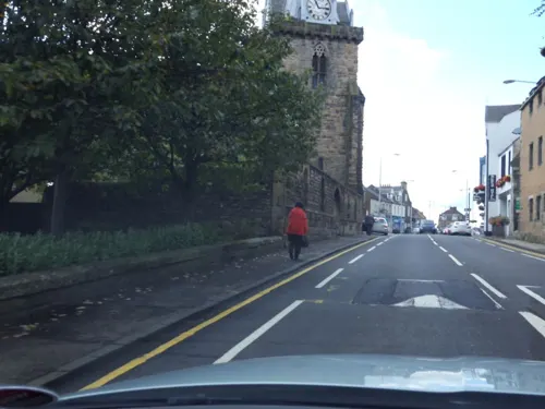
War Memorial, Church Street, Inverkeithing
Monument and historic site · 1.6 mi
War memorial in Inverkeithing, Fife, Scotland, UK

Rosyth Castle
Monument and historic site · 1.0 mi
Sign exists which states private property, however, Freedom to Roam is likely to apply here, and there are no barriers preventing entry...

Sir Hector Maclean of Duart & Battle of Inverkeithing Memorial
Monument and historic site · 1.2 mi
Parks, trails and playgrounds8

Ballast Bank Park
Park · 1.9 mi
Park in Inverkeithing, Fife, Scotland
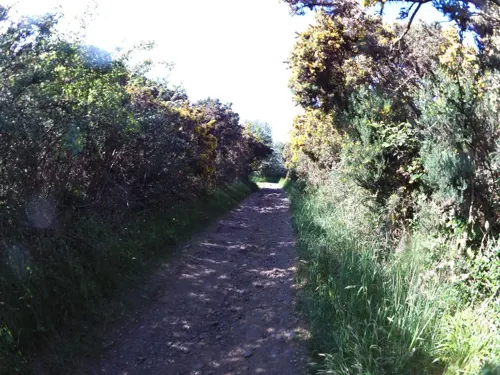
Carlingnose Point Nature Reserve
Park · 2.6 mi
Protected area in Fife, Scotland

Pittencrieff Park
Park · 2.5 mi
Public park in Dunfermline, Fife, Scotland, UK


Restaurants and cafes23

Starbucks
Cafe · Coffee Shop · 1.0 mi
Carnegie Avenue, Dunfermline
Mo-Fr 06:00-21:00; Sa 06:30-21:00; Su 07:00-20:00

Panas
Restaurant · Indian, Nepalese · 0.6 mi
170 Queensferry Road, Rosyth
Tu-Th 16:00-20:30; Fr-Sa 16:00-21:00; Su 15:00-20:00

11 more on the map.
More about Rosyth
Education
There are 4 Primary Schools currently located inside Rosyth as well as a Fife College Campus inside the Dockyard area of Rosyth.
Currently students from these schools go into Inverkeithing High School after Primary 7, but starting August 2026, students will start to go to the new Caledonia High School (Rosyth) which is currently under construction.
There is also a special education school located in the Dockyard called The Bridges Centre.
On 11 July 2024, construction for a future high school - Caledonia High School started in Caledonia Heights, Rosyth to replace the 50 year old Inverkeithing High School in the neighbouring town of Inverkeithing. It opened to students in August 2026 and is said to be able to handle 1,735 students which is more than Inverkeithing High School had enrolled in 2026. The school teaches students from Rosyth, Inverkeithing, Hillend, Dalgety Bay, North Queensferry, Aberdour, High Valleyfield, and also from Southern Dunfermline.
Residents of Rosyth are unable to take buses to school anymore causing children to be left to walk over 40 minutes in some cases as the high school is not central, leaving many parents disappointed.
From the Wikipedia article Rosyth, under CC BY-SA 4.0.
Notable people from Rosyth
- Gregory BurkeScottish playwright
- Andy PenmanScottish footballer (1943-1994)
- John Hay MunroBritish writer
Born in Rosyth, according to Wikidata (CC0). Each name links to its Wikipedia article.
Where to stay4
Churches and places of worship12
Episcopal Church of St Peter, Hope Street, Inverkeithing
Church · 1.6 mi
Rosyth Parish Church
Church · Church Of Scotland · 0.7 mi
82a Queensferry Road, Rosyth
St Leonard's Parish Church, Brucefield Avenue, Dunfermline
Church · 2.1 mi
St Peter's Parish Church, Church Street, Inverkeithing
Church · 1.6 mi
Shopping4
Gas and EV charging2
Schools, colleges and libraries10
Healthcare3
Map of Rosyth
83 places. The map loads OpenStreetMap tiles when you open it.
Getting there and nearby towns
Edinburgh Airport (EDI) is the nearest airport with scheduled flights listed in OpenStreetMap, 7 miles away.
- Inverkeithing 2 mi east, about 3 min by car
- Edinburgh 11 mi southeast, about 18 min by car
- Whitburn 15 mi southwest, about 24 min by car
- Stirling 20 mi west, about 32 min by car
- Tranent 20 mi east, about 32 min by car
- Wishaw 26 mi southwest, about 42 min by car
- Saint Andrews 32 mi northeast, about 52 min by car
- Rutherglen 33 mi southwest, about 54 min by car
- Glasgow 34 mi west, about 54 min by car
- Dundee 35 mi northeast, about 56 min by car
Drive times are estimates from straight-line distance, not routes.
Towns near Rosyth


Keep exploring
Local news
Headlines from INDB.
Reviews, tips and questions
Loading what members have shared...
Sources and licences
- GeoNames (CC BY 4.0): population, coordinates, regions and time zone
- Mapillary (see each image): photos
- OpenStreetMap contributors (ODbL 1.0): places, airports, map data
- Wikidata (CC0 1.0): elevation, founding date, time zone, website, landmarks and historic places
- Wikimedia Commons (see each image): photos
- Wikipedia (CC BY-SA 4.0): overview and history text
Photo credits
- Blue Star 1 Firth of Forth, Emoscopes, CC BY-SA 3.0
- Rosyth in 2006, Paul McIlroy, CC BY-SA 2.0
- (looking towards) Albraham Theatre, Dunfermline, Kilnburn ( talk ) 15:18, 4 April 2009 (UTC), Attribution
- Forthrailbridgefromsouthqueensferry, George Gastin, CC BY-SA 3.0
- Queensferry Crossing view01 2017-03-16, KlausFoehl, CC BY-SA 4.0
- Abbot House, Dunfermline Fife, Kim Traynor, CC BY-SA 3.0
- Birthplace of Andrew Carnegie, Dunfermline, Kilnburn ( talk ) 15:02, 7 February 2009 (UTC), Attribution
- Carnegie Library, Dunfermline, Kilnburn ( talk ) 20:28, 25 February 2009 (UTC), Attribution
- Section of Ballast Bank park playground, 2023, Harrybean07, CC0
- Gardens in Pittencrieff Park, Dkardokas, CC BY-SA 3.0
- St Leonard's Church, Dunfermline, Kilnburn ( talk ) 20:22, 3 April 2009 (UTC), Attribution
- St. Peter's Kirk, Inverkeithing, Kim Traynor, CC BY-SA 3.0
- Rosyth Castle, Stevouk at English Wikipedia, Public domain
- Boreland Road bridge arches over Keithing Burn and former Halbeath Waggon Way, Harrybean07, CC0
- St Peter in Chains, Inverkeithing, Harrybean07, CC0
- Pit stop !! (7817481346), Calum Cape from glenrothes , United Kingdom, CC BY 2.0
- Forth road bridge 1, Grant McIntosh Photography, CC BY-SA 4.0
- Rosyth Old Kirk morthouse entrance, PeterK147, CC BY-SA 4.0
- Street-level photo, ccbb7766, CC BY-SA 4.0
- Street-level photo, hobgoblin, CC BY-SA 4.0
- Street-level photo, ccbb7766, CC BY-SA 4.0
- Street-level photo, hobgoblin, CC BY-SA 4.0
- Street-level photo, hobgoblin, CC BY-SA 4.0
- Street-level photo, hobgoblin, CC BY-SA 4.0
- Street-level photo, smsm1, CC BY-SA 4.0
- Street-level photo, tallguy, CC BY-SA 4.0
- Street-level photo, hobgoblin, CC BY-SA 4.0
- Street-level photo, smsm1, CC BY-SA 4.0
- Street-level photo, tallguy, CC BY-SA 4.0
- Street-level photo, hobgoblin, CC BY-SA 4.0
- Street-level photo, hobgoblin, CC BY-SA 4.0
- Street-level photo, ccbb7766, CC BY-SA 4.0
- Street-level photo, hobgoblin, CC BY-SA 4.0
- Street-level photo, victuallers, CC BY-SA 4.0
- Street-level photo, victuallers, CC BY-SA 4.0
- Street-level photo, hobgoblin, CC BY-SA 4.0
- Street-level photo, hobgoblin, CC BY-SA 4.0


Page built November 10, 2026. Spotted a mistake? Tell us or suggest a place.