


Greenfield, United Kingdom
Greenfield is a town of 1,831 people in England, United Kingdom.
Why visit Greenfield
Townapedia lists 9 museums and landmarks, 11 parks and trails and 28 places to eat in and around town.
Highlights include Ruxox Cell, Ailesbury Mausoleum, Cut-throat Meadow and Flitwick Moor.
Weather in Greenfield
Forecast from MET Norway (CC BY 4.0). Full forecast
About Greenfield
Greenfield is a small village about 2 km (1.2 mi) from the town of Flitwick in Bedfordshire, England. It lies across Flitwick Moor from the larger settlement of Flitwick and is on the opposite side of the River Flit. It forms part of the parish of Flitton and Greenfield.
From the Wikipedia article Greenfield, Bedfordshire (this version), under CC BY-SA 4.0.
Museums and landmarks9

Ruxox Cell
Monument and historic site · 0.8 mi
Moated site in Flitwick, Bedfordshire, England, UK

Ailesbury Mausoleum
Monument and historic site · 2.0 mi
Mausoleum in Maulden, Central Bedfordshire, England, UK

Cainhoe Castle
Monument and historic site · 3.0 mi
11th century Norman castle in England

De Grey Mausoleum
Monument and historic site · 0.7 mi
Grade I listed building in Flitton, Central Bedfordshire, England, UK

Katherine's Cross Ampthill Park
Monument and historic site · 2.8 mi
Architectural structure in Ampthill, Central Bedfordshire, England, UK
Parks, trails and playgrounds11


Wrest Park
Park · 2.3 mi
Country estate near Silsoe, Bedfordshire, England, UK

Ampthill Park
Park · 3.1 mi
Country house and former country estate in Ampthill, Bedfordshire, England, UK
Cooper's Hill
Park · 2.3 mi
Nature reserve in Bedfordshire, England, UK

Restaurants and cafes28
Cravin Coffee
Cafe · Coffee Shop · 1.2 mi
Mo-Fr 05:45-13:00; Sa 08:00-14:00; Su 07:00-13:00
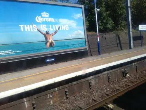
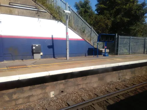


16 more on the map.
Churches and places of worship9

Church of Saint Mary the Virgin, Harlington, Bedfordshire
Church · 2.9 mi
Church in Harlington, Bedfordshire, England, UK

Church of St Nicholas, Tingrith
Church · 3.3 mi
Church in Tingrith, Bedfordshire, England, UK
Church of St Peter & St Paul, Flitwick
Church · 1.6 mi
Church in Flitwick, Bedfordshire, England, UK
St Marys Church, Clophill
Church · 3.4 mi
Church in Clophill, Bedfordshire, England, UK
History
The original agrarian folk community has had a long known history stretching back to the pre-Roman times. Evidence of an ancient settlement has been found on the adjacent woodland mire area of Flitwick Moor. Artifacts can be found in fields and ditches in Greenfield, mainly of flint scrapers and arrowheads from the Mesolithic era, and even into the Neolithic era and Iron Age due to the useful durable nature of the local flint. Ancient Briton relics respecting the Celtic god of thunder, such as a Wheel of Taranis, have been found at the Ruxox site, which in the 1220s became the Ruxox Cell of Dunstable Priory. Roman artefacts such as tiles, fragments of pots have and an altar to the cult of Bacchus have also been found locally at Ruxox (Hutchison 1986).
Read more of the history
During the last decade of the 18th century, field enclosure was introduced, quite late on in history, and riots were instigated by local tenants who gathered to protest as their livelihood was under threat. Further threat to the local folk way of life would also come from the relatively late introduction of Protestant Christian thought in the area. Greenfield was expanded in the 19th century as a Methodist settlement alongside the Church of England settlement at Flitton. Temperance meetings were introduced and organised by newcomer nobility from Wrest Park, which led to the demise of two key local beerhouses that served the traditional folk community at the time.
During Victorian times, the local Lady Cowper visited Greenfield from Wrest Park, and described Greenfield as "an 'End'- 'a long straggly, fenny place with poor housing and rough people. Many were originally squatters and built makeshift houses". There was significant hardship at this time with some families taking bread from charity. There were still "Poor Rights" for the locals which allowed them to cut peat from the Moors for drying and burning. There were ten shareholders of Flitton Moor who paid 15 shillings a share and Greenfield Moor divided into 6 portions at 12 shillings each.
The local primary school (once located on School Lane) was built during the time of Church of England school development era to improve literacy and "elevate the local populace" from superstitious beliefs. This is now a private residence and the primary school was moved to Pulloxhill road during the late 1960s.
Regarding health care during the Victorian times, cottagers had to pay between 1 shilling and 10 shillings a year depending on the treatment, and the very poor who could not afford the fee would have to rely on local folk treatments and cures.
The area was once well known as a strawberry-producing area, and the fields were full of strawberry plants on either side of the main road. Carts would take the strawberries to Luton until the 1920s when a blight and a series of rook infestations destroyed the crop.
Mill Lane was named after the watermill that ground wheat and barley corn until the 1950s and was located at the bottom of the lane. The mill was fed by a millpond, now a stream at the west side of the lane, and the outflow ran downhill into a ford that filled up when the mill was grinding corn. When grinding stopped, the river was diverted using sluice gates around the back of the mill. The mill photographed was built in the mid 19th century, although the records of Dunstable Priory indicate that there has been a mill on the site since at least year 1200 that served Ruxox Augustinian Ruxox Cell and local community. After a series of local disputes, Greenfield Mill was unused and became derelict from 1959 to 1970 when it was demolished to make way for houses.
The bridleway at the bottom of Mill Lane is the scene of an unsolved murder. In 1939, a worker from the nearby Ruxox Farm was attacked with "maniac brutality" on his way to his lodgings at the White Hart Inn in Flitton List of unsolved murders in the United Kingdom. The silver coins of his wage packet had been taken but the rest was left with the smashed body. During the investigation, the local mill disputes and folk theories relating to ancient artefacts being removed from Ruxox farm (the site of both ancient Celtic and Roman shrines) were dismissed by the local police. Scotland Yard concluded that the murder was more likely committed by a passing vagrant. The verdict on police records was stated as "murder by person or persons unknown".
From the History section of Greenfield, Bedfordshire on Wikipedia, under CC BY-SA 4.0.
Shopping3
Schools, colleges and libraries9
Healthcare1
Map of Greenfield
70 places. The map loads OpenStreetMap tiles when you open it.
Getting there and nearby towns
London Luton Airport (LTN) is the nearest airport with scheduled flights listed in OpenStreetMap, 9 miles away.
- Flitwick 1 mi west, about 2 min by car
- Ampthill 2 mi northwest, about 3 min by car
- Silsoe 2 mi east, about 3 min by car
- Houghton Conquest 4 mi north, about 7 min by car
- Shillington 5 mi east, about 7 min by car
- Lidlington 5 mi northwest, about 8 min by car
- Chicksands 5 mi northeast, about 8 min by car
- Meppershall 5 mi east, about 9 min by car
- Kempston Hardwick 6 mi north, about 10 min by car
- Pirton 6 mi east, about 10 min by car
Drive times are estimates from straight-line distance, not routes.
Towns near Greenfield


Keep exploring
Local news
Headlines from INDB.
Reviews, tips and questions
Loading what members have shared...
Sources and licences
- GeoNames (CC BY 4.0): population, coordinates, regions and time zone
- Mapillary (see each image): photos
- OpenStreetMap contributors (ODbL 1.0): places, airports, map data
- Wikidata (CC0 1.0): elevation, founding date, time zone, website, landmarks and historic places
- Wikimedia Commons (see each image): photos
- Wikipedia (CC BY-SA 4.0): overview and history text
Photo credits
- Greenf, Family, CC BY 3.0
- Ruxox Farm moated site 15, Simon Burchell, CC BY-SA 4.0
- Ailesbury Mausoleum 04, Simon Burchell, CC BY-SA 4.0
- Cainhoe Castle, Dennis simpson, CC BY-SA 2.0
- Cut-Throat Meadow 3, Dudley Miles, CC BY-SA 4.0
- River Flit in Flitwick Moor 3, Dudley Miles, CC BY-SA 4.0
- WrestHouse3, Nigel Cox, CC BY-SA 2.0
- St Marys C of E Church Harlington, Alex, CC BY-SA 4.0
- De Grey M, Tatraplan at English Wikipedia, Public domain
- Street-level photo, sk53, CC BY-SA 4.0
- Street-level photo, ris, CC BY-SA 4.0
- Street-level photo, ris, CC BY-SA 4.0
- Street-level photo, ris, CC BY-SA 4.0
- Street-level photo, ris, CC BY-SA 4.0
- Street-level photo, ris, CC BY-SA 4.0
- Street-level photo, ris, CC BY-SA 4.0
- Street-level photo, ris, CC BY-SA 4.0
Page built November 10, 2026. Spotted a mistake? Tell us or suggest a place.