


Greenfield, United Kingdom
Greenfield is a town of 2,446 people in Wales, United Kingdom.
Why visit Greenfield
Townapedia lists 19 museums and landmarks, 3 parks and trails, 34 places to eat, 3 places to stay and 2 attractions in and around town.
Highlights include Pen y Ball, Basingwerk Abbey, St Winefride’s Well Museum and Greenfield Valley Heritage Park.
Weather in Greenfield
Forecast from MET Norway (CC BY 4.0). Full forecast
About Greenfield
Greenfield (Welsh: Maes-glas) is a village in the community of Holywell, Flintshire, north-east Wales, on the edge of the River Dee estuary. At the time of the 2001 census it had a population of 2,741,
From the Wikipedia article Greenfield, Flintshire (this version), under CC BY-SA 4.0.
Photos of Greenfield

Things to do2

Museums and landmarks19

Basingwerk Abbey
Monument and historic site · 0.5 mi
Ruin of an abbey near Holywell, Flintshire, Wales

7 more on the map.
Parks, trails and playgrounds3

Greenfield Valley Heritage Park
Park
Country park in Flintshire, Wales

Restaurants and cafes34
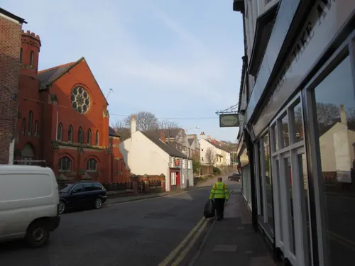
Cafe Dilshad
Restaurant · Indian · 0.7 mi
1 Whitford Street, Holywell
Su-Th 17:00-23:00; Fr-Sa 17:30-00:30
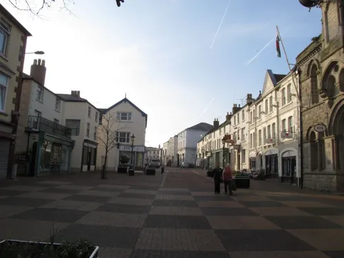

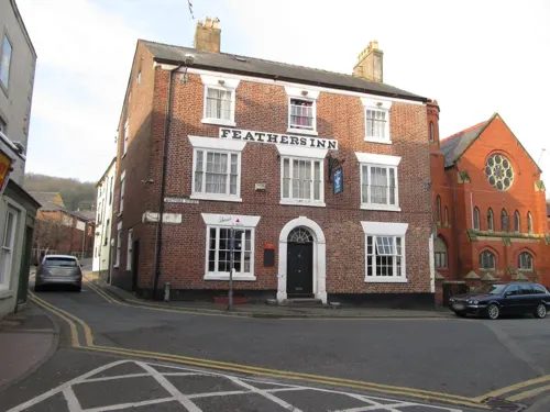

Tak Bo
Restaurant · Chinese · 0.8 mi
1 Halkyn Street, Holywell
Mo-Tu 17:00-22:30;We-Su 17:00-23:00

22 more on the map.
History
Greenfield is best known for its history of papermaking. A paper mill has been on this site since 1770. The site was chosen due to the constant water flow from the stream which comes from the St Winefride's Well. The speed this site developed was one of the reasons that Greenfield is still linked with the start of the Industrial Revolution. In the mid 19th century up to 80 businesses had set up in the mile stretch between Holywell and Greenfield The remains of some can now be seen as conservation and industrial archeological projects have been undertaken in recent years. Among the businesses were a copper mill, a flannel mill, a flour mill, shirt-makers and soft drink works, W Hall & Son (which still exists today). Greenfield was also home to two Courtaulds rayon factories and a sulphuric acid plant from 1936 to 1985.
Read more of the history
In 1842 William Crockford, of London gambling club fame, built the Zinc Smelting Works on the northern side of the coast road adjacent to the gas works. The factory was said at the time to be the most modern in Britain with its own dedicated railway to the nearby Crockford Wharf. Crockford died in 1844 and his widow Sarah continued running the factory with the assistance of a daughter and two sons - Fanny, Henry and Charles Crockford, the latter of whom patented several zinc smelting inventions. The family also laid a mineral railway from Pantasaph to the factory, converted Parys Mine works into a limestone crushing plant and ran a cement factory at Bryn Celyn. With industrial changes and periodic managerial problems output from the zinc works ceased by the turn of the century and derelict buildings were largely removed by 1928.
Greenfield's oldest building is Basingwerk Abbey, founded circa 1132 by Ranulph de Gernon, 2nd Earl of Chester. It was an important monastic centre in north Wales; both Llywelyn ap Iorwerth and Dafydd ap Llywelyn were patrons. In 1536, abbey life came to an end with the Dissolution of the Monasteries. In ruins since the time of Oliver Cromwell, it is in the care of Cadw (Welsh Heritage). The ruins are now part of Greenfield Valley Heritage Park, with the adjacent grounds home to an agricultural museum. Many of the museum's buildings were moved stone by stone from the surrounding area, including an old school house.
A hidden Gatso speed camera, on the A548 road leading to Bagillt, near the old disused railway bridge, was voted the worst-placed speed camera in the UK by the Association of British Drivers, despite the fact that until 2009 Arrive Alive conducted their Speed Awareness courses at the Greenfield Business Centre, based in the original paper mill building 200 yards away.
The North Wales Coast Line runs through Holywell Junction with trains running fast through the station.
The station was opened on 1 May 1848 as part of the Chester and Holyhead Railway (now the North Wales Coast Line) and was named simply Holywell. A brick built signal box was opened in 1902 to replace an earlier wooden one. The station initially had two platforms but as the line grew busier the number of tracks doubled from one each way to two and the number of platforms followed suit. The main station building was positioned on the down platform and a subway connected them all. In 1912 Holywell Branch Line was opened just east of the station which linked the mainline to the centre of Holywell. Therefore, Holywell station was renamed Holywell Junction on 1 May and the new station called Holywell Town.
The branch line lasted 42 years before being closed and Holywell Junction was closed to passengers on 14 February 1966
as part of the Beeching Axe, although it was open to freight until 1970. The Italianate station building designed by Francis Thompson
was listed Grade II* in 1970 and is a private dwelling. The signal box was listed Grade II in 1991.
From the History section of Greenfield, Flintshire on Wikipedia, under CC BY-SA 4.0.
Notable people from Greenfield
- Billy HoughWelsh footballer
Born in Greenfield, according to Wikidata (CC0). Each name links to its Wikipedia article.
Where to stay3
Churches and places of worship11
Shopping2
Gas and EV charging2
Schools, colleges and libraries7
Healthcare4
Map of Greenfield
87 places. The map loads OpenStreetMap tiles when you open it.
Getting there and nearby towns
Hawarden Airport (CEG) is the nearest airport with scheduled flights listed in OpenStreetMap, 12 miles away.
- Holywell 1 mi southwest, about 1 min by car
- Mostyn 3 mi northwest, about 5 min by car
- Flint 4 mi southeast, about 7 min by car
- Heswall 6 mi northeast, about 9 min by car
- West Kirby 6 mi north, about 10 min by car
- Northop 6 mi southeast, about 10 min by car
- Neston 7 mi east, about 11 min by car
- Greasby 7 mi northeast, about 12 min by car
- Hoylake 8 mi north, about 12 min by car
- Prestatyn 9 mi northwest, about 14 min by car
Drive times are estimates from straight-line distance, not routes.
Towns near Greenfield


Keep exploring
Local news
Headlines from INDB.
Reviews, tips and questions
Loading what members have shared...
Sources and licences
- GeoNames (CC BY 4.0): population, coordinates, regions and time zone
- Mapillary (see each image): photos
- OpenStreetMap contributors (ODbL 1.0): places, airports, map data
- Wikidata (CC0 1.0): elevation, founding date, time zone, website, landmarks and historic places
- Wikimedia Commons (see each image): photos
- Wikipedia (CC BY-SA 4.0): overview and history text
Photo credits
- Greenfield Valley Heritage Park (27783078700), Alex Liivet from Chester, United Kingdom, CC0
- St Winefride's Well, Wales - Ffynnon Gwenffrewi, Treffynnon, Sir y Fflint 40, Llywelyn2000, CC BY-SA 4.0
- Eglwys Chwitffordd, Sir y Fflint - Church of St Mary and St Beuno, Whitford, Flintshire, Wales 39, Llywelyn2000, CC BY-SA 4.0
- St Michael's Church, Brynford, Andrew, CC BY 2.0
- Eglwys Gatholig y Santes Gwenffrewi - St Winefride's Catholic Church, Holywell, Treffynnon, Wales 77, Llywelyn2000, CC BY-SA 4.0
- St James parish church, Treffynnon (Holywell), Flintshire, Wales 08, Llywelyn2000, CC BY-SA 4.0
- Red Lion, Holywell, Poliphilo, CC0
- Sunlight On The Lake, Lauren, CC BY 3.0
- Street-level photo, sk53, CC BY-SA 4.0
- Street-level photo, sk53, CC BY-SA 4.0
- Street-level photo, sk53, CC BY-SA 4.0
- Street-level photo, sk53, CC BY-SA 4.0
- Street-level photo, sk53, CC BY-SA 4.0
- Street-level photo, sk53, CC BY-SA 4.0
- Street-level photo, sk53, CC BY-SA 4.0
- Street-level photo, sk53, CC BY-SA 4.0
- Street-level photo, sk53, CC BY-SA 4.0
- Street-level photo, sk53, CC BY-SA 4.0
- Street-level photo, sk53, CC BY-SA 4.0
Page built November 10, 2026. Spotted a mistake? Tell us or suggest a place.