


Why visit Greasby
Townapedia lists 5 museums and landmarks, 18 parks and trails, 50 places to eat, 3 places to stay and 5 attractions in and around town.
Highlights include Bidston Lighthouse, Hoylake Lighthouse, Hoylake and West Kirby War Memorial and Royden Park.
Weather in Greasby
Forecast from MET Norway (CC BY 4.0). Full forecast
About Greasby
Greasby (locally ) is a large village on the Wirral Peninsula, Merseyside, England. A predominantly residential area, it is contiguous with Upton to the east and Saughall Massie to the north. The small village of Frankby is to the immediate west. Historically within the county of Cheshire, it is part of the Greasby, Frankby and Irby Ward of the Metropolitan Borough of Wirral and is in the parliamentary constituency of Wirral West.
From the Wikipedia article Greasby (this version), under CC BY-SA 4.0.
Travel tips from other travellers: Greasby on Wikivoyage (CC BY-SA 4.0).
Photos of Greasby

Things to do5

Bidston Lighthouse
Lighthouse · 2.8 mi
Lighthouse in Wirral, Merseyside, England, UK

Hoylake Lighthouse
Lighthouse · 2.8 mi
Lighthouse in Wirral, Merseyside, England, UK

Leasowe Lighthouse
Lighthouse · 2.8 mi
Lighthouse in Wirral, Merseyside, England, UK


Museums and landmarks5

Hoylake and West Kirby War Memorial
Monument and historic site · 2.2 mi
Grade II listed WW1 & WW2 war memorial in West Kirby, Wirral, Merseyside, England, UK

Parks, trails and playgrounds18


Cleaver Heath Nature Reserve
Park · 2.9 mi
Nature reserve and Site of Special Scientific Interest in Wirral, England

Coronation Gardens, West Kirby
Park · 2.5 mi
Public park in the Wirral, England

Meols Park
Park · 2.4 mi
Park located in Meols on the Wirral Peninsula, England

Wirral Country Park
Park · 2.3 mi
Country park on the Wirral Peninsula, England



6 more on the map.
Restaurants and cafes50
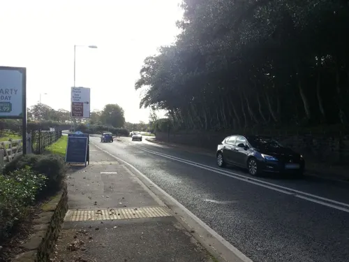
Cottage Loaf
Bar and pub · 1.5 mi
338 Telegraph Road, Wirral
Mo-Th 10:00-22:00; Fr-Sa 10:00-23:00; Su 10:00-22:00
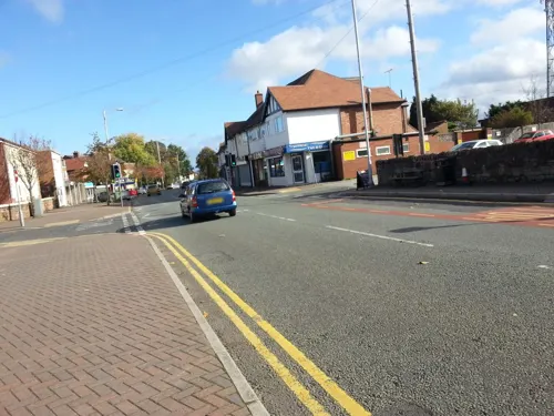




38 more on the map.
History
The earliest known human settlement in Merseyside has been found at Greasby, believed to date from approximately 7000 BC.
A rectangular floor of sandstone slabs and pebbles suggests regular use by the nomadic hunters of that period.
The remains of burnt hazelnut shells found at the site were used for radiocarbon dating. The results specified a time period between 8300 BC and 8500 BC, even earlier than previously thought.
National Museums Liverpool archaeologists excavated the site between 1987 and 1990.
Greasby was an Anglo Saxon settlement, as witnessed by the form of the name, Gravesberie, in the Domesday Book.
Gravesberie derives from the Old English gräf (a grove) and burh (a fortified place). This has been recorded as meaning "grove farm/settlement",
or alternatively, a "stronghold or fortification by a grove, trench, canal or wood".
The name was Scandinavianised to Greasby, under the influence of Old Norse speakers in Wirral (gräf and býr, with býr meaning "settlement" or "farmstead").
The name of the village has been variously spelt over time, including: Grauesberi, Grauesbyri, Grauisby (1093), Grauesbi (c.1155), Grauesby (c.1170), Griseby (1280) and Graysby (1610).
Read more of the history
Before the Norman conquest of England in 1066, Greasby was owned by a man named Dunning, who may have been an official (bailiff or steward) for the earls of Mercia. After the invasion, all land in the area passed to Hugh d'Avranches.
By the time of the Domesday Book (1086), Greasby was under the ownership of Nigel de Burcy and consisted of eight households.
After the Second World War the area expanded considerably, with significant residential development across previously agricultural land. This has resulted in Greasby becoming contiguous with the nearby settlements of Moreton, Upton and Woodchurch.
Greasby was formerly a township split between the parishes of Thurstaston and West Kirby, within the Wirral Hundred. It held civil parish status between 1866 and 1974.
From 1866 Greasby was part of Wirral Rural Sanitary District, which was replaced in 1894 by Wirral Rural District. In 1933 the village transferred to Hoylake Urban District.
On 1 April 1974 the parish was abolished and local government reorganisation in England and Wales resulted in most of the Wirral Peninsula, including Greasby, transfer from the county of Cheshire to Merseyside.
The population of the township/parish was 123 in 1801, rising to 177 in 1851, 290 in 1901 and significantly increasing to 4,367 in 1951.
From the History section of Greasby on Wikipedia, under CC BY-SA 4.0.
More about Greasby
Geography
Greasby is bounded by Arrowe Brook, at Upton Meadow, and by Greasby Brook which flows around the western and northern sides of Greasby. Greasby Brook merges into Arrowe Brook between Greasby and Saughall Massie, which becomes a tributary of the Birket.
Economy
The village contains a post office, a branch of Nisa, a branch of Age UK, a William Hill bookmaker and a BP petrol station. A Sainsbury's Local convenience store was opened on 8 October 2014, along with a veterinary surgery which opened on 6 October 2014. These were opened in new retail unit, after many parts of the local community opposed the construction of the new building. Greasby also has a number of other small shops including butchers, florist, greengrocer's, estate agents and a number of fast food takeaways.
From the Wikipedia article Greasby, under CC BY-SA 4.0.
Notable people from Greasby
- John BoweBritish actor
- Sam RamsbottomBritish association football player (born 1996)
Born in Greasby, according to Wikidata (CC0). Each name links to its Wikipedia article.
Where to stay3
Churches and places of worship27
Shopping5
Gas and EV charging2
Schools, colleges and libraries16
Healthcare5
Map of Greasby
136 places. The map loads OpenStreetMap tiles when you open it.
Getting there and nearby towns
Liverpool John Lennon Airport (LPL) is the nearest airport with scheduled flights listed in OpenStreetMap, 12 miles away.
- Moreton 2 mi north, about 3 min by car
- West Kirby 3 mi west, about 4 min by car
- Hoylake 3 mi northwest, about 4 min by car
- Prenton 3 mi east, about 5 min by car
- Heswall 3 mi south, about 5 min by car
- Wallasey 4 mi northeast, about 7 min by car
- Birkenhead 5 mi east, about 8 min by car
- Bebington 5 mi east, about 8 min by car
- Bromborough 6 mi east, about 10 min by car
- Liverpool 7 mi northeast, about 11 min by car
Drive times are estimates from straight-line distance, not routes.
Towns near Greasby


Keep exploring
Local news
Headlines from INDB.
Reviews, tips and questions
Loading what members have shared...
Sources and licences
- GeoNames (CC BY 4.0): population, coordinates, regions and time zone
- Mapillary (see each image): photos
- OpenStreetMap contributors (ODbL 1.0): places, airports, map data
- Wikidata (CC0 1.0): elevation, founding date, time zone, website, landmarks and historic places
- Wikimedia Commons (see each image): photos
- Wikipedia (CC BY-SA 4.0): overview and history text
Photo credits
- Greave Dunning 2019, Rodhullandemu, CC BY-SA 4.0
- Bidston Lighthouse 102, RHaworth, CC BY 2.5
- Hoylake Lighthouse 1, Rodhullandemu, CC BY-SA 4.0
- Leasowe Lighthouse 2019-1, Rodhullandemu, CC BY-SA 4.0
- Hoylake War Memorial, Peter Miller, CC BY-SA 2.0
- Coach House, Royden Park 2019-2, Rodhullandemu, CC BY 3.0
- Arrowe Park - DSC04037, Rept0n1x, CC BY-SA 3.0
- Arrowe Park - DSC04040, Rept0n1x, CC BY-SA 3.0
- Ashton Park, West Kirby (12), Rept0n1x, CC BY-SA 3.0
- Caldy Hill, Colmanian ( talk ) ( Uploads ), Public domain
- Wirral - Cleaver Heath Nature Reserve - 20210228145018, Ihaveseenthings, CC BY-SA 4.0
- Coronation Gardens, West Kirby (1), Rept0n1x, CC BY-SA 3.0
- Kirby Park disused station, Redvers, CC BY 3.0
- Christ Church, Barnston north side, Rodhullandemu, CC BY-SA 4.0
- St John, Frankby 2019-1, Rodhullandemu, CC BY-SA 4.0
- Church of the Resurrection, Caldy, David Quinn, CC BY-SA 2.0
- East end of Hoylake Chapel, Rodhullandemu, CC BY-SA 4.0
- South side of Holy Cross, Woodchurch, Rodhullandemu, CC BY-SA 4.0
- St Andrew's, West Kirby 2020-1, Rodhullandemu, CC BY-SA 4.0
- St Bridget's Church, West Kirby 2019, Rodhullandemu, CC BY-SA 4.0
- St James' Church, Birkenhead 2020-3, Rodhullandemu, CC BY-SA 4.0
- Untitled-Image-5, DatOneHampter, CC BY-SA 4.0
- View from Thurstaston Hill within the Thurstaston Common SSSI, Silentbob9484, CC BY-SA 4.0
- The New Meols Park Play Area-by-Roy-James-Shuttleworth, Roy James Shuttleworth, CC BY-SA 2.0
- Thurstaston Common - panoramio, Jorge Franganillo, CC BY 3.0
- Street-level photo, thingomy, CC BY-SA 4.0
- Street-level photo, thingomy, CC BY-SA 4.0


Page built November 10, 2026. Spotted a mistake? Tell us or suggest a place.