


Milford Haven, United Kingdom
Milford Haven is a town of 13,582 people in Wales, United Kingdom.
Why visit Milford Haven
Townapedia lists 3 museums and landmarks, 5 parks and trails, 20 places to eat, 1 place to stay and 2 attractions in and around town.
Highlights include Torch Theatre, The Torch Theatre, Milford Haven Museum and Hubberston Fort.
Weather in Milford Haven
Forecast from MET Norway (CC BY 4.0). Full forecast
About Milford Haven
Milford Haven (Welsh: Aberdaugleddau, lit. 'mouth of the two rivers Cleddau' ) is a town and community in Pembrokeshire, Wales. It is on the north side of the Milford Haven Waterway, an estuary forming a natural harbour that has been used as a port since the Middle Ages.
From the Wikipedia article Milford Haven (this version), under CC BY-SA 4.0.
Travel tips from other travellers: Milford Haven on Wikivoyage (CC BY-SA 4.0).
Photos of Milford Haven

Things to do2

Torch Theatre
Cinema and theater
Theatre and cinema in Milford Haven, Pembrokeshire, Wales
Museums and landmarks3

Milford Haven Museum
Museum
Maritime museum in Wales, United Kingdom
The Docks, Milford Haven
Mo-Sa 10:30-16:00


Parks, trails and playgrounds5



Restaurants and cafes20





8 more on the map.
History
The town of Milford was founded in 1793, after Sir William Hamilton obtained an act of Parliament, the Hubberston and Pill, Pembroke, Docks and Piers Act 1790 (30 Geo. 3. c. 55), to establish the port at Milford, and takes its name from the natural harbour of Milford Haven, which was used for several hundred years as a staging point on sea journeys to Ireland and as a shelter by Vikings. It was known as a safe port and is mentioned in Shakespeare's Cymbeline as "blessed Milford". It was used as the base for several military operations, such as Richard de Clare's invasion of Leinster in 1167, Henry II's Invasion of Ireland in 1171, John's continued subjugation of the Irish in 1185 and 1210 and Oliver Cromwell's 1649 invasion of Ireland; while forces which have disembarked at the point include Jean II de Rieux's 1405 reinforcement of the Glyndŵr Rising and Henry VII's 1485 landing at the waterway before marching on England. By the late 18th century the two local creeks were being used to load and unload goods, and surrounding settlements were established, including the medieval chapel, and Summer Hill Farm, the only man-made structures on the future site of Milford.
Read more of the history
Sir William Hamilton, the town's founder, had acquired the land from his wife, Catherine Barlow of Slebech. His nephew, the Hon. Charles Francis Greville, invited seven Quaker families from Nantucket and Martha's Vineyard to settle in the new town and develop a whaling fleet. They began by building a shipyard, and leased it to a Messrs. Harry and Joseph Jacob. In December 1796, in an unusual arrangement, the Admiralty (Navy operations) directed the Navy Board (administration and supplies) to contract Jacobs shipyard to build a frigate and later a 74-gun ship-of-the-line. However, due to a combined lack of local standing oak, access to supplies of timber from the Baltic, and local skills in volume, the Jacob operation soon went bankrupt.
In 1800, following the bankruptcy of the Jacobs & Sons, the Navy Board's overseer, Jean-Louis Barralier, was persuaded to lease the site for the Navy Board and develop a dockyard for building warships. Seven royal vessels were eventually launched from the dockyard, including HMS Surprise and HMS Milford. The town was built on a grid pattern, thought to have been to the design of Jean-Louis Barrallier, who remained in charge of shipbuilding there for the Navy Board. Between 1801 and 1803, the town and waterway were protected by temporary batteries at Hakin Point and south of St Katherine's Church, in response to the perceived threat following the Fishguard Invasion.
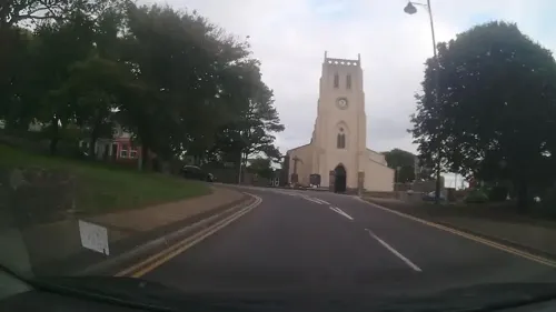
A church was consecrated in October 1808 and dedicated to St Catherine of Alexandria in the underdeveloped eastern side of the town, it remained a chapel of ease until 1891 when Milford became a parish, until that time competing with St Peter and St Cewydd in Steynton. By the start of the 19th century, a mail coach was operating between London and Hubberston, and in 1800 the short lived Milford and Pembrokeshire Bank was established by Thomas Phillips, operating from a branch in the town. It collapsed in 1810.
On 11 October 1809, a naval commission recommended purchase of the Milford Haven facility and formal establishment of a Royal Navy dockyard. This was, according to the report, due to the fact that Millford built-ships had proved to be cheaper due to the cheap cost of supplies and abundant labour supply. It proposed purchase of the yard at £4,455. However, as this was after the Battle of Trafalgar (21 October 1805), when the need for naval ships was decreasing in the Napoleonic Wars, and in such a remote location, the proposal seemed perplexing. However, in light of the end of the Franco-Spanish naval engagement, and the merging of the two sides of the Royal Navy under the Admiralty Board, the fact that Frenchman Barallier would remain in charge strongly suggests to historians that the Royal Navy accepted that its ships manoeuvrability was inferior to those of the Franco-Spanish alliance. In an effort to rectify this state of affairs the Royal Navy's first School of Naval Architecture was opened in Portsmouth in 1810. Effectively then, Millford was to be set up as a model dockyard under French management, from which lessons could be learnt for implementation in other dockyards.
In 1814 the Royal Dockyard was transferred to Pembroke Dock; though, when Robert Fulke Greville inherited the estate in 1824, a commercial dock was started which became the home of a successful fishing industry. By 1849, the district of Hakin was described as a considerable centre of boat building, and by 1906, Milford had become the sixth largest fishing port in the UK, and its population rose. The Pembrokeshire Herald claimed in 1912 that "the fish trade is Milford's sole industry ... the population of the town has doubled by means of it".
In 1863, the railway came to Milford, linking it to the Haverfordwest line and beyond. In 1866, work was completed on an additional extension which provided access to the docks and ship-breaking yard on the eastern side of the town. Between 1875 and 1886, SS Great Eastern was a permanent fixture at Milford Docks, remaining there for lengthy repairs. Her arrival into the docks was heralded as an example of the size of ship that the town could expect to attract.
In the late 1850s, work began on a network of forts on both sides of the Milford Haven estuary, as a direct result of the Royal Commission on the Defence of the United Kingdom. They were designed with the intention of defending the United Kingdom against French invasion, although were never used for this purpose. Notable examples in the town were Fort Hubberstone in Gelliswick and Scoveston Fort to the north east of the town.
From the History section of Milford Haven on Wikipedia, under CC BY-SA 4.0.
More about Milford Haven
Geography
The town of Milford Haven lies on the north bank of the Milford Haven Waterway, which is a ria or drowned valley. This is a landscape of low-lying wooded shorelines, creeks and mudflats.
There has been a great deal of loss and degradation of local mudflat habitat as a result of industrial and commercial development – one study indicated a 45 per cent loss in Hubberston Pill.
The town has an historic late 18th and 19th centuries core based, on a grid street pattern, between Hubberston Pill and Castle Pill, and extending inland for 500 metres (1,600 ft). Milford Haven's 20th century expansion absorbed several other settlements. Hakin and Hubberston are older, and situated to the west of the main town. Steynton is a medieval village to the north, no longer separated due to the expansion of houses. Lower Priory, with the remains of a very early religious Priory, is in a natural valley near the village of Thornton.
Milford Haven enjoys a mild climate. Its proximity to the coast contributes to wet winters, but it enjoys more sunshine than most of the UK with around 1,600 hours of sunshine a year. This is comparable to much of Southern England. The nearest official Met Office weather station is at Milford Haven Conservancy Board.
Economy
Milford Haven has experienced a history of boom and slump in shipbuilding, fishing, as a railhead and an ocean terminal. At the height of the fishing boom, it was said that "every day was a pay day". In 1921, 674 people were identified as working in the fishing industry, the leading occupation in the town, followed by transport and communication with 600 employees. However, at peak times, more than 200 trawlers and 2,000 people were required to service the fishing industry. The development of the oil industry also helped to boost the town's fortunes. However, the slumps have been just as severe, the area being scheduled as 'distressed' in the inter-war period. Over-fishing coupled with national economic factors contributed to a significant decline in the fishing industry, resulting in smaller catches and fewer trawlers. By 1972, only twelve trawlers were registered at the port, and 1974 saw industrial and political action to save jobs related to the industry.
Arts and culture
The Torch Theatre, opened in 1977 and designed by local architect Monty Minter, is one of only three repertory theatres in Wales, and possesses its own independent theatre company. The Pill Social Centre, operating since the 1950s, is a community hall and events venue, having hosted The Who and Gerry and the Pacemakers. Annual events in the town include the Milford Haven Music Festival in May, Founders Week in June and the carnival in July. Pembrokeshire Fish Week is held biannually in June. Milford Haven library, recently relocated to Havens Head Retail Park offers a full lending service and internet access. Milford Haven Museum, in the marina, houses a collection which focusses on the maritime history of the town.
The Milford & West Wales Mercury weekly newspaper covered the Milford Haven and West Pembrokeshire area. It was founded in 1992 and following a merger of its editorial team with that of the Western Telegraph, its local office was closed in 2008. A second newspaper, The Pembrokeshire Herald, covers the Milford Haven and surrounding areas. The town is also home to several charities, including PATCH and Gwalia.
Milford Haven is twinned with Romilly-sur-Seine, France, and Uman, Ukraine.
Education
Primary and pre-school education in Milford Haven is served by six state infant and primary schools and St Francis, a Roman Catholic primary school. Milford Haven town is served by junior, Infant, and nursery schools. Hakin pupils can attend Hakin Community School, an amalgamation of the former Hakin Junior School and Hakin Infants and Nursery Schools and the voluntarily controlled Hubberston Church in Wales VC Nursery and Primary. Secondary education is provided by Milford Haven School, a large comprehensive school with an enrolment of around 1200 pupils including the 6th form.
The MITEC School of Boatbuilding & Marine Engineering, a branch of Pembrokeshire College in Milford Docks, offers courses in boatbuilding and marine engineering.
From the Wikipedia article Milford Haven, under CC BY-SA 4.0.
Notable people from Milford Haven
 Sir William James, 1st BaronetWelsh naval commander in India (1720-1783)Photo: Joshua Reynolds, Public domain
 Annabel JonesEnglish television producerPhoto: MTV UK, CC BY 3.0
- Arthur SymonsBritish poet (1865-1945)
- Howell DavisWelsh pirate
- Helen WattsWelsh opera singer (1927-2009)
- Tommy BestWelsh footballer (1920-2018)
- William Rees Morgan DaviesBritish politician (1863-1939)
- John CooperWelsh serial killer, born 1944 (Bullseye killer)
- Isaac DavisWelsh advisor to Kamehameha I who helped form the Kingdom of Hawaii
- Marwood Marchantassociation football player (1922-1972)
- John HarrisBritish bishop, born 1680
- Alfred Weeks Szlumperchief engineer
Born in Milford Haven, according to Wikidata (CC0). Each name links to its Wikipedia article.
Where to stay1
Churches and places of worship9
Shopping6
Gas and EV charging1
Schools, colleges and libraries7
Gelliswick Church in Wales VC Primary School
School · 0.7 mi
Observatory Avenue, Pembrokeshire
Gelliswick Church in Wales Voluntary Controlled Primary School
School · 0.6 mi
Waterloo Road
Milford Haven Library and Information Centre
Library · 0.4 mi
Cedar Court, Milford Haven
Map of Milford Haven
54 places. The map loads OpenStreetMap tiles when you open it.
Getting there and nearby towns
Haverfordwest Airport (HAW) is the nearest airport with scheduled flights listed in OpenStreetMap, 9 miles away.
- Steynton 1 mi northeast, about 2 min by car
- Johnston 3 mi northeast, about 5 min by car
- Rosemarket 3 mi northeast, about 5 min by car
- Neyland 4 mi east, about 6 min by car
- Pembroke Dock 4 mi east, about 7 min by car
- Hill Mountain 5 mi east, about 8 min by car
- Swansea 47 mi east, about 1 h 15 min by car
- Neath 53 mi east, about 1 h 30 min by car
- Ilfracombe 53 mi southeast, about 1 h 30 min by car
- Ystalyfera 54 mi east, about 1 h 30 min by car
Drive times are estimates from straight-line distance, not routes.
Towns near Milford Haven


Keep exploring
Local news
Headlines from INDB.
Reviews, tips and questions
Loading what members have shared...
Sources and licences
- GeoNames (CC BY 4.0): population, coordinates, regions and time zone
- Mapillary (see each image): photos
- OpenStreetMap contributors (ODbL 1.0): places, airports, map data
- Wikidata (CC0 1.0): elevation, founding date, time zone, website, landmarks and historic places
- Wikimedia Commons (see each image): photos
- Wikipedia (CC BY-SA 4.0): overview and history text
Photo credits
- Milford Haven War Memorial (MGK13780), Markus G. Klötzer, CC BY-SA 4.0
- Milford Haven War Memorial (MGK13778), Markus G. Klötzer, CC BY-SA 4.0
- Milford Haven War Memorial (MGK13781), Markus G. Klötzer, CC BY-SA 4.0
- Milford Haven War Memorial (MGK13782), Markus G. Klötzer, CC BY-SA 4.0
- Harbour View Milford Haven, Russ Hamer, CC BY-SA 3.0
- Thomas a Beckett Chapel, Alvear24 ( talk ), CC BY-SA 3.0
- Torch Theatre, Alvear24, CC BY-SA 3.0
- Fort Hubberstone, Alvear24, CC BY-SA 3.0
- Milford Haven School, Alvear24 ( talk ), CC BY-SA 3.0
- Fort Hubberstone (MGK28064), Markus G. Klötzer, CC BY-SA 4.0
- Street-level photo, trigpoint, CC BY-SA 4.0
- Street-level photo, trigpoint, CC BY-SA 4.0
- Street-level photo, trigpoint, CC BY-SA 4.0
- Street-level photo, trigpoint, CC BY-SA 4.0
- Street-level photo, trigpoint, CC BY-SA 4.0
- Street-level photo, trigpoint, CC BY-SA 4.0
- Street-level photo, trigpoint, CC BY-SA 4.0
- Street-level photo, trigpoint, CC BY-SA 4.0
- Street-level photo, trigpoint, CC BY-SA 4.0
- Street-level photo, trigpoint, CC BY-SA 4.0
- Street-level photo, trigpoint, CC BY-SA 4.0
- Street-level photo, trigpoint, CC BY-SA 4.0
- Street-level photo, trigpoint, CC BY-SA 4.0
- Street-level photo, trigpoint, CC BY-SA 4.0
- Street-level photo, trigpoint, CC BY-SA 4.0
- Street-level photo, trigpoint, CC BY-SA 4.0
- Street-level photo, trigpoint, CC BY-SA 4.0

Page built November 10, 2026. Spotted a mistake? Tell us or suggest a place.