


Ilfracombe, United Kingdom
Ilfracombe is a town of 11,042 people in England, United Kingdom, founded in 1321.
Why visit Ilfracombe
Townapedia lists 5 museums and landmarks, 12 parks and trails, 78 places to eat, 33 places to stay and 9 attractions in and around town.
Highlights include Landmark Theatre, Tunnels Beaches, Ilfracombe Museum and Chambercombe Manor.
Weather in Ilfracombe
Forecast from MET Norway (CC BY 4.0). Full forecast
About Ilfracombe
Ilfracombe is a seaside town and civil parish on the North Devon coast, England, with a small harbour surrounded by cliffs.
From the Wikipedia article Ilfracombe (this version), under CC BY-SA 4.0.
Travel tips from other travellers: Ilfracombe on Wikivoyage (CC BY-SA 4.0).
Photos of Ilfracombe

Things to do9

Landmark Theatre
Cinema and theater · 0.4 mi
Theatre in Ilfracombe, Devon, England

Tunnels Beaches
Beach · 0.6 mi
Tourist attraction in Ilfracombe, England
easter-Apr: Mo-Su 10:00-17:00;May-Aug: Mo-Su 10:00-18:00;Sep-Oct:...

Ilfracombe Lighthouse
Lighthouse
Lighthouse in Ilfracombe, Devon, United Kingdom





Museums and landmarks5



Parks, trails and playgrounds12






Restaurants and cafes78
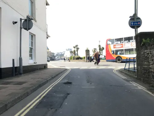
Giovanni & Luca
Restaurant · Italian, Italian Pizza, Pasta, Pizza
Gilbert Grove, Ilfracombe
Tu-Su 12:00-14:00, 17:30-21:00


George & Dragon
Bar and pub
4 Fore Street, Ilfracombe
Mo-Th 16:00-23:00; Fr 16:00-23:30; Sa 12:00-23:30; Su 12:00-22:30
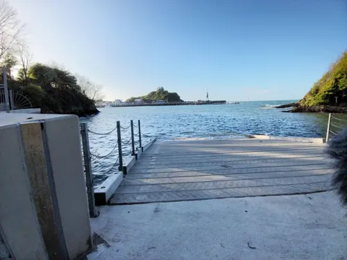
The Lime Kiln Cafe
Cafe · Breakfast, Burger, Cake, Chicken, Coffee Shop, Fish And Chips, Sandwich
1 Larkstone Gardens
Su,Mo 09:00-17:00; Tu-Sa 09:00-22:00
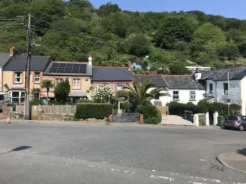

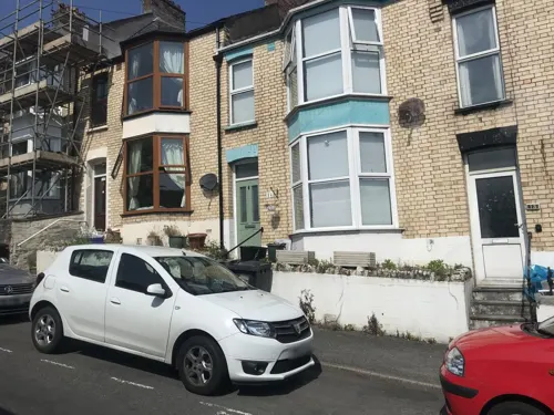



66 more on the map.
History
Ilfracombe has been settled since the Iron Age, when the Dumnonii (the Roman name for the inhabitants of the South-West) established a hill fort on the dominant hill, Hillsborough (formerly Hele's Barrow). The origin of the town's name has two possible sources. The first is that it is a derivative of the Anglo-Saxon Alfreinscoma - by which name it was noted in the Liber Exoniensis of 1086. The translation of this name (from Walter William Skeat of the department of Anglo Saxon at Cambridge University) means the "Valley of the sons of Alfred". The second origin is that the name Ilfracombe was derived from Norse illf (bad), Anglo-Saxon yfel (evil ford) and Anglo-Saxon cumb (valley) perhaps from a Celtic source (compare Welsh cwm), thus 'The valley with the bad ford'.
The manor house at Chambercombe in east Ilfracombe was recorded in the 1086 Domesday Book as being built by a Norman knight Champernon (from Chambernon in France) who landed with William of Normandy. It is also said to be haunted.
Read more of the history
Ilfracombe comprised two distinct communities; a farming community around the parish church called Holy Trinity, parts of which date from the 12th century, and a fishing community around the natural harbour formed between Capstone, Compass and Lantern Torrs. It is recorded that the lands by the church were part of the estate owned by Champernowne family, while those by the harbour belonged to the Bouchier family: Earls of Bath.
Because of the natural layout of the harbour, Ilfracombe became a significant safe port (registered port of refuge) on the Bristol Channel. It also had trade routes between Kinsale and Tenby, which made the port stronger. In 1208 it was listed as having provided King John with ships and men to invade Ireland; in 1247 it supplied a ship to the fleet that was sent to conquer the Western Isles of Scotland; 6 ships, with 79 men were sent to support the siege of Calais. Ilfracombe was the last disembarkation point for two large forces sent to subdue the Irish. The building which sits on Lantern Hill by the harbour, known as St Nicholas's Chapel (built 1361) is reputed to be the oldest working lighthouse in the UK; a light/beacon has been there for over 650 years.
The town was also home to the Bowen family. James Bowen was sailing master of HMS Queen Charlotte, the flagship of Richard, Earl Howe at the 1794 "Glorious First of June" battle. James Bowen was commissioned by Howe for his leadership in the battle. He rose through the levels - commander of HMS Argo, Dreadnought, and in Georgian England titled "defender of Madeira", led the fleet which rescued the British Army at Corunna in the Peninsular War. For his skill in saving the Peninsula army from Napoleon's forces, he was presented to a joint meeting of the Upper and Lower Houses of Parliament to receive the rare honour of record of "grateful thanks of the nation". He retired as a Rear Admiral and Commissioner of the Royal Navy. Captain Richard Bowen (1761–97) James Bowen's younger brother, a commander on HMS Terpsichore, served under Lord Nelson and was killed at the Battle of Santa Cruz de Tenerife (1797). John Bowen (1780–1827), son of Admiral James Bowen, was a naval officer and colonial administrator. He founded the first settlement of Tasmania at Risdon Cove in 1803 - the settlement that later became known as Hobart. Captain John Bowen married Queen Charlotte's niece.
Lieutenant A E Down was initially posted to Ilfracombe to lead a protection ship for HM Customs and Excise. He married a local girl and rose through the officers' ranks to retire as vice admiral. His son joined the navy aged 14 (his first navy kit is on display at National Maritime Museum, Greenwich). In 1802 James Meek married Down's daughter and settled in the town; James Meek was appointed the Comptroller of Victuals to the Royal Navy in 1832. He was knighted and died in Ilfracombe in 1852. (Gentlemen's Gazette)
There was a battlemented castle overlooking the harbour; of this nothing remains except contemporary records and the area designated Castle Hill off Portland Street/Montepellier Terrace.
The novelist Frances Burney stayed in Ilfracombe in 1817. Her diary entries (2 July – 5 October) record early 19th-century life in Ilfracombe: a captured Spanish ship; two ships in distress in a storm; the visit of Thomas Bowdler; and her lucky escape after being cut off by the tide. A few years later in the 1820s, a set of four tunnels were hand-carved by Welsh miners to permit access to the beaches by horse-drawn carriage as well as on foot. Previously access was gained by climbing the cliffs, rounding the point by boat, swimming or at the lowest tides clambering around the rocks of the point. These tunnels led to a pair of tidal pools, which in accordance with Victorian morals, were used for segregated male and female bathing. Whereas women were constrained to a strict dress code covering up the whole body, men generally swam naked. The tunnels are still viewable and are signposted as the Tunnels Beaches.
From the History section of Ilfracombe on Wikipedia, under CC BY-SA 4.0.
More about Ilfracombe
Geography
Ilfracombe overlies slates formed from sedimentary rock that underwent geological stress (creating faults and folds), towards the end of the Carboniferous Period, around 300 million years ago. These are known as the Ilfracombe slates. Ilfracombe lies within the North Devon Areas of Outstanding Natural Beauty which is renowned for its dramatic coastal cliffs and landscape. Hillsborough, lying close to the town centre is a local nature reserve, and around the town are many other havens for wildlife, notable including the Cairn. The coast itself is part of the North Devon Voluntary Marine Conservation area because of its diverse and rare species.
Economy
Until the mid-19th century Ilfracombe's economy was based around maritime activities: importing lime and coal from Wales; fishing for herring; and international trade, including to West Africa and the West Indies.
The town gradually developed into a tourist resort served by ferries along the Bristol Channel. The opening of the railway accelerated this development. The population grew until the First World War, then stabilised at 9,200, now 11,000. The economy suffered throughout the 1960s as UK holiday patterns changed, and suffered further through the closure of the railway line in 1970.
In the last 25 years, major investment by private 'light engineering' companies has added to the economy. These companies include: Pall Europe - a filtration manufacturer, the European headquarters TDK-Lambda, a subsidiary of the TDK Corporation, which manufactures industrial & medical power supplies. A number of light engineering firms provide additional employment and operate within a couple of miles of the town centre at Mullacott Cross. There are 3 deep-sea fishing boats which sail from the port and several inshore boats which farm the local lobster, crabs and whelks. There are many private charters, sea cruise and coastal tour boat operators sailing from the harbour.
Arts and culture
Each year, the residents and schoolchildren of Ilfracombe celebrate their heritage. These celebrations include six carnivals – a May Day, led by a "green" man walking celebration, it is a successor to the May Day events held for centuries until suppressed by the church in the 19th century because of riotous, licentious and drunken behaviour; Ilfracombe Victorian Celebration, a week-long programme of events held annually in June to celebrate a time of the town's prosperity; a large street carnival procession during August, organised by Ilfracombe Lions; the "sea ilfracombe" festival in September and the Lighting of the Lights held during November; and at Christmas, a Christingle.
The town hosts 10 small art galleries, including the exhibitions displayed by the Art Society in their gallery in the Arcade on the seafront, the foyer of the Landmark Theatre, the Quay and in "Number Eleven, The Quay" within which there are many Damien Hirst works.
Two other charitable events are organised each summer by Ilfracombe Round Table. Both make use of Ilfracombe Pier as a display area. The first of these is the annual "South West Birdman" contest which involves entrants seeking to 'fly' from the pier in home-made flying machines. The second event is "Rescue Day", an opportunity for members of the public to learn about the activities of the emergency services.
Education
The town's educational needs are served by three schools: an infants school, a junior school and the Ilfracombe Academy. Each of these schools are amongst the largest of their type in Devon. The Ilfracombe Academy serves the needs of Ilfracombe residents and those across the coastal North Devon area as far as Lynton and Lynmouth on the Somerset county boundary. It is a nationally recognised centre for Media Studies and was in 2004 awarded Media Arts Status. Upon completion of a new art block in 2007, the school's specialist status became simply arts. Further educational courses and vocational courses are run by the school.
Ilfracombe Museum was opened in 1932 in Ilfracombe Hotel's Victorian laundry and contains attractions from around the world including pickled bats and the two-headed kitten. It also contains items and photographs of local railway interest including one of the concrete name boards from the now closed local railway station, which can be seen on the front wall of the museum; and a collection of pieces of Victorian wedding cakes. It also has oak panels salvaged from the wreck of HMS Montagu.
Ilfracombe also has a library located on the Residential Candar Retirement Development.
From the Wikipedia article Ilfracombe, under CC BY-SA 4.0.
Notable people from Ilfracombe
 Emilia, Lady DilkeBritish author, art historian, feminist and trade unionistPhoto: Hubert von Herkomer, Public domain
 Thomas StukleyEnglish mercenaryPhoto: ( Lobsterthermidor ( talk ) 10:52, 2..., CC BY-SA 3.0
 Coulson KernahanBritish writer (1858–1943)Photo: Internet Archive Book Images, No restrictions
 Edward BanfieldEnglish railroad engineer and businessmanPhoto: StephenCWLL, CC BY-SA 4.0
 James BowenRoyal Navy officer during the French Revolutionary Wars and Napoleonic Wars.Photo: British school of the 19th century, Public domain
 Aliya WhiteleyBritish author (1974-)Photo: DavidPMaynard, CC BY-SA 4.0
 John Richards LapenotièreRoyal Navy officerPhoto: geni James Leakey, CC BY-SA 4.0
- John McCormickAmerican political scientist
- Ruth DownieBritish writer
- Arthur CleaveBritish actor (1884-1939)
- Helen FryBritish historian
- John BowenRoyal Navy officer and colonist who established a British settlement at Risdon Cove near Hobart, Tasmania, Australia
Born in Ilfracombe, according to Wikidata (CC0). Each name links to its Wikipedia article.
Where to stay33
Churches and places of worship12
The Salvation Army Ilfracombe Church & Community Centre
Church · Salvation Army · 0.6 mi
Shopping25
Gas and EV charging3
Schools, colleges and libraries4
Healthcare3
Combe Coastal Practice, Ilfracombe Medical Centre
Clinic and pharmacy · 0.7 mi
18 Saint Brannock's Road, Ilfracombe
Map of Ilfracombe
184 places. The map loads OpenStreetMap tiles when you open it.
Getting there and nearby towns
Swansea Airport (SWS) is the nearest airport with scheduled flights listed in OpenStreetMap, 27 miles away.
- Minehead 27 mi east, about 44 min by car
- Swansea 29 mi north, about 47 min by car
- Tiverton 34 mi southeast, about 55 min by car
- Exeter 42 mi southeast, about 1 h 15 min by car
- Cardiff 44 mi northeast, about 1 h 15 min by car
- Tavistock 46 mi south, about 1 h 15 min by car
- Kingsteignton 51 mi southeast, about 1 h 15 min by car
- Sidmouth 52 mi southeast, about 1 h 30 min by car
- Teignmouth 53 mi southeast, about 1 h 30 min by car
- Newport 55 mi northeast, about 1 h 30 min by car
Drive times are estimates from straight-line distance, not routes.
Towns near Ilfracombe


Keep exploring
Local news
Headlines from INDB.
Reviews, tips and questions
Loading what members have shared...
Sources and licences
- GeoNames (CC BY 4.0): population, coordinates, regions and time zone
- Mapillary (see each image): photos
- OpenStreetMap contributors (ODbL 1.0): places, airports, map data
- Wikidata (CC0 1.0): elevation, founding date, time zone, website, landmarks and historic places
- Wikimedia Commons (see each image): photos
- Wikipedia (CC BY-SA 4.0): overview and history text
Photo credits
- Ilfracombe (2022-08-26) 020, Simon Cobb, CC0
- Ilfracombe (2022-08-26) 021, Simon Cobb, CC0
- Ilfracombe (2022-08-26) 018, Simon Cobb, CC0
- Ilfracombe (2022-08-26) 019, Simon Cobb, CC0
- Ilfracombe.theatre.arp, Arpingstone, Public domain
- IlfracombeDevon gobeirne, Photograph by Greg O'Beirne, CC BY-SA 3.0
- St Nicholas Chapel, Ilfracombe, Nilfanion, CC BY-SA 3.0
- St Philip and St James Church, Ilfracombe, Nilfanion, CC BY-SA 3.0
- Ilfracombe (2022-08-27) 21, Simon Cobb, CC0
- Cross keys on gate railing, St Peter's Church, Ilfracombe, FHL2, CC BY-SA 4.0
- Ilfracombe (2022-08-26) 005, Simon Cobb, CC0
- Royal Britannia Hotel, Ilfracombe, from the harbour beach, FHL2, CC BY-SA 4.0
- Ilfracombe (2022-08-27) 36, Simon Cobb, CC0
- Ilfracombe (2022-08-26) 060, Simon Cobb, CC0
- Emmanuel Church Ilfracombe, Steven Manning, CC BY-SA 4.0
- Ilfracombe (2022-08-26) 002, Simon Cobb, CC0
- Ilfracombe (2022-08-26) 051, Simon Cobb, CC0
- Ilfracombe (2022-08-26) 106, Simon Cobb, CC0
- Ilfracombe (2022-08-26) 117, Simon Cobb, CC0
- Hele bay, Tony Atkin, CC BY-SA 2.0
- Harbour - panoramio (13), Mark A Coleman, CC BY 3.0
- Tunnels Beaches, Ilfracombe (43340754774), bongo vongo, CC BY-SA 2.0
- Ilfracombe (Devon, UK), Capstone Hill -- 2013 -- 1801, Dietmar Rabich, CC BY-SA 4.0
- Old mine collecting box, Ilfracombe Museum, Andy Dingley, CC BY-SA 4.0
- Street-level photo, cyclestreets, CC BY-SA 4.0
- Street-level photo, WaggyDog, CC BY-SA 4.0
- Street-level photo, cyclestreets, CC BY-SA 4.0
- Street-level photo, miguel_andrade, CC BY-SA 4.0
- Street-level photo, cyclestreets, CC BY-SA 4.0
- Street-level photo, cyclestreets, CC BY-SA 4.0
- Street-level photo, cyclestreets, CC BY-SA 4.0
- Street-level photo, miguel_andrade, CC BY-SA 4.0
- Street-level photo, cyclestreets, CC BY-SA 4.0
- Street-level photo, cyclestreets, CC BY-SA 4.0
- Street-level photo, cyclestreets, CC BY-SA 4.0
- Street-level photo, cyclestreets, CC BY-SA 4.0
- Street-level photo, miguel_andrade, CC BY-SA 4.0
- Street-level photo, cyclestreets, CC BY-SA 4.0
- Street-level photo, cyclestreets, CC BY-SA 4.0
- Street-level photo, cyclestreets, CC BY-SA 4.0
- Street-level photo, cyclestreets, CC BY-SA 4.0
- Street-level photo, miguel_andrade, CC BY-SA 4.0
- Street-level photo, cyclestreets, CC BY-SA 4.0
- Street-level photo, WaggyDog, CC BY-SA 4.0
- Street-level photo, cyclestreets, CC BY-SA 4.0


Page built November 10, 2026. Spotted a mistake? Tell us or suggest a place.