
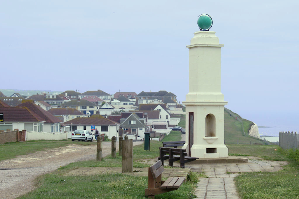


Peacehaven, United Kingdom
Peacehaven is a town of 18,579 people in England, United Kingdom.
Why visit Peacehaven
Townapedia lists 8 museums and landmarks, 14 parks and trails, 33 places to eat, 2 places to stay and 1 attraction in and around town.
Highlights include Monk's House, Beacon Hill and Saltdean Lido.
Weather in Peacehaven
Forecast from MET Norway (CC BY 4.0). Full forecast
About Peacehaven
Peacehaven is a town and civil parish in the Lewes district of East Sussex, England. It is above the chalk cliffs of the South Downs about 6 miles (10 km) east of Brighton city centre, on the A259 road. It is the place where the Greenwich meridian crosses the English south coast. Peacehaven is next to Telscombe Cliffs, a later western extension to Peacehaven, which is in a separate parish and has a separate town council.
From the Wikipedia article Peacehaven (this version), under CC BY-SA 4.0.
Things to do1

Museums and landmarks8

Monk's House
Museum · 3.3 mi
Historic house in Rodmell, East Sussex, now a National Trust property, was from 1919 until their deaths the home of Virginia and Leonard Woolf

Pedlersburgh
Monument and historic site · 1.1 mi
A Neolithic or Bronze Age bowl barrow, known as Pedlersburgh or Pedlersbery.
Parks, trails and playgrounds14





2 more on the map.
Restaurants and cafes33
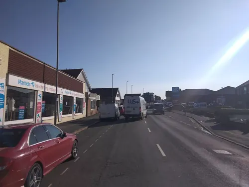
The Avenue
Bar and pub · 0.5 mi
174 South Coast Road, Peacehaven
Mo-Th,Su 11:00-23:00; Fr-Sa 11:00-24:00
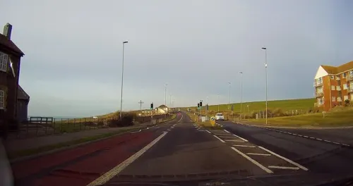
The Smugglers Rest
Bar and pub · 0.7 mi
South Coast Road, Peacehaven
Mo-Th 11:30-22:00; Fr-Sa 11:30-22:30; Su 11:30-22:00


21 more on the map.
History
There is a Bronze Age barrow (burial mound) near the cliff top, which has been under investigation by local societies. The barrow is evidence of human occupation at Peacehaven at least 3,500 years ago. A 2007 excavation of the new Bovis Homes site west of Peacehaven Community School's playing fields unearthed evidence for a prehistoric settlement throughout the Bronze and Iron Ages.
Peacehaven was founded in 1916 by entrepreneur Charles Neville, who bought land in the parish of Piddinghoe. He founded a company to develop the site, and also eventually built the nearby town of Saltdean and parts of Rottingdean). He advertised it by setting up a competition in virtually every newspaper in England to name the development. The winners who chose the name 'New Anzac-on-Sea' (to commemorate the ANZAC's involvement in the Battle of Gallipoli) were Mr West of Ilford, Essex and Mr Kemp of Maidstone, Kent.
The Daily Express later sued Neville over the competition, holding that it was a scam, since he was offering "free" plots of land in the town as runner-up prizes but issuing them only on the payment of a conveyancing fee. The Express won the case, but the publicity brought the scheme to a large audience. The idea was then to sell plots of land cheaply for people to build on themselves.
Read more of the history
Initially, the town was called New Anzac-on-Sea, but less than a year later, on 12 February 1917, it was renamed Peacehaven.
In 1927, the directors of Peacehaven Estates Ltd, of South Coast Road, Peacehaven, and 7, Pall Mall, Westminster, were Lord Teynham (chairman), CW Neville (managing director), and G. Kay Green.
Although it has been claimed that the town was originally formed for retiring World War I veterans in order for them to escape and recover from the effects of the war, this is not proven. Neville's publicity promoted the town as being an idyllic setting; sea air and simple lifestyle were thought to have aided good health. The land was also cheap and, as a result, working-class families from the city started to buy plots and gradually build makeshift homes for weekends and holidays. This movement of frontier-style buildings made with whatever materials were available at the time was called the plotlands movement. Inhabitants felt a sense of freedom in living off what they needed and enjoying a simpler life away from the busy, polluted city. The plotlands provided the working class an opportunity that might not have been available otherwise.
By 1924, there were 3,000 people living in Peacehaven. Original houses were often very temporary affairs (some were old railway carriages). Others were constructed from former army huts, brought from North Camp near Seaford, a few of these still survive, having been given an outer concrete block wall (they can be identified by their oblong shape that tends to be end-on to the road). Eventually the local council invested in water and electrical services and so people started to build more substantial houses. After World War II, the local council introduced a zoning scheme in order to distinguish areas for improvement along the coast road. In 1974 the Town Centre Map and Action Plan was formed to aid development.
There are two listed farmsteads in the town: Halcombe Farm House, built in the 17th century; and Hoddern Farm House, from the 18th century. Another old building is the Shepherds Cot; now in the garden of a private house in The Compts in north Peacehaven. This flint hut was built in the 1880s to shelter shepherds in the lambing season.
In 1933 the popular singer and comedian Gracie Fields set up the Gracie Fields Children's Home and Orphanage, for children of those in the theatre profession who could not look after them. She kept this until 1967, when the home was no longer needed. This was near her own home in Telscombe, and Fields often visited, with the children all calling her 'Aunty Grace'.
From the History section of Peacehaven on Wikipedia, under CC BY-SA 4.0.
More about Peacehaven
Geography
Peacehaven is on fairly flat coastal land, about 40 to 50 m (131 to 164 ft) above sea level. The pebble beach below the cliffs can be reached by a stairs and concrete driveway and sea walk. There is a number of green spaces along the A259 and the cliffs, one of which is called The Dell. A cinema formerly stood on this site, and now it holds events such as car boot sales, fireworks, fairgrounds, motorhome exhibitions, the Donkey Derby and an annual carnival, except in 2005 when the carnival was held on the Joff field behind the Meridian shopping centre. In the 1950s, the carnival stalls were on the then vacant land on the northwest corner of the South Coast Road (A259) and Dorothy Avenue.
Economy
Peacehaven is twinned with the French town of Épinay-sous-Sénart and the German town of Isernhagen.
The Co-operative Meridian Shopping Centre is in the town. There is also a leisure centre, several pubs, coffee shops, cafés and restaurants throughout the town, and a holiday caravan park on the eastern boundary.
Education
The town has one secondary school, Peacehaven Community School. There are also three primary schools: Peacehaven Heights Primary School, Meridian Primary School, and Telscombe Cliffs Primary School and Nursery. The library in the Meridian Centre hosts various training talks for adults and educational activities for children, as well as hosting a regular citizens' advice bureau.
From the Wikipedia article Peacehaven, under CC BY-SA 4.0.
Notable people from Peacehaven
- Jane GriffithsBritish actress (1928-1975)
Born in Peacehaven, according to Wikidata (CC0). Each name links to its Wikipedia article.
Where to stay2
Churches and places of worship11
Kingdom Hall of Jehovah's Witnesses
Church · Jehovahs Witness · 0.8 mi
99 South Coast Road, Peacehaven
Shopping6
Gas and EV charging3
Schools, colleges and libraries6
Healthcare5
Acorn Chiropody & Podiatry
Clinic and pharmacy · 0.4 mi
187 South Coast Road, Peacehaven
Epsom Skin Clinics (Peacehaven)
Clinic and pharmacy · 0.5 mi
164 South Coast Road, Peacehaven
Map of Peacehaven
89 places. The map loads OpenStreetMap tiles when you open it.
Getting there and nearby towns
Brighton City Airport (ESH) is the nearest airport with scheduled flights listed in OpenStreetMap, 13 miles away.
- Rottingdean 3 mi northwest, about 4 min by car
- Newhaven 3 mi east, about 4 min by car
- Seaford 5 mi east, about 8 min by car
- Brighton 6 mi northwest, about 10 min by car
- Lewes 6 mi north, about 9 min by car
- Portslade 10 mi west, about 16 min by car
- Shoreham-by-Sea 12 mi west, about 19 min by car
- Hailsham 12 mi northeast, about 20 min by car
- Eastbourne 13 mi east, about 21 min by car
- Burgess Hill 13 mi northwest, about 20 min by car
Drive times are estimates from straight-line distance, not routes.
Towns near Peacehaven


Keep exploring
Local news
Headlines from INDB.
Reviews, tips and questions
Loading what members have shared...
Sources and licences
- GeoNames (CC BY 4.0): population, coordinates, regions and time zone
- Mapillary (see each image): photos
- OpenStreetMap contributors (ODbL 1.0): places, airports, map data
- Wikidata (CC0 1.0): elevation, founding date, time zone, website, landmarks and historic places
- Wikimedia Commons (see each image): photos
- Wikipedia (CC BY-SA 4.0): overview and history text
Photo credits
- PeacehavenMemorial, MortimerCat, CC BY-SA 3.0
- Peacehaven Cliffs (37175093804), Nick Lansley, CC BY 2.0
- Virginia Woolf (2), Oliver Mallinson Lewis from Oxford, United Kingdom, CC BY-SA 2.0
- A lonely windmill - panoramio, Vojife, CC BY 3.0
- Telscombe Church, Charlesdrakew, Public domain
- Church of the Ascension, Peacehaven, The Voice of Hassocks, Public domain
- St Nicholas Church, Saltdean 01, The Voice of Hassocks, Public domain
- Saltdean Lido 2024-08-30, Andy Li, CC0
- Street-level photo, andreste96, CC BY-SA 4.0
- Street-level photo, tallguy, CC BY-SA 4.0
- Street-level photo, tallguy, CC BY-SA 4.0
- Street-level photo, tallguy, CC BY-SA 4.0
- Street-level photo, osde8info, CC BY-SA 4.0
- Street-level photo, andreste96, CC BY-SA 4.0
- Street-level photo, andreste96, CC BY-SA 4.0
- Street-level photo, andreste96, CC BY-SA 4.0
- Street-level photo, andreste96, CC BY-SA 4.0
- Street-level photo, tallguy, CC BY-SA 4.0
- Street-level photo, andreste96, CC BY-SA 4.0
- Street-level photo, tallguy, CC BY-SA 4.0
- Street-level photo, andreste96, CC BY-SA 4.0
- Street-level photo, osde8info, CC BY-SA 4.0
- Street-level photo, osde8info, CC BY-SA 4.0
- Street-level photo, andreste96, CC BY-SA 4.0
- Street-level photo, andreste96, CC BY-SA 4.0
- Street-level photo, andreste96, CC BY-SA 4.0
- Street-level photo, tallguy, CC BY-SA 4.0
- Street-level photo, andreste96, CC BY-SA 4.0
- Street-level photo, andreste96, CC BY-SA 4.0
- Street-level photo, tallguy, CC BY-SA 4.0
- Street-level photo, tallguy, CC BY-SA 4.0

Page built November 10, 2026. Spotted a mistake? Tell us or suggest a place.