


Why visit Lewes
Townapedia lists 40 museums and landmarks, 17 parks and trails, 77 places to eat, 6 places to stay and 8 attractions in and around town.
Highlights include Depot, Glyndebourne Opera House, Anne of Cleves' House and Lewes Castle.
Weather in Lewes
Forecast from MET Norway (CC BY 4.0). Full forecast
About Lewes
Lewes is the county town of East Sussex, England. The town is the administrative centre of the wider district of the same name. and lies on the River Ouse at the point where the river cuts through the South Downs. Lewes is approximately 7 miles (11 km) northeast of Brighton, 11 miles (18 km) northwest of Eastbourne, and 25 miles (40 km) west of Hastings. At the 2021 census, the parish had a population of 16,723.
From the Wikipedia article Lewes (this version), under CC BY-SA 4.0.
Travel tips from other travellers: Lewes on Wikivoyage (CC BY-SA 4.0).
Photos of Lewes


Things to do8


Glyndebourne Opera House
Cinema and theater · 2.4 mi
Opera house in Glyndebourne, Sussex, England (opened 1994)




Museums and landmarks40

Anne of Cleves' House
Museum · 0.4 mi
Grade I listed historic house museum in Lewes, Lewes, East Sussex, England, UK
52 Southover High Street, Lewes


Glynde Place
Museum · 2.7 mi
Grade I listed country house in Glynde, East Sussex, England, UK

Lewes War Memorial
Monument and historic site
War memorial in Lewes, East Sussex, United Kingdom. Sculptor: Vernon March

Monk's House
Museum · 2.5 mi
Historic house in Rodmell, East Sussex, now a National Trust property, was from 1919 until their deaths the home of Virginia and Leonard Woolf

Russian Memorial, Lewes
Monument and historic site
Memorial in Lewes, East Sussex, England, UK


The Tom Paine Printing Press & Press Gallery
Museum
Working 18th Century style wooden Common Press
151 High Street

Offham Hill Causewayed Enclosure
Monument and historic site · 1.4 mi
Archaeological site in Hamsey, Lewes, England, UK
28 more on the map.
Parks, trails and playgrounds17

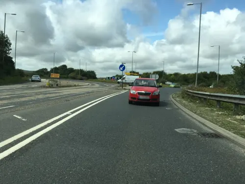

Lewes and Laughton Levels
Park · 2.1 mi
Park in Lewes, United Kingdom


5 more on the map.
Restaurants and cafes77

The Black Horse Inn
Bar and pub · 0.4 mi
55 Western Road, Lewes
Mo-Th 12:00-23:00; Fr-Sa 12:00-23:30; Su 12:00-22:30


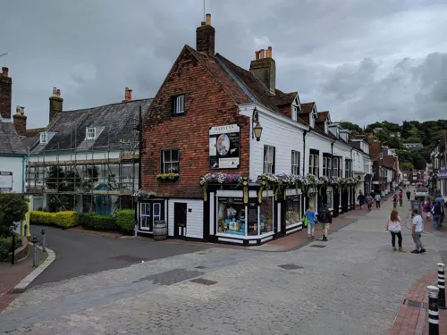


Flint Owl Bakery
Bakery
Bread, Cakes, Sandwichs, Coffee, Tea, Capucchino and so on
209 High Street, Lewes
Mo-Sa 09:00-17:00, Mo-Fr 08:30-17:00, Sa 09:00-17:00, Su 09:00-16:00




Royal Oak
Bar and pub
3 Station Street, Lewes
We-Sa 12:00-23:00; Mo,Tu 12:00-22:00
65 more on the map.
History
The immense strategic value of the site, which is able to command traffic between the Channel coast and the Sussex interior, was recognised as early as the Iron Age, when a hill-fort was built on Mount Caburn, the steep-sided hill that overlooks the Ouse (and the modern town of Lewes) from the east.
During the Roman period, there was an aristocratic villa at Beddingham, at the foot of Mount Caburn, and there have been several finds of Roman coins and pottery sherds in Lewes itself. The Victorian historian Thomas Walker Horsfield therefore reckoned that there must have been a Roman settlement on the site, and he identified it with the otherwise unlocatable town of Mutuantonis. Another antiquarian, John Elliot, even suggested that central Lewes's distinctive network of twittens was based on the layout of a Roman legionary fortress; however modern historians are rather more cautious about the possibility of a Roman Lewes, as there is as yet no archaeological evidence for a built-up area dating back to the Roman period.
Read more of the history
The earliest phase of Anglo-Saxon settlement in Sussex was concentrated between the Rivers Ouse and Cuckmere, and Anglo-Saxon finds begin to appear in Lewes from the sixth century. The town of Lewes was probably founded around this time, and it may have been one of the most important settlements in the Kingdom of Sussex, along with Chichester and Hastings, though the evidence for this early period is very sketchy.
By the ninth century, the Kingdom of Sussex had been annexed to the Kingdom of Wessex, and in 838 Ecgberht, King of Wessex donated the estate of Malling, on the opposite side of the Ouse from Lewes, to the archbishop of Canterbury. As a result, the Parish of Malling became a 'peculiar', which means that the parish was directly subject to the archbishop of Canterbury rather than the bishop of Chichester like every other parish in Sussex. Malling would retain this anomalous status until as late as 1845.
Information about Lewes becomes much more plentiful from the reign of Alfred the Great onward, as it was one of the towns which he fortified as part of the network of burhs he established in response to the Viking raids. The peace and stability brought by Alfred and his successors evidently stimulated economic activity in the area, for in the late Anglo-Saxon period Lewes seems to have been a thriving boom town – during the reign of Alfred's grandson Æthelstan it was assigned two royal moneyers, more than any other mint in Sussex, and according to Domesday Book it generated £26 of revenue for the Crown in 1065, almost twice the amount of any other town in the county, and comprised 127 households.
After the Norman Conquest, William the Conqueror rewarded his retainer William de Warenne by making him Earl of Surrey and granting him the Rape of Lewes, a strip of land stretching along the Ouse valley from the coast to the Surrey boundary. De Warenne constructed Lewes Castle within the walls of the Saxon burh, while his wife Gundreda founded the Priory of St Pancras, a Cluniac monastic house, in about 1081.
During the Second Barons' War, King Henry III was ambushed at Lewes by a force of rebel barons led by Simon de Montfort. Henry marched out to fight de Montfort, leading to a pitched battle on the hills above the town (roughly in the area of modern Landport Bottom). The king's son Prince Edward, commanding the right wing of the royal army, succeeded in driving off some of the baronial forces, but he got carried away with the pursuit, which took him as far as Offham. In Edward's absence the remainder of the royal army was attacked by de Montfort and Gilbert de Clare and decisively defeated. The king's brother Richard of Cornwall was captured, and the king himself was forced to sign the Mise of Lewes, a document which does not survive but was probably aimed at forcing Henry to uphold the Provisions of Oxford. Despite this uncertainty about its consequences, the battle is often seen as an important milestone in the development of English democracy.
The de Warenne family died out with Earl John in 1347, whereupon lordship of the Rape of Lewes passed to his sororal nephew Richard Fitzalan, 4th Earl of Arundel. Fitzalan preferred to reside at Arundel Castle rather than at Lewes, and the town therefore lost the prestige and economic advantages associated with being the seat of an important magnate. This was only the beginning of a series of misfortunes that struck Lewes, for in 1348 the Black Death arrived in England and later on in the century the Hundred Years' War led to a series of French and Castilian raids on Sussex, which badly disrupted trade. On one occasion in 1377 the Prior of St Pancras, John de Charlieu, was abducted by the raiders and held to ransom. Furthermore, after the main branch of the Fitzalan family died out in 1439, the Rape of Lewes was subsequently partitioned between the three sororal nephews of the last earl, namely John Mowbray, 3rd Duke of Norfolk, Edward Neville, 3rd Baron Bergavenny, and Edmund Lenthall. As a result of this dismemberment the district became even more neglected by its lords, although feudal politics was starting to become less important anyway due to the centralising reforms of the Yorkist and Tudor kings.
The English Reformation was begun by one of these Tudor monarchs, Henry VIII, and as part of this process the monasteries of England were dissolved; Lewes Priory was consequently demolished in 1538 and its property seized by the Crown. Henry's daughter Mary I reversed the religious policy of England, and during the resulting Marian Persecutions of 1555–1557, Lewes was the site of the execution of seventeen Protestant martyrs, most of them actually from the Weald rather than Lewes itself, who were burned at the stake in front of the Star Inn (now the site of Lewes Town Hall). Commemoration of the martyrs is one of the main purposes of Lewes Bonfire, and a stone memorial to the martyrs was unveiled on Cliffe Hill in 1901.
From the History section of Lewes on Wikipedia, under CC BY-SA 4.0.
More about Lewes
Geography
You can see Lewes lying like a box of toys under a great amphitheatre of chalk hills ... on the whole it is set down better than any town I have seen in England.
Lewes is situated on the Greenwich or prime meridian, in a gap in the South Downs, cut through by the River Ouse, and near its confluence with the Winterbourne Stream. It is approximately seven miles north of Newhaven, and an equal distance north-east of Brighton.
The South Downs rise above the river on both banks. The High Street, and earliest settlement, occupies the west bank, climbing steeply up from the bridge taking its ancient route along the ridge; the summit on that side, 2.5 miles (4.0 km) distant is known as Mount Harry. On the east bank there is a large chalk cliff, Cliffe Hill that can be seen for many miles, part of the group of hills including Mount Caburn, Malling Down (where there are a few houses in a wooded area on the hillside, in a development known as Cuilfail) and Golf Hill (home to the Lewes Golf Club). The two banks of the river are joined by Willey's Bridge (a footbridge), the Phoenix Causeway (a recent concrete road bridge, named after the old Phoenix Ironworks) and Cliffe Bridge (an 18th-century replacement of the mediaeval crossing, widened in the 1930s and now semi-pedestrianised).
Economy
The Lewes Chamber of Commerce represents the traders and businesses of the town. The town has been identified as unusually diversified with numerous specialist, independent retailers, counter to national trends toward 'chain' retailers and large corporate retail outlets.
Lewes Farmers' Market, one of the first in the UK, was started in the 1990s by Common Cause Co-operative Ltd and is a popular re-invention of Lewes as a market town. The Farmers' Market takes place in pedestrianised Cliffe High Street on the first and third Saturdays of every month, with local food producers coming to sell their wares under covered market stalls. A weekly food market in the Lewes Market Tower was established in July 2010 by Transition Town Lewes to allow traders to sell local produce. Occasionally French traders from the twin town of Blois attend, vending on Cliffe Bridge.
From 1794 beers, wines and spirits were distributed from Lewes under the Harveys name, and the town is today the site of Harvey's brewery celebrated as one of the finest ale producers in England.
Arts and culture
Located four miles (6.4 km) outside of Lewes is Glyndebourne opera house. Founded in 1934, the venue draws large audiences for its Summer Festival and has attracted a host of international talent throughout its history. Lewes Operatic Society (founded 1911) and New Sussex Opera are also based in the town of Lewes.
A number of other local classical music series operate in the town, including the Nicholas Yonge Society; and the baroque and early classical Workshop Series. The Musicians of All Saints is a Lewes-based chamber orchestra founded in 1987 who perform both new works and standard repertoire. A new annual music series, the Lewes Chamber Music Festival, was created in summer 2012. The Lewes Festival of Song was created in 2015 and the Lewes BaroqueFest in 2019. Other local music groups include the Lewes Concert Orchestra founded in 1993; and the Lewes, Glynde & Beddingham Brass Band, founded in 1922.
The East Sussex Bach choir is based in Lewes, as well as a number of other active amateur choirs, including Pro Musica Chamber Choir, the Everyman Ensemble, the Paddock Singers, Lewes Vox and East Sussex Community Choir.
Orlando Gough's opera The Finnish Prisoner is set in Lewes, telling the story of the Finnish prisoners of war held in Lewes after the Crimean War.
Education
Western Road and Southover School, despite being separate schools, are housed in linked buildings. The original Southover buildings are of red brick in the Queen Anne style, dating back to the early 20th century. The additions to it now forming the Western Road buildings date from after 1945. The two schools share a field. Pells Primary School closed in 2017. The alternative independent primary school, Lewes New School, closed in 2018.
Lewes Old Grammar School, an independent school which also has a sixth form.
Priory School, specialising in the arts, languages and science.
Kings Academy Ringmer, about three and a half miles from Lewes town centre, in a village called Ringmer, is a school for ages 11 to 16.
East Sussex College, formerly Sussex Downs College, has one of its campuses in Lewes, and provides a range of courses including A Levels, GCSEs, Functional Skills and Access courses and vocational qualifications such as NVQs and BTECs.
From the Wikipedia article Lewes, under CC BY-SA 4.0.
Notable people from Lewes
 Gideon MantellBritish scientist and obstetrician (1790–1852)Photo: Unknown author, Public domain
 Connor SwindellsBritish actorPhoto: John Sears, CC BY-SA 4.0
 John PeckhamArchbishop of CanterburyPhoto: Ealdgyth, CC BY-SA 3.0
 Ruth WareBritish author of crime thrillersPhoto: The British Library, CC BY 3.0
 Finnegan OldfieldFrench-British actorPhoto: Kacy Bao, CC BY-SA 4.0
 George Henry VerrallBritish horse racing official, entomologist, botanist and Conservative politician (1848-1911)Photo: Anonymous Unknown author, Public domain
 Henry PiddingtonEnglish scientist and merchant captain (1797-1858)Photo: Colesworthey Grant, Public domain
- William NicholsonBritish screenwriter, playwright and novelist (1948-)
- James IredellJustice on the US Supreme Court
- Anna CampbellBritish anarcha-feminist
- George HutsonBritish long-distance runner
- Ed HarcourtEnglish singer-songwriter
Born in Lewes, according to Wikidata (CC0). Each name links to its Wikipedia article.
Where to stay6
Churches and places of worship26
Shopping32
Gas and EV charging5
Schools, colleges and libraries12
Healthcare5
Map of Lewes
228 places. The map loads OpenStreetMap tiles when you open it.
Getting there and nearby towns
Brighton City Airport (ESH) is the nearest airport with scheduled flights listed in OpenStreetMap, 14 miles away.
- Rottingdean 5 mi southwest, about 9 min by car
- Newhaven 6 mi south, about 9 min by car
- Brighton 7 mi southwest, about 12 min by car
- Uckfield 8 mi northeast, about 12 min by car
- Seaford 8 mi southeast, about 13 min by car
- Portslade 10 mi west, about 16 min by car
- Shoreham-by-Sea 13 mi west, about 20 min by car
- Eastbourne 14 mi southeast, about 23 min by car
- Lancing 15 mi west, about 24 min by car
- Worthing 17 mi west, about 28 min by car
Drive times are estimates from straight-line distance, not routes.
Towns near Lewes


Keep exploring
Local news
Headlines from INDB.
Reviews, tips and questions
Loading what members have shared...
Sources and licences
- GeoNames (CC BY 4.0): population, coordinates, regions and time zone
- Mapillary (see each image): photos
- OpenStreetMap contributors (ODbL 1.0): places, airports, map data
- Wikidata (CC0 1.0): elevation, founding date, time zone, website, landmarks and historic places
- Wikimedia Commons (see each image): photos
- Wikipedia (CC BY-SA 4.0): overview and history text
Photo credits
- Lewes, United Kingdom (Unsplash), Oliver Maxwell olivermark_maxwell, CC0
- Battle of Lewes (3641090974), Simon Harriyott from Uckfield, England, CC BY 2.0
- Lewes Anne of Cleves House, Charlesdrakew, Public domain
- Keep To Lewes Castle April 2018 02, Arild Vågen, CC BY-SA 4.0
- Lewes war memorial, Poliphilo, CC0
- Virginia Woolf (2), Oliver Mallinson Lewis from Oxford, United Kingdom, CC BY-SA 2.0
- Lewes St. Anne's Church 4, Charlesdrakew, Public domain
- Lewes St John-sub-Castro Church, Charlesdrakew, Public domain
- Former Baptist Chapel, Southover, Lewes (IoE Code 293069), The Voice of Hassocks, Public domain
- Tapsel gate at St Pancras Church, Kingston near Lewes, Wheeltapper, CC BY-SA 3.0
- Firle 030, Charlesdrakew, Public domain
- Russian Memorial, Lewes (IoE 292975), Struway, Public domain
- Cliffe Cut, Simon Carey, CC BY-SA 2.0
- Jireh Chapel, Cliffe 2, Charlesdrakew, Public domain
- Cliffe Hill, The original uploader was StephenDawson at English Wikipedia ., CC BY-SA 2.0
- LewesPriory1, JohnArmagh, CC BY-SA 3.0
- St Michaels Church Lewes, RevanREK, CC BY-SA 4.0
- Pelham House, Richard Kelly, CC BY-SA 4.0
- Black Horse pub, Western Road, Lewes (NHLE Code 1043685) (June 2019) (2), Hassocks5489, CC0
- St Michael's Church, South Malling, Lewes (IoE Code 293011), The Voice of Hassocks, Public domain
- Pelham Arms pub, Western Road, Lewes (NHLE Code 1191429) (March 2022), Hassocks5489, CC0
- Friends Meeting House Lewes 2018, RevanREK, CC BY-SA 4.0
- Lewes Arms, A bit iffy, Public domain
- Lewes Library, Robert-brook, CC BY-SA 3.0
- BUN+BEAN in Lewes, UK, Andy Li, CC0
- Mount Caburn and its surroundings, Angus Wall, CC BY-SA 4.0
- Mead House (Lewes Old Grammar School), High Street, Lewes (NHLE Code 1043811) (March 2022), Hassocks5489, CC0
- Brack Mound House, Robert-brook, CC BY-SA 3.0
- The Maltings (2), Robert-brook, CC BY-SA 3.0
- 9 And 10, Castle Banks, Robert-brook, CC BY-SA 3.0
- Castle Precincts Cottage, Robert-brook, CC BY-SA 3.0
- The Old Poor House, Robert-brook, CC BY-SA 3.0
- Plant-based Cheeseburger - Depot Cinema and Restaurant 2025-03-06, Andy Li, CC0
- Glyndebourne Opera House (35434999420), Neil Rickards from Hertford, England, CC BY 2.0
- Glynde Place stable block, David Hawgood, CC BY-SA 2.0
- Street-level photo, janvanbekkum, CC BY-SA 4.0
- Street-level photo, southglos, CC BY-SA 4.0
- Street-level photo, asturksever, CC BY-SA 4.0


Page built November 10, 2026. Spotted a mistake? Tell us or suggest a place.