


Penzance, United Kingdom
Penzance is a town of 19,872 people in England, United Kingdom.
Why visit Penzance
Townapedia lists 28 museums and landmarks, 26 parks and trails, 103 places to eat, 33 places to stay and 6 attractions in and around town.
Highlights include The Acorn, Savoy Cinema, Penlee House, Gallery & Museum and Boskednan stone circle.
Weather in Penzance
Forecast from MET Norway (CC BY 4.0). Full forecast
About Penzance
Penzance ( pen-ZANSS; Cornish: Pennsans [pɛnːsanz] , meaning holy head) is a town, civil parish and port in Cornwall, England. It lies 64 miles (103 km) west-southwest of Plymouth, 255 miles (410 km) west-southwest of London, and 9 miles (14 km) east of Land's End. Penzance railway station is the terminus of the Cornish Main Line and is both the southernmost and westernmost station in England. Situated in the shelter of Mount's Bay, the town faces south-east onto the English Channel.
From the Wikipedia article Penzance (this version), under CC BY-SA 4.0.
Travel tips from other travellers: Penzance on Wikivoyage (CC BY-SA 4.0).
Photos of Penzance


Things to do6




Museums and landmarks28


Boskednan stone circle
Monument and historic site · 3.8 mi
Stone circle in Cornwall, England, UK

Chysauster Ancient Village
Monument and historic site · 2.9 mi
Archaeological site in New Mill, Cornwall, Cornwall, England, UK


Lanyon Quoit
Monument and historic site · 3.4 mi
Dolmen in Cornwall, England, UK

Mên-an-Tol
Monument and historic site · 4.1 mi
Standing stones near the Madron–Morvah road in Cornwall, England, UK

Mulfra Quoit
Monument and historic site · 3.4 mi
Dolmen in the Cornwall region, England

Newlyn Art Gallery
Museum · 1.3 mi
Contemporary art gallery in Cornwall
Penlee House Museum and Gallery
Museum
Museum and art gallery in Penzance, Cornwall, England, United Kingdom

Caer Bran
Monument and historic site · 4.1 mi
Archaeological site in Cornwall, UK
Carfury Standing Stone
Monument and historic site · 3.1 mi
Menhir in Madron, Cornwall, England, UK
Madron Well and Madron Well Chapel
Monument and historic site · 2.3 mi
Ruined medieval chapel in England
16 more on the map.
Parks, trails and playgrounds26



Marazion Marsh RSPB Reserve
Park · 2.4 mi
Royal Society for the Protection of Birds (RSPB) reserve west of Marazion, Cornwall, UK
14 more on the map.
Restaurants and cafes103

The Old Lifeboat House Bistro
Restaurant · Seafood
Wharf Road, Penzance
Tu-Sa 11:00-14:30,17:00-20:30
Fika
Cafe · Coffee Shop, Snack, Toastie, Pastry, Cake · 0.9 mi
New Road, Penzance
Mo,Su,Su 09:00-16:00; Tu,Th 08:00-16:00; We,Fr 07:30-16:00
The Tremenheere
Bar and pub · Burger, Pizza, Sausage
4-8 Market Place, Penzance
Su-Th 08:00-23:00; Fr-Sa 08:00-23:55
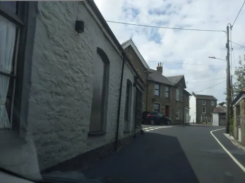
King William the Fourth
Bar and pub · 1.6 mi
22 Church Road, Madron
We-Fr 17:00-23:30; Sa-Su 12:00-23:30
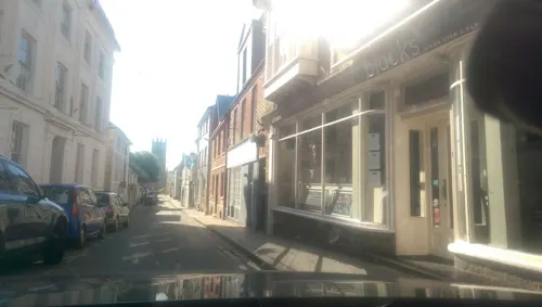
The Bakehouse
Restaurant · Seafood, Steak House
Chapel Street, Penzance
Fr-Sa 10:00-12:00; Tu-Sa 12:00-14:00,18:00-20:30

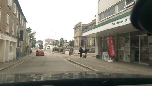



Cornerstone Heamoor
Cafe · Coffee Shop, Cake, Cornish · 1.0 mi
8 Bolitho Road, Heamoor
Mo-Fr 08:00-15:30

91 more on the map.
History
About 400 prehistoric stone axes, known as Group 1 axes and made from greenstone, have been found all over Britain, which from petrological analysis appear to come from west Cornwall. Although the quarry has not been identified, it has been suggested that the Gear, a rock now submerged half a mile from the shore at Penzance, may be the site. A significant amount of trade is indicated as many have been found elsewhere in Britain. The earliest evidence of settlement in Penzance is from the Bronze Age. A number of bronze implements such as a palstave, a spear-head, a knife, and pins, along with much pottery and large quantities of charcoal were discovered when building a new housing estate, at Tredarvah, to the west of Alverton.
Read more of the history
The defensive earthwork known as Lescudjack Castle is not excavated, but almost certainly belongs to the Iron Age. A single rampart encloses three acres of hilltop, and would have dominated the approach to the area from the east. There are no signs of the additional ramparts reported by William Hals in about 1730, and the site is now surrounded by housing with allotments. Excavations in 2008, 1 kilometre (0.62 mi) to the west at Penwith College found an enclosure ditch and pottery indicating a settlement, and an evolving field system with ditches and interconnecting pits suggesting water management. There are traces of a rampart and ditch to the west of Penzance at Mount Misery, and an oval rampart and ditch at Lesingey above the St Just road, which together with Lescudjack, overlook the coast of Penzance and Newlyn.
Until recently, there was little evidence for anything but an early and short Roman occupation of Cornwall, and there have so far been only three finds in Penzance. In August 1899 two coins of Vespasian (69–79 AD) were found in an ancient trench in Penzance Cemetery. The coins were eight feet below ground together with some cow bones, and are now in the Penlee House Museum. Another coin, found in 1934 in the Alverton area, depicts Sol, the Roman sun god. It is described as a ″coin of the reign of Constantine the Great″, and was also donated to the museum. A 30 mm (1 3/16 in) sestertius was found on a building site in or around Penzance about ten years previously, and was presented to the Royal Institution of Cornwall. Larger quantities of Roman coins have been found nearby, at Marazion Marsh and Kerris in Paul parish, but there is no evidence of any Roman settlement in the area, although nearby villages such as Chysauster were occupied at this time.
The Hundred of Penwith had its ancient centre at Connerton, now buried beneath the sands of Gwithian Towans at Gwithian. The Manor of Alverton, with an area of 64 Cornish acres, gave its name to the second largest tithing in Penwith. The manor included Penzance as well as parts of Madron, Paul, St Buryan and Sancreed.
Although Penzance is not mentioned in the survey document the Domesday Book, it is likely that the area would have been included. Domesday records that in 1066 the Manor of Alwarton was owned by Alward who was dispossessed by Robert, Count of Mortain, a half-brother of William the Conqueror. The name Alward and tun, a personal name combined with a town or settlement suffix, indicate Saxon land ownership. In Cornwall the tun indicates a manorial centre such as Helston or Connerton. The change of ownership in 1066 was a change from one alien landlord to another, and the name Alverton lives on as the western part of Penzance from St John's Hall, to the housing estate on the west side of the River Laregan.
The first mention of the name Pensans is in the Assize Roll of 1284, and the first mention of the actual church that gave Penzance its name is in a manuscript written by William Borlase in 1750: ″The ancient chapel belonging to the town of Penzance may be seen in a fish cellar, near the key; it is small and as I remember had the image of the Virgin Mary in it.″ The chapel was built of greenstone and about 30 ft in length and 15 ft in breadth of which only a fragment remained in situ. In around 1800 the chapel was converted to a fish cellar. A carving in "Ludgvan granite" thought to be of St Anthony was removed in about 1830 and was used in the wall of a pig sty, which was further vandalised in 1850 when "a stranger ... taking fancy to the stony countenance and rough hands, they were broken off and carried away as relics ...". The remains of the vandalised relic were taken to St Mary's Churchyard by a mason who told Mr Millett that he "popped St Raffidy into a wheelbarrow and trundle him off to the chapel yard." The carving remains in St Mary's Churchyard and has been dated by Prof Charles Thomas as early 12th century. There are no early documents mentioning the dedication to St Anthony; this seems to depend entirely on tradition and may be groundless. A licence for Divine Service in the Chapel of St Gabriel and St Raphael was granted in 1429, but nothing more is known of this chapel except, possibly, for the mason who mentioned ″St Raffidy″ in 1850. Adjoining the chapel is St Anthony's Gardens, named in 1933 and containing an archway said to have been taken from the chapel site.
From the History section of Penzance on Wikipedia, under CC BY-SA 4.0.
More about Penzance
Economy
The economy of Penzance has, like those of many Cornish communities, suffered from the decline of the traditional industries of fishing, mining and agriculture. Penzance now has a mixed economy consisting of light industrial, tourism and retail businesses. However, like the rest of Cornwall, housing remains comparatively expensive, wages low and unemployment high. In 2007, house prices rose 274% from 10 years prior, the fastest rise in the UK. The fishing port of Newlyn, which falls within the parish boundaries, provides some employment in the area, but has also been greatly affected by the decline in the fishing industry over the last 30 years. In the 2004 index of deprivation Penzance is listed as having 3 wards within the top 10% for employment deprivation, Penzance East (125th most deprived in England) Penzance West (200th most deprived in England), and Penzance Central (712th most deprived in England). 18–31% of households in the parish are described as "poor households". Penzance East also has one of the highest unemployment rates in Cornwall, stated as 15.4%.
Arts and culture
Every June since 1991 the Golowan Festival (which includes Mazey Day) has been held in the town. The name comes from the Cornish gool (meaning feast) and Jowan (a Cornish name equivalent to the English John) - loosely translating to 'Feast of St John' and marking the midsummer-eve as the vigil of John the Baptist.
Before the 1930s Penzance was the scene of large May Day celebrations, which saw local children making and using tin 'May horns' and 'May whistles'; a small revival of these traditions took place on 4 May 2008. The feast day of Corpus Christi was also celebrated in Penzance. The Corpus Christi fair has been a long-standing event in the town, and is currently undergoing attempts to revive it in a more traditional format.
The summer solstice was, in 1882, described as a very old custom and celebrated with all the rude revelry of heathendom. Bonfires were lit in the town centre and lines of tar barrels were swung along the streets by males and females. It was also accompanied by dancing of the roughest kind, uncouth dress and semi-disguise, sky and hand rockets, and all sorts of fireworks.
Around Penzance the period of Petertide has long been celebrated by Midsummer bonfires and sometimes the burning of effigies of unpopular residents.
Education
Penzance has two comprehensive schools, Mounts Bay Academy and Humphry Davy School. Post 16 education is catered for by Penwith College, founded in 1981 from the sixth form departments of the former Penzance Girls' Grammar School and the Humphry Davy Grammar School. In the Penzance parish there are 8 primary schools, including the newly created Pensans Primary School which was formed in 2006 from the former Penzance Junior School and the Lescudjack Infants School. There is also a special educational needs school within the parish boundary named Nancealverne.
Various other schools have existed in past times, including St Erbyn's School, West Cornwall School for Girls and Bolitho School at Polwithen House. The Polwithen site was originally home to Penzance Church of England Girls' High School and later the School of St Clare (a Woodard school) whose pupils included author Rosamund Pilcher and Ethiopian Princess Aida Desta. Bolitho School closed in 2017 because too few pupils were available. The building is now being developed as a care home, named the Frances Bolitho Care Home.
From the Wikipedia article Penzance, under CC BY-SA 4.0.
Notable people from Penzance
 Humphry DavyBritish chemistPhoto: Thomas Phillips, Public domain
 William ColensoNew Zealand printer, botanist, explorer, missionary and politician (1811–1899)Photo: unknown, Public domain
 George EusticeBritish politician (born 1971)Photo: Simon Dawson / No 10 Downing Street, CC BY 2.0
 Edward Russell1st Earl of Orford, First Lord of the Admiralty (1653–1727)Photo: Thomas Gibson, Public domain
 ZomboyBritish electronic music producer and DJPhoto: Jamesradio, CC BY-SA 4.0
 Francis Polkinghorne PascoeEnglish entomologist (1813–1893)Photo: Unknown author Unknown author, Public domain
 George Marsden WaterhousePremier of South Australia and Premier of New Zealand (1824-1906)Photo: not identified, Public domain
 Leonard Courtney, 1st Baron Courtney of PenwithBritish politician (1832–1918)Photo: Unknown author Unknown author, Public domain
- Ethelwynn TrewavasEnglish ichthyologist (1900–1993)
- Stanley JohnsonBritish politician (born 1940)
- Sandy WoodwardBritish admiral (1932-2013)
- Alex ReidBritish actress


Born in Penzance, according to Wikidata (CC0). Each name links to its Wikipedia article.
Where to stay33
Churches and places of worship19
Shopping20
Gas and EV charging2
Schools, colleges and libraries16
Healthcare5
Map of Penzance
250 places. The map loads OpenStreetMap tiles when you open it.
Getting there and nearby towns
Land's End Airport (LEQ) is the nearest airport with scheduled flights listed in OpenStreetMap, 6 miles away.
- Madron 2 mi northwest, about 3 min by car
- Mousehole 2 mi south, about 4 min by car
- Marazion 3 mi east, about 4 min by car
- St Just 6 mi west, about 10 min by car
- Uny Lelant 6 mi northeast, about 10 min by car
- St Ives 7 mi north, about 11 min by car
- Hayle 7 mi northeast, about 11 min by car
- Porthleven 10 mi east, about 16 min by car
- Truro 24 mi northeast, about 38 min by car
- St Austell 37 mi northeast, about 1 h by car
Drive times are estimates from straight-line distance, not routes.
Keep exploring
Local news
Headlines from INDB.
Reviews, tips and questions
Loading what members have shared...
Sources and licences
- GeoNames (CC BY 4.0): population, coordinates, regions and time zone
- Mapillary (see each image): photos
- OpenStreetMap contributors (ODbL 1.0): places, airports, map data
- Wikidata (CC0 1.0): elevation, founding date, time zone, website, landmarks and historic places
- Wikimedia Commons (see each image): photos
- Wikipedia (CC BY-SA 4.0): overview and history text
Photo credits
- PZHARBOURPANORAMA, The original uploader was Marktee1 at English Wikipedia ., CC BY-SA 3.0
- Samba Band, Mazey Day, Penzance, Cornwall - June 2023, Mutney, CC BY-SA 4.0
- Coral betting shop, Market Place, Penzance, Cornwall - May 2024, Mutney, CC BY 4.0
- 9 Market Place, Penzance, Cornwall - July 2025, Mutney, CC BY 4.0
- Penzance (2022-07-17) 032, Simon Cobb, CC0
- Penzance (2022-07-17) 033, Simon Cobb, CC0
- Wren and Raven cafe-bar, Penzance, Cornwall - July 2025, Mutney, CC BY 4.0
- Scaffolding on Market House, Penzance, July 2024, Gazamp, CC BY-SA 4.0
- Bedfred betting shop, Market Place, Penzance, Cornwall - May 2024, Mutney, CC BY 4.0
- Market Place. Penzance, Cornwall - July 2025, Mutney, CC BY 4.0
- Penzance - 23 Market Place, Jowaninpensans, CC BY-SA 4.0
- Therapy Dog in the parade, Mazey Day, Penzance, Cornwall - June 2022 (1), Mutney, CC BY-SA 4.0
- Wall-e in the parade, Mazey Day, Penzance, Cornwall - June 2022, Mutney, CC BY-SA 4.0
- Penzance - 9 Market Place (May 2020), Jowaninpensans, CC BY-SA 4.0
- Penzance (2022-07-17) 031, Simon Cobb, CC0
- Penzance - COVID-19 stickers (09), Jowaninpensans, CC BY-SA 4.0
- Spaceship in the parade, Mazey Day, Penzance, Cornwall - June 2022, Mutney, CC BY-SA 4.0
- Bedfred shopfront, Market Place, Penzance, Cornwall - May 2024, Mutney, CC BY 4.0
- Lloyds bank building, Penzance, March 2021, Gazamp, CC BY-SA 4.0
- Cornish Hen Deli, Market Place, Penzance, Cornwall - August 2023, Mutney, CC BY-SA 4.0
- Cornish Hen Deli shopfront, Market Place, Penzance, Cornwall - August 2023, Mutney, CC BY-SA 4.0
- Therapy Dog in the parade, Mazey Day, Penzance, Cornwall - June 2022 (2), Mutney, CC BY-SA 4.0
- Pub blackboard, The Globe, Penzance, July 2024, Gazamp, CC BY-SA 4.0
- HSBC bank, Penzance, Cornwall - April 2024 (2), Mutney, CC0
- Whirlwind Sports shopfront, Market Place, Penzance, Cornwall - May 2024, Mutney, CC BY 4.0
- Cornish Chough in the parade, Mazey Day, Penzance, Cornwall - June 2022, Mutney, CC BY-SA 4.0
- Market House, Penzance (5686313087), Tim Green from Bradford, CC BY 2.0
- Cancer Research charity shop, Market Place, Penzance, Cornwall - May 2024, Mutney, CC BY 4.0
- Boskednan stones at sunset penwith, Jim Champion, CC BY-SA 3.0
- Chysauster, MortimerCat, CC BY 2.5
- Lanyonquoit3, waterborough, Public domain
- Men-an-Tol 2004, Bkroll, CC BY-SA 3.0
- Mulfraquoit1, polandeze, CC BY 2.0
- NAG ext, Steve Tanner, photographer, CC BY-SA 4.0
- Penzance, Morrab Gardens 01, Palickap, CC BY-SA 3.0
- Baker's Pit Nature Reserve information board, Jowaninpensans, CC BY-SA 4.0
- Sancreed church and war memorial cornwall, Phil Williams, CC BY-SA 2.0
- Penlee House 2, Purely Penzance, CC BY 2.0
- Penzance - St John's Church (April 2020), Jowaninpensans, CC BY-SA 4.0
- 2024 St Pol-de-Leon's Church, Paul (5), Chris06, CC BY-SA 4.0
- Pond, Trengwainton, N p holmes, CC BY-SA 3.0
- Penzance (2022-07-17) 101, Simon Cobb, CC0
- Penzance (2022-07-17) 127, Simon Cobb, CC0
- Penzance (2022-07-17) 106, Simon Cobb, CC0
- Penzance old lifeboat station (2024), Geof Sheppard, CC BY-SA 4.0
- Penzance (2022-07-17) 016, Simon Cobb, CC0
- Penzance (2022-07-17) 144, Simon Cobb, CC0
- Penzance harbour light 466, Herbythyme, CC BY-SA 4.0
- Savoy Cinema, Causewayhead, Penzance - August 2023, Mutney, CC BY-SA 4.0
- Acorn Theatre, Penzance, June 2021, Gazamp, CC BY-SA 4.0
- Penzance (2022-07-17) 148, Simon Cobb, CC0
- Penzance (2022-07-17) 188, Simon Cobb, CC0
- Trewidden Garden - Cornwall, England - DSC02190, Daderot, CC0
- Humphry Davy School, Brokenchair74, CC BY-SA 4.0
- Penzance Grand Casino (Pavilion), Jowaninpensans, CC BY-SA 4.0
- Alexandra Terrace from Lariggan Gardens, Penzance, June 2024, Gazamp, CC BY-SA 4.0
- Penzance - Alexandra Grounds Ceremonial Cornerstone, Jowaninpensans, CC BY-SA 4.0
- Street-level photo, live, CC BY-SA 4.0
- Street-level photo, WaggyDog, CC BY-SA 4.0
- Street-level photo, WaggyDog, CC BY-SA 4.0
- Street-level photo, WaggyDog, CC BY-SA 4.0
- Street-level photo, WaggyDog, CC BY-SA 4.0
- Street-level photo, live, CC BY-SA 4.0
- Street-level photo, live, CC BY-SA 4.0
- Street-level photo, live, CC BY-SA 4.0
- Street-level photo, WaggyDog, CC BY-SA 4.0
- Street-level photo, WaggyDog, CC BY-SA 4.0
- Street-level photo, live, CC BY-SA 4.0
- Street-level photo, live, CC BY-SA 4.0
- Street-level photo, live, CC BY-SA 4.0
- Street-level photo, live, CC BY-SA 4.0
- Street-level photo, live, CC BY-SA 4.0
- Street-level photo, WaggyDog, CC BY-SA 4.0
- Street-level photo, WaggyDog, CC BY-SA 4.0
- Street-level photo, live, CC BY-SA 4.0
- Street-level photo, live, CC BY-SA 4.0
- Street-level photo, live, CC BY-SA 4.0
- Street-level photo, live, CC BY-SA 4.0
- Street-level photo, live, CC BY-SA 4.0
- Street-level photo, WaggyDog, CC BY-SA 4.0


Page built November 10, 2026. Spotted a mistake? Tell us or suggest a place.