


St Austell, United Kingdom
St Austell is a town of 24,360 people in England, United Kingdom.
Why visit St Austell
Townapedia lists 7 museums and landmarks, 14 parks and trails, 70 places to eat, 14 places to stay and 1 attraction in and around town.
Highlights include White River Cinema, Menacuddle Well, Poltair Park and Wheal Martyn.
Weather in St Austell
Forecast from MET Norway (CC BY 4.0). Full forecast
About St Austell
St Austell ( , ; Cornish: Sen Austel [sɛn ˈɔstɛl] ) is a town and civil parish in Cornwall, England, United Kingdom, 10 miles (16 km) south of Bodmin and 30 miles (48 km) west of the border with Devon.
From the Wikipedia article St Austell (this version), under CC BY-SA 4.0.
Travel tips from other travellers: St Austell on Wikivoyage (CC BY-SA 4.0).
Photos of St Austell


Things to do1

Museums and landmarks7



Parks, trails and playgrounds14






2 more on the map.
Restaurants and cafes70
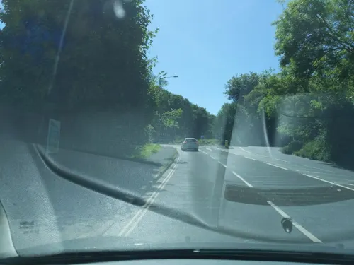
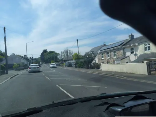
Nile's Bakery
Cafe · Regional, Coffee Shop · 0.8 mi
100 Holmbush Road, St Austell
Mo-Sa 07:30-17:00; Su 09:00-16:00

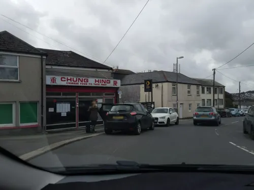
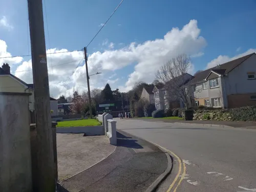

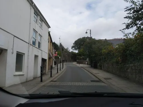
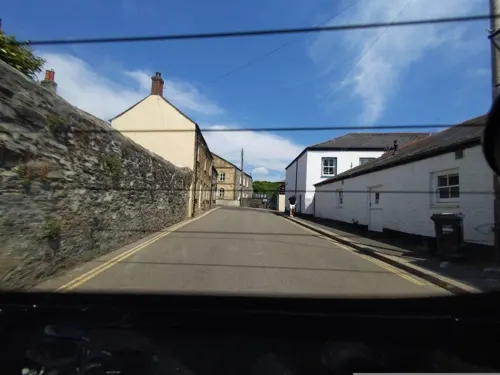
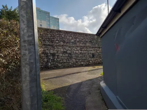
Watermargin
Restaurant · Chinese · 1.1 mi
2 Gover Road, St Austell
We,Th,Su 17:30-21:00; Fr,Sa 17:30-21:30; Mo,Tu off
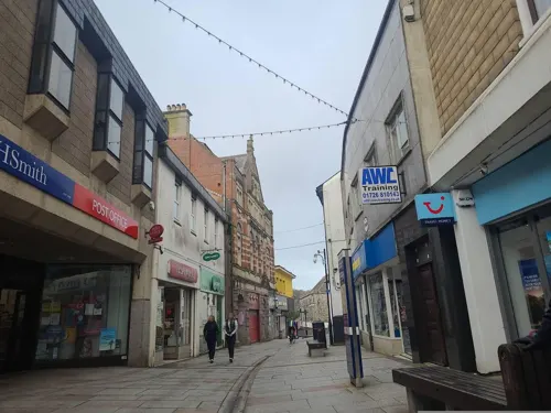
Gurkha Restaurant
Restaurant · Nepalese · 0.9 mi
36-38 Fore Street, St Austell
Th-Tu 10:30-13:30,17:00-23:00

58 more on the map.
History
St Austell was a village centred around the parish church, until the arrival of significant tin mining in the 18th century turned it into a town.
St Austell is not mentioned in Domesday Book (1086). However, A. L. Rowse, in his book St. Austell: Church, Town, and Parish, cites records which show a church was dedicated on 9 October 1262 by Bishop Bronescombe, and other records show a church there in 1169, dedicated to "Sanctus Austolus". The current church dates from the 13th–14th centuries, and was extended in 1498–99. The join between the two sections is still visible.
In the time of Henry VIII, St Austell is described as a poor village. In John Leland's Itinerary he says, in around 1542, "At S. Austelles is nothing notable but the paroch chirch". Neither travel writer, John Norden (c. 1547 – 1625) or Richard Carew (1555–1620) in his Survey of Cornwall mentioned St Austell as a place of any consequence. Oliver Cromwell granted a charter to hold a market on Friday, as a reward to a local gentleman who fought for him at the battle of Boconnoc.
Read more of the history
The village started to grow in the 18th century. The nearby Polgooth mine became known as the greatest tin mine in the world. Around 1760 the Land's End to Plymouth road went through the town. Along with William Cookworthy's discovery of china clay at Tregonning Hill in west Cornwall, and the same mineral, found in greater quantity in Hensbarrow downs north of St Austell, the town became more prominent.
China clay mining soon took over from tin and copper mining as the principal industry in the area, and this eventually contributed enormously to the growth of the town. The china clay industry really only came into its own during the mid-19th to early 20th centuries, at a time when the falling prices of tin and other metals forced many mines to close down or convert to clay mining. The success and high profitability of the industry attracted many families whose breadwinner had been put out of work by the depression in the local metal mining industry, and increased the population of the town considerably. This meant that more shops and businesses took root, providing more jobs and improving trade. This, along with other factors, led to St Austell becoming one of the ten most important commercial centres of Cornwall.
The town was a noted centre of Methodism. By 1839 The West Briton recorded 37 non-conformist chapels in the town.
According to Charles Henderson there were 19 in 1898. St Austell was connected to the electric telegraph network in 1863 when the Electric and International Telegraph Company opened stations at Truro, Redruth, Penzance, Camborne, Liskeard and St Austell.
Work began in 1963 on a brutalist-style pedestrian precinct which included shops, offices, and flats. The design was by Alister MacDonald & Partners and the materials reinforced concrete with some stone facing.
In the 2000s this area of the town had become very outdated, and underwent a £75 million redevelopment process. In August 2007, developers David McLean and demolition team Gilpin moved onto the town centre site to complete the preparation, with the Filmcentre which was originally an Odeon cinema dating back to 1936, being demolished in late September/early October.
In October 2007, the South West of England Regional Development Agency (SWRDA) announced the new development would be named White River Place. It was also announced that 50% of shop units had been leased to High Street stores, with New Look, Peacocks, Bonmarché and Wilko opening new stores. This would mean New Look relocating from its current premises in Fore Street and the return of Peacocks to St Austell following the demolition of its old store to make way for the new development. Bonmarché, New Look, Peacocks and Wilko have since closed.
It was announced in October 2008 that the developer David McLean Developments had gone into administration and concern was expressed that this could jeopardise the completion of the project.
The new White River Cinema opened its doors in December 2008 for the first time: the cinema is technically advanced and the first purpose-built cinema in Cornwall for over 60 years. The Torchlight Carnival was revived in November 2009 as a direct result of public demand through a survey conducted with local residents. The Torchlight Procession has become an important event in the town's calendar, heralding in the Winter celebrations and drawing thousands of people from across Cornwall and Devon. The event is run by a small group of non-affiliated volunteers.
The St Austell and Clay Country Eco-town is a plan for several new settlements around St Austell on old Imerys sites. It was given outline government approval in July 2009.
The Cornwall Council strategic planning committee voted in July 2011 to approve a £250 million beach resort scheme at Carlyon Bay, St Austell. The development was initially proposed in 2003.
From the History section of St Austell on Wikipedia, under CC BY-SA 4.0.
More about St Austell
Economy
St Austell is the main centre of the china clay industry in Cornwall and employs around 2,200 people as of 2006, with sales of £195 million.
The St Austell Brewery, which celebrated its 150th anniversary in 2001, supplies cask ale to pubs in Cornwall and other parts of the country. Its flagship beer is St Austell Tribute; a number of other ales are brewed but are less commonly sold outside Cornwall. St Austell Brewery's first public house, The Seven Stars Inn, purchased in 1863, still stands on East Hill in the town but has closed as a public house; the building is let by the Brewery at 'minimal rent' to a charity providing an educational facility for young people. Tregonissey House, the site of the company's first steam brewery, built in 1870, can also be seen in Market Hill. A brewery museum and visitor centre is open to the public on the present brewery site in Trevarthian Road.
As in much of Cornwall and neighbouring counties, tourism is increasingly important to St Austell's economy. Tourists are drawn to the area by nearby beaches and tourist attractions such as the Eden Project, sited in a former clay pit, and the Lost Gardens of Heligan. The China Clay Country Park, in a former china-clay pit two miles (3 km) north of the town, tells the story of the men, women and children who lived, worked and played in the shadow of the clay tips around St Austell.
Education
St Austell has three comprehensive schools, Poltair School, formerly the grammar school, and Penrice Academy; together with Brannel School which is situated in the nearby village of St Stephen-in-Brannel. All three are part of an academy trust called CELT (Cornwall Education and Learning Trust).
Cornwall College St Austell is a Further & Higher Education institution incorporating the former St Austell Sixth Form Centre and Mid Cornwall College of Further Education. The college is based at John Keay House, which is also home to the college group's headquarters.
From the Wikipedia article St Austell, under CC BY-SA 4.0.
Notable people from St Austell
 John NettlesBritish actor and writerPhoto: Man vyi, Public domain
 John ColensoBritish bishop and mathematician (1814-1883)Photo: Samuel Sidley, Public domain
 Steve BakerBritish politician (born 1971)Photo: Richard Townshend, CC BY 3.0
 Steve DoubleBritish politicianPhoto: Richard Townshend, CC BY 3.0
 David TremlettEnglish artist (born 1945)Photo: Bosinver, CC BY-SA 4.0
 Rosie RoffBritish modelPhoto: Jose Miranda, CC BY-SA 2.0
- Nigel MartynEnglish footballer (born 1966)
- Dan RogersonBritish politician (born 1975)
- A. L. RowseBritish historian (1903–1997)
- Mike ElliottBritish aerodynamicist (born 1974)
- Ivan SharrockEnglish sound engineer
- Robin DaveyBritish musician
Born in St Austell, according to Wikidata (CC0). Each name links to its Wikipedia article.
Where to stay14
Churches and places of worship23
Church of Jesus Christ of Later Day Saints St Austell Chapel
Church · Latter Day Saints
Kingfisher Drive, St Austell
Shopping28
Gas and EV charging3
Schools, colleges and libraries11
Healthcare12
St Austell Healthcare Wheal Northey
Clinic and pharmacy · 0.6 mi
Wheal Northey, St Austell
Map of St Austell
183 places. The map loads OpenStreetMap tiles when you open it.
Getting there and nearby towns
Cornwall Airport Newquay (NQY) is the nearest airport with scheduled flights listed in OpenStreetMap, 12 miles away.
- Saint Blazey 3 mi northeast, about 5 min by car
- Par 3 mi east, about 5 min by car
- Bugle 4 mi north, about 6 min by car
- Nanpean 5 mi northwest, about 7 min by car
- Mevagissey 5 mi south, about 8 min by car
- Roche 5 mi northwest, about 8 min by car
- Truro 13 mi southwest, about 22 min by car
- Saltash 25 mi east, about 40 min by car
- Plymouth 28 mi east, about 45 min by car
- Tavistock 31 mi northeast, about 50 min by car
Drive times are estimates from straight-line distance, not routes.
Towns near St Austell


Keep exploring
Local news
Headlines from INDB.
Reviews, tips and questions
Loading what members have shared...
Sources and licences
- GeoNames (CC BY 4.0): population, coordinates, regions and time zone
- Mapillary (see each image): photos
- OpenStreetMap contributors (ODbL 1.0): places, airports, map data
- Wikidata (CC0 1.0): elevation, founding date, time zone, website, landmarks and historic places
- Wikimedia Commons (see each image): photos
- Wikipedia (CC BY-SA 4.0): overview and history text
Photo credits
- Shops on Polkyth Road, St Austell, Cornwall - July 2023, Mutney, CC BY-SA 4.0
- Shops on Clifden Road, St Austell, Cornwall - July 2023, Mutney, CC BY-SA 4.0
- Detached houses, Park Way, St Austell, Cornwall - July 2023, Mutney, CC BY-SA 4.0
- Brookside, St Austell, Cornwall - July 2023, Mutney, CC BY-SA 4.0
- Houses on Slades Road, St Austell, Cornwall - July 2023, Mutney, CC BY-SA 4.0
- Detached houses, Manor Close, St Austell, Cornwall - July 2023, Mutney, CC BY-SA 4.0
- Chinese Wok takeaway, Clifden Road, St Austell, Cornwall - July 2023, Mutney, CC BY-SA 4.0
- Green house, Polkyth Road, St Austell, Cornwall - July 2023, Mutney, CC BY-SA 4.0
- Housing on Polkyth Road, St Austell, Cornwall - July 2023 (2), Mutney, CC BY-SA 4.0
- Terraced houses, Polkyth Road, St Austell, Cornwall - July 2023, Mutney, CC BY-SA 4.0
- Carpet shop, Clifden Road, St Austell, Cornwall - July 2023, Mutney, CC BY-SA 4.0
- Green houses, Polkyth Road, St Austell, Cornwall - July 2023, Mutney, CC BY-SA 4.0
- Terraced houses on Slades Road, St Austell, Cornwall - July 2023, Mutney, CC BY-SA 4.0
- Fish and chip shop, Clifden Road, St Austell, Cornwall - July 2023, Mutney, CC BY-SA 4.0
- Housing on Polkyth Road, St Austell, Cornwall - July 2023 (4), Mutney, CC BY-SA 4.0
- Housing on Polkyth Road, St Austell, Cornwall - July 2023 (1), Mutney, CC BY-SA 4.0
- Polkyth Road, St Austell, Cornwall - July 2023, Mutney, CC BY-SA 4.0
- Semi detached houses, Polkyth Road, St Austell, Cornwall - July 2023, Mutney, CC BY-SA 4.0
- Housing on Polkyth Road, St Austell, Cornwall - July 2023 (3), Mutney, CC BY-SA 4.0
- Tremarne, Slades Road, St Austell, Cornwall - July 2023, Mutney, CC BY-SA 4.0
- Carlyon Road, St Austell, Cornwall - July 2023 (1), Mutney, CC BY-SA 4.0
- Semi-detached houses on the corner of Slades Road and Central Avenue, St Austell, Cornwall - July 2023, Mutney, CC BY-SA 4.0
- Roundabout at junction of Tremayne Road and Carlyon Road. St Austell, Cornwall - July 2023, Mutney, CC BY-SA 4.0
- Costcutter, Carlyon Road, St Austell, Cornwall - July 2023, Mutney, CC BY-SA 4.0
- Morrisons Daily convenience store and Post Office, Slades Road, St Austell, Cornwall - July 2023, Mutney, CC BY-SA 4.0
- Wheal Martyn works, AtticTapestry, CC BY-SA 4.0
- Poltair School St Austell Cornwall, Ashley Smith, CC BY-SA 4.0
- Menacuddle, Jolyonvincent, CC BY-SA 4.0
- St Austell library front view, Amj2264, CC BY-SA 4.0
- Pier House Hotel, Charlestown, Cornwall, Amj2264, CC BY-SA 4.0
- Friends Meeting House, High Cross Street, St Austell, Cornwall - October 2024, Mutney, CC BY 4.0
- 1 and 3 Victoria Place, St Austell, Cornwall - October 2024, Mutney, CC BY 4.0
- St Austell Brewery-by-Tony-Atkin, Tony Atkin, CC BY-SA 2.0
- Studio 19, Market House, St Austell, Cornwall - October 2024, Mutney, CC BY 4.0
- Football pitch, Poltair park, St Austell, Cornwall - August 2026, Mutney, CC BY 4.0
- Cemetery Park, St Austell, Cornwall - October 2024, Mutney, CC BY 4.0
- Street-level photo, WaggyDog, CC BY-SA 4.0
- Street-level photo, WaggyDog, CC BY-SA 4.0
- Street-level photo, WaggyDog, CC BY-SA 4.0
- Street-level photo, WaggyDog, CC BY-SA 4.0
- Street-level photo, WaggyDog, CC BY-SA 4.0
- Street-level photo, WaggyDog, CC BY-SA 4.0
- Street-level photo, WaggyDog, CC BY-SA 4.0
- Street-level photo, WaggyDog, CC BY-SA 4.0
- Street-level photo, MitchB, CC BY-SA 4.0
- Street-level photo, MitchB, CC BY-SA 4.0
- Street-level photo, WaggyDog, CC BY-SA 4.0
- Street-level photo, MitchB, CC BY-SA 4.0
- Street-level photo, severecci, CC BY-SA 4.0
- Street-level photo, WaggyDog, CC BY-SA 4.0
- Street-level photo, WaggyDog, CC BY-SA 4.0
- Street-level photo, WaggyDog, CC BY-SA 4.0
- Street-level photo, WaggyDog, CC BY-SA 4.0
- Street-level photo, MitchB, CC BY-SA 4.0
- Street-level photo, MitchB, CC BY-SA 4.0
- Street-level photo, MitchB, CC BY-SA 4.0
- Street-level photo, MitchB, CC BY-SA 4.0
- Street-level photo, WaggyDog, CC BY-SA 4.0
- Street-level photo, WaggyDog, CC BY-SA 4.0
- Street-level photo, MitchB, CC BY-SA 4.0
- Street-level photo, WaggyDog, CC BY-SA 4.0
- Street-level photo, WaggyDog, CC BY-SA 4.0
- Street-level photo, MitchB, CC BY-SA 4.0
- Street-level photo, WaggyDog, CC BY-SA 4.0
- Street-level photo, WaggyDog, CC BY-SA 4.0
- Street-level photo, WaggyDog, CC BY-SA 4.0


Page built November 10, 2026. Spotted a mistake? Tell us or suggest a place.