


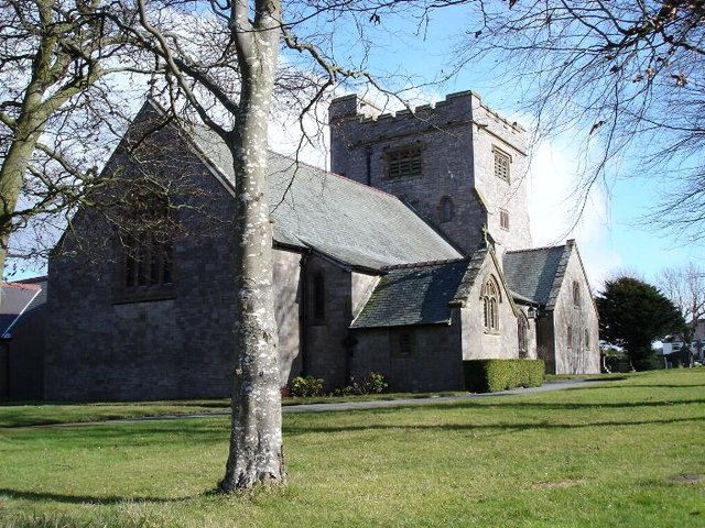


Colwyn Bay, United Kingdom
Colwyn Bay is a town of 29,275 people in Wales, United Kingdom.
Why visit Colwyn Bay
Townapedia lists 6 museums and landmarks, 8 parks and trails, 114 places to eat, 16 places to stay and 4 attractions in and around town.
Highlights include Bryn Euryn, Harlequin Puppet Theatre, Llys Euryn and Welsh Mountain Zoo.
Weather in Colwyn Bay
Forecast from MET Norway (CC BY 4.0). Full forecast
About Colwyn Bay
Colwyn Bay (/ˈkɒlwɪn/; Welsh: Bae Colwyn [ˈbai ˈkɔlʊɨn] ) is a town, community and seaside resort in Conwy County Borough on the north coast of Wales overlooking the Irish Sea. It lies within the historic county boundaries of Denbighshire. At the 2021 census, the community had a population of 10,576, and the built up area had a population of 29,275. According to the tourist board, it is renowned for its 4.8 kilometre long sandy beach which has been enhanced with millions of tonnes of sand, so therefore 'man-made' and its permanently available irrespective of the tides.
From the Wikipedia article Colwyn Bay (this version), under CC BY-SA 4.0.
Travel tips from other travellers: Colwyn Bay on Wikivoyage (CC BY-SA 4.0).
Things to do4


Harlequin Puppet Theatre
Cinema and theater · 1.0 mi
Puppet theatre in Rhos-on-Sea, Wales
Cayley Promenade, Colwyn Bay

Museums and landmarks6



Parks, trails and playgrounds8


Conwy RSPB reserve
Park · 3.3 mi
Royal Society for the Protection of Birds reserve on the east side of the Conwy estuary, North Wales




Restaurants and cafes114



Tapps
Bar and pub · 1.1 mi
1 Everard Road, Colwyn Bay
Mo 12:00-21:00; Tu,We,Su 12:00-22:00; Th-Sa 12:00-23:00

102 more on the map.
History
The western side of Colwyn Bay, Rhos-on-Sea, includes a number of historic sites associated with St Trillo and Ednyfed Fychan, the 13th century general and councillor to Llywelyn the Great.
The name 'Colwyn' may be named after Collwyn ap Tangno, an 11th century nobleman who was Lord of Eifionnydd, Ardudwy and part of the Llŷn peninsula, or after the River Colwyn in Old Colwyn. (In Welsh the word Colwyn means "puppy" (with the 'w' being a vowel), but Collwyn (with an alveolar lateral fricative) is a more plausible toponym, meaning "hazel grove" (llwyn cyll).)
King Richard II (1367–1400) was ambushed in Old Colwyn in 1399 by supporters of Henry Bolingbroke as he returned to England from Ireland.
Colwyn Bay railway station opened in 1849 on the Chester and Holyhead Railway. The station was initially just called Colwyn, but was renamed Colwyn Bay in 1876. As with nearby Llandudno and Rhyl, Colwyn Bay grew rapidly following the arrival of the railway, becoming a seaside holiday town, conveniently accessible for the large towns in north-west England. Much of the area around Colwyn Bay station was owned by the Pwllycrochan Estate. From 1875 onwards, the estate actively sought to develop its land, selling building plots for development whilst retaining some control over the nascent town.
Read more of the history
In 1890, the British and African Incorporated Association (African Training Institute) was established in the town by Reverend William Hughes, a missionary pastor, and friend of Henry Morton Stanley, who had spent the early 1880s in 'Congoland' (Congo Free State). Hughes brought back two Congolese children to Colwyn Bay in 1885 to train with the intention that they would then return and be missionaries in Africa. Over its 23 years, the institute trained 87 students.
Britain's first milk bar branch of the National Milk Bar company of Robert William Griffiths was opened in Colwyn Bay in 1933.
During World War II the Colwyn Bay Hotel, Marine Road (now demolished) was the headquarters of the Ministry of Food. This also housed the Cocoa & Chocolate division and was the communications hub for the ministry. They continued to use the hotel until 1953. Colwyn also supported the war effort by becoming a significant location for the diamond cutting and polishing industry, which was used to help fund the war effort.
From the History section of Colwyn Bay on Wikipedia, under CC BY-SA 4.0.
More about Colwyn Bay
Geography
The town is situated about halfway along the north coast of Wales, between the sea and the Pwllycrochan Woods on the towering hillside. Groes yn Eirias (Welsh:Cross in Torch) was once a separate hamlet centred on the Glyn farmhouse (c1640) but the area is now occupied by the Glyn estate and Eirias Park.
Economy
The town is dominated by the tourist trade, because of its famous beaches. Colwyn Bay is a Fairtrade Town as certified by the Fairtrade Foundation as part of the Fairtrade Towns scheme.
Arts and culture
Colwyn Bay hosted the National Eisteddfod in 1910 and 1947. Also the Victoria Pier hosted many dances and shows during the 20th century and became popular with touring bands and artistes through the 1960s until the final gig there in August 2008.
Education
Colwyn Bay has three secondary schools - one private and two state. Eirias High School is in Eirias Park and Ysgol Bryn Elian is in Old Colwyn. Ysgol Bryn Elian mainly serves Old Colwyn and Eirias High School mainly serves Colwyn Bay, Rhos on Sea and Penrhyn Bay.
Rydal Penrhos School is a Methodist public school, which is on multiple sites in the town. Fees at this elite public school exceeded more than £34,000 per year for boarding in 2021 and boasts the only Eton Fives courts in Wales. Former alumni include Princess Maria of Romania, a cousin of King Charles III.
The town's primary schools are Ysgol Nant y Groes, Ysgol Pen-y-Bryn, Ysgol T Gwynn Jones, Ysgol Hen Golwyn, and Saint Joseph's R.C. Primary and the Welsh-language Ysgol Bod Alaw.
From the Wikipedia article Colwyn Bay, under CC BY-SA 4.0.
Notable people from Colwyn Bay
 Timothy DaltonBritish actor of stage, film and televisionPhoto: File:Timothy Dalton 1987.jpg :..., CC BY-SA 3.0 nl
 Richard EllisBritish astronomerPhoto: Copyright with California Institute..., CC BY-SA 4.0
- Terry JonesWelsh actor, comedian, director, historian and writer (1942–2020)
- Paula YatesBritish television presenter and writer (1959–2000)
- The VivienneBritish drag performer (1992–2025)
- Mike WalkerWelsh footballer (born 1945)
- Reg HunterWelsh footballer (born 1938)
- Ffred FfransisWelsh activist
- Archie HughesWelsh football goalkeeper (1919-1992)
- Cyril SidlowWelsh footballer (1915-2005)
- William DaviesWelsh Roman Catholic priest
- Peter O'SullivanWelsh footballer (born 1951)
Born in Colwyn Bay, according to Wikidata (CC0). Each name links to its Wikipedia article.
Where to stay16
Lyndale Hotel & Tamarind Thai Restaurant
Motel and hotel · 1.5 mi
410 Abergele Road, Colwyn Bay
Churches and places of worship26
Shopping22
Gas and EV charging3
Schools, colleges and libraries15
Healthcare7
Camella Health Care Old Colwyn Pharmacy
Clinic and pharmacy · 1.2 mi
397 Abergele Road, Colwyn Bay
Nant-y-Glyn Health Resource Centre
Hospital · 0.4 mi
10 Nant-Y-Glyn Road, Colwyn Bay
Map of Colwyn Bay
221 places. The map loads OpenStreetMap tiles when you open it.
Getting there and nearby towns
Hawarden Airport (CEG) is the nearest airport with scheduled flights listed in OpenStreetMap, 32 miles away.
- Llandudno 5 mi northwest, about 8 min by car
- Rhyl 10 mi east, about 16 min by car
- Prestatyn 13 mi east, about 22 min by car
- Flint 25 mi east, about 40 min by car
- Heswall 26 mi east, about 42 min by car
- Moreton 26 mi east, about 42 min by car
- Mold 26 mi east, about 41 min by car
- Wallasey 29 mi east, about 46 min by car
- Birkenhead 30 mi east, about 49 min by car
- Liverpool 32 mi east, about 51 min by car
Drive times are estimates from straight-line distance, not routes.
Towns near Colwyn Bay


Keep exploring
Local news
Headlines from INDB.
Reviews, tips and questions
Loading what members have shared...
Sources and licences
- GeoNames (CC BY 4.0): population, coordinates, regions and time zone
- Mapillary (see each image): photos
- OpenStreetMap contributors (ODbL 1.0): places, airports, map data
- Wikidata (CC0 1.0): elevation, founding date, time zone, website, landmarks and historic places
- Wikimedia Commons (see each image): photos
- Wikipedia (CC BY-SA 4.0): overview and history text
Photo credits
- Welsh Mountain Zoo, Frombowen, CC BY-SA 4.0
- ConwyRSPB, Tigershrike, Public domain
- Christ Church, Bryn-y-Maen, Dot Potter, CC BY-SA 2.0
- Eglwys Sant Ioan - St John's Church, Ceri Morgan, CC BY-SA 2.0
- St Paul's Church, Colwyn Bay, Jonathan Wilkins, CC BY-SA 2.0
- Rydal Penrhos Pavilion, PeeJay2K3, CC BY-SA 3.0
- Eglwys Sant Trillo, Llandrillo-yn-Rhos, St Trillo, Rhos-on-Sea, Conwy 12, Llywelyn2000, CC BY-SA 3.0
- Sant Trillo St Trillo Betws yn Rhos Conwy Gogledd Cymru North Wales 27, Llywelyn2000, CC BY-SA 4.0
- Cayley Flyer, Huwpritchard, CC BY-SA 3.0
- The Station 2, Octavius Aurelius, CC BY-SA 4.0
- Bryn Euryn, & distant view of Penmon Rhos label QS:Len,"Bryn Euryn, & distant view of Penmon Rhos" label QS:Lcy,"Bryn Euryn a'r olygfa tuag at Penmon Rhos", John Ingleby, Public domain
- Bryn Euryn, Rkedata, CC BY-SA 4.0
- A bench in Eirias Park (Mainc ym Mharc Eirias) 2674840 c6090872, Ceri Thomas, CC BY-SA 2.0
- Street-level photo, trigpoint, CC BY-SA 4.0
- Street-level photo, trigpoint, CC BY-SA 4.0
- Street-level photo, laye, CC BY-SA 4.0


Page built November 10, 2026. Spotted a mistake? Tell us or suggest a place.