


Why visit Swindon
Townapedia lists 49 museums and landmarks, 79 parks and trails, 160 places to eat, 36 places to stay and 13 attractions in and around town.
Highlights include Swindon Mechanics' Institute, Lotmead Farm Pick Your Own, Museum & Art Swindon and STEAM - Museum of the Great Western Railway.
Weather in Swindon
Forecast from MET Norway (CC BY 4.0). Full forecast
About Swindon
Swindon is a town in Wiltshire, England. At the time of the 2021 census, the population of the built-up area was 224,942, making it the largest settlement in the county. Located at the northeastern edge of the South West England region, Swindon lies on the M4 corridor, 84 miles (135 km) to the west of London and 36 miles (57 km) to the east of Bristol. The Cotswolds lie just to the town's north and the North Wessex Downs lie just to the town's south.
From the Wikipedia article Swindon (this version), under CC BY-SA 4.0.
Travel tips from other travellers: Swindon on Wikivoyage (CC BY-SA 4.0).
Photos of Swindon


Things to do13

Swindon Mechanics' Institute
Cinema and theater · 0.5 mi
Education and theatre building in Swindon, England


Lotmead Farm Pick Your Own
Farm and orchard · 2.8 mi
Pick Your Own
Lotmead Lane, Swindon
May-Oct: Mo-Su 09:30-19:00

Wyvern Theatre
Cinema and theater
Theatre in Swindon, Wiltshire, England
Theatre Square, Swindon

1 more on the map.
Museums and landmarks49


Barbury Castle
Monument and historic site · 5.0 mi
Hill fort in England

Bincknoll Castle
Monument and historic site · 4.2 mi
Site of a possible Iron Age univallate hillfort located in Wiltshire, England, UK



Day House Lane Stone Circle
Monument and historic site · 2.2 mi
Stone circle in South Swindon, Wiltshire, England, UK
Durocornovium
Monument and historic site · 2.6 mi
Small Roman settlement in Britain
Fir Clump Stone Circle
Monument and historic site · 1.9 mi
Destroyed prehistoric sandstone megalith circle

37 more on the map.
Parks, trails and playgrounds79
Lydiard Park
Park · 3.5 mi
Country park in Swindon, Wiltshire, England, UK

Town Gardens
Park · 0.6 mi
Park and gardens in Swindon, Wiltshire, England

The Nigel Eady County Ground
Sports field and stadium · 0.6 mi
County Road, Swindon

Mouldon Hill Country Park
Park · 3.0 mi
Country park in Wiltshire, England, UK

Coate Water Pitch & Putt Course
Golf course · 1.8 mi
Mo off; Tu 11:00-18:00; We off; Th 11:00-18:00; Fr-Su off;...


67 more on the map.
Restaurants and cafes160
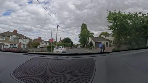
The White Hart
Bar and pub · 2.5 mi
21 High Street, Swindon
Mo-Th 11:00-22:00; Fr-Sa 11:00-23:00; Su 11:30-21:00
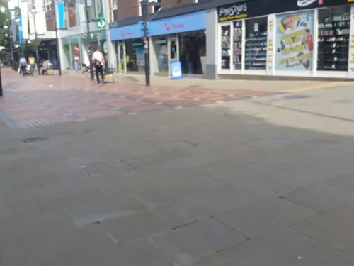
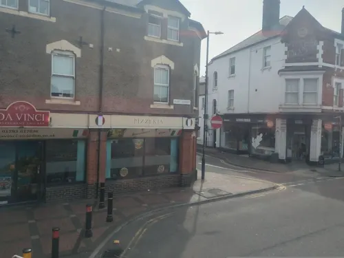
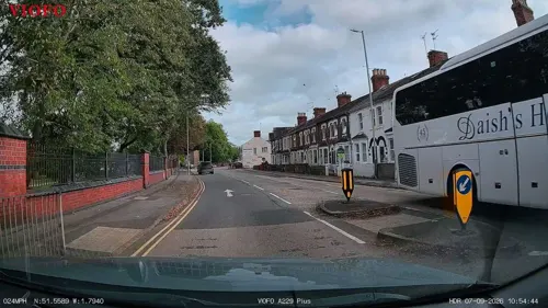
Greek Olive
Restaurant · Greek · 0.5 mi
141 Faringdon Road, Swindon
Tu-Th 17:00-22:00; Fr 17:00-23:00; Sa 17:00-23:00; Su 13:00-20:00


Harper's Steakhouse at the Weighbridge
Restaurant · Steak House · 0.9 mi
Penzance Drive, Swindon
Mo-Sa 11:00-23:00; Su 12:00-23:00

Boswells
Cafe · Breakfast, Lunch, Cafe, Sandwich
19D Regent Street, Swindon
Mo-Sa 08:00-17:00, Su 10:00-16:00

Hickory's Smokehouse
Restaurant · Barbecue · 2.9 mi
Middleleaze Drive, Swindon
Mo-Fr 12:00-23:00; Sa-Su 10:00-23:00
Kitchen in the Corner
Cafe · Breakfast, Cake, Coffee Shop, Donut, Tea · 0.4 mi
1 Faringdon Road, Swindon
Mo-Sa 08:00-17:00; Su 10:00-16:00
Ruchi
Restaurant · Indian
89 Victoria Road, Swindon
Mo-Th 17:00-23:00; Fr-Sa 17:00-00:00; Su 17:00-23:00
148 more on the map.
History
The Anglo-Saxon settlement of Swindon sat in a defensible position atop a limestone hill. It is referred to in the 1086 Domesday Book as Suindune, believed to be derived from the Old English words "swine" and "dun" meaning "pig hill" or possibly Sweyn's hill, Sweyn being a Scandinavian name akin to Sven and English swain, meaning a young man.
Swindon is recorded in the Domesday Book as a manor in the hundred of Blagrove, Wiltshire. It was one of the larger manors, recorded as having 27 households and a rent value of £10 14s, which was divided among five landlords. Before the Battle of Hastings the Swindon estate was owned by an Anglo-Saxon thane called Leofgeat. After the Norman Conquest, Swindon was split into five holdings: the largest was held between Miles Crispin and Odin the Chamberlain, and the second by Wadard, a knight in the service of Odo of Bayeux, brother of the king. The manors of Westlecot, Walcot, Rodbourne, Moredon and Stratton are also listed; all are now part of Swindon.
The Goddard family were lord of the manor from the 16th century for many generations, living at the manor house, sometimes known as The Lawn.
Swindon was a small market town, mainly for barter trade, until roughly 1848. This original market area is on top of the hill in central Swindon, now known as Old Town.
Read more of the history
The Industrial Revolution was responsible for an acceleration of Swindon's growth. Construction of the Wilts and Berks Canal in 1810 and the North Wilts Canal in 1819 brought trade to the area, and Swindon's population started to grow.
Between 1841 and 1842, Isambard Kingdom Brunel's Swindon Works was built for the repair and maintenance of locomotives on the Great Western Railway (GWR). The GWR built a small railway village to house some of its workers. The Museum of the Great Western Railway and English Heritage, including the English Heritage Archive, now occupy part of the old works. In the village were the GWR Medical Fund Clinic at Park House and its hospital, both on Faringdon Road, and the 1892 health centre in Milton Road, which housed clinics, a pharmacy, laundries, baths, Victorian Turkish baths and swimming pools, which were almost opposite.
From 1871, GWR workers had a small amount deducted from their weekly pay and put into a healthcare fund; GWR doctors could prescribe them or their family members medicines or send them for medical treatment. In 1878 the fund began providing artificial limbs made by craftsmen from the carriage and wagon works, and nine years later opened its first dental surgery. In his first few months in post, the dentist extracted more than 2,000 teeth. From the opening in 1892 of the health centre, a doctor could also prescribe a haircut or even a bath. The cradle-to-grave extent of this service was later used as a blueprint for the NHS.
The Mechanics' Institute, formed in 1844, moved into a building that looked rather like a church and included a covered market on 1 May 1855. The New Swindon Improvement Company, a co-operative, raised the funds for this programme of self-improvement and paid the GWR £40 a year for its new home on a site at the heart of the railway village. It was a groundbreaking organisation that transformed the railway's workforce into some of the country's best-educated manual workers.
The Mechanics' Institute had the UK's first lending library, put on a range of improving lectures, and arranged various other activities such as access to a theatre, ambulance classes and xylophone lessons. A former institute secretary formed the New Swindon Co-operative Society in 1853, which, after a schism in the society's membership, spawned the New Swindon Industrial Society, which ran a retail business from a stall in the market at the institute. The institute also nurtured pioneering trade unionists and encouraged local democracy.
When tuberculosis hit the new town, the Mechanics' Institute persuaded the industrial pioneers of North Wiltshire to agree that the railway's former employees should continue to receive medical attention from the doctors of the GWR Medical Society Fund, which the institute had played a role in establishing and funding.
In 1874, a skeleton of the stegosaurian dinosaur Dacentrurus was excavated from Swindon Great Quarry.
Swindon's other railway, the Swindon, Marlborough and Andover Railway, merged with the Swindon and Cheltenham Extension Railway to form the Midland & South Western Junction Railway, which set out to join the London & South Western Railway with the Midland Railway at Cheltenham. The Swindon, Marlborough & Andover had planned to tunnel under the hill on which Swindon's Old Town stands but the money ran out and the railway ran into Swindon Town railway station, off Devizes Road in the Old Town, skirting the new town to the west, intersecting with the GWR at Rushey Platt and heading north for Cirencester, Cheltenham and the LMS, whose 'Midland Red' livery the M&SWJR adopted.
During the second half of the 19th century, Swindon New Town grew around the main line between London and Bristol. In 1900, the original market town, Old Swindon, merged with its new neighbour at the bottom of the hill to become a single town.
On 1 July 1923, the GWR took over the largely single-track M&SWJR and the line northwards from Swindon Town was diverted to Swindon Junction station, leaving the Town station with only the line south to Andover and Salisbury. The last passenger trains on what had been the SM&A ran on 10 September 1961, 80 years after the railway's first stretch opened.
During the first half of the 20th century, the railway works was the town's largest employer and one of the biggest in the country, employing more than 14,500. Alfred Williams (1877–1930) wrote about his life as a hammerman at the works.
From the History section of Swindon on Wikipedia, under CC BY-SA 4.0.
More about Swindon
Geography
Swindon is a town in northeast Wiltshire, 35 miles (56 km) west-northwest of Reading and the same distance east-northeast of Bristol 'as the crow flies'. The town is also 26 miles (42 km) southwest of Oxford, 65 miles (105 km) south-southeast of Birmingham, 71 miles (114 km) west of London and 60 miles (97 km) east of Cardiff. Swindon town centre is also equidistant from the county boundaries of Berkshire and Gloucestershire, both being 8 miles (13 km) away. The border with Oxfordshire is slightly closer, being around 5 miles (8 km) away.
Swindon is within a landlocked county and is a considerable distance from any coastline. The nearest section of coast on the English Channel is near Christchurch, 56 miles (90 km) due south. Meanwhile, the eastern limit of the Bristol Channel, just north of Weston-super-mare, lies 53 miles (85 km) to the west.
Economy
Major employers in the town include BMW/Mini (formerly Pressed Steel Fisher) in Stratton, Dolby Labs, international engineering consultancy firm Halcrow, and retailer W H Smith's distribution centre and headquarters. Electronics company Intel, insurance and financial services companies such as Nationwide Building Society and Zurich Financial Services, the energy companies RWE Generation UK plc and Npower (a company of the Innogy group), the fleet management company Arval, pharmaceutical companies such as Canada's Patheon and the United States–based Catalent Pharma Solutions and French medical supplies manufacturer Vygon (UK) have their UK divisions headquartered in the town.
Swindon also has the head office of the National Trust and the head office of the UK Space Agency. Other employers include all of the national Research Councils, the British Computer Society, and TE Connectivity.
From 1985 to 2021, Japanese car manufacturer Honda had its sole UK plant at South Marston, just outside Swindon. In March 2021, it was announced that logistics firm Panattoni would move to the former Honda site.
Arts and culture
The Swindon Festival of Literature, held over two weeks in May.
The Swindon Mela, an all-day celebration of South Indian arts and culture in the Town Gardens, which attracts up to 10,000 visitors each year.
The Children's Fete, a town-wide event in celebration of Swindon's children, community, culture, and heritage, is usually held the first Saturday in July.
The Summer Breeze Festival has been held annually in the town since 2007. The family-friendly music event is run by volunteers on a non-profit basis with any funds raised going to charity.
An annual Gay Pride Parade called Swindon And Wiltshire Pride is held in the town. The parade has been held in the Town Gardens since 2007. Swedish DJ Basshunter performed in the 2012 celebrations, with around 8,000 people attending.
The Swindon Beer Festival, Organised by the local branch of the Campaign for Real Ale (CAMRA), is held at the STEAM museum in October each year. There is also an Old Town Beer Festival held in Christ Church.
Swindon Open Studios, held over two weekends every September; local artists open their studios to visitors or take part in group exhibitions around the town.
Wyvern Theatre and Swindon Arts Centre are sister theatres operated by Trafalgar Entertainment, with seated capacities of 635 and 212.
Meca is a music and entertainment venue with a standing capacity of 1,500, or 700 seated.
Education
The borough of Swindon has many primary schools, 12 secondary schools, and two purpose-built sixth-form colleges. Three secondary schools also have sixth forms. There is one independent school, Maranatha Christian School at Sevenhampton.
Swindon Academy (3–19 which is a post-nursery, primary and secondary school within Swindon)
Bradon Forest School (ages 11–18) is at Purton, near the west side of Swindon.
New College and Swindon College cater for the town's further education and higher education requirements, mainly for 16 to 22-year-olds. Swindon College is one of the largest FE-HE colleges in southwestern England, with a purpose-built campus in North Star, Swindon.
Swindon is the UK's largest centre of population without its own university (by comparison, there are two universities in nearby Bath, which is half Swindon's size). In March 2008, a proposal was made by former Swindon MP, Anne Snelgrove, for a university-level institution to be established in the town within a decade, culminating in a future 'University of Swindon' (with some touting the future institution to be entitled 'The Murray John University, Swindon', after the town's most distinguished post-war civic leader).
From the Wikipedia article Swindon, under CC BY-SA 4.0.
Notable people from Swindon
 Billie PiperBritish actress and singer (born 1982)Photo: Kevin Paul, CC BY 4.0
 Diana DorsEnglish actressPhoto: Silver Screen Collections, Public domain
 Rick DaviesBritish musician (1944–2025)Photo: Fin Costello, CC BY 2.5
 Mehdi HasanEnglish and American journalist (born 1979)Photo: SWinxy, CC BY 4.0
 Justin HaywardBritish rock musicianPhoto: Derek Russell, CC BY-SA 2.0
 Shelley RudmanBritish skeleton bobsleigh athletePhoto: Wiltshire Council, CC BY 2.0
 Hannah MileyBritish swimmer, Olympic athlete, world championPhoto: Smiley8889, CC BY-SA 3.0
 Mark HarperBritish politician (born 1970)Photo: UK Government, CC BY 2.0
- Richard JefferiesBritish naturalist and writer (1848–1887)
- Rachel ShelleyEnglish actress and model
- Nic BishopAustralian actor
- Jazmin CarlinBritish swimmer


Born in Swindon, according to Wikidata (CC0). Each name links to its Wikipedia article.
Where to stay36
Churches and places of worship45
Christ Church Swindon
Church · Anglican · 0.4 mi
Cricklade Street, Swindon
Parish Church of All Saints
Church · Anglican · 1.0 mi
Southbrook Street, Swindon
Shopping78
Gas and EV charging35
Schools, colleges and libraries40
Holy Rood Catholic Primary School - Reception and Key Stage One
School · Roman Catholic
Groundwell Road, Swindon
South Marston Church of England Primary School
School · Anglican · 3.4 mi
Old Vicarage Lane, South Marston
Healthcare40
Okus Pharmacy and Health Clinic
Clinic and pharmacy · 0.9 mi
15 Curie Avenue, Swindon
Map of Swindon
250 places. The map loads OpenStreetMap tiles when you open it.
Getting there and nearby towns
RAF Fairford (FFD) is the nearest airport with scheduled flights listed in OpenStreetMap, 9 miles away.
- Wroughton 2 mi south, about 4 min by car
- Chiseldon 4 mi southeast, about 6 min by car
- Wanborough 4 mi east, about 6 min by car
- Lydiard Millicent 4 mi west, about 6 min by car
- Broad Blunsdon 4 mi north, about 6 min by car
- Purton 5 mi northwest, about 7 min by car
- Royal Wootton Bassett 5 mi west, about 9 min by car
- Highworth 6 mi northeast, about 9 min by car
- Worcester 47 mi northwest, about 1 h 15 min by car
- Woking 55 mi east, about 1 h 30 min by car
Drive times are estimates from straight-line distance, not routes.
Keep exploring
Local news
Headlines from INDB.
Reviews, tips and questions
Loading what members have shared...
Sources and licences
- GeoNames (CC BY 4.0): population, coordinates, regions and time zone
- Mapillary (see each image): photos
- OpenStreetMap contributors (ODbL 1.0): places, airports, map data
- Wikidata (CC0 1.0): elevation, founding date, time zone, website, landmarks and historic places
- Wikimedia Commons (see each image): photos
- Wikipedia (CC BY-SA 4.0): overview and history text
Photo credits
- Swindon-view crop, Dickbauch, Public domain
- Barbury Hill Iron Age Fort, Geotrekker72, CC BY-SA 4.0
- St Andrew's Church, Wanborough, Brian Robert Marshall, CC BY-SA 2.0
- Mechanical Institute Swindon West, Mika38240, CC BY-SA 4.0
- Lydiard House, Swindon, Delta 51, CC BY-SA 4.0
- England 259, My another account ( talk ), CC0
- Kingswoodstand, Swindonx at English Wikipedia, Public domain
- Swindon STEAM museum ... go there! (2986459341), BazzaDaRambler, CC BY 2.0
- Museum of Computing, Swindon (3680454093), Neil Thompson, CC BY-SA 2.0
- Swindon.shopping.arp.750pix, Adrian Pingstone, Public domain
- St Marys Church Cheney Manor facing north, PaulCooper555, CC BY-SA 4.0
- Brunel and North Star, Murgatroyd49, CC BY-SA 4.0
- Don Rogers Stand 2014-05-03 14-42, User:Fl72, CC BY-SA 3.0
- Euclid street civic offices swindon, Roger Cornfoot, CC BY-SA 2.0
- Swindon-view, Unknown author, Public domain
- Christ Church Swindon. View from north west, Ojwelch, CC BY-SA 4.0
- Bandstand in the Town Gardens, Swindon, surrounded by sunflowers and other plants, Patch86UK, CC0
- The Platform Swindon back, Mika38240, CC BY-SA 4.0
- Bincknoll Castle - panoramio, ian freeman, CC BY-SA 3.0
- Street-level photo, RyanBush, CC BY-SA 4.0
- Street-level photo, matth81, CC BY-SA 4.0
- Street-level photo, matth81, CC BY-SA 4.0
- Street-level photo, swinetown, CC BY-SA 4.0
- Street-level photo, RyanBush, CC BY-SA 4.0
- Street-level photo, RyanBush, CC BY-SA 4.0
- Street-level photo, RyanBush, CC BY-SA 4.0
- Street-level photo, RyanBush, CC BY-SA 4.0
- Street-level photo, southglos, CC BY-SA 4.0
- Street-level photo, RyanBush, CC BY-SA 4.0
- Street-level photo, RyanBush, CC BY-SA 4.0
- Street-level photo, RyanBush, CC BY-SA 4.0
- Street-level photo, RyanBush, CC BY-SA 4.0
- Street-level photo, RyanBush, CC BY-SA 4.0


Page built November 10, 2026. Spotted a mistake? Tell us or suggest a place.