


Why visit Woking
Townapedia lists 54 museums and landmarks, 102 parks and trails, 205 places to eat, 15 places to stay and 32 attractions in and around town.
Highlights include The New Victoria Theatre, Rhoda McGaw Theatre, The Lightbox and Send and Ripley History Society Museum.
Weather in Woking
Forecast from MET Norway (CC BY 4.0). Full forecast
About Woking
Woking is a town and borough in north-west Surrey, England, around 23 mi (36 km) from central London. It appears in Domesday Book as Wochinges, and its name probably derives from that of a Saxon landowner. The earliest evidence of human activity is from the Palaeolithic, but the low fertility of the sandy local soils meant that the area was the least populated part of the county in 1086. Between the mid-17th and mid-19th centuries, new transport links were constructed, including the Wey Navigation, Basingstoke Canal and London to Southampton railway line.
From the Wikipedia article Woking (this version), under CC BY-SA 4.0.
Travel tips from other travellers: Woking on Wikivoyage (CC BY-SA 4.0).
Photos of Woking


Things to do32

The New Victoria Theatre
Cinema and theater
The Ambassadors, Peacocks Centre, Woking
Mo-Su 10:00-23:00


Chertsey Bridge
Bridge · 5.8 mi
Classical bridge over the Thames in England that has stood since 1785

Electric Theatre
Cinema and theater · 5.8 mi
Theatre in Guildford, England

Yvonne Arnaud Theatre
Cinema and theater · 5.9 mi
Theatre in Guildford, England



20 more on the map.
Museums and landmarks54

The Lightbox
Museum
The lightbox museum (free entry, some exhibitions have a charge, see website for details)
Chobham Road, Woking
Tu-Sa 10:00-17:00; Su 11:00-16:00; PH off
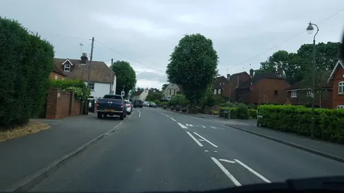

Brooklands Museum
Museum · 4.7 mi
Sports museum in Weybridge, Surrey, England, United Kingdom


Clandon Park
Museum · 5.2 mi
Country house and museum in Surrey, England, UK

Guildford Castle
Museum · 5.9 mi
Castle in Guildford, Surrey, England, UK

Hatchlands Park
Museum · 5.7 mi
Grade I listed historic house museum in East Clandon, Surrey, United Kingdom (National Trust property)

Lewis Elton Gallery
Museum · 5.4 mi
Art gallery at the University of Surrey's Guildford campus

London Bus Museum
Museum · 4.7 mi
Transport museum located at Brooklands, Weybridge, England, United Kingdom

The Hockey Museum
Museum
High Street, Woking
Tu,We 10:00-16:00 || "by appointment"
Guildford House
Museum · 5.8 mi
House in Guildford, Surrey, England, UK
Guildford Museum
Museum · 5.9 mi
Local museum in Guildford, England, United Kingdom
42 more on the map.
Parks, trails and playgrounds102


Burner's Heath and Swallows Pond
Park · 4.2 mi
Nature reserve in Pirbright in Surrey, South East England


Hoebridge Golf Centre
Golf course · 1.4 mi
18 hole Par 72 Hoebridge Course Course & 9 hole Par 33 Shey Copse Course & 9 hole Par 27 Short Course (Maybury)
Old Woking Road, Old Woking
90 more on the map.
Restaurants and cafes205


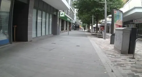
Starbucks
Cafe · Coffee Shop
48 Wolsey Walk, Woking
Mo-Fr 06:30-18:30; Sa 07:30-18:30; Su,PH 09:00-17:00
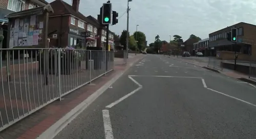
Beijing Restaurant
Restaurant · Chinese · 0.8 mi
95-99 High Street, Woking
Tu-Th 12:00-14:00,17:30-22:30; Fr,Sa 12:00-14:00,17:30-23:00; Su...
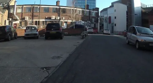
Caffè Nero
Cafe · Coffee Shop
63 Commercial Way, Woking
Mo-Fr 06:30-17:30; Sa 07:30-18:00; Su 08:30-17:30
L'Aroma
Restaurant · Italian
16 High Street, Woking
Mo-Th 12:00-14:30,17:00-22:00; Fr-Sa 12:00-22:00; Su "by...



Latino
Restaurant · Italian
44 Commercial Way, Woking
Mo-Fr 12:00-15:00,17:00-22:30; Sa 12:00-22:30; Su 12:00-21:00
193 more on the map.
History
The earliest evidence of human activity in the Woking area is from the Palaeolithic. Flints dated to c. 13000 years before present (BP) have been found at Horsell, and knife blades from c. 12000 – c. 11000 BP have been discovered at Pyrford. Two bell barrows and a disc barrow at Horsell are thought to date from the early Bronze Age. Pollen samples taken from the westernmost barrow suggest that the local environment at the time of construction was predominantly open heathland with some areas of deciduous woodland. Aerial photographs suggest that there may have been field systems on Horsell Common, Smarts Heath and Whitmoor Common in the same period, although the local soils are relatively infertile and could not have sustained the farming practices of the time for very long.
Roman occupation in the borough appears to have been concentrated in the Old Woking and Mayford areas. The sites excavated to date show evidence of low-status dwellings, possibly connected to iron working and pottery making. Roman tiles can be found in the lower part of the tower of St Peter's Church.
Read more of the history
The earliest documented reference to Woking suggests that there was a religious foundation in the area in the early 8th century. Around this time, the settlement was the administrative centre for north-west Surrey, with its western border as the watershed between the Rivers Mole and Wey and its southern border as the North Downs. By 775, there was a minster in Woking, which may be the forerunner of St Peter's Church and by the mid-late 9th century, the settlement was the centre of a royal vill. Towards the end of the Saxon period, Surrey was divided into hundreds, of which Woking Hundred was one.
Woking appears in Domesday book as Wochinges. In 1086, it was partly held by William I and partly by two lesser tenants of the Bishop of Exeter. Together the two holdings had sufficient land for 15+1⁄2 ploughteams, 46 acres (19 ha) of meadow and woodland for 160 swine. Between them, the manors had two mills and one church, and the settlement was among the largest 20% of those recorded in the country in 1086.
Three other manors in the modern borough are listed in Domesday Book: Byfleet and Pyrford were held by the abbeys of Chertsey and Westminster respectively; Sutton was held by Durand Malet as lesser tenant and by Robert Malet as tenant-in-chief.
Woking was held by the Crown until 1189, when Richard I granted it to Alan Basset, who later received the manor of Sutton from King John. Woking was inherited by his descendants until it passed, through marriage, to Hugh le Despenser. It remained in the Despenser family until 1326 when it was granted to Edmund Holland, the fourth Earl of Kent. In the mid-15th century, the manor was inherited by Margaret Beauchamp. It was briefly held by the Crown before it was passed to her daughter, Margaret Beaufort, in 1466. On her death in 1509, Woking was inherited by her grandson, the future Henry VIII. James I sold the manor to Edward Zouch, but it reverted to the Crown in 1671. In 1752, it was bought by Richard Onslow, the third Baron Onslow and remained in his family's possession until the mid-19th century.
Byfleet became a royal property at the start of the 14th century. Edward II granted it to Piers Gaveston, but following Gaveston's downfall in 1312, it reverted to the Crown. Anne of Denmark, wife of King James I was the manor's last royal owner and thereafter it was held by a series of private individuals. The current manor house dates from 1686, but it was restored and extended in 1905.
Pyrford was held by Westminster Abbey until the dissolution of the monasteries when it became the property of the Crown. Elizabeth I granted the manor to Edward Clinton, the first Earl of Lincoln in 1574 and it was sold repeatedly until the mid-17th century. In 1677, Richard Onslow, the first Baron Onslow purchased Pyrford, and it was owned by his family until 1805.
Reforms during the Tudor period reduced the importance of manorial courts and the day-to-day administration of towns became the responsibility of local vestries. By this time, the modern Borough of Woking was divided between four parishes: Woking, Byfleet, Horsell and Pyrford. The vestries appointed constables, distributed funds to the poor and took charge of the repair of local roads. From the 17th century, the roles of Justices of the Peace were expanded to take greater responsibility for law and order in the area.
Following the Poor Law Amendment Act 1834, the parish of Woking was included in the Guildford Poor Law Union, whilst the parishes of Byfleet, Horsell, and Pyrford were included in the Chertsey Poor Law Union. These unions then formed the basis for the rural sanitary districts established in 1872, which gradually took on more local government responsibilities. Surrey County Council was established in 1889 under the Local Government Act 1888 to operate as a higher-tier authority alongside the sanitary districts. In 1893 a separate local board was established for the parish of Woking, making it its own urban sanitary district, independent from the Guildford Rural Sanitary District. After elections, the first meeting of the Woking Local Board was held on 4 October 1893.
Under the Local Government Act 1894, the Woking Local Board became an urban district council (UDC). Byfleet, Horsell and Pyrford became part of the Chertsey Rural District, although the parish of Horsell was transferred into the Woking Urban District in 1907, It was not until 1933, when the Chertsey Rural District was abolished, that both Byfleet and Pyrford joined the Woking Urban District. The council was granted a coat of arms in 1930 and three years later it applied to the Privy Council for borough status, but without success. A similar request made in 1955 was also declined. It was not until the 1974 reorganisation of local government that Woking finally became a borough. The parishes within the borough were abolished at the same time, making it an unparished area.
From the History section of Woking on Wikipedia, under CC BY-SA 4.0.
More about Woking
Geography
The Borough of Woking covers an area of 64 km2 (25 sq mi) in north-west Surrey. Woking town, the main population centre, is surrounded by smaller, distinct settlements, such as West Byfleet and Byfleet in the east and Knaphill to the west. The villages of Brookwood and Mayford retain strong individual identities and lie just outside the primary built-up area of the borough.
Around 60% of the land in the borough is part of the Metropolitan Green Belt, which severely limits the potential for urban expansion. Of the six Sites of Special Scientific Interest, five are areas of heathland and the sixth covers the majority of the Basingstoke Canal.
Woking town centre is around 23 mi (36 km) from central London. It covers an area of about 50 ha (120 acres) to the north and south of the station, although the primary shopping and office spaces are between the railway line and the Basingstoke Canal. The two main shopping centres, Victoria Place and Peacocks Shopping Centre, adjoin Jubilee Square. A second public space, Victoria Square, was completed in 2022 as part of a project to construct two high-rise residential apartment blocks and a 23-storey hotel.
Economy
In the early 21st century, Woking has a strong economy relative to the rest of the UK; the borough was awarded first place in the UK Vitality Index of Local Authorities, compiled by Lambert Smith Hampton in 2021, and was placed in the top 20% of all Local Authorities for economic vibrancy by Grant Thornton in 2016. University graduates comprise more than 60% of the workforce, although around 53% of all working residents commute out of the borough on a daily basis. According to the 2015–2016 Annual Population Survey, 85% of the working-age population are in employment (compared to the Surrey average of 80%) and 14% are self-employed (compared to the county average of 12%). However, economic prosperity is not spread uniformly across the borough; two areas of Sheerwater are the most deprived parts of Surrey.
In the mid-2010s, the industries providing the largest number of jobs in the borough were information technology, food and beverage services, and motor vehicle design and manufacture. Woking also has a significant cluster of companies operating in the oil and gas industries, financial and business services industry, as well as the environmental technologies sector.
Arts and culture
Much of The War of the Worlds by H. G. Wells is set in the Woking area. The author wrote the majority of the novel between 1895 and 1898, when he lived in Maybury Road. During the early part of the story, a Martian cylinder lands on Horsell Common. A bronze statue of Wells, by the artist Wesley Harland, was unveiled in Woking town centre in September 2016. A 7 m-high (23 ft) sculpture of a Wellesian Martian Tripod by Michael Condron, was installed at one end of Crown Square in April 1998.
Briarbrae, the Woking home of a Foreign Office employee, Mr Percy Phelps, is a key setting in Sir Arthur Conan Doyle's 1892 Sherlock Holmes short story "The Adventure of the Naval Treaty". Douglas Adams defined 'Woking' in The Deeper Meaning of Liff as: "Standing in the kitchen wondering what you came in here for".
The Woking News and Mail was first published in 1894 as The Woking News and was later merged with its rival, The Woking Mail, to create the combined title. In March 2011, it was closed by its owners, Guardian Media Group, but two months later, it was restarted as a monthly newspaper by local businessman, Philip Davies. Weekly editions resumed in November 2012 and in May 2017 the Woking News and Mail had a print circulation of 2,500. Tindle Newspapers Ltd acquired the paper in October 2022.
Education
The oldest surviving record of a school in the modern borough is from 1725 when there appears to have been a small school at Byfleet. In the same year, the vicar of Woking reported that there was "one poore writing master" living in his parish and that younger children attended dame schools to learn to read. There is a record of a Church of England-affiliated school in Horsell in 1788 and, in the 1790s, a school for non-conformists opened nearby. National schools were established at Pyrford in 1847 and at Old Woking in 1848.
The Winston Churchill School is a mixed comprehensive school for pupils aged 11 to 16. It opened in January 1967 on part of the former Inkerman Barracks site and its buildings were designed by the County Architect, Raymond Ash. The school planetarium was opened in 2019 by former pupil and Doctor Who actor, Peter Davison. Outside of school hours, the planetarium is open to the public and regularly hosts films and lectures on astronomy.
The St John the Baptist School is a mixed Catholic school for pupils aged 11 to 18. It has been sponsored by the Xavier Catholic Education Trust since September 2016, when it gained academy status. The school, on Elmbridge Lane, was founded in 1969.
From the Wikipedia article Woking, under CC BY-SA 4.0.
Notable people from Woking
 Sarah Mullally106th archbishop of CanterburyPhoto: Roger Harris, CC BY 3.0
 Ron DennisBritish businessmanPhoto: Matthew Lamb, CC BY-SA 2.0
 Paul WellerEnglish recording artist; singer-songwriter, musicianPhoto: Marcelo Costa, CC BY 2.0
 Rick ParfittBritish rock musician (1948–2016)Photo: Håkan Henriksson ( Narking ), CC BY 3.0
 Sam UnderwoodBritish actorPhoto: Gage Skidmore, CC BY-SA 3.0
 Kenneth FramptonBritish architect, critic and historian (born 1930)Photo: Columbia GSAPP, CC BY 2.0
 Ian OgilvyBritish actorPhoto: Original uploader was Ianogilvy at..., CC BY-SA 3.0
 Rebecca RootEnglish actress and stand-up comedianPhoto: GabboT, CC BY-SA 2.0
 Imogen HassallEnglish actress (1942-1980)Photo: Allan warren, CC BY-SA 3.0
 Samuel Morton PetoBritish politician, building contractor, railway contractor (1809-1889)Photo: Unknown author, Public domain
- Martin BirchBritish record producer (1948–2020)
- Dana GillespieBritish actress, singer and songwriter


Born in Woking, according to Wikidata (CC0). Each name links to its Wikipedia article.
Where to stay15
Churches and places of worship70
Shopping50
Gas and EV charging18
Schools, colleges and libraries53
St John the Baptist Catholic Comprehensive School
School · Roman Catholic · 0.9 mi
Elmbridge Lane, Woking
Healthcare23
Map of Woking
250 places. The map loads OpenStreetMap tiles when you open it.
Getting there and nearby towns
Farnborough Airport (FAB) is the nearest airport with scheduled flights listed in OpenStreetMap, 10 miles away.
- Sheerwater 2 mi northeast, about 3 min by car
- Mayford 2 mi southwest, about 3 min by car
- Pyrford 2 mi east, about 3 min by car
- Knaphill 2 mi west, about 4 min by car
- Send 3 mi southeast, about 4 min by car
- West Byfleet 3 mi northeast, about 4 min by car
- Chobham 3 mi northwest, about 5 min by car
- Ottershaw 3 mi northeast, about 5 min by car
- London 23 mi northeast, about 37 min by car
- Worthing 36 mi south, about 57 min by car
Drive times are estimates from straight-line distance, not routes.
Keep exploring
Local news
Headlines from INDB.
Reviews, tips and questions
Loading what members have shared...
Sources and licences
- GeoNames (CC BY 4.0): population, coordinates, regions and time zone
- Mapillary (see each image): photos
- OpenStreetMap contributors (ODbL 1.0): places, airports, map data
- Wikidata (CC0 1.0): elevation, founding date, time zone, website, landmarks and historic places
- Wikimedia Commons (see each image): photos
- Wikipedia (CC BY-SA 4.0): overview and history text
Photo credits
- Woking town centre from the west, Mertbiol, CC0
- Bare shelves at Sainsbury's in Woking, 16 March 2020 (11), Owen Blacker, CC0
- Bare shelves at Sainsbury's in Woking, 16 March 2020 (10), Owen Blacker, CC0
- Bare shelves at Sainsbury's in Woking, 16 March 2020 (13), Owen Blacker, CC0
- Bare shelves at Sainsbury's in Woking, 16 March 2020 (12), Owen Blacker, CC0
- Bare shelves at Sainsbury's in Woking, 16 March 2020 (9), Owen Blacker, CC0
- Bare shelves at Sainsbury's in Woking, 16 March 2020 (14), Owen Blacker, CC0
- Bare shelves at Sainsbury's in Woking, 16 March 2020 (2), Owen Blacker, CC0
- Bare shelves at Sainsbury's in Woking, 16 March 2020 (6), Owen Blacker, CC0
- Bare shelves at Sainsbury's in Woking, 16 March 2020 (5), Owen Blacker, CC0
- Bare shelves at Sainsbury's in Woking, 16 March 2020 (4), Owen Blacker, CC0
- Bare shelves at Sainsbury's in Woking, 16 March 2020 (7), Owen Blacker, CC0
- Bare shelves at Sainsbury's in Woking, 16 March 2020 (3), Owen Blacker, CC0
- Bare shelves at Sainsbury's in Woking, 16 March 2020 (8), Owen Blacker, CC0
- Bare shelves at Sainsbury's in Woking, 16 March 2020 (15), Owen Blacker, CC0
- Bare shelves at Sainsbury's in Woking, 16 March 2020 (16), Owen Blacker, CC0
- Bare shelves at Sainsbury's in Woking, 16 March 2020 (19), Owen Blacker, CC0
- Bare shelves at Sainsbury's in Woking, 16 March 2020 (20), Owen Blacker, CC0
- Bare shelves at Sainsbury's in Woking, 16 March 2020 (17), Owen Blacker, CC0
- Bare shelves at Sainsbury's in Woking, 16 March 2020 (18), Owen Blacker, CC0
- Chertsey Bridge, Alistair young, CC BY 2.0
- Electric Theatre, Guildford, Weydonian ( talk ), CC BY 3.0
- Yvonne Arnaud Theatre View 2016, Jack1956, CC0
- The Lightbox (c) Ian Rudgewick Brown - cropped, The Lightbox, CC BY-SA 4.0
- Clandon House, Murraypaul at English Wikipedia, Public domain
- Guildford castle 1, SuzanneKn at English Wikipedia, Public domain
- HatchlandsPark front, Martinvl, CC BY-SA 4.0
- Lewis Elton Gallery, Murgatroyd49, CC BY-SA 4.0
- Brookwood Lye 6, Dudley Miles, CC BY-SA 4.0
- Burner's Heath and Swallows Pond 4, Dudley Miles, CC BY-SA 4.0
- StPetersChurch 1, Akoliasnikoff, CC BY-SA 4.0
- AllSoulsSuttonGreen, Jasontutty, CC BY-SA 3.0
- New Victoria Theatre, Woking, Murgatroyd49, CC BY-SA 4.0
- St Andrew SU9858 231, RHaworth, CC BY-SA 3.0
- Winston Churchill School, Woking, Surrey, Mertbiol, CC0
- Woking-TownSquare, AlanFord at English Wikipedia, Public domain
- The Cricketers, Horsell, Surrey, 1209b, CC BY-SA 4.0
- All Saints Church, Woodham Lane, Woodham, Woking (June 2015) (3), Hassocks5489, CC0
- The White Hart Inn, Chobham, Surrey - April 2025 - 01, Mertbiol, CC0
- Horsell CofE Aided Junior School, Quilt Phase, CC BY-SA 3.0
- Holy Trinity Church, Chobham Road, Knaphill (June 2015) (5), Hassocks5489, CC0
- Wisley Gardens laboratory 8 6 7-90, Patche99z, Public domain
- Rhoda McGaw Auditorium front 1975, Woking Borough Council, CC0
- Brooklands Museum, 22 July 2012, Colin Smith, CC BY-SA 2.0
- Byfleet Manor House, Colin Smith, CC BY-SA 2.0
- London Bus Museum Transportfest 2013 140 (10382998473), MANHATTAN RESEARCH INC (MANHATTAN RESEARCH INC) from S E A T T L E , S E A T T L E, CC BY 2.0
- Street-level photo, jpennycook, CC BY-SA 4.0
- Street-level photo, jpennycook, CC BY-SA 4.0
- Street-level photo, jpennycook, CC BY-SA 4.0
- Street-level photo, jpennycook, CC BY-SA 4.0
- Street-level photo, richardc, CC BY-SA 4.0
- Street-level photo, jpennycook, CC BY-SA 4.0
- Street-level photo, jpennycook, CC BY-SA 4.0
- Street-level photo, jpennycook, CC BY-SA 4.0
- Street-level photo, jpennycook, CC BY-SA 4.0
- Street-level photo, jpennycook, CC BY-SA 4.0
- Street-level photo, jpennycook, CC BY-SA 4.0
- Street-level photo, jpennycook, CC BY-SA 4.0
- Street-level photo, jpennycook, CC BY-SA 4.0
- Street-level photo, jpennycook, CC BY-SA 4.0
- Street-level photo, jpennycook, CC BY-SA 4.0
- Street-level photo, jpennycook, CC BY-SA 4.0
- Street-level photo, jpennycook, CC BY-SA 4.0
- Street-level photo, jpennycook, CC BY-SA 4.0
- Street-level photo, richardc, CC BY-SA 4.0
- Street-level photo, richardc, CC BY-SA 4.0
- Street-level photo, richardc, CC BY-SA 4.0
- Street-level photo, jpennycook, CC BY-SA 4.0
- Street-level photo, richardc, CC BY-SA 4.0
- Street-level photo, jpennycook, CC BY-SA 4.0
- Street-level photo, jpennycook, CC BY-SA 4.0
- Street-level photo, jpennycook, CC BY-SA 4.0


Page built November 10, 2026. Spotted a mistake? Tell us or suggest a place.