


Why visit Watford
Townapedia lists 28 museums and landmarks, 62 parks and trails, 217 places to eat, 16 places to stay and 5 attractions in and around town.
Highlights include Watford Colosseum, Vue, Warner Bros. Studio Tour London and Bushey Museum.
Weather in Watford
Forecast from MET Norway (CC BY 4.0). Full forecast
About Watford
Watford is a town and non-metropolitan district with borough status in Hertfordshire, England, 15 miles (24 km) northwest of Central London, on the banks of the River Colne.
From the Wikipedia article Watford (this version), under CC BY-SA 4.0.
Travel tips from other travellers: Watford on Wikivoyage (CC BY-SA 4.0).
Photos of Watford


Things to do5


Watford Palace Theatre
Cinema and theater
Theatre and cinema in Watford, Hertfordshire, England, UK
Museums and landmarks28

Warner Bros. Studio Tour London
Monument and historic site · 2.6 mi
Studio Tour Drive, Watford
Mo-Su 10:00-20:00

Bushey Museum and Art Gallery
Museum · 1.5 mi
Museum and gallery in Hertfordshire, England, United Kingdom

Headstone Manor
Museum · 4.6 mi
Grade I listed manor house in the London Borough of Harrow, England,UK

Headstone Manor and Museum
Museum · 4.6 mi
Museum in London Borough of Harrow, United Kingdom

Heath Robinson Museum
Museum · 4.4 mi
Museum in northwest London, United Kingdom, about W. Heath Robinson

Museum of Watford
Museum · 0.4 mi
Local museum in Hertfordshire, United Kingdom

Watford Peace Memorial
Monument and historic site · 0.5 mi
Memorial in Watford, Hertfordshire, England, UK



House of Amma
Museum
Atria Watford, Level 1, Watford WD17 2UB Jewellery & ceramics also on display. Hire space for parties, events, live music performances,...
16 more on the map.
Parks, trails and playgrounds62

Garston Park
Park · 2.6 mi
Watford suburb recreation
72 Coates Dell, Watford
24/7

Prestwick Road Meadows
Hiking and trails · 2.6 mi
Local Nature Reserve. There is access from Prestwick Road between Little Oxhey Lane and Heysham Drive.

Cassiobury Park
Park · 0.9 mi
Park in Watford, Hertfordshire, England, UK
Central Avenue, Watford
24/7

Bentley Priory Nature Reserve
Park · 3.6 mi
Nature reserve in the London Borough of Harrow, England


Harrow Weald Common
Park · 3.0 mi
Nature reserve in Harrow Weald, Greater London, England

Hilfield Park Reservoir LNR
Park · 3.0 mi
Local Nature Reserve between Bushey and Elstree in Hertfordshire, England


Aldenham Golf Club
Golf course · 2.1 mi
18 hole Par 70 Church Course & 9 hole Par 33 Berry Grove Course
Church Lane, Watford
Cheslyn House & Gardens
Park · 1.7 mi
Nascot Wood Road, Watford
Nov-Feb Mo-Su 09:00-16:00, Mar,Oct Mo-Su 09:00-18:00, Apr-Sep...
Chorleywood Common
Park · 4.6 mi
Nature reserve in Hertfordshire, England
Hartsbourne Country Club
Golf course · 2.5 mi
18 hole Par 71 Main Course & 9 hole Par 35 Hunt Course
Hartsbourne Avenue, Bushey
50 more on the map.
Restaurants and cafes217
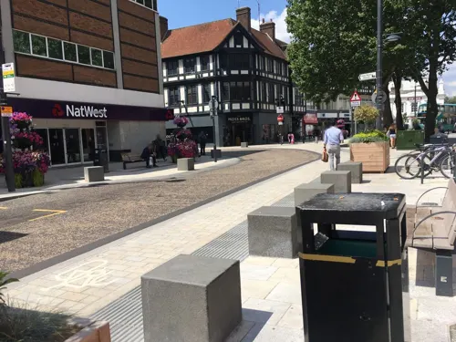
Las Iguanas
Restaurant · Latin American
61 - 63 High Street, Watford
Mo-We 11:00-21:00; Th 11:00-21:30; Fr-Sa 11:00-22:00; Su 11:00-21:00
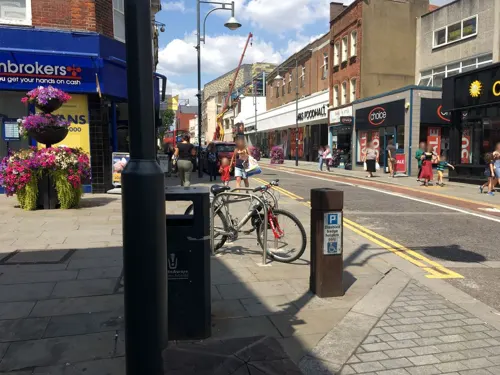
Bubbleology
Cafe · Bubble Tea
116 High Street, Watford
Mo-Th 11:00-19:00; Fr-Sa 11:00-20:00; Su 11:00-19:00
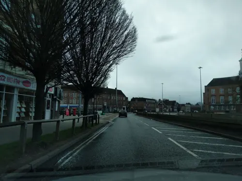


Rabbani's Indian Restaurant
Restaurant · Indian · 0.4 mi
167-169 The Parade, Cassiobury, Watford
Mo-Su 17:00-00:00

Amicis Cafe
Cafe · Coffee Shop, Italian, Sandwich · 1.6 mi
53 Baldwins Lane, Rickmansworth
Mo-Fr 08:00-17:00
Crazy Goat Coffee & Deli
Cafe · Coffee Shop · 2.3 mi
141 New Road, Rickmansworth
Mo-Fr 08:00-15:30; Sa 09:00-15:30; Su 09:00-14:30

PizzaExpress
Restaurant · Pizza
137 High Street, Watford
Mo-We 11:30-22:00; Th-Sa 11:30-23:00; Su 11:30-22:00

Anchor Tap & Bottle
Bar and pub · 2.1 mi
142 Watford Road, Rickmansworth
Mo-Th 15:00-23:00; Fr 14:00-23:30; Sa 12:00-23:30; Su 12:00-22:30

205 more on the map.
History
There is evidence of some limited prehistoric occupation around the Watford area, with a few Celtic and Roman finds, though there is no evidence of a settlement until much later. Watford stands where the River Colne could be crossed on an ancient trackway from the southeast to the northwest. Watford's High Street follows the line of part of this route. The town was located on the first dry ground above the marshy edges of the River Colne.
The name Watford may have arisen from the Old English for "waet" (full of water – the area was marshy), or "wath" (hunting), and ford. St Albans Abbey claimed rights to the manor of Casio (then called "Albanestou"), which included Watford, dating from a grant by King Offa in AD 793.
The name Watford is first mentioned in an Anglo-Saxon charter of 1007, where "Watforda" is one of the places marking the boundary of "Oxanhæge". It is not mentioned in the Domesday Book of 1086, when this area was part of St Albans Abbey's manor of Cashio. In the 12th century the Abbey was granted a charter allowing it to hold a market here, and the building of St Mary's Church began. The settlement's location helped it to grow, since as well as trade along this north–south through route it possessed good communications into the vale of St Albans to the east and into the Chiltern Hills along the valley of the River Chess to the west.
Read more of the history
The town grew modestly, assisted by travellers passing through to Berkhamsted Castle and the royal palace at Kings Langley. A big house was built at Cassiobury in the 16th century. This was partly rebuilt in the 17th century and another substantial house was built nearby at The Grove. The houses were expanded and developed throughout the following centuries. Cassiobury became the family seat of the Earls of Essex, and The Grove the seat of the Earls of Clarendon.
Writing between 1724 and 1727, Daniel Defoe described Watford as a "genteel market town, very long, having but one street."
In 1762, Sparrows Herne Turnpike Road was established across the Chilterns. The toll road approximately followed the route of the original A41 road. The location of a toll house can be seen at the bottom of Chalk Hill on the Watford side of Bushey Arches; set in an old flint stone wall is a Sparrows Herne Trust plaque.
Watford remained an agricultural community with some cottage industry for many centuries. The Industrial Revolution brought the Grand Junction Canal (now Grand Union Canal) from 1798 and the London and Birmingham Railway from 1837, both located here for the same reasons the road had followed centuries before, seeking an easy gradient over the Chiltern Hills. The land-owning interests permitted the canal to follow closely by the river Gade, but the prospect of smoke-emitting steam trains drove them to ensure the railway gave a wide berth to the Cassiobury and Grove estates. Consequently, although the road and canal follow the easier valley route, the railway company was forced to build an expensive tunnel under Leavesden to the north of the town.
Watford's original railway station opened in 1837 on the west side of St Albans Road, a small, single-storey red-brick building. It closed in 1858 when it was replaced by a new, larger station at Watford Junction approximately 200 metres (220 yd) further south-east. The old station house still stands today; it is a Grade-II-listed building, now in the middle of a high density housing development, it and was for many years a second-hand car dealership. Watford Junction railway station is situated to the north east of the town centre.
These developments gave the town excellent communications and stimulated its industrial growth during the 19th and 20th centuries. The Grand Union Canal, allowed coal to be brought into the district and paved the way for industrial development. The Watford Gas and Coke Company was formed in 1834 and gas works built. The canal allowed paper-making mills to be sited at Croxley. The John Dickinson and Co. mill beside the canal manufactured the Croxley brand of fine quality paper. There had been brewing in Watford from the 17th century and, by the 19th century, two industrial scale brewers Benskins and Sedgwicks were located in the town. The parish church of St Mary's was extensively restored in 1871.
The town expanded slightly during this time. In 1851 a new street off the High Street was opened, King Street, followed by Queens Road and Clarendon Road in the early 1860s. During this time, Watford had a population of around 6,500 The railways also continued to expand from Watford during this period; the Watford and Rickmansworth Railway opened in 1862 as a short branch line via Watford High Street to Rickmansworth (Church Street), and another branch was added to Croxley Green in 1912. The original plan was to extend the Rickmansworth line south connecting Watford to Uxbridge; this scheme failed and both the Rickmansworth and Croxley branches closed.
Watford's population had risen to 17,063 by 1891 to become very cramped. Local landowners sold land for the development of the town and it was bought up by commercial interests. Various factories and other works sprung up in Watford, mostly breweries and prints, but also engineering works, a steam laundry, a cold storage company and a cocoa processing plant. The town expanded rapidly, most of the new inhabitants moving in from London.
At the start of the 20th century the town was growing fast. New roads were laid out in Callowland, North Watford, and in West Watford on farmland. Many continued to live in the cramped and unsanitary houses in the yards and alley-ways opening off the High Street. Some of these people were among those who rioted in 1902 when the celebration for King Edward VII's coronation was postponed. The council had a programme of slum clearance which stopped with the outbreak of World War I in 1914. Building council houses resumed after the war and in the 1920s the Harebreaks estate was developed.
From the History section of Watford on Wikipedia, under CC BY-SA 4.0.
More about Watford
Geography
Watford developed on the River Colne in southern Hertfordshire, England, 16 miles (26 km) northwest of central London. Ethnicity is 61.9% White British, 2.3% Irish, 0.1% Gypsy or Irish traveller, 7.7% Other White, 17.9% Asian/Asian British, 5.8% Black or Black British.
The borough had 102,246 inhabitants at the time of the 2021 census. The borough is separated from Greater London to the south by the urbanised parish of Watford Rural in the Three Rivers District. The Watford subdivision of the Greater London Urban Area, which includes much of the neighbouring districts, had a total population of 120,960 in the 2001 census.
Economy
Watford is a major regional centre in the northern home counties. Hertfordshire County Council designates Watford and Stevenage to be its major sub-regional centres, heading its list of preferred sites for retail development.
The High Street is the main focus of activity at night having a high concentration of the town's bars, clubs and restaurants. The primary shopping area is the Harlequin Shopping Centre, a large purpose-built indoor mall with over 140 shops, restaurants and cafes built during the 1990s, opened officially in June 1992. The owners of the shopping centre, Capital Shopping Centres, changed their name to Intu, resulting in The Harlequin changing name to "intu Watford" from May 2013. Carrying forward £4.5 billion of debt into 2020, the company was not able to survive the retail downturn due to the COVID-19 crisis, and went into administration in June 2020. The council owns part of the freehold the site, and feels that as the shopping centre is very popular (it was one of top 20 places to shop in the UK in 2019), it will remain open and viable.
Education
The earliest records of schooling in Watford are of a schoolmaster named George Redhead in 1595, and of a Free School receiving an annual donation of £10 in 1640. The school consisted of "a room over two houses belonging to the Church Estate, nearest the churchyard." In 1704, Elizabeth Fuller of Watford Place built a new Free School for forty boys and twenty girls on her land next to the churchyard, with rooms for a master and a mistress. In the mid-19th century, the recorded schools in Watford were Fuller's Free School, by now in a poor state, and the separate boys and girls national schools of St Mary's in Church Street. All offered elementary education.
The Free School closed in 1882, and its endowment contributed to founding the Watford Endowed Schools, which provided secondary education and charged fees. After these schools, now called the Watford Grammar School for Boys and the Watford Grammar School for Girls, moved to new sites in 1907 and 1912, the building housed the Watford Central school, which taught pupils up to the age of 14. St Mary's National Schools closed in 1922, and the site is now a car park. The London Orphan Asylum, later Reed's School, was located near Watford Junction station between 1871 and 1940.
From the Wikipedia article Watford, under CC BY-SA 4.0.
Notable people from Watford
 Gareth SouthgateEnglish professional football manager and former player (born 1970)Photo: Number 10, CC BY 2.0
 Anthony JoshuaBritish boxer (born 1989)Photo: JazzyJoeyD, CC BY-SA 4.0
 Tom CarrollEnglish association football player (born 1992)Photo: CFCUnofficial (Chelsea Debs), CC BY-SA 2.0
 Grant ShappsBritish politician (born 1968)Photo: Simon Dawson / No 10 Downing Street, CC BY 2.0
 Jack CollisonWelsh footballer (born 1988)Photo: Egghead06, CC BY-SA 4.0
 Kelly SmithEnglish footballer (born 1978)Photo: Katie Chan, CC BY-SA 4.0
 Lee HodsonNorthern Ireland association football player (born 1991)Photo: Glenn Salt, CC BY-SA 2.0
 Naughty BoyBritish DJ, songwriter and producer (born 1981)Photo: The Asian Awards, CC BY 3.0
- Vinnie JonesBritish footballer and actor
- Ian WalkerEnglish footballer and manager (born 1971)
- Mo MowlamBritish politician (1949-2005)
- Anthony Berkeley CoxEnglish crime writer (1893–1971)


Born in Watford, according to Wikidata (CC0). Each name links to its Wikipedia article.
Where to stay16
Churches and places of worship66
North Jamia Watford Mosque
Place of worship · Sunni · 1.9 mi
167 N Western Ave, Watford, Watford
Shopping31
Gas and EV charging11
Schools, colleges and libraries75
Healthcare25
Map of Watford
250 places. The map loads OpenStreetMap tiles when you open it.
Getting there and nearby towns
RAF Northolt (NHT) is the nearest airport with scheduled flights listed in OpenStreetMap, 7 miles away.
- Cassiobury Park Station map
- Holywell 1 mi southwest, about 2 min by car
- Bushey 2 mi southeast, about 3 min by car
- North Watford 2 mi north, about 3 min by car
- Carpenders Park 2 mi south, about 3 min by car
- Meriden 2 mi north, about 3 min by car
- Garston 2 mi north, about 4 min by car
- Moor Park 2 mi southwest, about 4 min by car
- Croxley Green 3 mi southwest, about 4 min by car
- London 15 mi southeast, about 25 min by car
- Woking 24 mi south, about 39 min by car
Drive times are estimates from straight-line distance, not routes.
Keep exploring
Local news
Headlines from INDB.
Reviews, tips and questions
Loading what members have shared...
Sources and licences
- GeoNames (CC BY 4.0): population, coordinates, regions and time zone
- Mapillary (see each image): photos
- OpenStreetMap contributors (ODbL 1.0): places, airports, map data
- Wikidata (CC0 1.0): elevation, founding date, time zone, website, landmarks and historic places
- Wikimedia Commons (see each image): photos
- Wikipedia (CC BY-SA 4.0): overview and history text
Photo credits
- Heads on spikes in Watford 2026-09-05, Matt Brown, CC BY 4.0
- St Mary Watford, Cnbrb, CC BY-SA 4.0
- Tomb of Dorothy Clerke, Watford St Mary, Cnbrb, CC0
- Dorothy Clerke, Watford St Mary, Cnbrb, CC0
- Bridget Morison, Watford St Mary, Cnbrb, CC0
- Tomb of Sir Charles Morrison the younger, Watford St Mary, Cnbrb, CC0
- Memorial to Harriet Capel-Coningsby, Watford St Mary, Cnbrb, CC0
- Memorial to Rev. William Robert Capell, Watford St Mary, Cnbrb, CC0
- Memorial to Arthur De Vere Capel, Watford St Mary, Cnbrb, CC0
- The old clock, Watford St Mary, Cnbrb, CC0
- Memorial to Reginal Algernon Capel, Watford St Mary, Cnbrb, CC0
- Effigy of Sir Charles Morrison the younger, Watford St Mary, Cnbrb, CC0
- Tomb of Sir Charles Morison the elder, Watford St Mary, Cnbrb, CC0
- Watford Town Hall (19716814084), Matt Brown from London, England, CC BY 2.0
- Headstone Manor, Bernard Burns, CC BY-SA 3.0
- Harrow Museum Tithe Barn, Bernard Burns, CC BY-SA 3.0
- Heath Robinson Museum exterior 2 by Tom Fish, Sharonpink2, CC BY-SA 4.0
- Watford Peace Memorial, Matt Brown from London, England, CC BY 2.0
- Garston Park Local Nature Reserve 8, Dudley Miles, CC BY-SA 4.0
- Prestwick Road Meadows 4, Dudley Miles, CC BY-SA 4.0
- Cassiobury Park 012, Panhard, CC BY 2.5
- Bentley Priory Summerhouse Lake 1, Dudley Miles, CC BY-SA 3.0
- Harrow Weald Common path, Dudley Miles, CC BY-SA 3.0
- Hilfield Park Reservoir 14, Dudley Miles, CC BY-SA 4.0
- Kings Langley Church, UKgeofan ( talk ), CC BY-SA 3.0
- St John the Baptist's Church, Pinner, Middlesex (3960273702), Robert Cutts from Bristol, England, UK, CC BY 2.0
- Bushey Museum, Rudolph Road, Bushey, Richard Kelly, CC BY-SA 4.0
- Lululaund (postcard c.1900) by Henry Hobson Richardson, Hubert von Herkomer, Unknown author Unknown author, Public domain
- Watford General Hospital from Vicarage Road, Dormskirk, CC BY-SA 3.0
- Front view, Watford Grammar School for Boys, Kanguole, Public domain
- Harry Potter Leavesden entrance, Karen Roe, CC BY 3.0
- Watford Colosseum 03, Cnbrb, CC BY-SA 4.0
- Entrance of Warner Bros. Studio Tour London (2025), S. Perquin, CC BY-SA 4.0
- GOC Chorleywood & Chess Valley 032 Chorleywood House Estate (21672031176), Peter O'Connor aka anemoneprojectors, CC BY-SA 2.0
- Street-level photo, 4004, CC BY-SA 4.0
- Street-level photo, 4004, CC BY-SA 4.0
- Street-level photo, 4004, CC BY-SA 4.0
- Street-level photo, 4004, CC BY-SA 4.0
- Street-level photo, adam2, CC BY-SA 4.0
- Street-level photo, _mark, CC BY-SA 4.0
- Street-level photo, adam2, CC BY-SA 4.0
- Street-level photo, 4004, CC BY-SA 4.0
- Street-level photo, smsm1, CC BY-SA 4.0
- Street-level photo, mappo2, CC BY-SA 4.0


Page built November 10, 2026. Spotted a mistake? Tell us or suggest a place.