


Weston Turville, United Kingdom
Weston Turville is a town of 2,115 people in England, United Kingdom.
Why visit Weston Turville
Townapedia lists 10 museums and landmarks, 15 parks and trails, 13 places to eat, 2 places to stay and 3 attractions in and around town.
Highlights include Aylesbury Waterside Theatre, Small Dean Viaduct, Aylesbury War Memorial and King's Head Inn.
Weather in Weston Turville
Forecast from MET Norway (CC BY 4.0). Full forecast
About Weston Turville
Weston Turville is a historic village and civil parish in the Vale of Aylesbury in Buckinghamshire, England. The village is at the foot of the Chiltern Hills, 3 miles (4.9 km) from the market town of Wendover and 3.5 miles (5.7 km) from Aylesbury. In 2011 the parish had a population of 3127.
From the Wikipedia article Weston Turville (this version), under CC BY-SA 4.0.
Things to do3

Aylesbury Waterside Theatre
Cinema and theater · 2.9 mi
Theatre in Aylesbury, England


Museums and landmarks10

Aylesbury War Memorial
Monument and historic site · 2.9 mi
War memorial in Aylesbury, Buckinghamshire, England, UK

King's Head Inn
Museum · 2.9 mi
Pub in Aylesbury, Buckinghamshire, England, UK


Discover Bucks Museum
Museum · 3.0 mi
Museum in Aylesbury, England, United Kingdom
Roald Dahl Children's Gallery
Museum · 3.0 mi
Children's museum in Aylesbury, England
Trenchard Museum
Museum · 1.9 mi
Military Museum in Buckinghamshire, England

Parks, trails and playgrounds15


Aston Hill Mountain Bike Area
Park · 1.9 mi
Bike Park in Buckinghamshire



Hampden Hall Play Area
Park · 1.1 mi
Hampden Hall Play Park and Recreational Area.
3 more on the map.
Restaurants and cafes13
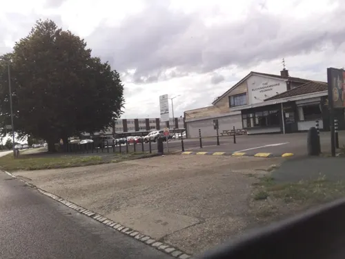
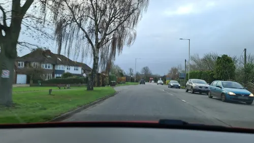
The Village Gate
Bar and pub · 1.2 mi
Was a pub which closed after a fire, and probably will never reopen fhrs:id 950843


1 more on the map.
Where to stay2
Churches and places of worship9
Halton: St Michael & All Angels
Church · Anglican · 1.2 mi
Church View, Aylesbury
Shopping3
Gas and EV charging1
Schools, colleges and libraries4
Map of Weston Turville
60 places. The map loads OpenStreetMap tiles when you open it.
Getting there and nearby towns
Wycombe Air Park (HYC) is the nearest airport with scheduled flights listed in OpenStreetMap, 13 miles away.
- Aylesbury 3 mi northwest, about 5 min by car
- Tring 4 mi east, about 7 min by car
- Cheddington 6 mi northeast, about 9 min by car
- Longwick 6 mi southwest, about 9 min by car
- Waddesdon 8 mi northwest, about 13 min by car
- Hyde Heath 8 mi southeast, about 13 min by car
- Berkhamsted 9 mi east, about 14 min by car
- Chesham 9 mi southeast, about 15 min by car
- Leighton Buzzard 10 mi northeast, about 16 min by car
- High Wycombe 11 mi south, about 18 min by car
Drive times are estimates from straight-line distance, not routes.
Towns near Weston Turville


Keep exploring
Local news
Headlines from INDB.
Reviews, tips and questions
Loading what members have shared...
Sources and licences
- GeoNames (CC BY 4.0): population, coordinates, regions and time zone
- Mapillary (see each image): photos
- OpenStreetMap contributors (ODbL 1.0): places, airports, map data
- Wikidata (CC0 1.0): elevation, founding date, time zone, website, landmarks and historic places
- Wikimedia Commons (see each image): photos
- Wikipedia (CC BY-SA 4.0): overview and history text
Photo credits
- Aylesbury Waterside Theatre, Virginia Knight, CC BY-SA 2.0
- Aylesbury War Memorial in the Market Square, Steve Daniels, CC BY-SA 2.0
- Aylesbury KingsHeadInn02, Chris Nyborg, CC BY-SA 3.0
- Dancersend 14, Dudley Miles, CC BY-SA 4.0
- Haltonhouse-northface, Unknown author, Public domain
- Church of St Michael and All Angels, Halton, March 2022 01, No Swan So Fine, CC BY-SA 4.0
- Street-level photo, alexanderar, CC BY-SA 4.0
- Street-level photo, southglos, CC BY-SA 4.0
- Street-level photo, southglos, CC BY-SA 4.0
- Street-level photo, southglos, CC BY-SA 4.0
- Street-level photo, alexanderar, CC BY-SA 4.0
- Street-level photo, alexanderar, CC BY-SA 4.0
Page built November 10, 2026. Spotted a mistake? Tell us or suggest a place.