


Leighton Buzzard, United Kingdom
Leighton Buzzard is a town of 42,727 people in England, United Kingdom.
Why visit Leighton Buzzard
Townapedia lists 8 museums and landmarks, 30 parks and trails, 98 places to eat, 1 place to stay and 1 attraction in and around town.
Highlights include Leighton Buzzard Theatre, Ascott House, Watling Street and Kings and Bakers Woods and Heaths.
Weather in Leighton Buzzard
Forecast from MET Norway (CC BY 4.0). Full forecast
About Leighton Buzzard
Leighton Buzzard is a market town in the civil parish of Leighton–Linslade, in the Central Bedfordshire district, in Bedfordshire, England, in the southwest of the county and close to the Buckinghamshire border. It lies between Aylesbury, Tring, Luton/Dunstable and Milton Keynes, near the Chiltern Hills.
From the Wikipedia article Leighton Buzzard (this version), under CC BY-SA 4.0.
Travel tips from other travellers: Leighton Buzzard on Wikivoyage (CC BY-SA 4.0).
Photos of Leighton Buzzard


Things to do1

Leighton Buzzard Theatre
Cinema and theater
Lake Street, Leighton Buzzard
Museums and landmarks8

Ascott House
Museum · 2.5 mi
Historic house and National Trust site in Buckinghamshire, England, UK




'Fly Past' Monument
Monument and historic site · 0.4 mi
The centre of the design represents the propeller of a Vimy bomber biplane which were constructed until 1919 at the Morgan & Co. factory...
Parks, trails and playgrounds30

Kings and Bakers Woods and Heaths
Park · 3.0 mi
Nature reserve in the United Kingdom



Leighton Buzzard Golf Club
Golf course · 1.5 mi
Plantation Road, Leighton Buzzard



18 more on the map.
Restaurants and cafes98

The Golden Bell
Bar and pub
5 Church Square, Leighton Buzzard
Mo 12:00-19:00; Tu-Th 12:00-23:00; Fr-Sa 12:00-24:00; Su 12:00-19:00
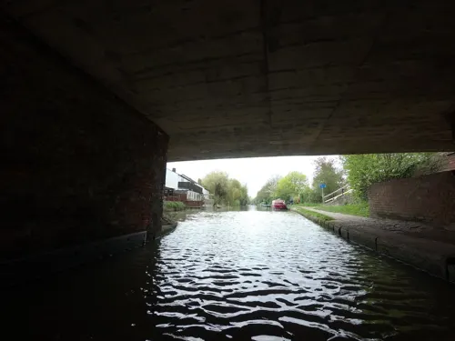
Cafe The Vibes
Restaurant · Italian, Coffee Shop, Breakfast · 0.5 mi
24-30 Leighton Road, Leighton Buzzard
Mo-Sa 08:00-18:00; Su 09:00-17:00
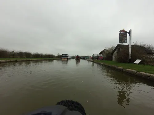



Mevan
Restaurant · Turkish
6 Lake Street, Leighton Buzzard
Mo-Th 12:00-22:00; Fr,Sa 12:00-23:00; Su off
Thai Chef
Restaurant · Thai
12 Hockliffe Street, Leighton Buzzard
We-Sa 12:00-14:30; Mo-Su 17:30-23:00
ShakeBox Diner
Cafe
12 Market Square, Leighton Buzzard
Mo-Sa 11:00-18:00; Su 11:00-16:00

The Clay Pipe
Bar and pub · 0.8 mi
Appenine Way, Leighton Buzzard
Mo-Su 12:00-23:00; Fr,Sa 12:00-24:00

86 more on the map.
History
It is unclear when the town was initially founded, although some historians believe that there may have been settlement in the area from as early as 571. There are a number of theories concerning the derivation of the town's name: ‘Leighton’ came from Old English Lēah-tūn, meaning 'farm in a clearing in the woods', and one version of the addition of ‘Buzzard’ was that it was added by the Dean of Lincoln, in whose diocese the town lay in the 12th century, from Beau-desert. Another version is that having two communities called ‘Leighton’ and seeking some means of differentiating them the Dean added the name of his local Prebendary or representative to that of the town. At that time it was Theobald de Busar and so over the years the town became known as Leighton Buzzard. The other Leighton became Leighton Bromswold. In the Domesday Book of 1086, Leighton Buzzard and Linslade were both called Leestone.
A further variation may be seen in a legal record of 1424, where "William Dagenale of Leytun Busherd, Beds" appears as a defendant.
Read more of the history
Leighton Buzzard developed into a thriving market town supported by good road, canal and, later, rail links to the agricultural hinterland and London. The town's market charter was granted in 1086 and is still active today. The High Street has numerous historical buildings, more than 70 of which are listed. They include the notable Bank Building on the Market Square (now home to Barclays Bank), designed by the eminent architect Alfred Waterhouse, designer of London's Natural History Museum, London. They also include the Old Town Hall, later used as a fire station and now as a restaurant.
The Grand Junction Canal opened in 1800. It skirted the western edge of the town, but lay just over the parish and county boundary (the River Ouzel), being in the neighbouring parish of Linslade in Buckinghamshire. The London and Birmingham Railway was built in the 1830s and passed just over half a mile west of the centre of Leighton Buzzard; Leighton railway station opened with the line in 1838. Although named after Leighton Buzzard, the station (like the canal) was actually in the parish of Linslade. When built, the station was in open countryside, with Linslade village lying 1 mile (1.6 km) north of the station at what is now known as Old Linslade. New development was subsequently laid out between the station and the canal, known initially as Chelsea or New Linslade, before assuming the name Linslade.
Linslade has always had Leighton Buzzard postal addresses, forming part of the Leighton Buzzard post town. Linslade remained administratively separate from Leighton Buzzard until 1965, when it was transferred from Buckinghamshire to Bedfordshire, and the urban districts of Leighton Buzzard and Linslade merged into a single Leighton-Linslade Urban District. The Office for National Statistics uses the name Leighton Buzzard for the whole built-up area, including Linslade.
The town has had a long association with the Rothschild family, since Lionel de Rothschild bought neighbouring farmlands to the west of the town in 1873. Over time the farm developed into the Ascott House estate located less than 2 miles (3 km) from the town. In the late 19th century, Baron Ferdinand de Rothschild used the now demolished Leighton House and its stabling, on the High Street, as a hunting box. The family still maintain links with the town through their ownership of Southcourt Stud in Southcote.
The town has a strong history of dissenters and is home to one of the oldest Friends meeting houses in the region. Established in the 18th century, local Quakers continue to meet in the Meeting House on North Street.
After the Poor Law Amendment Act 1834 Leighton Buzzard became the centre of a poor law union that consisted of 15 surrounding parishes with the union workhouse (still standing) being sited in Grovebury Road.
In 1847, additional land was obtained adjacent to the workhouse on which to build an isolation hospital. It had twenty beds over three wards, one each for patients with diphtheria, scarlet fever and typhoid. Jane Sarah Downer was appointed nurse-matron of the hospital in 1899, and worked there until at least 1911. Downer had trained under Eva Luckes at The London Hospital between 1895 and 1897, and then worked on the Private Nursing Staff for one year, before her appointment as matron in Leighton Buzzard.
During World War II, RAF Leighton Buzzard, a secret communications facility described as "the largest telephone exchange in the world", was located to the south of Stanbridge Road. Also the headquarters of No. 60 Group RAF, which controlled the air defence radar network across Britain, operated from Oxenden House (now demolished) off Plantation Road.
The Great Train Robbery took place in 1963 at Bridego Bridge just outside Leighton Buzzard. The robbers were held at the Old Police Station on Wing Road Linslade while waiting to be seen by the local magistrate after being captured a month after the robbery.
Leighton Buzzard station was the location for part of the film Robbery, which is based on the ‘Great Train Robbery’.
The UK's first and only TXE1 electronic telephone exchange went into service here in 1968. The large building, built on the site of the former Lake House, that housed this and later exchanges, can be found in Lake Street.
The population of Leighton-Linslade was originally recorded in the 2001 census as 32,417. Part of Billington parish was transferred in 2003 to Leighton-Linslade, and the revised census result including this area was 32,753. At the 2011 census, the population of the Leighton-Linslade built-up area was recorded by the Office for National Statistics as 37,469, and was estimated to have reached 43,203 in 2020.
The town is expanding southwards, with the development of sites in southern Leighton Buzzard through the Southern Leighton Buzzard Development Brief. It is also expanding eastwards, with several developments forming the Eastern Leighton Linslade Urban Extension Scheme.
From the History section of Leighton Buzzard on Wikipedia, under CC BY-SA 4.0.
More about Leighton Buzzard
Economy
Leighton Buzzard is now home to several UK head offices for national and international firms. Connells Group, the estate agents' chains, have their head offices in the town, as do the UK operations of Tupperware and Grundfos. FTSE 250 company Rightmove had their first ever office in the town, which at the time consisted of just 25 employees. Leighton Buzzard is also home to the Vinci SA Technology Centre, where technology for London's new Crossrail stations was tested. Since 2014, the town has had its own brewery.
The town has a sizeable sand quarrying industry, with good enough quality 'building' sand to export to Egypt. The town is, or has at one time been, the home to various other industries including B/E Aerospace (Aircraft Interiors), Polyformes, Lipton Tea which has now closed down, Gossard clothing, and Lancer Boss (forklifts, etc.).
Education
As this is a religious school, distances to houses are not considered for admission, and no Leighton Buzzard residence will have it deemed as the closest school for priority admission purposes.
The education authority, for Leighton Buzzard, since September 2019, calculates distances from each residence to the nearest lower school (in most circumstances) and uses that to determine priority admissions; the education authority uses computer systems to do this. Designated catchment zones are, as of 2024, no longer used for lower schools in Leighton Buzzard.
Brooklands Middle School – a school near the south east edge of the town.
Gilbert Inglefield Academy – next door to Vandyke Upper School.
Leighton Middle School – in the centre of the town, Mary Norton, who wrote The Borrowers books, lived there in her childhood.
Linslade School (Middle) – situated over the road from Cedars.
Cedars Upper School – Located on the west edge of town, in Linslade, adjoined to Tiddenfoot Leisure Centre. Cedars was once a grammar school.
Vandyke Upper School – Situated on the east edge of town, on Vandyke Road.
Central Bedfordshire College has a campus near the town centre of Leighton Buzzard.
From the Wikipedia article Leighton Buzzard, under CC BY-SA 4.0.
Notable people from Leighton Buzzard
 Zoe Harrisonrugby union player from EnglandPhoto: Stefano Delfrate, CC BY-SA 2.0
 Matthew MeadEnglish ministerPhoto: Gustavus Ellinthorpe Sintzenich, Public domain
- Derek ReidBritish mycologist (1927-2006)
- Albert Kempstersport shooter (1874-1952)
- Francis Augustus CoxEnglish writer and Baptist minister
- Edgar Allison PeersScholar in Hispanic Studies and educationist (1891–1952)
- Adam CunningtonBritish footballer (born 1987)
- Alan BileyEnglish footballer (born 1957)
- Harry PantlingEnglish footballer (1891-1952)
- Jonathan DollimoreEnglish sociologist and social theorist
- Philip O'ConnorBritish writer and surrealist poet (1916–1998)
- Sue TompkinsScottish visual artist and singer
Born in Leighton Buzzard, according to Wikidata (CC0). Each name links to its Wikipedia article.
Where to stay1
Churches and places of worship17
Shopping20
Gas and EV charging6
Schools, colleges and libraries22
Healthcare7
Map of Leighton Buzzard
210 places. The map loads OpenStreetMap tiles when you open it.
Getting there and nearby towns
London Luton Airport (LTN) is the nearest airport with scheduled flights listed in OpenStreetMap, 12 miles away.
- Tring 8 mi south, about 14 min by car
- Flitwick 9 mi northeast, about 15 min by car
- Milton Keynes 10 mi northwest, about 15 min by car
- Ampthill 10 mi northeast, about 17 min by car
- Luton 11 mi east, about 17 min by car
- Berkhamsted 12 mi south, about 19 min by car
- Newport Pagnell 12 mi north, about 19 min by car
- Kempston Hardwick 14 mi northeast, about 22 min by car
- Harpenden 15 mi southeast, about 23 min by car
- Chesham 15 mi south, about 24 min by car
Drive times are estimates from straight-line distance, not routes.
Towns near Leighton Buzzard


Keep exploring
Local news
Headlines from INDB.
Reviews, tips and questions
Loading what members have shared...
Sources and licences
- GeoNames (CC BY 4.0): population, coordinates, regions and time zone
- Mapillary (see each image): photos
- OpenStreetMap contributors (ODbL 1.0): places, airports, map data
- Wikidata (CC0 1.0): elevation, founding date, time zone, website, landmarks and historic places
- Wikimedia Commons (see each image): photos
- Wikipedia (CC BY-SA 4.0): overview and history text
Photo credits
- King's Wood, Heath and Reach 4, Dudley Miles, CC BY-SA 4.0
- Stockgrovecountrypark, Cameraman, CC BY-SA 2.0
- All Saints, Wing Nov 2010, User:Hogweard, Public domain
- LeightonMiddleSchool, M J Richardson, CC BY-SA 2.0
- The Golden Bell Public House, Back ache, CC BY-SA 3.0
- 21, High Street, Back ache, CC BY-SA 3.0
- Friends Meeting House, Leighton Buzzard, Back ache, CC BY-SA 3.0
- The Globe Inn Pub, Linslade, canalandriversidepubs co uk, CC BY-SA 2.0
- Leighton Buzzard Library, Back ache, CC BY-SA 3.0
- Leighton Middle School, Back ache, CC BY-SA 3.0
- 1911Watling Street, LlywelynII, CC BY-SA 4.0
- 21A, Hockliffe Street, Neil Carmichael, CC BY-SA 4.0
- 19 And 21, Hockliffe Street, Neil Carmichael, CC BY-SA 4.0
- 17, Hockliffe Street, Neil Carmichael, CC BY-SA 4.0
- 10-14, Lammas Walk, Neil Carmichael, CC BY-SA 4.0
- 4, Hockliffe Street, Neil Carmichael, CC BY-SA 4.0
- Numbers 13 And 15 (Front Block Only), Back ache, CC BY-SA 3.0
- Outbuilding To The Black Horse Public House, Back ache, CC BY-SA 3.0
- 12, North Street, Back ache, CC BY-SA 3.0
- 6 And 6A, Lake Street, Back ache, CC BY-SA 3.0
- Unicorn Club, Back ache, CC BY-SA 3.0
- 12, Lake Street, Back ache, CC BY-SA 3.0
- 20 And 22, Lake Street, Back ache, CC BY-SA 3.0
- At Ascott House 2024 07, Photograph by Mike Peel ( www.mikepeel.net )., CC BY-SA 4.0
- Leighton–Linslade - Market Cross - 20231202085859, Simon Burchell, CC BY-SA 4.0
- Leighton Buzzard Railway - Pages Park Station yard, Chris Allen, CC BY-SA 2.0
- Street-level photo, tallguy, CC BY-SA 4.0
- Street-level photo, adam2, CC BY-SA 4.0
- Street-level photo, tallguy, CC BY-SA 4.0
- Street-level photo, tallguy, CC BY-SA 4.0
- Street-level photo, adam2, CC BY-SA 4.0
- Street-level photo, adam2, CC BY-SA 4.0
- Street-level photo, adam2, CC BY-SA 4.0


Page built November 10, 2026. Spotted a mistake? Tell us or suggest a place.