


Berkhamsted, United Kingdom
Berkhamsted is a town of 21,997 people in England, United Kingdom.
Why visit Berkhamsted
Townapedia lists 15 museums and landmarks, 10 parks and trails, 84 places to eat, 5 places to stay and 6 attractions in and around town.
Highlights include The Rex, Court Theatre, Berkhamsted Castle and Bridgewater Monument.
Weather in Berkhamsted
Forecast from MET Norway (CC BY 4.0). Full forecast
About Berkhamsted
Berkhamsted is a market town in Hertfordshire, England. Located in the Bulbourne Valley, it is 26 miles (42 km) north-west of London and had a population of 21,245 at the 2021 census. The town is a civil parish within the borough of Dacorum, which is based in the neighbouring large new town of Hemel Hempstead. Berkhamsted, along with the adjoining village of Northchurch, is surrounded by countryside and the Chiltern Hills, an Area of Outstanding Natural Beauty.
From the Wikipedia article Berkhamsted (this version), under CC BY-SA 4.0.
Travel tips from other travellers: Berkhamsted on Wikivoyage (CC BY-SA 4.0).
Things to do6

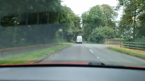
Court Theatre
Cinema and theater · 4.0 mi
Theatre in the former stables of Pendley Manor in the UK
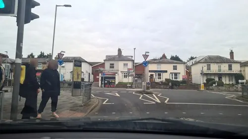
Dacorum Pavilion
Cinema and theater · 4.0 mi
Former theatre in Hemel Hempstead, England

The Old Town Hall
Cinema and theater · 4.0 mi
Theatre and arts centre in Hemel Hempstead, England

British Rail Midland Region London Rugby Line Bridge Number 113
Bridge · 4.0 mi
Bridge in Aldbury, Dacorum, Hertfordshire, England, UK

Museums and landmarks15

Berkhamsted Castle
Monument and historic site · 0.4 mi
Norman motte-and-bailey castle built on earlier Saxon site. Final surrender of Saxons to Normans made here.

Bridgewater Monument
Monument and historic site · 3.5 mi
Grade II* scheduled monument in England

Inns of Court War Memorial
Monument and historic site · 1.2 mi
War memorial in Hertfordshire, England, UK


Dacorum Heritage
Museum
Museum in Hertfordshire, United Kingdom
Clarence Road, Berkhamsted
"by appointment"

Northchurch Roman villa
Monument and historic site · 1.4 mi
Roman villa in the UK
3 more on the map.
Parks, trails and playgrounds10


Sands Bank
Park · 3.7 mi
Local nature reserve in Buckinghamshire, England


Canal Fields
Park
Canal Fields is the main park in Berkhamsted. It is an attractive green space, centrally located between the High Street and Berkhamsted...

Restaurants and cafes84

Platform Wines
Cafe · Coffee Shop
Lower Kings Road, Berkhamsted
Mo 12:00-20:30; Tu 07:00-10:00,12:00-20:30; We-Th...
Puccino's
Cafe · Coffee Shop
Lower Kings Road, Berkhamsted
Mo-Fr 06:00-18:00; Sa 07:00-18:00; Su 07:00-16:00



Jester
Cafe · Breakfast, Pancake, Cake
24 Lower Kings Road, Berkhamsted
Mo-Fr 08:00-16:00; Sa 08:00-17:00; Su 09:00-16:00

Wild Restaurant
Restaurant · Brunch
247-249 High Street, Berkhamsted
Tu 18:00-22:00; We-Sa 12:00-14:30,18:00-22:00
Caffè Nero
Cafe · Coffee Shop
230 High Street, Berkhamsted
Mo-Fr 06:30-18:30; Sa 07:30-19:00; Su 07:30-18:30

72 more on the map.
History
Neolithic, Bronze Age, Iron Age and Roman artefacts show that the Berkhamsted area of the Bulbourne Valley has been settled for over 5,000 years.
A major iron production around Northchurch is considered to be one of the most important late Iron Age and Roman industrial areas in England; this led to the settlement of a Roman town at Cow Roast, about two miles (three kilometres) north-west of Berkhamsted. Other evidence of settlement includes a pottery kiln on Bridgewater Road. The town's high street still follows the line of the Roman-engineered Akeman Street, which had been a pre-existing route from St Albans (Verulamium) to Cirencester (Corinium).
During the Roman occupation, which lasted until 410 AD, the Berkhamsted area appears to have been divided into two or three farming estates, with villa buildings; remains of a villa were found close to the river. A Roman-British villa, dyke and temple were found 1.25 miles (2.0 km) away from the castle at Frithsden. Excavations in 1954 revealed masonry foundations and tesserae floors. Together, the villa, dyke and temple form a unique complex, suggesting occupation in the late Iron Age and Roman period.
Read more of the history
The earliest written reference to Berkhamsted is in the will of Ælfgifu (died 970 CE), the wife of King Eadwig of England (r. 955–959), who bequeathed land including Berkhamsted. Rare Anglo-Saxon pottery dating from the 7th century and 9th century water mills demonstrate the existence of Anglo-Saxon settlement. The church may have been an important minster, which became part of the medieval manor of Berkhamsted after the Norman Conquest. The church held various synods at Berkhamsted during the medieval period.
By the 14th century, the adjoining village of "Berkhamsted St Mary" or "Berkhamsted Minor" had become "North Church", later "Northchurch". In 1070 at Berkhamsted, in the presence of the Archbishop of Canterbury, King William the Conqueror vowed to keep the ancient Saxon laws and set up local courts.
In the 13th and 14th centuries, the town was a wool trading centre, with a busy local market. The oldest-known extant jettied timber-framed building in Great Britain, built between 1277 and 1297, survives as a shop on the town's high street.
The Domesday survey records that there was enough land for 26 plough teams, but only 15 working teams. There were two flour mills, woodland for 1,000 pigs and a vineyard. The population was calculated at either 37 or 88 households.
From 1066 to 1495, Berkhamsted Castle, of which only ruins are extant, was a Norman motte-and-bailey castle. was a favoured residence of royalty and the nobility, including King Henry II, Edward the Black Prince, Thomas Becket and Geoffrey Chaucer. Radiocarbon dating indicates that it was probably built post-1066. The castle was a high-status residence and, an administrative centre, it contributed to the growth of the town.
In 1227, Richard of Cornwall, was given the castle, redeveloped it as a palatial residence and the centre for the administration of the Earldom of Cornwall. In 1317, the castle was given to Edward II's Queen, Isabella of France.
Edward III gave the castle to his son, Edward, the Black Prince, under whom Berkhamsted become a centre of English longbow archery, making the longbow a decisive factor in the English victory at the Battle of Crécy. In 1400, Henry IV lived in the castle after he deposed Richard and, during this time, Geoffrey Chaucer – later famous for writing The Canterbury Tales – oversaw renovation work on the castle in his role as Clerk of Works at Berkhamsted. Henry V and Henry VI owned the castle; in 1469, Edward IV gave the castle to his mother, Cecily Neville, Duchess of York, who had a significant social and financial impact on the town and was the last person to live in the castle.
In 1833, the castle was the first building in the United Kingdom to receive statutory protection. The castle ruins are managed by the Berkhamsted Castle Trust, in partnership with English Heritage, for the Duchy of Cornwall, and are open to the public.
From the 12th to the 15th centuries, the town continued to develop separately on the old Akeman Street 0.4 miles (0.6 km) to the south of the castle and to the west of St Peter's Church. In 1156, Henry II officially recognised Berkhamsted as a town in a royal charter, which confirmed the conditions enjoyed under Edward the Confessor, and also decreed that no market could be set up within 7 miles (11 km) of the town.
The town became a trading centre on an important trade route in the 12th and 13th centuries, and received more royal charters. In 1216, Henry III relieved the men and merchants of the town from all tolls and taxes everywhere in England, and the growing wool trade brought prosperity to Berkhamsted from the 12th century until the early Tudor period.
In 1217, Henry III recognised Berkhamsted's market by royal charter. In the mid–13th century, the wealthy banker Abraham of Berkhamsted, financier to the Earl of Cornwall, lived in the town; this was unusual for a small town in a time of heightened persecution of Jews.
At this time, larger houses were built on the south side of the high street including 173 High Street, the oldest known extant jettied building in England). In 1307, Berkhamsted was a large town by English medieval standards, with an estimated population of 2,000 to 2,500. In the 14th century, Berkhamsted (recorded as "Berchamstede") was considered to be one of the "best" market towns in the country. In 1440, there is a reference to lime kilns.
From the History section of Berkhamsted on Wikipedia, under CC BY-SA 4.0.
More about Berkhamsted
Geography
Berkhamsted is situated within the Chiltern Hills, part of a system of chalk downlands throughout eastern and southern England, believed to have formed between 84 and 100 million years ago in the Cretaceous Period, when the area was a chalk-depositing marine environment. The town is located in a narrow north-west to south-east valley, falling from 590 feet (180 m) above sea level to 344 feet (105 m). The valley is at the southernmost limit of the Pleistocene glaciation ice erosion throughout the Chiltern scarp, giving it a smooth rounded appearance, with alluvial soils in the valley bottom and chalk, clay and flint on the sides.
Economy
In 1986, farming, service and light industry were characteristic local employers. In 2015, schools and retail (predominantly Waitrose) were the town's largest employers; these are both situated in Berkhamsted Castle ward. Of the employed residents living in both Berkhamsted and Tring, 35% live and work in the towns, while 65% commute to workplaces away from the towns, particularly to London. Of the 7,100 people who work in Berkhamsted, 58% commute into the town. In 2011, 9.5% of Berkhamsted residents (aged 16 to 74 in employment) worked mainly at or from home; 52% drove to work by car (2.5% as a passenger in a car); 22% travelled by public transport; and 13% cycled or walked to work. In 2011, an average commute to work was around 13 miles (21 km).
In 2014, Berkhamsted's High Street had full retail occupancy of independent traders and a "cafe culture". Coming top in the south-east region in Sunday Times 2018 Best Places to Live, Berkhamsted was described as "affluent and attractive; its medieval centre is filled with chic shops and great places to eat", with 76% of shops being independent stores. Berkhamsted has an active Transition Town community.
Arts and culture
Geoffrey Chaucer was clerk of works at Berkhamsted Castle from 1389 and based his Doctor of Phisick in The Canterbury Tales on John of Gaddesden, who lived in nearby Little Gaddesden. William Cowper was born in Berkhamsted Rectory in 1731. Although he moved away when still a boy, there are frequent references to the town in his poems and letters. In the Victorian era, Cowper became a cult figure and Berkhamsted was a place of pilgrimage for his devotees. Maria Edgeworth, a prolific Anglo-Irish writer of adults' and children's literature who was a significant figure in the evolution of the novel in Europe, lived in Berkhamsted as a child in the 18th century. Between 1904 and 1907, the Llewelyn Davies boys were the inspiration for the author and playwright J.M. Barrie's Peter Pan. A little later, novelist Graham Greene was born in the town and was educated at Berkhamsted School, alongside literary contemporaries Claud Cockburn, Peter Quennell, Humphrey Trevelyan and Cecil Parrott.
Education
State schools in Berkhamsted provide education in a two-tier system. Elementary education is offered by the seven primary schools in the town: Bridgewater Primary School, Greenway Primary & Nursery School, St Mary's Church of England Primary School, St. Thomas More Catholic Primary School, Swing Gate Infant School and Nursery, Thomas Coram Church of England Primary School, and Westfield Primary School and Nursery.
Ashlyns School is a Foundation school and sixth form with 1,200 mixed pupils aged 11 to 19 years. The school was begun in the 18th century, when a philanthropist, Thomas Coram, was granted a royal charter "for the Maintenance and Education of Exposed and Deserted Children" in 1739. The school is located in a Grade II listed building and is an example of neo-Georgian architecture.Since 2003, Ashlyns School building and its chapel have been a Grade II listed building.
Primary and secondary education is also provided by two independent schools:
Berkhamsted School, a private fee-paying school for around 1,850 pupils aged 3 to 18. The present school was formed in 1997 by the amalgamation of the original Berkhamsted School, founded in 1541 by John Incent, Dean of St Paul's Cathedral, Berkhamsted School for Girls, established in 1888, and Berkhamsted Preparatory School.
From the Wikipedia article Berkhamsted, under CC BY-SA 4.0.
Notable people from Berkhamsted
 Graham GreeneBritish writer, playwright and literary critic (1904–1991)Photo: FOTO:Fortepan — ID 84697 :..., CC BY-SA 3.0
 William CowperEnglish poet and hymnodist (1731–1800)Photo: Lemuel Francis Abbott, Public domain
 Sarah BrightmanBritish singer and actressPhoto: Eckhard Pecher ( Arcimboldo ), CC BY 2.5
 Michael HordernBritish actor (1911–1995)Photo: Distributed by PBS/Mobil Masterpiece Theatre, Public domain
 Thomas StevensRound-the-world, cyclist and writer (1854-1935)Photo: Unknown author Unknown author, Public domain
 Horace Smith-DorrienBritish soldier (1858–1930)Photo: Harris & Ewing, Public domain
 Thomas KenBishop of Bath and Wells (1637-1711)Photo: F. Scheffer (floruit 1700-1710), Public domain
 Esther RantzenEnglish journalist and television presenter (1940–2026)Photo: Number 10, CC BY 2.0
 George FieldEnglish chemist (1777?–1854)Photo: Unknown author, CC BY 4.0
 Sir Michael Culme-Seymour, 3rd BaronetRoyal Navy admiral (1836-1920)Photo: Unknown author Unknown author, Public domain
 Felix GreeneBritish journalist (1909–1985)Photo: Ron Kroon for Anefo, CC BY-SA 3.0 nl
- Christopher Edmund BroomeBritish mycologist (1812-1886)
Born in Berkhamsted, according to Wikidata (CC0). Each name links to its Wikipedia article.
Where to stay5
Churches and places of worship16
St Michael's & All Angels Church
Church · Anglican · 0.7 mi
Ivy House Lane, Berkhamsted
Church of St John the Evangelist and Attached Church Hall
Church · 3.9 mi
Shopping11
Gas and EV charging3
Schools, colleges and libraries16
Victoria Church of England Infant and Nursery School
School · Anglican
Prince Edward Street, Berkhamsted
Healthcare5
Map of Berkhamsted
171 places. The map loads OpenStreetMap tiles when you open it.
Getting there and nearby towns
London Luton Airport (LTN) is the nearest airport with scheduled flights listed in OpenStreetMap, 12 miles away.
- Chesham 4 mi south, about 7 min by car
- Tring 5 mi northwest, about 7 min by car
- Chorleywood 8 mi south, about 12 min by car
- Rickmansworth 9 mi southeast, about 15 min by car
- Luton 10 mi northeast, about 17 min by car
- Watford 10 mi southeast, about 17 min by car
- Harpenden 10 mi northeast, about 16 min by car
- Croxley Green 10 mi southeast, about 16 min by car
- Chalfont Saint Peter 10 mi south, about 17 min by car
- High Wycombe 12 mi southwest, about 19 min by car
Drive times are estimates from straight-line distance, not routes.
Towns near Berkhamsted


Keep exploring
Local news
Headlines from INDB.
Reviews, tips and questions
Loading what members have shared...
Sources and licences
- GeoNames (CC BY 4.0): population, coordinates, regions and time zone
- Mapillary (see each image): photos
- OpenStreetMap contributors (ODbL 1.0): places, airports, map data
- Wikidata (CC0 1.0): elevation, founding date, time zone, website, landmarks and historic places
- Wikimedia Commons (see each image): photos
- Wikipedia (CC BY-SA 4.0): overview and history text
Photo credits
- Berkhamsted Town Hall Clock (18357462), Paul Downey from Berkhamsted, UK, CC BY 2.0
- Civic Centre, 161 High Street, Berkhamsted, Richard Kelly, CC BY-SA 4.0
- The Old Town Hall, Hemel Hempstead, Dormskirk, CC BY-SA 3.0
- UK Ashridge Bridgewater monument, Pointillist, CC BY-SA 3.0
- Inns of Court War Memorial, Berkhamsted, August 2026 01, No Swan So Fine, CC BY-SA 4.0
- St Peter's Parish Church, Berkhamsted, Hertfordshire, MichaelMaggs, CC BY-SA 3.0
- Ashlyns School driveway, Cnbrb, CC BY-SA 4.0
- Berkhamsted School Old Hall, Jbou at English Wikipedia, CC BY-SA 3.0
- Berkhamsted Rex proscenium2, Wikidwitch, CC BY-SA 3.0
- Ashley Green Church, UKgeofan ( talk ), CC BY-SA 3.0
- Friends Meeting House, High Street, Berkhamsted 03, No Swan So Fine, CC BY-SA 4.0
- St. Michael and All Angels, Sunnyside, Alex, CC BY-SA 4.0
- Church of All Saints, Berkhamsted, February 2024 01, No Swan So Fine, CC BY-SA 4.0
- Old Mill House Hotel, Berkhamsted, September 2024 01, No Swan So Fine, CC BY-SA 4.0
- 125 High Street, Berkhamsted, June 2022, No Swan So Fine, CC BY-SA 4.0
- Inscription on Smith Dorrien Monument, St Peter's Churchyard, Berkhamsted, October 2022, No Swan So Fine, CC BY-SA 4.0
- H.H. Dickman at 222 High Street, Berkhamsted, March 2025, No Swan So Fine, CC BY-SA 4.0
- Church of Saint John the Evangelist Bourne End 01, Cnbrb, CC BY-SA 4.0
- The Crown, High Street, Berkhamsted, October 2022, No Swan So Fine, CC BY-SA 4.0
- Sands Bank 17, Dudley Miles, CC BY-SA 4.0
- Berkhamsted Castle 3655, Cnbrb, CC BY-SA 4.0
- Bridge over River Gade, Gadebridge Park, Hemel Hempstead, May 2022 03, No Swan So Fine, CC BY-SA 4.0
- Street-level photo, sds, CC BY-SA 4.0
- Street-level photo, sds, CC BY-SA 4.0
- Street-level photo, adam2, CC BY-SA 4.0
- Street-level photo, alexanderar, CC BY-SA 4.0
- Street-level photo, mappo2, CC BY-SA 4.0
- Street-level photo, tallguy, CC BY-SA 4.0
- Street-level photo, adam2, CC BY-SA 4.0


Page built November 10, 2026. Spotted a mistake? Tell us or suggest a place.