

Whitburn, United Kingdom
Whitburn is a town of 11,490 people in Scotland, United Kingdom.
Why visit Whitburn
Townapedia lists 9 museums and landmarks, 5 parks and trails, 36 places to eat, 1 place to stay and 2 attractions in and around town.
Highlights include Regal Community Theatre, Whitburn Community Museum, Polkemmet Country Park and Polkemmet Golf and Driving Range.
Weather in Whitburn
Forecast from MET Norway (CC BY 4.0). Full forecast
About Whitburn
Whitburn (originally Whiteburn) is a town on the south bank of the River Almond in West Lothian, Scotland, halfway between Scotlands's two largest cities, about 23 miles (37 kilometres) east of Glasgow and 22 miles (35 kilometres) west of Edinburgh. The nearest major towns are Bathgate, four miles (six kilometres) and Livingston, six miles (ten kilometres).
From the Wikipedia article Whitburn, West Lothian (this version), under CC BY-SA 4.0.
Things to do2

Regal Community Theatre
Cinema and theater · 2.9 mi
Former theatre and cinema in Bathgate, Scotland

Museums and landmarks9

Parks, trails and playgrounds5

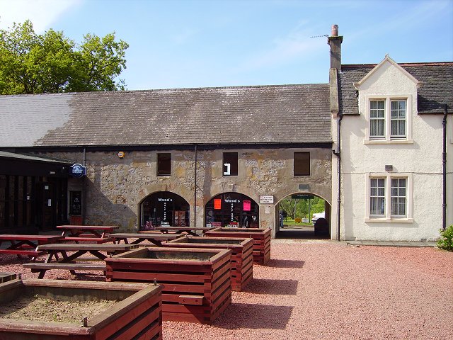
Polkemmet Country Park
Park · 1.5 mi
Country park in West Lothian, Scotland, UK



Restaurants and cafes36
Golden Bowl
Restaurant · Chinese
7 West Main Street
Mo-Tu 16:00-22:30; Th-Sa 16:00-22:30; Su 16:00-22:00
Ma'ami's Kitchen
Restaurant · African
94e West Main Street
Tu-Th 11:00-14:00,17:00-20:00; Fr-Sa 11:00-14:00,17:00-21:00

Blend Heartlands
Cafe · Coffee Shop · 1.0 mi
124 Rigghouse View, Bathgate
Tu-Th 09:00-19:00; Fr-Sa 09:00-24:00; Su 10:00-21:00
24 more on the map.
History
Originally a small farming and weaving community centred around the White Burn, the stream from which Whitburn takes its name, the settlement was once a district of Linlithgow until 1973 and a parish of Livingston until 1730, when it became an independent parish as the population began to rise. The burn later became synonymous with the area's shale and coal industries, with pollution frequently turning its waters black during the industrial era. "The White Burn Turns Black". Scottish Shale. Retrieved 2 June 2026.
When reliable statistics began with the Statistical Accounts of Scotland the population was counted at 1,121 in 1755 followed by a more accurately count of 1,322 in 1795.
Whitburn has appeared on maps since the 17th century of the Early Modern period and appears on a manuscript authored by Scottish map maker John Adair in 1680.
The earliest documented reference to Whitburn is dated 26 September 1363 and can be found in the Index of Charters by King David II of Scotland. It grants William de Carnys and his heir Duncan a concession to the terms upon which they held the baronies of Easter and Wester Whitburn. There were also two gold pieces of Roman coin discovered in a field in 1845 but there is no other evidence of Roman occupation.
During the Age of Enlightenment the community was trading cotton, pig iron and coal.
Read more of the history
"Old quarries" can be seen dotted over the area on the Ordnance Survey 1st Edition map, presumably from the days of clay, sandstone and iron ore extraction.
The majority of farmers rented agricultural land because of the Lowland Clearances and most of it was owned by Esquires.
Between the 18th and 20th century the town was dominated by mines with the largest being Polkemmet Colliery – a large coal mine, discovered in the town in the late 1800s – but this was closed in the 1980s as a result of damage by underground flooding during the 1984–85 miners' strike and never re-opened. The colliery buildings have gone, and the coal bings that once were prominent have now been removed. Work to dismantle Bing No 3, the infamous burning bing, started in August 2006 and was completed by February 2008. The last major outbreak of burning occurred in 1998.
As of 2017 the bings have been flattened and it is now a large housing estate as a result from the Heartlands Project.
There was a Scottish Police College located on the current site of Townhead Gardens in the 1940s, before it moved to the old mansion at Polkemmet.
The town's population was boosted by the 1960s Glasgow overflow. The town's Murraysgate and surrounding areas north-west of the cross were established to deal with the overflow.
From the History section of Whitburn, West Lothian on Wikipedia, under CC BY-SA 4.0.
Notable people from Whitburn
 Michael GallagherAustralian Paralympic cyclist from ScotlandPhoto: Sport the Library, CC BY-SA 3.0
 Danny LennonScottish football manager (born 1969)Photo: Mclview9, CC0
- Leon JacksonScottish recording artist; singer
- John LambieScottish footballer and manager (1941-2018)
- Scott BoydScottish footballer (born 1986)
- Michael E. RodgersBritish actor
- Jamie Brandonassociation football player
- Jim IrvineFootballer (born 1940)
- Duncan LambieScottish footballer (1952-2015)
- Audrey CooperBritish (beach) volleyball player and coach
- Wilson WoodScottish footballer (1943-2017)
- Charlie McGillivrayScottish footballer (1912-1986)
Born in Whitburn, according to Wikidata (CC0). Each name links to its Wikipedia article.
Where to stay1
Churches and places of worship5
Shopping11
Gas and EV charging4
Schools, colleges and libraries9
Healthcare3
Map of Whitburn
85 places. The map loads OpenStreetMap tiles when you open it.
Getting there and nearby towns
Edinburgh Airport (EDI) is the nearest airport with scheduled flights listed in OpenStreetMap, 14 miles away.
- East Whitburn 1 mi east, about 1 min by car
- Armadale 1 mi northwest, about 2 min by car
- Longridge 2 mi south, about 2 min by car
- Blackburn 2 mi east, about 3 min by car
- Stoneyburn 2 mi southeast, about 4 min by car
- Wishaw 11 mi southwest, about 18 min by car
- Edinburgh 20 mi east, about 32 min by car
- Glasgow 22 mi west, about 36 min by car
- Troon 44 mi southwest, about 1 h 15 min by car
- Dundee 50 mi northeast, about 1 h 15 min by car
Drive times are estimates from straight-line distance, not routes.
Towns near Whitburn


Keep exploring
Local news
Headlines from INDB.
Reviews, tips and questions
Loading what members have shared...
Sources and licences
- GeoNames (CC BY 4.0): population, coordinates, regions and time zone
- Mapillary (see each image): photos
- OpenStreetMap contributors (ODbL 1.0): places, airports, map data
- Wikidata (CC0 1.0): elevation, founding date, time zone, website, landmarks and historic places
- Wikimedia Commons (see each image): photos
- Wikipedia (CC BY-SA 4.0): overview and history text
Photo credits
- Regal Community Theatre, Temppwdonly, CC BY-SA 3.0
- Polkemmet Country Park, Richard Webb, CC BY-SA 2.0
- Street-level photo, hobgoblin, CC BY-SA 4.0
- Street-level photo, floatingboater, CC BY-SA 4.0
- Street-level photo, floatingboater, CC BY-SA 4.0
- Street-level photo, hobgoblin, CC BY-SA 4.0
- Street-level photo, hobgoblin, CC BY-SA 4.0
- Street-level photo, floatingboater, CC BY-SA 4.0
- Street-level photo, hobgoblin, CC BY-SA 4.0
- Street-level photo, floatingboater, CC BY-SA 4.0
- Street-level photo, hobgoblin, CC BY-SA 4.0
- Street-level photo, hobgoblin, CC BY-SA 4.0
- Street-level photo, hobgoblin, CC BY-SA 4.0
- Street-level photo, hobgoblin, CC BY-SA 4.0
- Street-level photo, hobgoblin, CC BY-SA 4.0
- Street-level photo, hobgoblin, CC BY-SA 4.0
- Street-level photo, hobgoblin, CC BY-SA 4.0
- Street-level photo, hobgoblin, CC BY-SA 4.0
- Street-level photo, floatingboater, CC BY-SA 4.0
- Street-level photo, hobgoblin, CC BY-SA 4.0
- Street-level photo, hobgoblin, CC BY-SA 4.0
- Street-level photo, floatingboater, CC BY-SA 4.0
- Street-level photo, hobgoblin, CC BY-SA 4.0
- Street-level photo, hobgoblin, CC BY-SA 4.0
- Street-level photo, hobgoblin, CC BY-SA 4.0
- Street-level photo, hobgoblin, CC BY-SA 4.0
- Street-level photo, hobgoblin, CC BY-SA 4.0
- Street-level photo, hobgoblin, CC BY-SA 4.0
- Street-level photo, hobgoblin, CC BY-SA 4.0
- Street-level photo, hobgoblin, CC BY-SA 4.0
Page built November 10, 2026. Spotted a mistake? Tell us or suggest a place.