
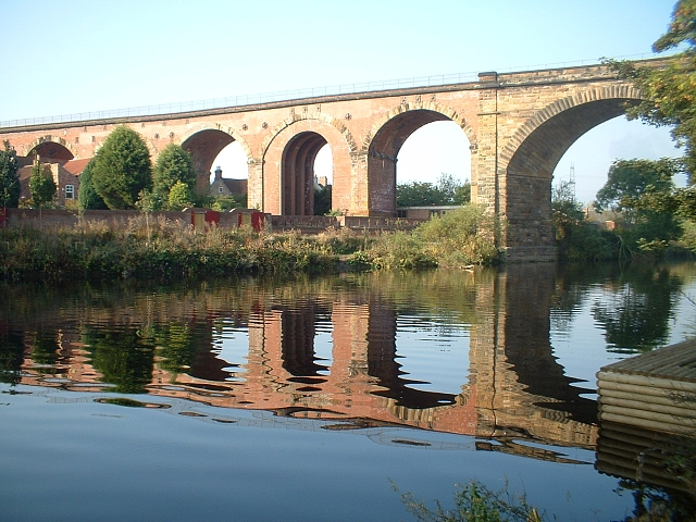
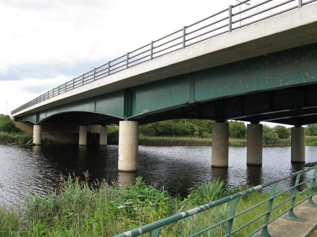


Why visit Yarm
Townapedia lists 5 museums and landmarks, 15 parks and trails, 53 places to eat, 4 places to stay and 4 attractions in and around town.
Highlights include Jubilee Bridge, Preston Pipe Bridge, Lucy Pittaway Gallery Yarm and Egglescliffe War Memorial.
Weather in Yarm
Forecast from MET Norway (CC BY 4.0). Full forecast
About Yarm
Yarm-on-Tees, or simply Yarm, is a market town and civil parish in the Borough of Stockton-on-Tees in North Yorkshire, England. It lies on a meander of the River Tees, extending south-east to the River Leven and south to the village of Kirklevington. Yarm is near the towns of Stockton-on-Tees, 5 miles (8.0 km) to its northeast, and Darlington, 11 miles (18 km) to its west.
From the Wikipedia article Yarm (this version), under CC BY-SA 4.0.
Travel tips from other travellers: Yarm on Wikivoyage (CC BY-SA 4.0).
Things to do4



Museums and landmarks5


Parks, trails and playgrounds15

Bassleton Wood and The Holmes
Park · 2.7 mi
Local nature reserve in England
Preston Park, Stockton-on-Tees
Park · 2.4 mi
Public park in north eastern England
Quarry Wood
Park · 2.0 mi
Nature reserve in Preston-on-Tees, County Durham, England, UK

3 more on the map.
Restaurants and cafes53



Lucky House Chinese Takeaway
Restaurant · Chinese · 1.1 mi
Durham Lane, Stockton-on-Tees
Tu-Su 16:30-23:00
41 more on the map.
History
The name Yarm is thought to be derived from the Old English gearum, dative plural of gear, 'pool for catching fish' (source of the modern dialect word yair with the same meaning), hence 'at the place of the fish pools'. Yarm was first mentioned in the Domesday Book of 1086, and was originally a chapelry in the Kirklevington parish in the North Riding of Yorkshire; it later became a parish in its own right.
The Yarm helmet is a c. 10th-century Viking Age helmet that was found in Yarm. It is the first relatively complete Anglo-Scandinavian helmet found in Britain and only the second Viking helmet discovered in north-west Europe. It is displayed nearby in Preston Park Museum, Preston-on-Tees.
Dominican Friars settled in Yarm about 1286, and maintained a friary and a hospital in the town, until 1583. Their memory is preserved in the names of Friarage and Spital Bank. The Friarage was built on top of the cellars of a Dominican friary in 1770, for the Meynell family. It is now at the centre of Yarm School.
Bishop Skirlaw of Durham built a stone bridge, which still stands, across the Tees in 1400. An iron replacement was built in 1805, but it fell down in 1806. For many years, Yarm was at the tidal limit and head of navigation on the River Tees.
Read more of the history
On 1 February 1643, during the First English Civil War, a small Roundhead force attempted to halt the progress of a large waggon-train of arms, landed at Tynemouth and destined to bolster the Royalist war effort in Yorkshire and beyond. Heavily outnumbered and outflanked by Royalist ford crossings, the Parliamentarians were quickly routed and the Royalists gained the bridge, crossing into Yorkshire.
On 12 February 1821, at the George & Dragon Inn, the meeting was held that pressed for the third and successful attempt for a Bill to give permission to build the Stockton & Darlington Railway, the world's first public railway.
In 1890, Bulmer & Co listed twelve inns in Yarm: Black Bull, Cross Keys, Crown Inn, Fleece, George and Dragon, Green Tree, Ketton Ox, Lord Nelson, Red Lion, Three Tuns, Tom Brown, and Union. Also listed was Cross Keys beside the Leven Bridge.
In the 13th century, Yarm was classed as a borough, but this status did not persist. It formed part of the Stokesley Rural District under the Local Government Act 1894, and remained so until 1 April 1974 when, under the Local Government Act 1972, it became part of the district of Stockton-on-Tees in the new non-metropolitan county of Cleveland. Cleveland was abolished in 1996 under the Banham Review, with Stockton-on-Tees becoming a unitary authority.
In January 2025, the Town Hall clock-winder, 76-year-old Graham Tebbs, retired after 32 years of manual clock-winding. The clock mechanism was now wound electrically.
From the History section of Yarm on Wikipedia, under CC BY-SA 4.0.
More about Yarm
Geography
Yarm is bordered by two rivers, the River Tees to the north, and the River Leven to the east. The Leven is a tributary of the Tees. Yarm was once the highest port on the Tees.
Two road bridges cross the river, Yarm Bridge crossing from the High Street to Eaglescliffe, which is Grade II* listed, and Leven Bridge crossing the Leven between Yarm and Low Leven, which is Grade II listed. On 26 February 2010, Leven Bridge was closed after cracks appeared in it. Repairs took less time than expected, and the bridge re-opened on 18 June 2010.
Yarm Town Hall in the High Street was built in 1710 by Thomas Belasyse, 3rd Viscount Fauconberg who was Lord of the manor. In a poll taken for the BBC's Breakfast programme on 19 January 2007, Yarm's High Street was voted the 'Best High Street': the street and its cobbled parking areas is fronted by many Georgian-style old buildings, with their red pantile roofs.
From the Wikipedia article Yarm, under CC BY-SA 4.0.
Notable people from Yarm
 Dorothy Greenhough-Smith1908 Olympic bronze medalist ladies singles (1882–1965)Photo: Unknown author Unknown author, Public domain
 Brian HavelockBritish speedway riderPhoto: Lawson Speedway, CC BY-SA 3.0
 Callum Johnsonassociation football playerPhoto: Bradford City AFC, CC BY 3.0
- James Grayassociation football player (born 1992)
- Jordan RobinsonEnglish footballer (born 1991)
- Mark StephensonEnglish darts player
- William HaltonEnglish cricketer
Born in Yarm, according to Wikidata (CC0). Each name links to its Wikipedia article.
Where to stay4
Churches and places of worship13
Shopping11
Gas and EV charging1
Schools, colleges and libraries12
Egglescliffe Church of England Primary School
School · Anglican · 0.7 mi
Butts Lane, Stockton-on-Tees
Healthcare2
Pharmacy Express
Clinic and pharmacy · 1.2 mi
9 Sunningdale Drive, Stockton-on-Tees
Map of Yarm
120 places. The map loads OpenStreetMap tiles when you open it.
Getting there and nearby towns
Teesside International Airport (MME) is the nearest airport with scheduled flights listed in OpenStreetMap, 3 miles away.
- Eaglescliffe 2 mi north, about 2 min by car
- Kirklevington 2 mi southeast, about 3 min by car
- Thornaby-on-Tees 3 mi northeast, about 5 min by car
- Stockton-on-Tees 5 mi north, about 8 min by car
- Middlesbrough 7 mi northeast, about 11 min by car
- Sunderland 28 mi north, about 45 min by car
- Newcastle upon Tyne 34 mi north, about 55 min by car
- York 39 mi south, about 1 h by car
- Leeds 49 mi south, about 1 h 15 min by car
- Bradford 52 mi south, about 1 h 30 min by car
Drive times are estimates from straight-line distance, not routes.
Towns near Yarm


Keep exploring
Local news
Headlines from INDB.
Reviews, tips and questions
Loading what members have shared...
Sources and licences
- GeoNames (CC BY 4.0): population, coordinates, regions and time zone
- Mapillary (see each image): photos
- OpenStreetMap contributors (ODbL 1.0): places, airports, map data
- Wikidata (CC0 1.0): elevation, founding date, time zone, website, landmarks and historic places
- Wikimedia Commons (see each image): photos
- Wikipedia (CC BY-SA 4.0): overview and history text
Photo credits
- Yarm Viaduct, Andrew Duffell at English Wikipedia, Public domain
- Jubilee Bridge-from South bank-1-1280, JohnYeadon, CC BY 3.0
- Preston Pipe Bridge-1200, JohnYeadon, CC BY 3.0
- Yarm-bridge03, Nosbig Kram, CC BY-SA 4.0
- All Saints' Church, Low Worsall, Mick Garratt, CC BY-SA 2.0
- St. Cuthbert's Church, Middleton-on-Leven, Mick Garratt, CC BY-SA 2.0
- Thornaby Old St Peters, Simon Armstrong, CC BY-SA 3.0
- Yarm library garden (30568435063), Libraries Taskforce, CC BY 2.0
- St Mary St Romuald Roman Catholic Church, Bill Henderson, CC BY-SA 2.0
- Street-level photo, victuallers, CC BY-SA 4.0


Page built November 10, 2026. Spotted a mistake? Tell us or suggest a place.