


Why visit Hazardville
Townapedia lists 12 museums and landmarks, 17 parks and trails, 13 places to eat and 5 attractions in and around town.
Highlights include Melrose Road Bridge, Enfield–Suffield Covered Bridge, Enfield Shakers Historic District and Bigelow-Hartford Carpet Mills.
July is the warmest month, with average highs of 85°F; January lows average 19°F, and about 52 inches of snow fall in a normal year.
Weather in Hazardville
Forecast from the National Weather Service. Full forecast
About Hazardville
Hazardville is a section of the town of Enfield, Connecticut, United States, in Hartford County. It is a census-designated place (CDP) that had a population of 6,870 as of the 2020 census.
From the Wikipedia article Hazardville, Connecticut (this version), under CC BY-SA 4.0.
Things to do5
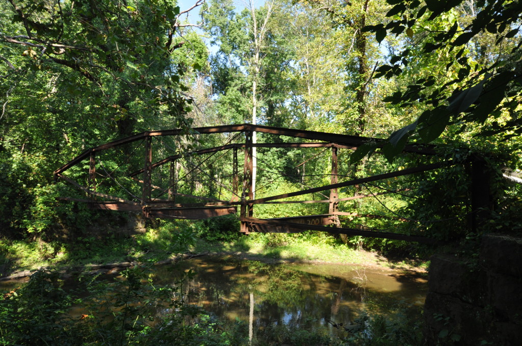
Melrose Road Bridge
Bridge · National Register of Historic Places · 3.7 mi
Bridge in United States of America

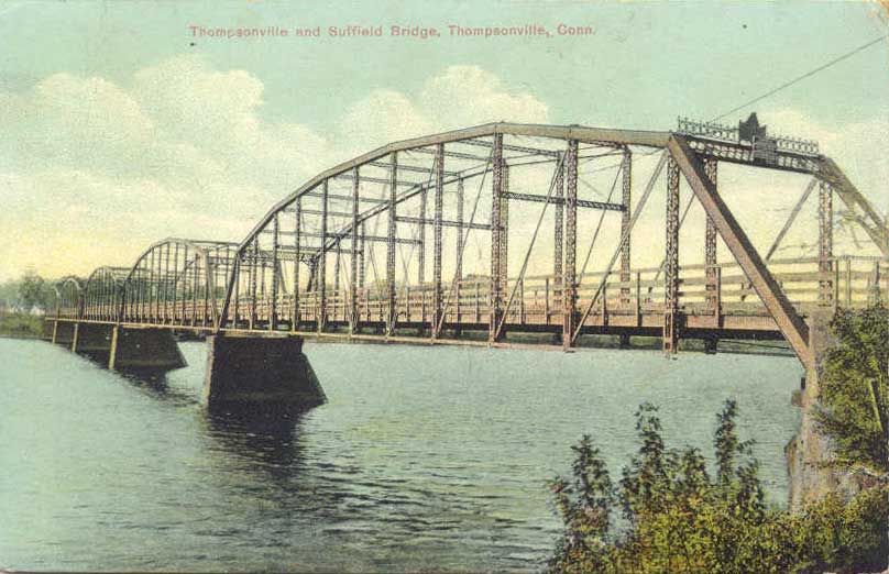
Enfield–Suffield Covered Bridge
Bridge · 4.0 mi
Bridge in United States of America

Enfield–Suffield Veterans Bridge
Bridge · 3.7 mi
Bridge in United States of America

Museums and landmarks12

Enfield Shakers Historic District
Monument and historic site · National Register of Historic Places · 1.7 mi
Historic district in Connecticut, United States

Bigelow-Hartford Carpet Mills
Monument and historic site · National Register of Historic Places · 3.7 mi
Building in the United States of America

Bigelow-Hartford Carpet Mills Historic District
Monument and historic site · National Register of Historic Places · 3.6 mi
Historic district in Enfield, Connecticut

Enfield Falls Canal
Monument and historic site · National Register of Historic Places · 3.8 mi
Canal in the United States

Enfield Historic District
Monument and historic site · National Register of Historic Places · 3.3 mi
Historic district in Enfield, Connecticut
Enfield Town Meetinghouse
Monument and historic site · National Register of Historic Places · 3.3 mi
Meetinghouse in Enfield, Connecticut

Hazardville Historic District
Monument and historic site · National Register of Historic Places · 1.0 mi
Historic district in Hazardville, Connecticut, United States
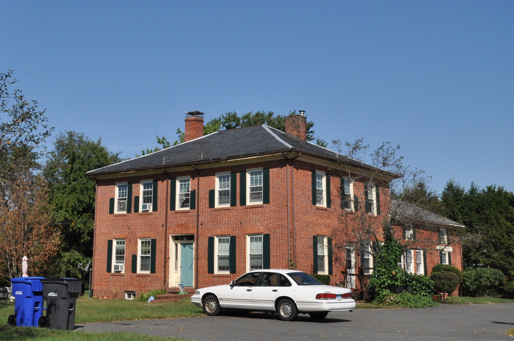
Melrose
Monument and historic site · National Register of Historic Places · 3.7 mi
Village in Connecticut, USA

Somersville Historic District
Monument and historic site · National Register of Historic Places · 2.3 mi
In Somers, Connecticut

Swetland-Pease House
Monument and historic site · National Register of Historic Places · 4.1 mi
Historic house at East Longmeadow, Massachusetts


William H. Thompson Farmstead
Monument and historic site · National Register of Historic Places · 3.7 mi
Historic farm property in East Windsor, Connecticut
Parks, trails and playgrounds17

Hazardville Playground
Park
Municipal, Open To Public Without Fee
Hazard Avenue, Enfield

Green Manor Park
Hiking and trails · 1.0 mi
Municipal, Open To Public Without Fee
Town Open Space (East Of Chief Street)
Hiking and trails · 1.8 mi
Municipal, Open To Public Without Fee
Town Open Space (East Of Somers Road)
Hiking and trails · 1.6 mi
Municipal, Open To Public Without Fee
Town Open Space (North Of Hazard Avenue)
Hiking and trails · 1.5 mi
Municipal, Open To Public Without Fee
Town Open Space (Off Broad Brook Road)
Hiking and trails · 1.7 mi
Municipal, Open To Public Without Fee
Town Open Space (Off Charnley Road)
Hiking and trails · 1.8 mi
Municipal, Open To Public Without Fee
Town Open Space (Rear Buchanan & Tyler Roads)
Hiking and trails · 1.6 mi
Municipal, Open To Public Without Fee
Town Open Space (Rear Of Birchwood Road)
Hiking and trails · 1.9 mi
Municipal, Open To Public Without Fee
Town Open Space (Rear Of High Meadow Lane)
Hiking and trails
Municipal, Open To Public Without Fee
Town Open Space (Rear Of Maple Street)
Hiking and trails · 1.7 mi
Municipal, Open To Public Without Fee
5 more on the map.
Restaurants and cafes13

New China
Restaurant · Chinese · 2.2 mi
284 North Maple Street
Mo-Th 10:30-21:00; Su 11:30-21:00; Fr-Sa 10:30-22:30
Buona Vita
Restaurant · Italian · 2.2 mi
284 North Maple Street
Fr-Sa 11:30-22:00; Su, Tu-Th 11:30-21:00

1 more on the map.
History
Hazardville originated as an industrial village centered around the manufacture of gunpowder using water power from the Scantic River. The first small black powder mill was established in 1835 by Allen Loomis in an area then known as Powder Hollow. This became the Hazard Powder Company.
Hazardville takes its name from Colonel Augustus George Hazard.
From the History section of Hazardville, Connecticut on Wikipedia, under CC BY-SA 4.0.
Churches and places of worship6
Saint Bernard Roman Catholic Church
Church · Roman Catholic · 0.4 mi
426 Hazard Avenue, Enfield
Hazardville United Methodist Church
Church · Methodist · 0.5 mi
330 Hazard Avenue, Enfield
Shopping3
Gas and EV charging3
Schools, colleges and libraries31
Academy of Computer Science And Engineering
School · 4.6 mi
1617 King Street, Enfield
Healthcare5
DaVita Palomba Drive Dialysis
Clinic and pharmacy · 2.0 mi
51 palomba drive, Enfield
Map of Hazardville
95 places. The map loads OpenStreetMap tiles when you open it.
Climate by month
Monthly table
| Month | High | Low | Rain | Snow |
|---|---|---|---|---|
| Jan | 35°F | 19°F | 3.3 in | 14.2 in |
| Feb | 38°F | 21°F | 3.1 in | 14.8 in |
| Mar | 47°F | 28°F | 3.8 in | 9.4 in |
| Apr | 60°F | 38°F | 3.9 in | 1.1 in |
| May | 72°F | 48°F | 3.8 in | 0.0 in |
| Jun | 80°F | 58°F | 4.3 in | 0.0 in |
| Jul | 85°F | 63°F | 4.2 in | 0.0 in |
| Aug | 83°F | 62°F | 4.2 in | 0.0 in |
| Sep | 76°F | 54°F | 4.4 in | 0.0 in |
| Oct | 64°F | 42°F | 4.5 in | 0.7 in |
| Nov | 52°F | 33°F | 3.5 in | 1.4 in |
| Dec | 41°F | 25°F | 4.1 in | 10.1 in |
U.S. Climate Normals 1991-2020 for Hartford Bradley Intl Ap 72508 (9 mi away), NOAA NCEI.
People and cost of living
American Community Survey 5-year estimates, 2020-2024, U.S. Census Bureau. Estimates have margins of error, larger for small towns.
Disaster history
The county has had 21 federal disaster declarations since 2000, most often for hurricanes.
- 2024-10-24: Hawthorne Fire (Fire)
- 2021-08-22: Hurricane Henri (Hurricane)
- 2021-01-12: Tropical Storm Isaias (Hurricane)
- 2020-08-06: Tropical Storm Isaias (Hurricane)
- 2020-03-28: Covid-19 Pandemic (Biological)
- 2020-03-13: Covid-19 (Biological)
OpenFEMA disaster declarations summaries.
Getting there and nearby towns
Bradley International Airport (BDL) is the nearest airport with scheduled flights listed in OpenStreetMap, 9 miles away.
- Sherwood Manor 2 mi northwest, about 4 min by car
- Southwood Acres 3 mi southwest, about 5 min by car
- Thompsonville 3 mi west, about 5 min by car
- Longmeadow 4 mi northwest, about 7 min by car
- Somers 4 mi east, about 7 min by car
- Broad Brook 6 mi south, about 9 min by car
- Suffield Depot 6 mi west, about 9 min by car
- Agawam Town 8 mi northwest, about 13 min by car
- Windsor Locks 8 mi southwest, about 12 min by car
- Springfield 9 mi north, about 14 min by car
Drive times are estimates from straight-line distance, not routes.
Local news
Headlines from INDB, the NEMICO news database.
Reviews, tips and questions
Loading what members have shared...
Sources and licences
- NCES EDGE (Public domain): public schools
- NOAA NCEI U.S. Climate Normals 1991-2020 (Public domain): climate by month
- OpenFEMA (Public domain): disaster declarations
- OpenStreetMap contributors (ODbL 1.0): places, airports, map data
- U.S. Census Bureau (Public domain): population, income, housing, education, commute
- Wikidata (CC0 1.0): elevation, founding date, time zone, website, landmarks and historic places
- Wikimedia Commons (see each image): photos
- Wikipedia (CC BY-SA 4.0): overview and history text
Photo credits
- HazardvilleCTMainStEastviewCA1906, Unknown author Unknown author, Public domain
- CT Route 190 westbound, Hazardville CT, John Phelan, CC BY 4.0
- CT Route 192, Hazardville CT, John Phelan, CC BY 4.0
- Old Hazardville Cemetery, Hazardville CT, John Phelan, CC BY 4.0
- EnfieldCT TownMeetinghouse, Jerry Dougherty, CC BY 2.5
- EastWindsorCT MelroseRoadBridge, Magicpiano, CC BY-SA 4.0
- EastWindsorCT WilliamThompsonFarmstead, Magicpiano, CC BY-SA 4.0
- ILLEBIGELOWHARTFORDCARPETMILLS-vi, Jerry Dougherty, CC BY 2.5
- EastLongmeadowMA SwetlandPeaseHouse, User:Magicpiano, CC BY-SA 4.0
- Mill worker housing, Thompsonville, Connecticut, Zach from Brooklyn, USA, CC BY-SA 2.0
- Ye Olde Blacksmith, Somersville CT, Jerry Dougherty, CC BY 2.5
- EastWindsorCT MelroseHD 3, Magicpiano, CC BY-SA 4.0
- Hazardville Institute, Hazardville CT, John Phelan, CC BY-SA 3.0
- Windsor Locks Canal and bridge postcard, Unknown author Unknown author, Public domain
- Congregational Church, Enfield, Paperchaser29, CC BY-SA 3.0
- Enfield Covered Bridge, Unknown author Unknown author, Public domain
- 216 37 Enfield Suffield Veterans Bridge, Denimadept, CC BY-SA 3.0
- Thompsonville-Suffield-Bridge, Denimadept, Public domain
- Railway bridge, Scitico CT, John Phelan, CC BY 4.0
- Old Scitico School, Scitico CT, John Phelan, CC BY 4.0
- Former service station, Scitico CT, John Phelan, CC BY 4.0
- Train on Scitico railroad bridge - 1908 postcard, Unknown author Unknown author, Public domain
- Scantic River, Scitico CT, John Phelan, CC BY 4.0
- Scitico Roll of Honor, Scitico CT, John Phelan, CC BY 4.0
- K and R Liquors, Scitico CT, John Phelan, CC BY 4.0
- Little Free Library, Enfield CT, John Phelan, CC BY 4.0
- Corner of Coolidge and Kennedy in the Presidential Section, Enfield CT, John Phelan, CC BY 4.0
- Waeves laying down, QuadRacer10, CC BY-SA 4.0
- South Family Dwelling House from the side, Enfield CT, John Phelan, CC BY 4.0
- South Family Dwelling House, Enfield CT, John Phelan, CC BY 4.0
- EnfieldCT EnfieldShakers ShakerRoad, Magicpiano, CC BY-SA 4.0
- EnfieldCT EnfieldShakers CybulskiRoad 1, Magicpiano, CC BY-SA 4.0
- EnfieldCT EnfieldShakers TaylorRoad 1, Magicpiano, CC BY-SA 4.0
- EnfieldCT EnfieldShakers CybulskiRoad 2, Magicpiano, CC BY-SA 4.0
- EnfieldCT EnfieldShakers TaylorRoad 2, Magicpiano, CC BY-SA 4.0
- EnfieldCT EnfieldShakers CybulskiRoad 3, Magicpiano, CC BY-SA 4.0
- Shaker Farm, Sherwood Manor CT, John Phelan, CC BY-SA 4.0
- ISS045-E-13951 - View of Earth, Earth Science and Remote Sensing Unit , Lyndon B. Johnson Space Center, Public domain
- ISS047-E-90609 - View of Earth, Earth Science and Remote Sensing Unit , Lyndon B. Johnson Space Center, Public domain
- ISS047-E-90610 - View of Earth, Earth Science and Remote Sensing Unit , Lyndon B. Johnson Space Center, Public domain


Page built October 30, 2026. Spotted a mistake? Tell us or suggest a place.