


Suffield Depot, Connecticut
Suffield Depot is a community of 2,006 people in Connecticut.
Why visit Suffield Depot
Townapedia lists 17 museums and landmarks, 13 parks and trails, 4 places to eat and 7 attractions in and around town.
Highlights include Bridge No. 455, Enfield–Suffield Covered Bridge, Suffield Historic District and Alexander King House.
July is the warmest month, with average highs of 85°F; January lows average 19°F, and about 52 inches of snow fall in a normal year.
Weather in Suffield Depot
Forecast from the National Weather Service. Full forecast
About Suffield Depot
Suffield Depot is the name of a census-designated place (CDP) corresponding to the village of Suffield, the primary settlement of the town of Suffield, Connecticut, United States. As of the 2020 census, Suffield Depot had a population of 1,440.
From the Wikipedia article Suffield Depot, Connecticut (this version), under CC BY-SA 4.0.
Things to do7

Bridge No. 455
Bridge · National Register of Historic Places · 1.9 mi
Road bridge in Suffield, United States of America

Enfield–Suffield Covered Bridge
Bridge · 1.8 mi
Bridge in United States of America

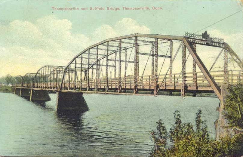
Enfield–Suffield Veterans Bridge
Bridge · 1.9 mi
Bridge in United States of America


Museums and landmarks17

Suffield Historic District
Monument and historic site · National Register of Historic Places · 0.7 mi
Historic district in Suffield, Connecticut

Alexander King House
Monument and historic site · National Register of Historic Places · 1.0 mi
Historic house in Connecticut, United States

Bigelow-Hartford Carpet Mills
Monument and historic site · National Register of Historic Places · 2.2 mi
Building in the United States of America

Bigelow-Hartford Carpet Mills Historic District
Monument and historic site · National Register of Historic Places · 2.2 mi
Historic district in Enfield, Connecticut

Enfield Falls Canal
Monument and historic site · National Register of Historic Places · 1.8 mi
Canal in the United States

Enfield Historic District
Monument and historic site · National Register of Historic Places · 2.4 mi
Historic district in Enfield, Connecticut
Enfield Town Meetinghouse
Monument and historic site · National Register of Historic Places · 2.7 mi
Meetinghouse in Enfield, Connecticut
Gothic Cottage
Monument and historic site · National Register of Historic Places · 2.4 mi
Cottage in Suffield, Connecticut

Hastings Hill Historic District
Monument and historic site · National Register of Historic Places · 2.8 mi
Historic district in Suffield, Connecticut, United States

Hatheway House
Monument and historic site · National Register of Historic Places · 0.8 mi
House in Suffield, Connecticut

Hilltop Farm
Monument and historic site · National Register of Historic Places · 2.9 mi
Farm in Suffield, Connecticut
John Fuller House
Monument and historic site · National Register of Historic Places · 2.4 mi
House in Suffield, Connecticut
5 more on the map.
Parks, trails and playgrounds13

Briarwood Subdivision (G&Pstewart)
Hiking and trails · 0.7 mi
Private, Members Or Owners Only
Stony Brook Park
Hiking and trails · 1.3 mi
Municipal, Open To Public Without Fee

Briarwood Subdivision (G&P Stewart)
Hiking and trails · 0.9 mi
Private, Members Or Owners Only
Dale Inc. (Devine Road)
Hiking and trails · 1.3 mi
Private, Members Or Owners Only

Pine Manor Subdivision
Hiking and trails · 0.8 mi
Private, Members Or Owners Only
Stony Brook Estates (Diane Lane) 3 Parcels
Hiking and trails · 1.5 mi
Private, Members Or Owners Only
Suffield Land Conservancy, Inc.(Remington Street)
Hiking and trails · 1.7 mi
Private, Open To Public Without Fee
1 more on the map.
Restaurants and cafes4



Churches and places of worship6
Saint Josephs Church
Church · Roman Catholic · 0.8 mi
140 South Main Street, Suffield
First Church of Christ Congregational
Church · United Church Of Christ · 0.6 mi
81 High Street, Suffield
Good Shepherd Lutheran Church
Church · Lutheran · 1.7 mi
585 South Street, Suffield
Shopping1
Schools, colleges and libraries30
Academy of Computer Science And Engineering
School · 3.3 mi
1617 King Street, Enfield
Healthcare1
Map of Suffield Depot
79 places. The map loads OpenStreetMap tiles when you open it.
Climate by month
Monthly table
| Month | High | Low | Rain | Snow |
|---|---|---|---|---|
| Jan | 35°F | 19°F | 3.3 in | 14.2 in |
| Feb | 38°F | 21°F | 3.1 in | 14.8 in |
| Mar | 47°F | 28°F | 3.8 in | 9.4 in |
| Apr | 60°F | 38°F | 3.9 in | 1.1 in |
| May | 72°F | 48°F | 3.8 in | 0.0 in |
| Jun | 80°F | 58°F | 4.3 in | 0.0 in |
| Jul | 85°F | 63°F | 4.2 in | 0.0 in |
| Aug | 83°F | 62°F | 4.2 in | 0.0 in |
| Sep | 76°F | 54°F | 4.4 in | 0.0 in |
| Oct | 64°F | 42°F | 4.5 in | 0.7 in |
| Nov | 52°F | 33°F | 3.5 in | 1.4 in |
| Dec | 41°F | 25°F | 4.1 in | 10.1 in |
U.S. Climate Normals 1991-2020 for Hartford Bradley Intl Ap 72508 (4 mi away), NOAA NCEI.
People and cost of living
American Community Survey 5-year estimates, 2020-2024, U.S. Census Bureau. Estimates have margins of error, larger for small towns.
Disaster history
The county has had 21 federal disaster declarations since 2000, most often for hurricanes.
- 2024-10-24: Hawthorne Fire (Fire)
- 2021-08-22: Hurricane Henri (Hurricane)
- 2021-01-12: Tropical Storm Isaias (Hurricane)
- 2020-08-06: Tropical Storm Isaias (Hurricane)
- 2020-03-28: Covid-19 Pandemic (Biological)
- 2020-03-13: Covid-19 (Biological)
OpenFEMA disaster declarations summaries.
Getting there and nearby towns
Bradley International Airport (BDL) is the nearest airport with scheduled flights listed in OpenStreetMap, 4 miles away.
- Thompsonville 2 mi east, about 4 min by car
- Windsor Locks 4 mi south, about 6 min by car
- Southwood Acres 4 mi southeast, about 6 min by car
- Sherwood Manor 4 mi northeast, about 7 min by car
- Agawam Town 5 mi north, about 9 min by car
- Longmeadow 6 mi northeast, about 9 min by car
- Hazardville 6 mi east, about 9 min by car
- Broad Brook 7 mi southeast, about 12 min by car
- Salmon Brook 8 mi west, about 13 min by car
- Springfield 10 mi northeast, about 17 min by car
Drive times are estimates from straight-line distance, not routes.
Local news
Headlines from INDB, the NEMICO news database.
Reviews, tips and questions
Loading what members have shared...
Sources and licences
- NCES EDGE (Public domain): public schools
- NOAA NCEI U.S. Climate Normals 1991-2020 (Public domain): climate by month
- OpenFEMA (Public domain): disaster declarations
- OpenStreetMap contributors (ODbL 1.0): places, airports, map data
- U.S. Census Bureau (Public domain): population, income, housing, education, commute
- Wikidata (CC0 1.0): elevation, founding date, time zone, website, landmarks and historic places
- Wikimedia Commons (see each image): photos
- Wikipedia (CC BY-SA 4.0): overview and history text
Photo credits
- Tracks leading to Suffield Depot CT, John Phelan, CC BY-SA 3.0
- First Church of Christ Congregational, Suffield CT, John Phelan, CC BY-SA 3.0
- Suffield Built By George Fuller 1829-vi, Jerry Dougherty, CC BY 2.5
- EnfieldCT TownMeetinghouse, Jerry Dougherty, CC BY 2.5
- SuffieldCT GothicCottage, Magicpiano, CC BY-SA 4.0
- Phelps-HathawayHousesideview1, CTGardengirl, Public domain
- ILLEBIGELOWHARTFORDCARPETMILLS-vi, Jerry Dougherty, CC BY 2.5
- SuffieldCT Bridge455, Magicpiano, CC BY-SA 4.0
- AlexanderKingHouseSuffieldCT, Jerry Dougherty, CC BY 2.5
- SuffieldCT KingFieldHouse, Magicpiano, CC BY-SA 4.0
- Mill worker housing, Thompsonville, Connecticut, Zach from Brooklyn, USA, CC BY-SA 2.0
- SuffieldCT HilltopFarm 3, Magicpiano, CC BY-SA 4.0
- Windsor Locks Canal and bridge postcard, Unknown author Unknown author, Public domain
- Congregational Church, Enfield, Paperchaser29, CC BY-SA 3.0
- SuffieldCT FirstBaptistChurch, Jerry Dougherty, CC BY 2.5
- 216 29 Amtrak Springfield Terminal Railroad Bridge w train, Denimadept, CC BY-SA 3.0
- Enfield Covered Bridge, Unknown author Unknown author, Public domain
- 216 37 Enfield Suffield Veterans Bridge, Denimadept, CC BY-SA 3.0
- Thompsonville-Suffield-Bridge, Denimadept, Public domain
- Composite Lodge 28 AF and AM, Suffield CT, John Phelan, CC BY 4.0
- Chem room, Ninjinnot232, CC BY-SA 4.0
- Kent Memorial Library, Suffield CT, John Phelan, CC BY 4.0
- Spectramator, Antheathcote1, CC BY-SA 4.0
- HABS CONN,2-SUFI,2- (sheet 21 of 21) - Reverend Ebenezer Gay Manse, Route 75, Suffield, Hartford County, CT, Unknown author, Public domain
- HABS CONN,2-SUFI,2- (sheet 7 of 21) - Reverend Ebenezer Gay Manse, Route 75, Suffield, Hartford County, CT, Unknown author, Public domain
- HABS CONN,2-SUFI,2- (sheet 12 of 21) - Reverend Ebenezer Gay Manse, Route 75, Suffield, Hartford County, CT, Unknown author, Public domain
- HABS CONN,2-SUFI,2- (sheet 3 of 21) - Reverend Ebenezer Gay Manse, Route 75, Suffield, Hartford County, CT, Unknown author, Public domain
- HABS CONN,2-SUFI,2- (sheet 20 of 21) - Reverend Ebenezer Gay Manse, Route 75, Suffield, Hartford County, CT, Unknown author, Public domain
- HABS CONN,2-SUFI,2- (sheet 4 of 21) - Reverend Ebenezer Gay Manse, Route 75, Suffield, Hartford County, CT, Unknown author, Public domain
- HABS CONN,2-SUFI,2- (sheet 5 of 21) - Reverend Ebenezer Gay Manse, Route 75, Suffield, Hartford County, CT, Unknown author, Public domain
- HABS CONN,2-SUFI,2- (sheet 0 of 21) - Reverend Ebenezer Gay Manse, Route 75, Suffield, Hartford County, CT, Unknown author, Public domain
- HABS CONN,2-SUFI,2- (sheet 19 of 21) - Reverend Ebenezer Gay Manse, Route 75, Suffield, Hartford County, CT, Unknown author, Public domain
- HABS CONN,2-SUFI,2- (sheet 11 of 21) - Reverend Ebenezer Gay Manse, Route 75, Suffield, Hartford County, CT, Unknown author, Public domain
- HABS CONN,2-SUFI,2- (sheet 2 of 21) - Reverend Ebenezer Gay Manse, Route 75, Suffield, Hartford County, CT, Unknown author, Public domain


Page built October 30, 2026. Spotted a mistake? Tell us or suggest a place.