


Why visit Thompsonville
Townapedia lists 13 museums and landmarks, 11 parks and trails, 36 places to eat, 2 places to stay and 7 attractions in and around town.
Highlights include Bridge No. 455, Enfield–Suffield Covered Bridge, Bigelow-Hartford Carpet Mills Historic District and Enfield Historic District.
July is the warmest month, with average highs of 85°F; January lows average 19°F, and about 52 inches of snow fall in a normal year.
Weather in Thompsonville
Forecast from the National Weather Service. Full forecast
About Thompsonville
Thompsonville is a census-designated place (CDP) in the town of Enfield, Connecticut, United States. As of the 2020 census, Thompsonville had a population of 8,514.
From the Wikipedia article Thompsonville, Connecticut (this version), under CC BY-SA 4.0.
Things to do7

Bridge No. 455
Bridge · National Register of Historic Places · 2.8 mi
Road bridge in Suffield, United States of America

Enfield–Suffield Covered Bridge
Bridge · 1.3 mi
Bridge in United States of America

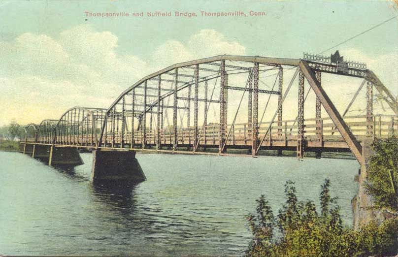
Enfield–Suffield Veterans Bridge
Bridge · 0.4 mi
Bridge in United States of America

Six Flags New England
Monument and historic site · 3.3 mi
Amusement park


Museums and landmarks13

Bigelow-Hartford Carpet Mills Historic District
Monument and historic site · National Register of Historic Places · 0.6 mi
Historic district in Enfield, Connecticut

Enfield Historic District
Monument and historic site · National Register of Historic Places · 1.1 mi
Historic district in Enfield, Connecticut

Alexander King House
Monument and historic site · National Register of Historic Places · 3.1 mi
Historic house in Connecticut, United States
Bigelow-Hartford Carpet Mills
Monument and historic site · National Register of Historic Places · 0.7 mi
Building in the United States of America

Enfield Falls Canal
Monument and historic site · National Register of Historic Places · 0.6 mi
Canal in the United States

Enfield Town Meetinghouse
Monument and historic site · National Register of Historic Places · 1.5 mi
Meetinghouse in Enfield, Connecticut

Gothic Cottage
Monument and historic site · National Register of Historic Places · 2.2 mi
Cottage in Suffield, Connecticut

Hatheway House
Monument and historic site · National Register of Historic Places · 3.0 mi
House in Suffield, Connecticut

Hazardville Historic District
Monument and historic site · National Register of Historic Places · 3.5 mi
Historic district in Hazardville, Connecticut, United States

Hilltop Farm
Monument and historic site · National Register of Historic Places · 2.4 mi
Farm in Suffield, Connecticut

King's Field House
Monument and historic site · National Register of Historic Places · 2.6 mi
Historic house in Connecticut, United States


Suffield Historic District
Monument and historic site · National Register of Historic Places · 2.9 mi
Historic district in Suffield, Connecticut
1 more on the map.
Parks, trails and playgrounds11

Briarwood Subdivision (G&P Stewart)
Hiking and trails · 1.6 mi
Private, Members Or Owners Only
Town Open Space (East Of Saint James Avenue)
Hiking and trails · 1.2 mi
Municipal, Open To Public Without Fee

South Road Open Space
Hiking and trails · 0.9 mi
Municipal, Open To Public Without Fee; Town Open Space (South Road East Of I-91)
Town Open Space (End Of Colony Road)
Hiking and trails · 1.5 mi
Municipal, Open To Public Without Fee
Town Open Space (Rear Of Ridge Road)
Hiking and trails · 1.6 mi
Municipal, Open To Public Without Fee
Town Open Space (South & Barrett Roads)
Hiking and trails · 1.7 mi
Municipal, Open To Public Without Fee
Town Open Space (West Of Saint James Avenue)
Hiking and trails · 1.3 mi
Municipal, Open To Public Without Fee

Restaurants and cafes36


Starbucks
Cafe · Coffee Shop · 0.7 mi
9 Hazard Avenue, Enfield
Mo-Th 05:30-20:00; Fr 05:30-21:00,09:00-18:00; Sa 05:00-21:30; Su...
24 more on the map.
History
Thompsonville was established in the 19th century as a carpet-manufacturing community. Orrin Thompson, from whom the community takes its name, built a dam across Freshwater Brook in 1828 and opened the first carpet mill in 1829. Thompson's first mill, named "White Mill", employed skilled weavers brought from Scotland. Initially its product was largely flat-woven ingrain carpeting, an inexpensive type of carpeting, but over time it added more expensive weaves, such as three-ply ingrain and loop brussels. The mill had 230 looms in operation as of 1846.
Carpeting continued to be manufactured in Thompsonville until 1971, by which time most production had shifted to the southern United States.
From the History section of Thompsonville, Connecticut on Wikipedia, under CC BY-SA 4.0.
Where to stay2
Churches and places of worship3
Enfield United Church of Christ
Church · United Church Of Christ · 1.1 mi
1295 Enfield Street, Enfield
Shopping11
Gas and EV charging5
Schools, colleges and libraries34
Academy of Computer Science And Engineering
School · 3.0 mi
1617 King Street, Enfield
Healthcare7
Community Health Center - Enfield
Clinic and pharmacy · 0.5 mi
5 North Main Street, Enfield
DaVita Palomba Drive Dialysis
Clinic and pharmacy · 1.3 mi
51 palomba drive, Enfield
Map of Thompsonville
129 places. The map loads OpenStreetMap tiles when you open it.
Climate by month
Monthly table
| Month | High | Low | Rain | Snow |
|---|---|---|---|---|
| Jan | 35°F | 19°F | 3.3 in | 14.2 in |
| Feb | 38°F | 21°F | 3.1 in | 14.8 in |
| Mar | 47°F | 28°F | 3.8 in | 9.4 in |
| Apr | 60°F | 38°F | 3.9 in | 1.1 in |
| May | 72°F | 48°F | 3.8 in | 0.0 in |
| Jun | 80°F | 58°F | 4.3 in | 0.0 in |
| Jul | 85°F | 63°F | 4.2 in | 0.0 in |
| Aug | 83°F | 62°F | 4.2 in | 0.0 in |
| Sep | 76°F | 54°F | 4.4 in | 0.0 in |
| Oct | 64°F | 42°F | 4.5 in | 0.7 in |
| Nov | 52°F | 33°F | 3.5 in | 1.4 in |
| Dec | 41°F | 25°F | 4.1 in | 10.1 in |
U.S. Climate Normals 1991-2020 for Hartford Bradley Intl Ap 72508 (6 mi away), NOAA NCEI.
People and cost of living
American Community Survey 5-year estimates, 2020-2024, U.S. Census Bureau. Estimates have margins of error, larger for small towns.
Disaster history
The county has had 21 federal disaster declarations since 2000, most often for hurricanes.
- 2024-10-24: Hawthorne Fire (Fire)
- 2021-08-22: Hurricane Henri (Hurricane)
- 2021-01-12: Tropical Storm Isaias (Hurricane)
- 2020-08-06: Tropical Storm Isaias (Hurricane)
- 2020-03-28: Covid-19 Pandemic (Biological)
- 2020-03-13: Covid-19 (Biological)
OpenFEMA disaster declarations summaries.
Getting there and nearby towns
Bradley International Airport (BDL) is the nearest airport with scheduled flights listed in OpenStreetMap, 6 miles away.
- Sherwood Manor 2 mi northeast, about 3 min by car
- Suffield Depot 2 mi west, about 4 min by car
- Southwood Acres 3 mi southeast, about 4 min by car
- Hazardville 3 mi east, about 5 min by car
- Longmeadow 4 mi north, about 7 min by car
- Windsor Locks 5 mi southwest, about 9 min by car
- Agawam Town 6 mi northwest, about 9 min by car
- Broad Brook 6 mi southeast, about 10 min by car
- Somers 8 mi east, about 13 min by car
- Springfield 9 mi north, about 14 min by car
Drive times are estimates from straight-line distance, not routes.
Local news
Headlines from INDB, the NEMICO news database.
Reviews, tips and questions
Loading what members have shared...
Sources and licences
- NCES EDGE (Public domain): public schools
- NOAA NCEI U.S. Climate Normals 1991-2020 (Public domain): climate by month
- OpenFEMA (Public domain): disaster declarations
- OpenStreetMap contributors (ODbL 1.0): places, airports, map data
- U.S. Census Bureau (Public domain): population, income, housing, education, commute
- Wikidata (CC0 1.0): elevation, founding date, time zone, website, landmarks and historic places
- Wikimedia Commons (see each image): photos
- Wikipedia (CC BY-SA 4.0): overview and history text
Photo credits
- Thompsonville 2, MMZach, CC BY-SA 3.0
- Pearl Street Branch Library, Thompsonville CT, John Phelan, CC BY 4.0
- Thompsonville trolley station undivided back postcard, Unknown author Unknown author, Public domain
- CT Route 220, Thompsonville CT, John Phelan, CC BY 4.0
- Thompsonville trolley station with Hartford and Springfield trolley postcard, Unknown author Unknown author, Public domain
- Freshwater Pond Dam wide angle, Thompsonville CT, John Phelan, CC BY 4.0
- Freshwater Pond Dam, Thompsonville CT, John Phelan, CC BY 4.0
- Thompsonville trolley station divided back postcard, Unknown author Unknown author, Public domain
- Thompsonville Square 1907 postcard, Unknown author Unknown author, Public domain
- Track equipment at former Thompsonville station, December 2014, Pi.1415926535, CC BY-SA 3.0
- Platform at former Thompsonville station, December 2014, Pi.1415926535, CC BY-SA 3.0
- Mill worker housing, Thompsonville, Connecticut, Zach from Brooklyn, USA, CC BY-SA 2.0
- Congregational Church, Enfield, Paperchaser29, CC BY-SA 3.0
- EnfieldCT TownMeetinghouse, Jerry Dougherty, CC BY 2.5
- SuffieldCT GothicCottage, Magicpiano, CC BY-SA 4.0
- Phelps-HathawayHousesideview1, CTGardengirl, Public domain
- SuffieldCT Bridge455, Magicpiano, CC BY-SA 4.0
- AlexanderKingHouseSuffieldCT, Jerry Dougherty, CC BY 2.5
- SuffieldCT KingFieldHouse, Magicpiano, CC BY-SA 4.0
- Hazardville Institute, Hazardville CT, John Phelan, CC BY-SA 3.0
- SuffieldCT HilltopFarm 3, Magicpiano, CC BY-SA 4.0
- Windsor Locks Canal and bridge postcard, Unknown author Unknown author, Public domain
- First Church of Christ Congregational, Suffield CT, John Phelan, CC BY-SA 3.0
- 216 29 Amtrak Springfield Terminal Railroad Bridge w train, Denimadept, CC BY-SA 3.0
- Enfield Covered Bridge, Unknown author Unknown author, Public domain
- 216 37 Enfield Suffield Veterans Bridge, Denimadept, CC BY-SA 3.0
- Thompsonville-Suffield-Bridge, Denimadept, Public domain
- 20241231 golden crowned kinglet windsor locks canal state park PD209443-, Paul Danese, CC BY-SA 4.0
- 20241231 golden crowned kinglet windsor locks canal state park PD209442-, Paul Danese, CC BY-SA 4.0
- 20241231 golden crowned kinglet windsor locks canal state park PD209472-, Paul Danese, CC BY-SA 4.0
- 20241231 golden crowned kinglet windsor locks canal state park PD209440-, Paul Danese, CC BY-SA 4.0
- 20241231 golden crowned kinglet windsor locks canal state park PD209444-, Paul Danese, CC BY-SA 4.0
- 20241231 black capped chickadee windsor locks canal state park PD209512-s, Paul Danese, CC BY-SA 4.0
- 20241231 black capped chickadee windsor locks canal state park PD209513s, Paul Danese, CC BY-SA 4.0
- 20241231 song sparrow windsor locks canal state park PD209585, Paul Danese, CC BY-SA 4.0
- 20241231 southwest airlines plane windsor locks canal state park PD209645, Paul Danese, CC BY-SA 4.0
- 20241231 golden crowned kinglet windsor locks canal state park PD209498-, Paul Danese, CC BY-SA 4.0
- 20241231 golden crowned kinglet windsor locks canal state park PD209473-, Paul Danese, CC BY-SA 4.0
- 20241231 song sparrow windsor locks canal state park PD209601, Paul Danese, CC BY-SA 4.0
- 20241231 golden crowned kinglet windsor locks canal state park PD209497-, Paul Danese, CC BY-SA 4.0


Page built October 30, 2026. Spotted a mistake? Tell us or suggest a place.