


Hendersonville, Tennessee
Hendersonville is a city of 63,091 people in Sumner County, Tennessee, founded in 1784.
Why visit Hendersonville
Townapedia lists 16 museums and landmarks, 30 parks and trails, 62 places to eat, 4 places to stay and 6 attractions in and around town.
Highlights include Regal Streets of Indian Lake & IMAX, Middle Tennessee School of Anesthesia, Rock Castle and Ashcrest Farm.
August is the warmest month, with average highs of 90°F; January lows average 27°F.
Weather in Hendersonville
Forecast from the National Weather Service. Full forecast
About Hendersonville
Hendersonville is the most populous city in Sumner County, Tennessee, on Old Hickory Lake. As of the 2020 census the city's population was 61,753. Hendersonville is the fourth-most populous city in the Nashville metropolitan area after Nashville, Murfreesboro, and Franklin and the 10th largest in Tennessee. Hendersonville is located 18 miles (29 km) northeast of downtown Nashville.
From the Wikipedia article Hendersonville, Tennessee (this version), under CC BY-SA 4.0.
Things to do6

Regal Streets of Indian Lake & IMAX
Cinema and theater · 1.7 mi
300 Indian Lake Boulevard, Hendersonville

Middle Tennessee School of Anesthesia
School · 5.9 mi
Private graduate school in Madison, Tennessee, US

Welch College
School · 5.1 mi
Private four-year college in Gallatin, Tennessee

Museums and landmarks16

Rock Castle
Monument and historic site · National Register of Historic Places · 2.0 mi
Historic house in Tennessee, United States

Ashcrest Farm
Monument and historic site · National Register of Historic Places · 0.9 mi
Building in Tennessee, United States
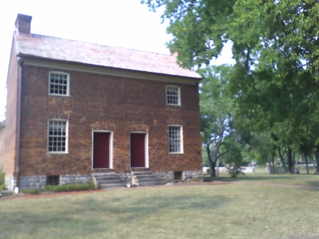
Bowen-Campbell House
Monument and historic site · National Register of Historic Places · 5.0 mi
Historic house in Tennessee, United States
Cleveland Hall
Monument and historic site · National Register of Historic Places · 5.5 mi
Antebellum mansion
Daniel Smith Donelson House
Monument and historic site · National Register of Historic Places · 0.8 mi
Historic house in Tennessee, United States
Hazel Path
Monument and historic site · National Register of Historic Places
Building in Tennessee, United States

John Cloyd House
Monument and historic site · National Register of Historic Places · 6.2 mi
House in Wilson County, Tennessee, United States
Monthaven
Monument and historic site · National Register of Historic Places · 3.4 mi
Historic house in Tennessee, United States

Oakley
Monument and historic site · National Register of Historic Places · 6.1 mi
House near Gallatin, Tennessee

Robert Chadwell House
Monument and historic site · National Register of Historic Places · 6.5 mi
Historic house in Nashville-Davidson County, Tennessee, USA

The Hermitage
Museum · National Register of Historic Places · 6.4 mi
Historical plantation and museum in Tennessee

Tulip Grove
Monument and historic site · National Register of Historic Places · 6.6 mi
Human settlement in United States of America
4 more on the map.
Parks, trails and playgrounds30




18 more on the map.
Restaurants and cafes62

Demos' Restaurant
Restaurant · Italian · 0.5 mi
161 Indian Lake Boulevard, Hendersonville
Su-Th 11:00-22:00; Fr-Sa 11:00-23:00


Don Miguel Juicery + Rustic Kitchen
Restaurant · 1.0 mi
115 Walton Ferry Road, Hendersonville
Mo-Fr 08:00-17:00; Sa 08:00-16:00
50 more on the map.
History
In 1784 Daniel Smith received a land grant from the state of North Carolina in payment for surveying Middle Tennessee. (North Carolina at the time claimed its boundaries extended to this territory across the Appalachian Mountains.) He began work on his house later known as Rock Castle, but it was not completed until 1796. Due to his surveying trips, he frequently was gone on long journeys, and his wife supervised much of the construction.
In 1790, William Henderson settled in Sumner County and later became the namesake of the town. It was a trading center for the county, which was devoted to the production of tobacco and hemp as commodity crops, and blood livestock: both horses and cattle. During the Civil War, Monthaven was used by Union troops as a field hospital, as they occupied Middle Tennessee from 1862 to 1870. In the late 20th century, this historic home was listed on the National Register of Historic Places. Even before the Emancipation Proclamation of January 1863, refugee slaves with their families found their way to Union lines in the state in search of freedom. The Army established a contraband camp near Hendersonville, to offer shelter to the freedmen, help them with supplies and food, and sign them up to work for wages for the Army, often building defenses. Missionary societies helped teach both adults and children among the slaves.
From the History section of Hendersonville, Tennessee on Wikipedia, under CC BY-SA 4.0.
Where to stay4
Hampton Inn & Suites Nashville Hendersonville
Motel and hotel · 1.5 mi
111 Saundersville Road, Hendersonville
InTown Suites Extended Stay Nashville TN - Hendersonville
Motel and hotel · 2.8 mi
Churches and places of worship22
Old Hickory Methodist Church
Church · National Register of Historic Places · 4.3 mi
Long Hollow Baptist Church
Church · Baptist · 4.2 mi
3031 Long Hollow Pike, Hendersonville
Shopping12
Gas and EV charging16
Schools, colleges and libraries40
Dr. William Burrus Elementary At Drakes Creek
School · 2.6 mi
1336 Drakes Creek Rd, Hendersonville
Healthcare4
Map of Hendersonville
212 places. The map loads OpenStreetMap tiles when you open it.
Climate by month
Monthly table
| Month | High | Low | Rain | Snow |
|---|---|---|---|---|
| Jan | 47°F | 27°F | 3.7 in | 0.6 in |
| Feb | 51°F | 30°F | 4.3 in | 0.3 in |
| Mar | 60°F | 37°F | 4.6 in | 0.2 in |
| Apr | 71°F | 45°F | 4.7 in | 0.0 in |
| May | 79°F | 55°F | 4.5 in | 0.0 in |
| Jun | 86°F | 64°F | 3.8 in | 0.0 in |
| Jul | 90°F | 67°F | 4.0 in | 0.0 in |
| Aug | 90°F | 67°F | 3.4 in | 0.0 in |
| Sep | 83°F | 60°F | 3.7 in | 0.0 in |
| Oct | 72°F | 47°F | 3.3 in | 0.0 in |
| Nov | 60°F | 36°F | 3.4 in | 0.0 in |
| Dec | 50°F | 29°F | 4.4 in | 0.1 in |
U.S. Climate Normals 1991-2020 for Old Hickory Dam (3 mi away), NOAA NCEI.
People and cost of living
American Community Survey 5-year estimates, 2020-2024, U.S. Census Bureau. Estimates have margins of error, larger for small towns.
Disaster history
Sumner County has had 16 federal disaster declarations since 2000, most often for severe storms.
- 2026-02-06: Severe Winter Storm (Winter Storm)
- 2026-01-24: Severe Winter Storm (Winter Storm)
- 2025-04-02: Severe Storms, Straight-Line Winds, Tornadoes, And Flooding (Severe Storm)
- 2024-06-17: Severe Storms, Tornadoes, And Flooding (Severe Storm)
- 2023-12-13: Severe Storms And Tornadoes (Severe Storm)
- 2023-05-17: Severe Storms, Straight-Line Winds, And Tornado (Severe Storm)
OpenFEMA disaster declarations summaries.
Getting there and nearby towns
Nashville International Airport (BNA) is the nearest airport with scheduled flights listed in OpenStreetMap, 14 miles away.
- Goodlettsville 6 mi west, about 9 min by car
- Gallatin 9 mi northeast, about 15 min by car
- Nashville-Davidson 14 mi southwest, about 22 min by car
- Brentwood 24 mi southwest, about 38 min by car
- Hartsville/Trousdale County 25 mi east, about 41 min by car
- Franklin 28 mi north, about 45 min by car
- Franklin 31 mi southwest, about 49 min by car
- Murfreesboro 33 mi south, about 53 min by car
- Fairview 37 mi southwest, about 59 min by car
- Clarksville 45 mi northwest, about 1 h 15 min by car
Drive times are estimates from straight-line distance, not routes.
Local news
Headlines from INDB, the NEMICO news database.
Reviews, tips and questions
Loading what members have shared...
Sources and licences
- NCES EDGE (Public domain): public schools
- NOAA NCEI U.S. Climate Normals 1991-2020 (Public domain): climate by month
- OpenFEMA (Public domain): disaster declarations
- OpenStreetMap contributors (ODbL 1.0): places, airports, map data
- U.S. Census Bureau (Public domain): population, income, housing, education, commute
- Wikidata (CC0 1.0): elevation, founding date, time zone, website, landmarks and historic places
- Wikimedia Commons (see each image): photos
- Wikipedia (CC BY-SA 4.0): overview and history text
Photo credits
- Hendersonville High, Michaelandstuff, CC BY-SA 3.0
- Hazel Path mansion in Hendersonville, TN - October 2025, Jasman777, CC BY-SA 4.0
- Monthaven (Leonard B. Fite House) in Hendersonville, TN - October 2025, Jasman777, CC BY-SA 4.0
- Rock Castle 026, Sugarlandfanatic ( talk ), CC BY-SA 3.0
- U.S. Post Office-Old Hickory, rossograph, CC BY-SA 4.0
- TulipGrove-LeftFront, Bryan MacKinnon, CC BY-SA 4.0
- Bowen-Campbell House2007, Scottgink at English Wikipedia, Public domain
- Robert Chadwell House, rossograph, CC BY-SA 4.0
- John Cloyd House-Mt. Juliet, TN, rossograph, CC BY-SA 4.0
- Oakley House-TN, rossograph, CC BY-SA 4.0
- Front of church, Old Hickory United Methodist Church, Jgamb, CC BY-SA 4.0
- The Hermitage by Jim Bowen, Jim Bowen from Zhenhai, China, CC BY 2.0
- Welch College Color - Stacked-01, WelchCollege, CC BY-SA 4.0
- Ashcrest Farm, SydneySmith, CC BY-SA 3.0
- Daniel Smith Donelson House, SydneySmith, CC BY-SA 3.0
- Hazel Path, SydneySmith, CC BY-SA 3.0
- Shackle Island Historic District, SydneySmith, CC BY-SA 3.0
- ISS053-E-266137 - View of Earth, Earth Science and Remote Sensing Unit , Lyndon B. Johnson Space Center, Public domain
- ISS023-E-11111 - View of Earth, Earth Science and Remote Sensing Unit , Lyndon B. Johnson Space Center, Public domain
- ISS059-E-104515 - View of Earth, Earth Science and Remote Sensing Unit, NASA Johnson Space Center, Public domain
- ISS053-E-274223 - View of Earth, Earth Science and Remote Sensing Unit , Lyndon B. Johnson Space Center, Public domain
- ISS059-E-29719 - View of Earth, Earth Science and Remote Sensing Unit, NASA Johnson Space Center, Public domain
- ISS035-E-7960 - View of Earth, Earth Science and Remote Sensing Unit , Lyndon B. Johnson Space Center, Public domain
- ISS012-E-11716 - View of Iowa, Earth Science and Remote Sensing Unit , Lyndon B. Johnson Space Center, Public domain
- DottieMiller, KennedySovine, CC BY 4.0
- Another Close-up of Daniel Smith's Marker, Sassy Countess, CC BY-SA 3.0
- Nadiia Vasina with Mark Carman and Jason Crabb in Nashville recording studio, Andriy Vasin, CC BY-SA 4.0
- High-end EF2 damage in Old Hickory Lock and Dam, NOAA / NWS Nashville, Tennessee, Public domain
- Prep students shadow Nashville District engineers (6979267091), U.S. Army Corps of Engineers Nashville District, CC BY-SA 2.0
- Old Hickory Dam, Lee Roberts, CC BY-SA 2.0
- Historic Monthaven (Front View), Robert L Young, CC BY-SA 3.0
- Historic Monthaven (Full View), Robert L Young, CC BY-SA 3.0
- Old Hickory lock greenway - panoramio (2), Paula Tejo, CC BY 3.0
- Old Hickory lock greenway - panoramio (1), Paula Tejo, CC BY 3.0
- Old Hickory lock greenway - panoramio, Paula Tejo, CC BY 3.0
- At the dock - Flickr - deldevries, deldevries, CC BY-SA 2.0
- Fishing - Flickr - deldevries, deldevries, CC BY-SA 2.0
- SHUTES BRANSH RECREATION AREA. - panoramio (1), Paula Tejo, CC BY 3.0
- SHUTES BRANSH RECREATION AREA. - panoramio, Paula Tejo, CC BY 3.0
- Upperairballoon, scottunger, Public domain


Page built October 30, 2026. Spotted a mistake? Tell us or suggest a place.