
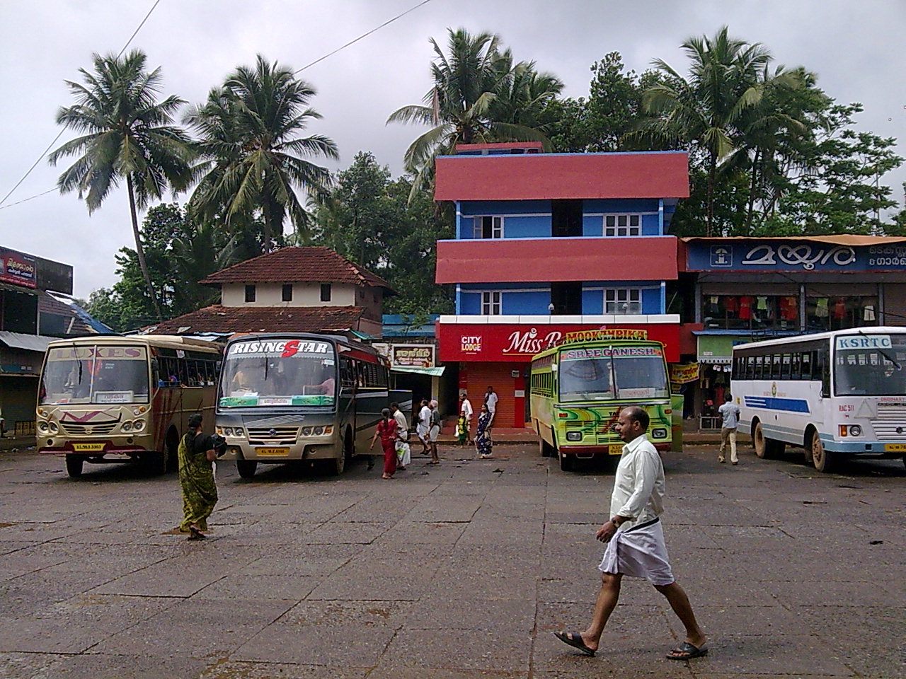


Why visit Nādāpuram
Townapedia lists 2 parks and trails and 6 places to eat in and around town.
Weather in Nādāpuram
Forecast from MET Norway (CC BY 4.0). Full forecast
About Nādāpuram
Nadapuram is a census town and a special grade panchayath located in Kozhikode District of Kerala, coming under Nadapuram assembly constituency. It is in the North Malabar region of Kerala, India.
From the Wikipedia article Nadapuram (this version), under CC BY-SA 4.0.
Parks, trails and playgrounds2

Nadapuram Indoor Stadium
Sports field and stadium
Nadapuram-Kuttiady Road, Nadapuram

Restaurants and cafes6


Churches and places of worship27

Karayat Maha Vishnu Temple
Place of worship · 2.6 km
Purameri-Kuningad Road, Purameri PO, Purameri
Salafi Masjid Thuneri
Place of worship · 3.8 km
PJ5J+C3R, Tuneri, Kerala 673505, kozhikode
Sree Kottath Paradevatha Temple
Place of worship · 2.8 km
Purameri-Kuningad Road, Kuningad PO, Purameri
Sree Kunhalloor Narasimhamoorthy Temple
Place of worship · 3.0 km
Purameri-Kuningad Road, Purameri PO, Purameri
Sree Purameri Kovilakam Vettakkorumakan Temple
Place of worship · 2.7 km
Purameri-Kuningad Road, Purameri PO, Purameri
Udayapuram Maha Siva Temple
Place of worship · 2.8 km
Purameri-Kuningad Road, Purameri PO, Purameri
15 more on the map.
Shopping6



History
In the past, Nadapuram was the place which lies in between Kuttipuram Kovilakam and Kadathanad palace. The derivation of the name Nadapuram is widely known through the two names Nagapuram and Nadapuram (land of music). Nadapuram is the place that is well-known as part of the ballad of Kadathanad and is known all over Kerala. This land witnessed the padayottam of Thacholi Othenan and Unniyarcha in earlier times. Art forms like Dafmuttu, Aravanamuttu, Poorakkali and Kolkkali were nourished in this place.
In his book Malayala Rajyam Charithrathodu Chernna Bhoomisathram, Hermen Gundert states that Nadapuram is two miles northeast to Kuttipuram; also, there is a mosque (mazjid) and a market mainly concentrated on the pepper business.
Kuttipuram was part of the famous Kurumbanad Taluk and was famous for its martial arts. Nowadays, the remnant of Kuttipuram Kovilakam is only a pond with dilapidated pavement and covered with waterweed. Unniyarcha defeated Jonakans using a wet cloth dipped in the pond.
In earlier times, Nadapuram was well known for its secular nature and was famous as a centre for Islamic teaching. Significant marks for its secularism can be noted in places like Kallachi where the Kallachi Avolam road is named in the name of ruler Tipu Sulthan.
From the History section of Nadapuram on Wikipedia, under CC BY-SA 4.0.
Gas and EV charging1
Schools, colleges and libraries31
C C Upper Primary School Nadapuram
School · 1.9 km
Puthiyangadi - Koothuparamba Road
E V Upper Primary School Tuneri
School · 3.4 km
Puthiyangadi - Koothuparamba Road
Government Higher Secondary School Kallachi
School · 2.5 km
Puthiyangadi - Koothuparamba Road
Healthcare13
Rajeevan Doctor's Clinic
Clinic and pharmacy · 2.2 km
Vadakara - Nadapuram Road, Purameri
Map of Nādāpuram
86 places. The map loads OpenStreetMap tiles when you open it.
Getting there and nearby towns
Kannur International Airport (CNN) is the nearest airport with scheduled flights listed in OpenStreetMap, 29 km away.
- Panoor 12 km northwest, about 12 min by car
- Tellicherry 19 km west, about 19 min by car
- Irikkūr 35 km north, about 35 min by car
- Pāppinisshēri 46 km northwest, about 46 min by car
- Kozhikode 50 km south, about 50 min by car
- Taliparamba 51 km northwest, about 51 min by car
- Tirūrangādi 77 km south, about 1 h 15 min by car
- Nilambūr 77 km southeast, about 1 h 15 min by car
- Malappuram 85 km southeast, about 1 h 30 min by car
- Nīlēshwar 85 km northwest, about 1 h 30 min by car
Drive times are estimates from straight-line distance, not routes.
Local news
Headlines from INDB.
Reviews, tips and questions
Loading what members have shared...
Sources and licences
- GeoNames (CC BY 4.0): population, coordinates, regions and time zone
- OpenStreetMap contributors (ODbL 1.0): places, airports, map data
- Wikidata (CC0 1.0): elevation, founding date, time zone, website
- Wikimedia Commons (see each image): photos
- Wikipedia (CC BY-SA 4.0): overview and history text
Photo credits
- Nadapuram Bus stand, Azharabdulazeez, Public domain
- 16603 GMLP School Kannankai, Manaftb, CC BY 4.0
- 16226 Vilathapuram LP School, Manaftb, CC BY 4.0
- 16244 Kuningad LP School, Manaftb, CC BY 4.0
Page built November 3, 2026. Spotted a mistake? Tell us or suggest a place.